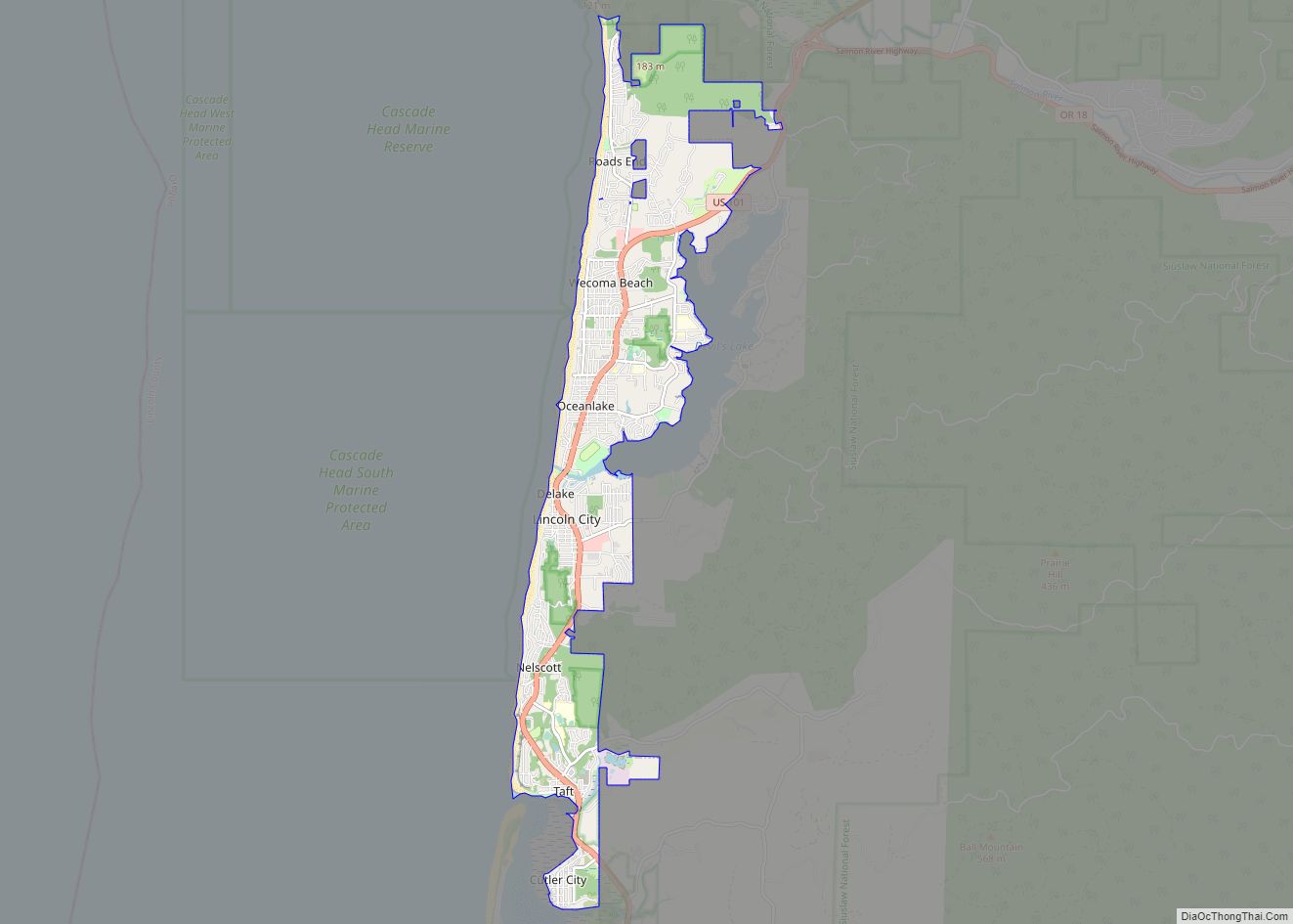
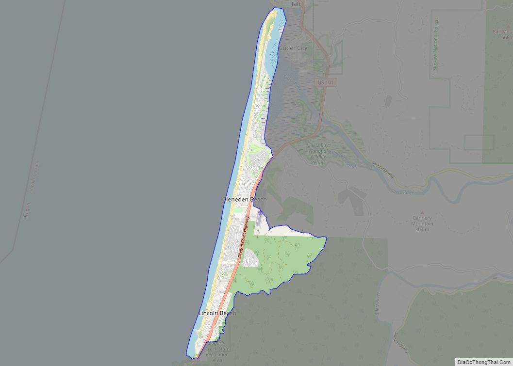
Map of Lincoln Beach CDP

Map of Lincoln Beach CDP

Lincoln Beach is a census-designated place (CDP) in Lincoln County, Oregon, United States. It includes the unincorporated communities of Lincoln Beach and Gleneden Beach. The total population was 2,045 at the 2010 census. Lincoln Beach CDP overview: Name: Lincoln Beach CDP LSAD Code: 57 LSAD Description: CDP (suffix) State: Oregon County: Lincoln County Elevation: 46 ft … Read more

Map of Lexington town, Oregon

Map of Lexington town, Oregon

Lexington is a city in Morrow County, Oregon, United States. The population was 238 at the 2010 census. It is part of the Pendleton–Hermiston Micropolitan Statistical Area. Lexington town overview: Name: Lexington town LSAD Code: 43 LSAD Description: town (suffix) State: Oregon County: Morrow County Incorporated: 1903 Elevation: 1,450 ft (440 m) Total Area: 0.44 sq mi (1.13 km²) Land … Read more

Map of McMinnville city

Map of McMinnville city, Oregon

McMinnville is the county seat of and largest city in Yamhill County, Oregon, United States. The city is named after McMinnville, Tennessee. As of the 2020 census, the city had a population of 34,319. McMinnville is at the confluence of the North and South forks of the Yamhill River in the Willamette Valley. The city’s … Read more

Map of Maywood Park city

Map of Maywood Park city

Maywood Park is a city in Multnomah County, Oregon, United States. The name came from a comment made by the wife of the man who developed the original subdivision, E. F. Taylor, who remarked one winter night how attractive the woods were in May. An enclave within the city of Portland, the residents of the … Read more

Map of Maupin city

Map of Maupin city

Maupin is a city in Wasco County, Oregon, United States. Located on the Deschutes River, much of the city’s economy is related to the river through outdoor activities, such as fishing and rafting. The population was 418 at the 2010 census. Maupin city overview: Name: Maupin city LSAD Code: 25 LSAD Description: city (suffix) State: … Read more

Map of Marion CDP, Oregon

Map of Marion CDP, Oregon

Marion is an unincorporated community in Marion County, Oregon, United States. For statistical purposes, the United States Census Bureau has defined Marion as a census-designated place (CDP). The census definition of the area may not precisely correspond to local understanding of the area with the same name. The population was 307 at the 2020 census. … Read more

Map of Manzanita city

Map of Manzanita city

Manzanita /ˌmænzəˈniːtə/ is a coastal city in Tillamook County, Oregon, United States. It is located on U.S. Route 101 about 25 miles (40 km) south of Seaside and 25 miles (40 km) north of Tillamook. The population was 603 at the 2020 census. Manzanita city overview: Name: Manzanita city LSAD Code: 25 LSAD Description: city (suffix) State: … Read more

Map of Malin city

Map of Malin city

Malin is a city in Klamath County, Oregon, United States. The population was 805 at the 2010 census. Malin city overview: Name: Malin city LSAD Code: 25 LSAD Description: city (suffix) State: Oregon County: Klamath County Incorporated: 1922 Elevation: 4,062 ft (1,238 m) Total Area: 0.50 sq mi (1.29 km²) Land Area: 0.50 sq mi (1.29 km²) Water Area: 0.00 sq mi (0.00 km²) Total Population: … Read more

Map of Madras city

Map of Madras city

Madras (/ˈmædrəs/ MAD-res) is a city in and the county seat of Jefferson County, Oregon, United States. Originally called “The Basin” after the circular valley the city is in, it is unclear whether Madras was named in 1903 for the cotton fabric called “Madras” that originated in the city of Madras (now Chennai) in Tamil … Read more

Map of Lyons city, Oregon

Map of Lyons city, Oregon

Lyons is a city in Linn County, Oregon, United States. The population was 1,161 at the 2010 census. The center of population of Oregon is located in Lyons. Lyons city overview: Name: Lyons city LSAD Code: 25 LSAD Description: city (suffix) State: Oregon County: Linn County Incorporated: 1958 Elevation: 660 ft (201.2 m) Total Area: 0.88 sq mi (2.28 km²) … Read more

Map of Lowell city, Oregon

Map of Lowell city, Oregon

Lowell is a city in Lane County, in the U.S. state of Oregon. As of the 2010 census, the city population was 1,045. The city is on the north shore of Dexter Reservoir on the Middle Fork Willamette River. The most used route to Lowell is along Lowell Bridge, a covered bridge that crosses the … Read more

Map of Medford city, Oregon

Map of Medford city, Oregon

Medford is a city in and the county seat of Jackson County, Oregon, in the United States. As of the 2020 United States Census on April 1, 2020, the city had a total population of 85,824 and a metropolitan area population of 223,259, making the Medford MSA the fourth largest metro area in Oregon. The … Read more