Medford is a city in and the county seat of Jackson County, Oregon, in the United States. As of the 2020 United States Census on April 1, 2020, the city had a total population of 85,824 and a metropolitan area population of 223,259, making the Medford MSA the fourth largest metro area in Oregon. The city was named in 1883 by David Loring, civil engineer and right-of-way agent for the Oregon and California Railroad, after Medford, Massachusetts, which was near Loring’s hometown of Concord, Massachusetts. Medford is near the middle ford of Bear Creek.
| Name: | Medford city |
|---|---|
| LSAD Code: | 25 |
| LSAD Description: | city (suffix) |
| State: | Oregon |
| County: | Jackson County |
| Elevation: | 1,382 ft (421 m) |
| Land Area: | 27.71 sq mi (71.78 km²) |
| Water Area: | 0.01 sq mi (0.03 km²) |
| Population Density: | 3,096.66/sq mi (1,195.61/km²) |
| FIPS code: | 4147000 |
| Website: | medfordoregon.gov |
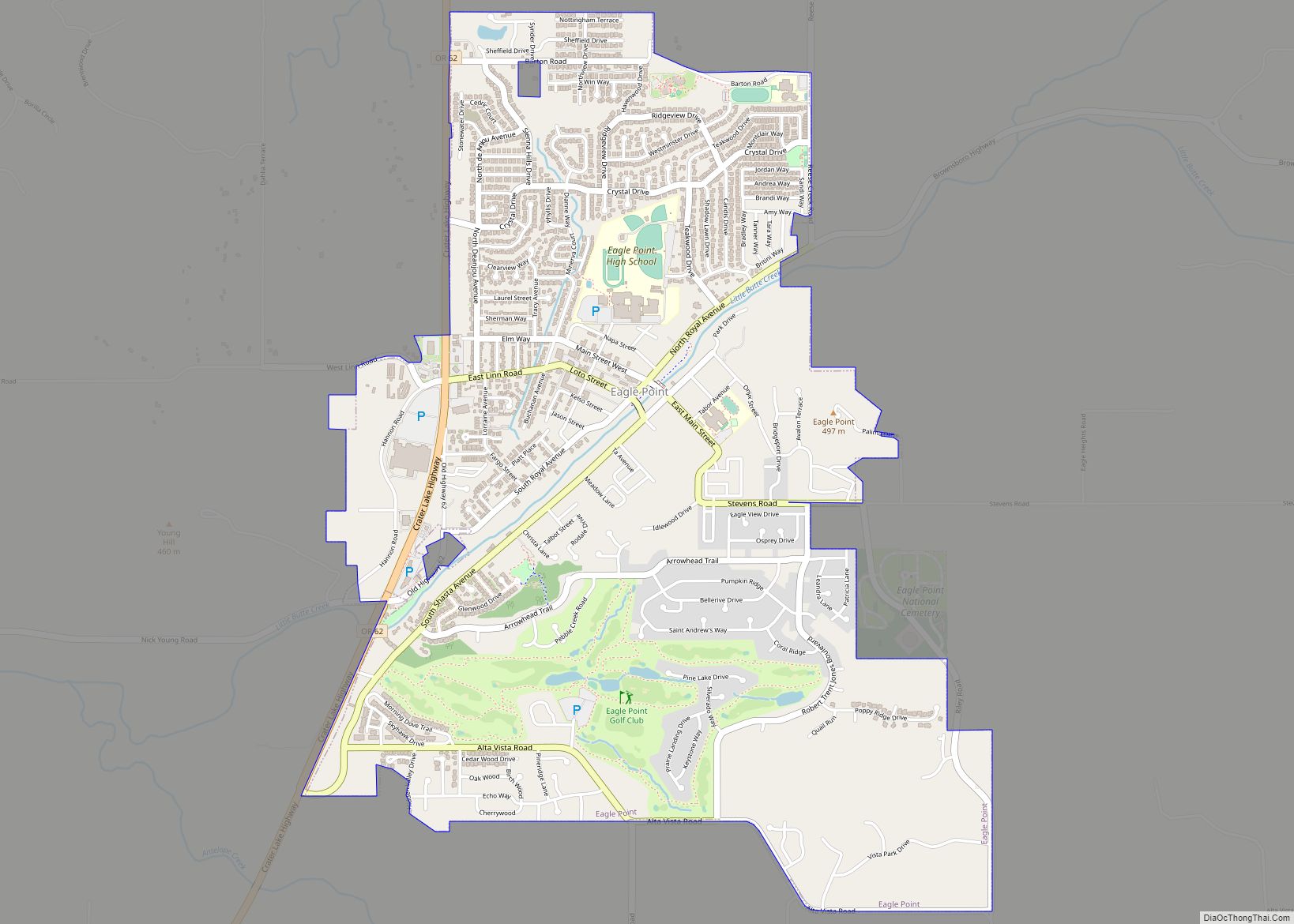
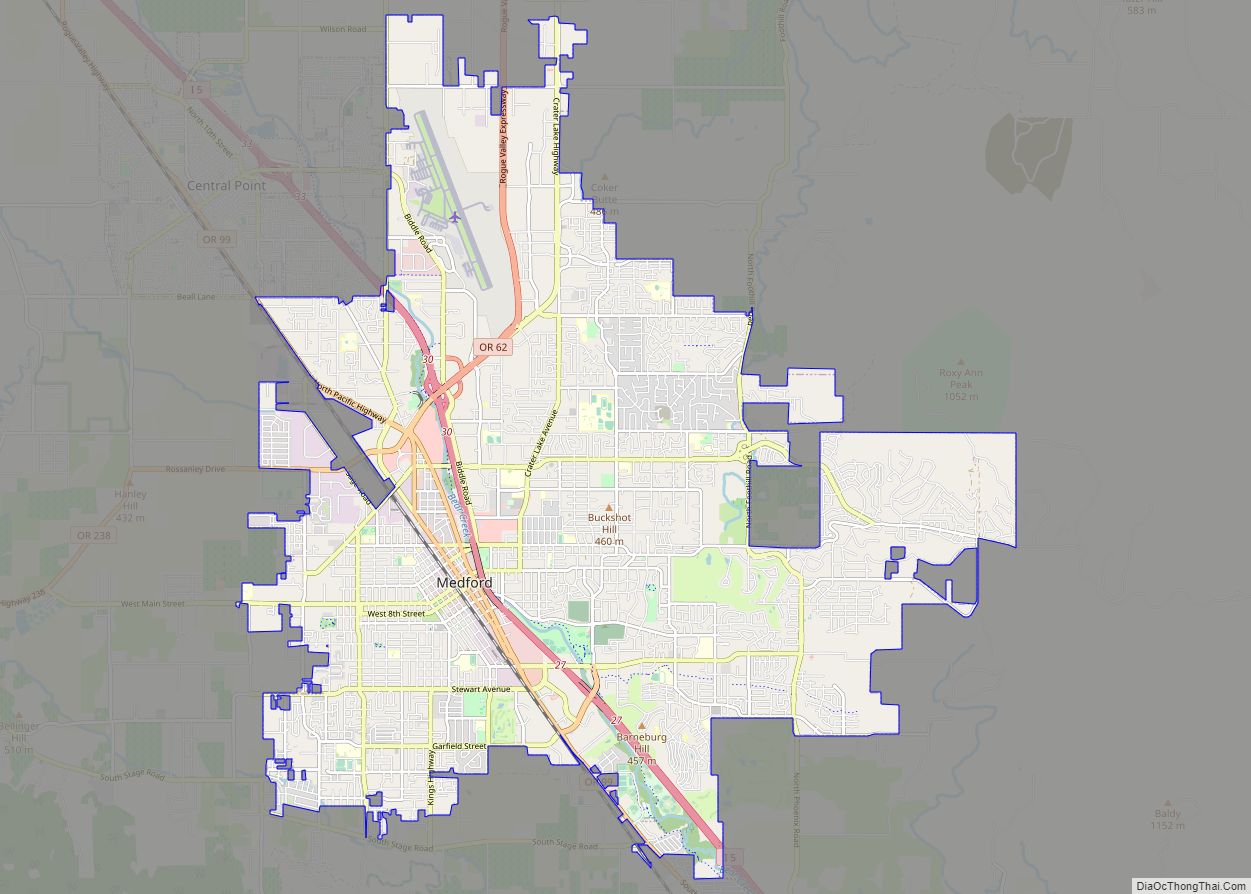
Online Interactive Map
Click on ![]() to view map in "full screen" mode.
to view map in "full screen" mode.
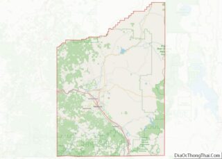
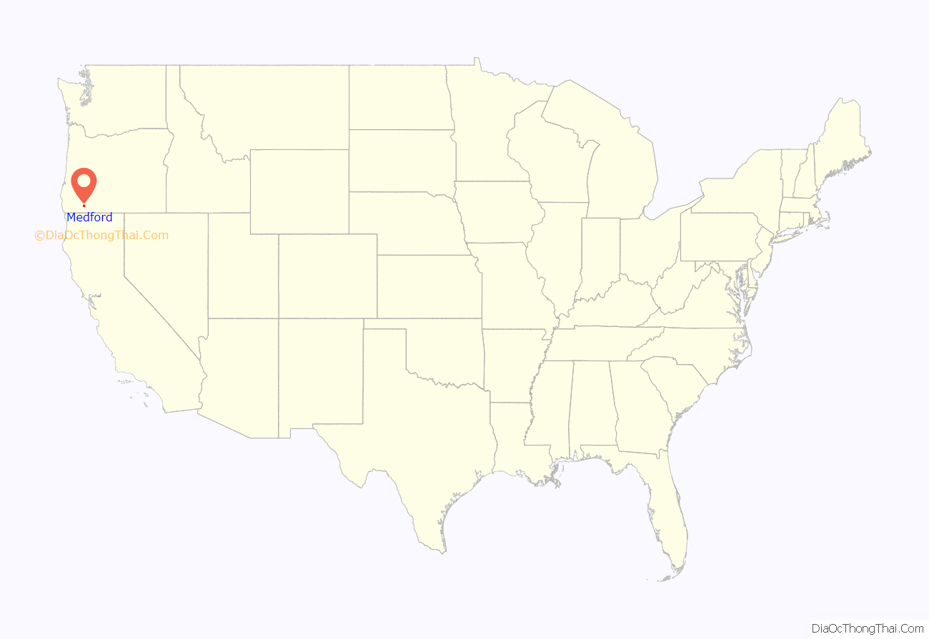
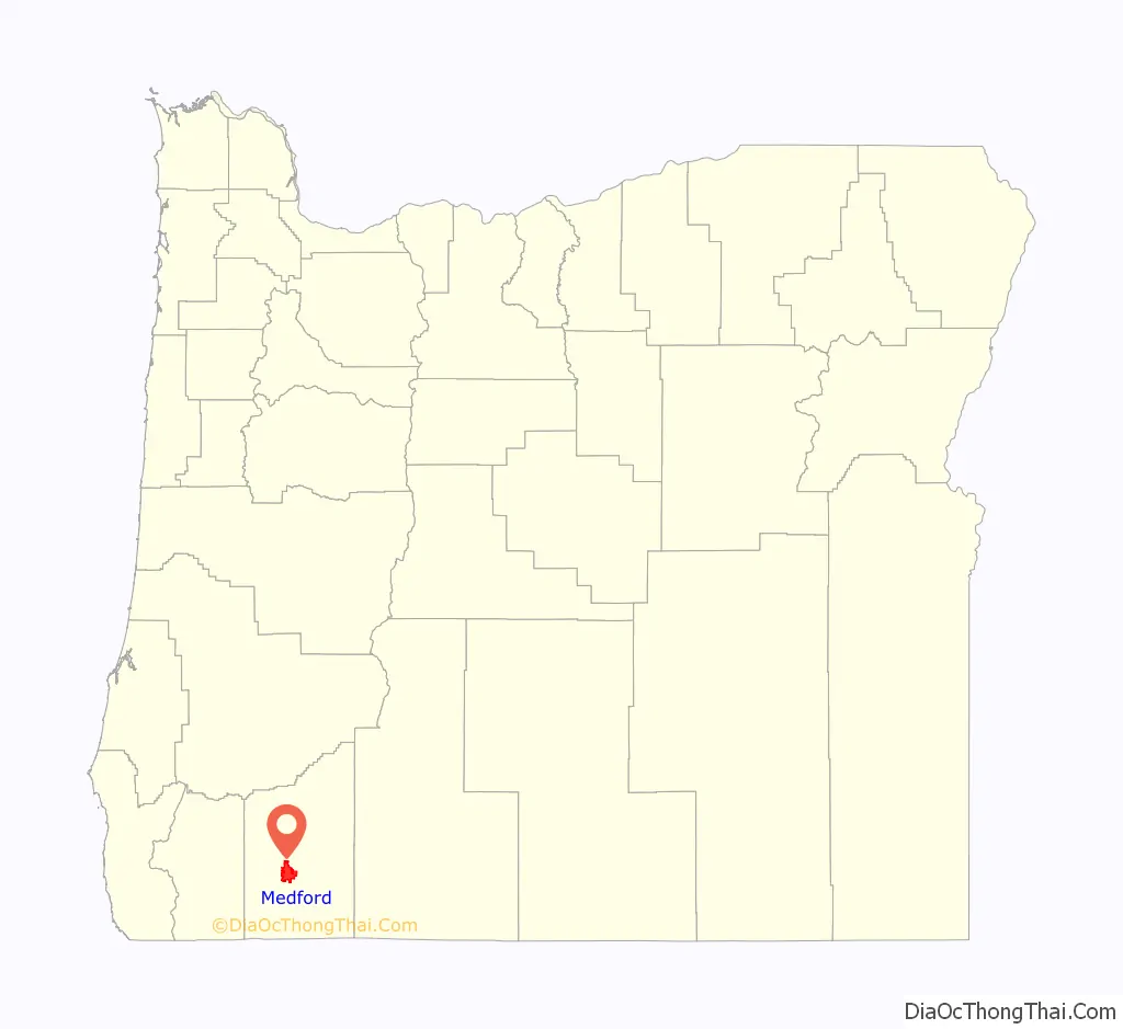
Medford location map. Where is Medford city?
History
In 1883, a group of railroad surveyors headed by S. L. Dolson and David Loring arrived in Rock Point, near present-day Gold Hill. They were charged with finding the best route through the Rogue Valley for the Oregon and California Railroad. Citizens of neighboring Jacksonville hoped that it would pass between their town and Hanley Butte, near the present day Claire Hanley Arboretum. Such a move would have all but guaranteed prosperous growth for Jacksonville, but Dolson decided instead to stake the railroad closer to Bear Creek. The response from Jacksonville was mixed, but the decision was final. By November 1883, a depot site had been chosen and a surveying team led by Charles J. Howard was hard at work platting the new town. They completed their work in early December 1883, laying out 82 blocks for development.
James Sullivan Howard, a merchant and surveyor, claimed to have built the town’s first building in January 1884, though blacksmith Emil Piel was advertising for business at the “central depot” in the middle of December 1883. Others point out the farms of town founders Iradell Judson Phipps and Charles Wesley Broback, which were present before the town was platted. Regardless, on February 6, 1884 (less than a month after it was built), J. S. Howard’s store became Medford’s first post office, with Howard serving as postmaster. The establishment of the post office led to the incorporation of Medford as a town by the Oregon Legislative Assembly on February 24, 1885, and again as a city in 1905. Howard held the position of postmaster for Medford’s first ten years, and again held the post upon his death on November 13, 1919.
The beginning of the 20th century was a transitional period for the area. Medford built a new steel bridge over Bear Creek to replace an earlier one which washed away three years before. Without a bridge, those wanting to cross had to ford the stream, typically using a horse-drawn wagon; the first automobile did not arrive in Medford until 1903. Pharmacist George H. Haskins had opened a drugstore just after the town was platted, and in 1903 he allowed the Medford Library Association to open a small library in that store. Five years later the library moved to Medford’s new city hall, in another four years, Andrew Carnegie’s donation allowed a dedicated library to be built. Construction on the Medford Carnegie Library was completed in 1912.
In 1927, Medford took the title of county seat of Jackson County away from nearby Jacksonville.
Between World War II and the 1960s, Medford had a reputation as a sundown town where African Americans and other nonwhites were not allowed to live or stay at night.
In 1967, Interstate 5 was completed immediately adjacent to downtown Medford to replace the Oregon Pacific Highway. It has been blamed for the decline of small businesses in downtown Medford since its completion, but nevertheless remains an important route for commuters wishing to travel across the city. In fact, a study completed in 1999 found that 45% of vehicles entering I-5 from north Medford heading south exited in south Medford, just three miles (5 km) away.
The high volume of traffic on Interstate 5 led to the completion of a new north Medford interchange in 2006. The project, which cost about $36 million, improved traffic flow between I-5 and Crater Lake Highway. Further traffic problems identified in south Medford prompted the construction of another new interchange, costing $72 million. The project began in 2006 and was completed in 2010.
Since the 1990s, Medford has dedicated an appreciable amount of resources to urban renewal in an attempt to revitalize the downtown area. Several old buildings have been restored, including the Craterian Ginger Rogers Theater and the Prohibition era Cooley-Neff Warehouse, now operating as Pallet Wine Company, an urban winery. Streets have been realigned, new sidewalks, traffic signals, and bicycle lanes were installed, and two new parking garages have been built. Downtown Medford also received a new library building to replace the historic Medford Carnegie Library and now boasts satellite campuses for both Rogue Community College and Southern Oregon University.
Economic problems in 2008 and 2009 put a hold on The Commons project, a collaboration between the city of Medford and Lithia Motors. The project, one of the largest undertaken in downtown in recent years, aims to provide more parking, recreation, and commerce to the area. Before the work stopped, the Greyhound Bus depot was moved and $850,000 was spent replacing water lines. The Commons is anchored by the new corporate headquarters of Lithia Motors, Inc. (NYSE: LAD). Included in The Commons are two public park blocks slated to be informal public gathering areas as well as an area for special events such as the farmer’s market. Ground breaking for the project was April 22, 2011, with a Phase 1 completion date of 2012.
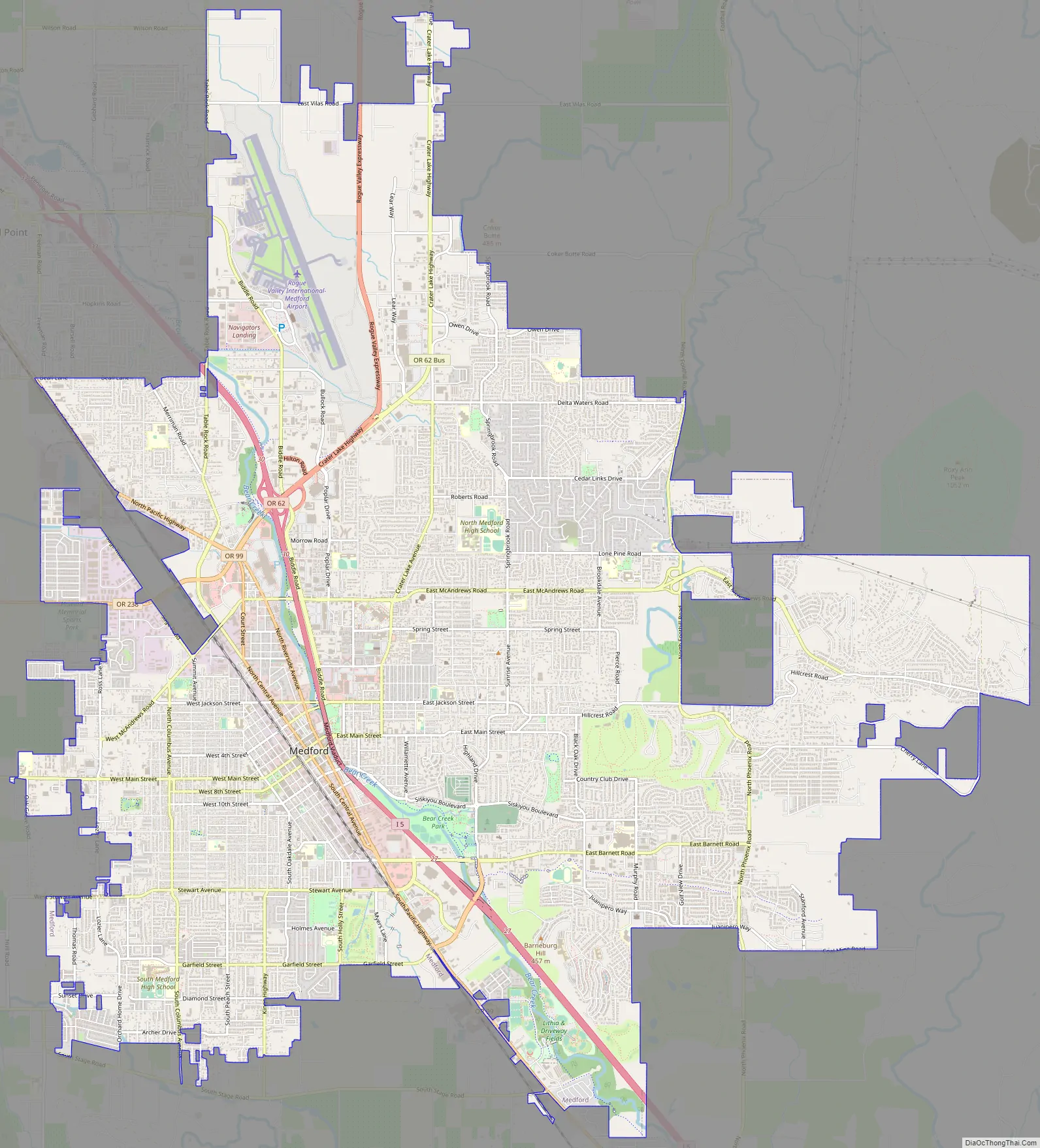
Medford Road Map
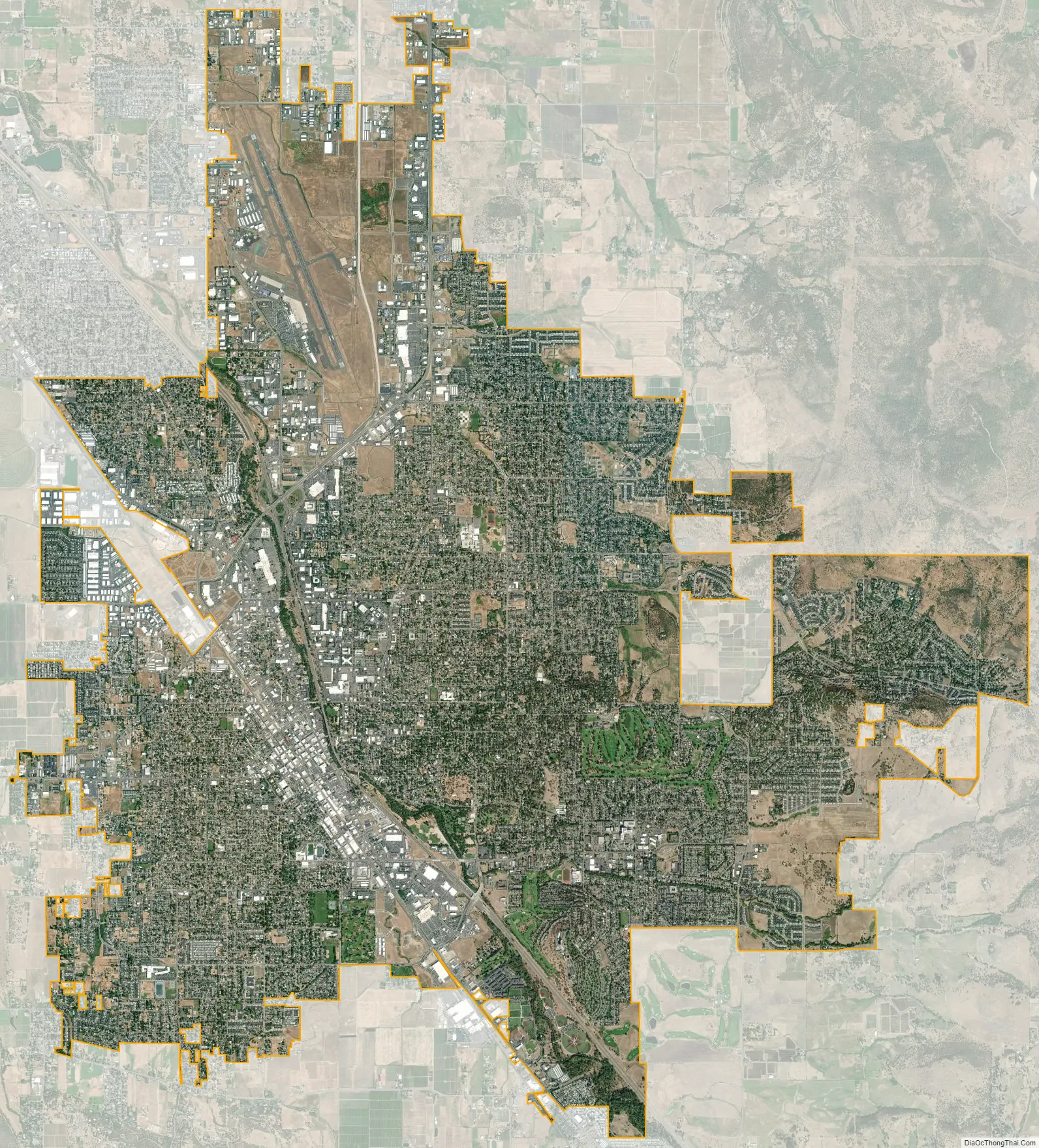
Medford city Satellite Map
Geography
Medford is located approximately 27 miles (43 km) north of the northern California border.
According to the United States Census Bureau, the city has a total area of 25.74 square miles (66.67 km), of which, 25.73 square miles (66.64 km) is land and 0.01 square miles (0.03 km) is water.
Medford is situated in the remains of ancient volcanic flow areas as demonstrated by the Upper and Lower Table Rock lava formations and nearby Mount McLoughlin and Crater Lake, which is the remains of Mount Mazama.
Climate
Medford sits in a rain shadow between the Cascade Range and Siskiyou Mountains called the Rogue Valley. As such, most of the rain associated with the Pacific Northwest and Oregon in particular skips Medford, making it drier and sunnier than the Willamette Valley. Medford’s climate is considerably warmer, both in summer and winter, than its latitude would suggest, with a Mediterranean climate (Köppen Csa). Summers are akin to Eastern Oregon, and winters resemble the coast. Here, summer sees an average of 57 afternoons over 90 °F or 32.2 °C and eleven afternoons over 100 °F or 37.8 °C. In August 1981, the high temperature reached over 110 °F or 43.3 °C for four consecutive days, with two days reaching 114 °F or 45.6 °C. Freezing temperatures occur on 69 mornings during an average year, and in some years there may be a day or two where the high stays at or below freezing; the average window for freezing temperatures is October 23 through April 23. The city is located in USDA hardiness zone 8. Medford also experiences temperature inversions in the winter which during its lumber mill days produced fog so thick that visibility could be reduced to less than five feet. These inversions can last for weeks; some suggest this is because the metropolitan area has one of the lowest average wind speeds of all American metropolitan areas. The heavy fog returns nearly every winter with the inversions lowering air quality for several months without relief.
Medford residents experience snowfall during the winter that, due to the weather shadow effect, averages 3.6 inches or 0.09 metres and melts fairly quickly. In the past, the city has seen seasonal snowfall totals reach 31 inches or 0.79 metres in 1955–1956. That season was also the wettest “rain year” with a total of 33.41 inches (848.6 mm); this immediately followed the driest “rain year” since records started in 1911 from July 1954 to June 1955 when only 9.28 inches (235.7 mm) was recorded. By far the wettest month has been December 1964 with 12.72 inches (323.1 mm); no other month has had more than 10 inches or 254 millimetres. The wettest day on record has been December 2, 1962 with 3.30 inches (83.8 mm).
The lowest recorded temperature in Medford was −10 °F (−23 °C) on December 13, 1919, and the highest recorded temperature was 115 °F (46 °C) on July 20, 1946, and June 28, 2021. There is significantly more diurnal temperature variation in summer than in winter, with the difference between December high and low average temperatures being only 13.2 °F (7.3 °C), but the difference between August high and low average temperatures is 33.9 °F (18.8 °C).
See also
Map of Oregon State and its subdivision: Map of other states:- Alabama
- Alaska
- Arizona
- Arkansas
- California
- Colorado
- Connecticut
- Delaware
- District of Columbia
- Florida
- Georgia
- Hawaii
- Idaho
- Illinois
- Indiana
- Iowa
- Kansas
- Kentucky
- Louisiana
- Maine
- Maryland
- Massachusetts
- Michigan
- Minnesota
- Mississippi
- Missouri
- Montana
- Nebraska
- Nevada
- New Hampshire
- New Jersey
- New Mexico
- New York
- North Carolina
- North Dakota
- Ohio
- Oklahoma
- Oregon
- Pennsylvania
- Rhode Island
- South Carolina
- South Dakota
- Tennessee
- Texas
- Utah
- Vermont
- Virginia
- Washington
- West Virginia
- Wisconsin
- Wyoming