Madras (/ˈmædrəs/ MAD-res) is a city in and the county seat of Jefferson County, Oregon, United States. Originally called “The Basin” after the circular valley the city is in, it is unclear whether Madras was named in 1903 for the cotton fabric called “Madras” that originated in the city of Madras (now Chennai) in Tamil Nadu, India or from the name of the city itself. The population was 6,046 at the 2010 census.
| Name: | Madras city |
|---|---|
| LSAD Code: | 25 |
| LSAD Description: | city (suffix) |
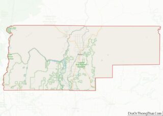
| State: | Oregon |
| County: | Jefferson County |
| Incorporated: | 1911 |
| Elevation: | 2,242 ft (683 m) |
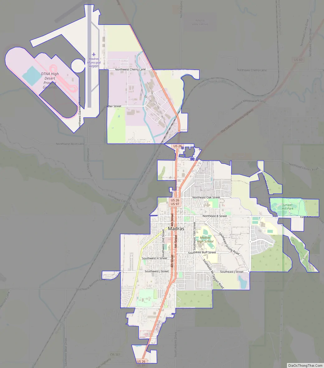
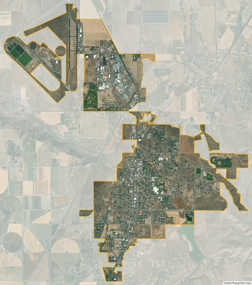
| Total Area: | 8.16 sq mi (21.13 km²) |
| Land Area: | 8.16 sq mi (21.13 km²) |
| Water Area: | 0.00 sq mi (0.00 km²) |
| Total Population: | 7,456 |
| Population Density: | 913.95/sq mi (352.88/km²) |
| ZIP code: | 97741 |
| Area code: | 541 |
| FIPS code: | 4145250 |
| GNISfeature ID: | 1145724 |
| Website: | ci.madras.or.us |
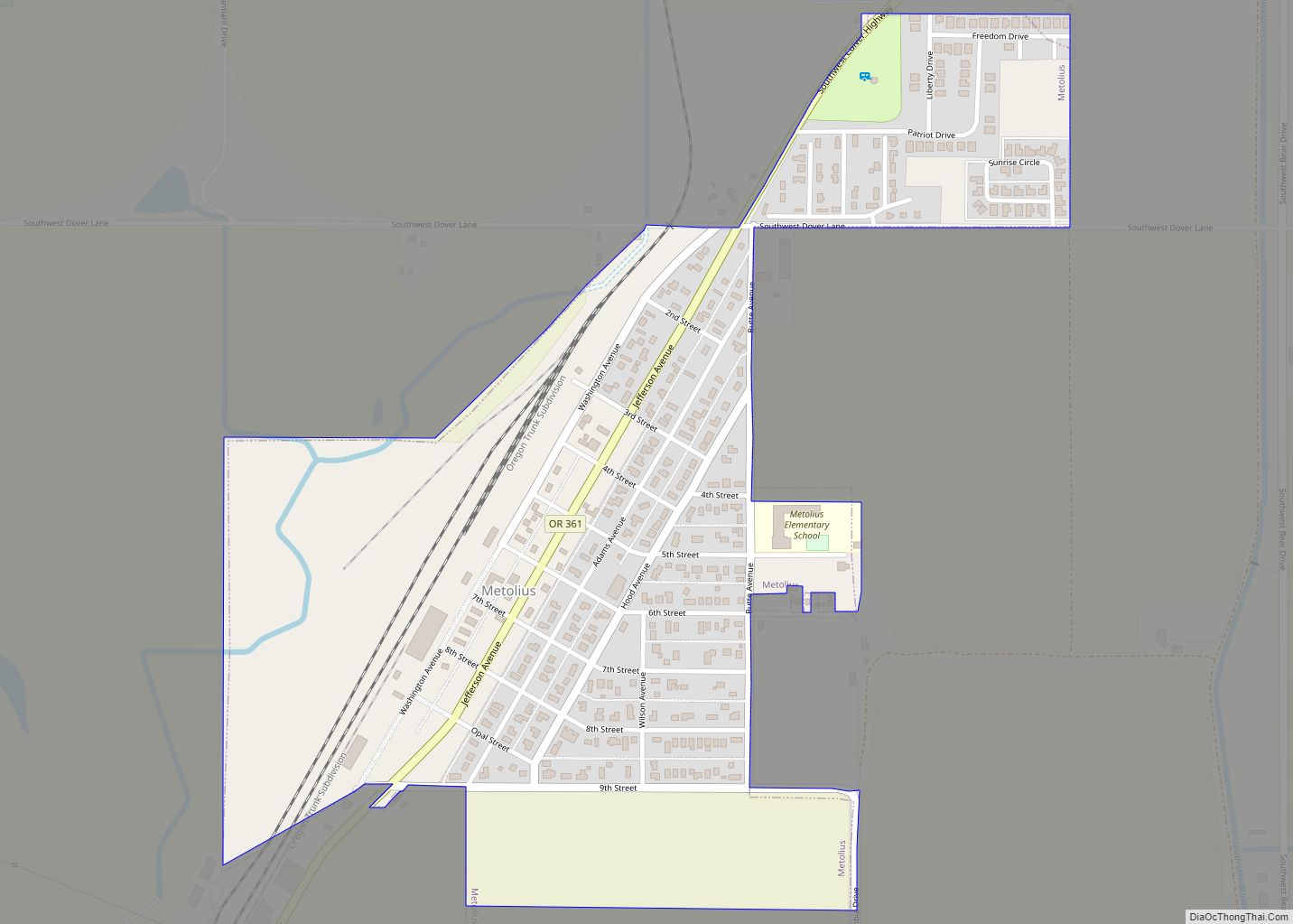
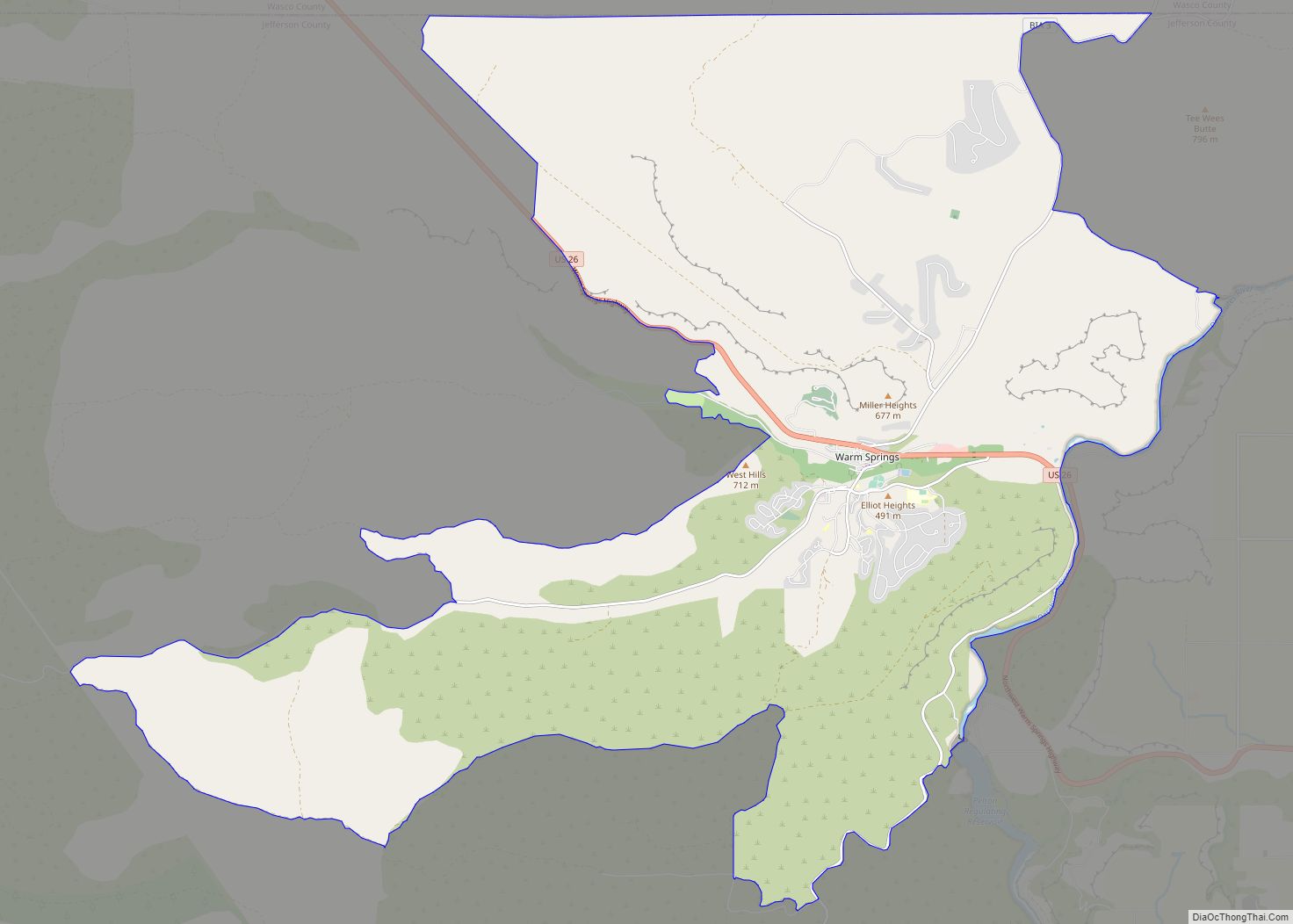
Online Interactive Map
Click on ![]() to view map in "full screen" mode.
to view map in "full screen" mode.
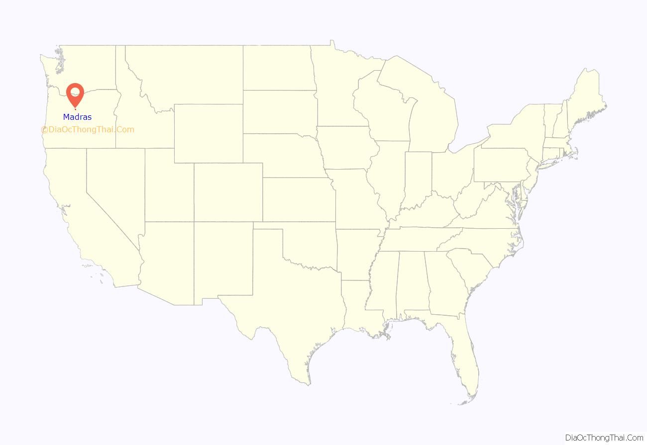
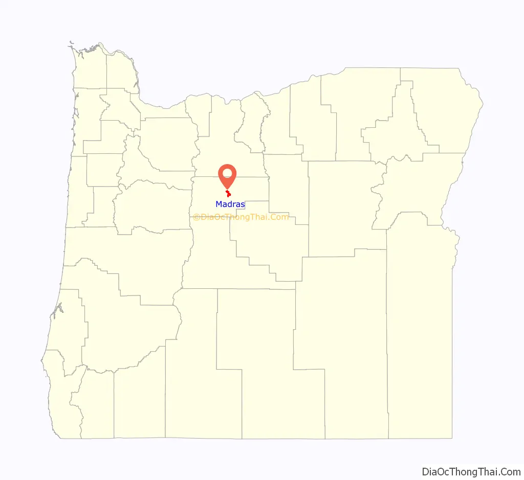
Madras location map. Where is Madras city?
History
The original plat for Madras was filed on July 18, 1902, by Scandinavian immigrant John A. Palmehn, for whom the town was originally named “Palmain”. The name was rejected by the U.S. Postal Service over its similarity to a post office named Parmen, and the name “Madras” was adopted, inspired by the cloth fabric of the same name, itself named for the city of Madras (now Chennai) in India.
Madras was incorporated as a city in 1911. An Army Air Corps base was built nearby during World War II. This airfield now serves as the Madras Municipal Airport. Homesteads approximately 5 miles (8 km) north of the city on Agency Plains were based on dryland wheat.
GMO incident
In 2003, a Scotts Company large field trial of GMO bentgrass near Madras resulted in pollen spreading the transgene, which is Roundup resistant, over an area of 120 square miles (310 km). Because the grower could not remove all genetically engineered plants, the U.S. Department of Agriculture fined the grower $500,000 for non-compliance with regulations in 2007.
2017 solar eclipse
The centerline of the path of totality of the Solar eclipse of August 21, 2017, ran through the center of Madras. Because the city is located in a high desert environment and has consistently clear skies in August, it was considered a prime eclipse viewing location. All of the hotel and motel rooms in the area had been reserved for several years. The town had prepared for an influx of about 100,000 visitors for the eclipse.
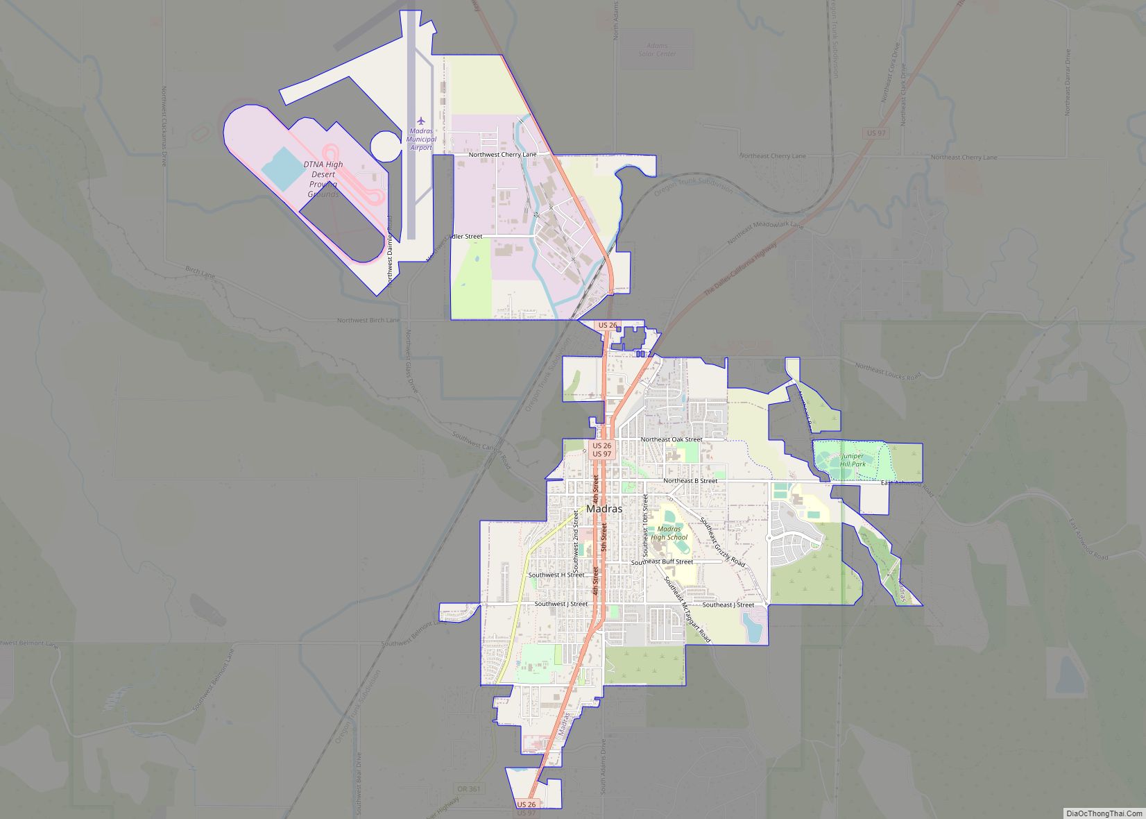
Madras Road Map
Madras city Satellite Map
Geography
According to the United States Census Bureau, the city has a total area of 5.02 square miles (13.00 km), all land.
Madras has a steppe climate (BSk) according to the Köppen climate classification system, also known as semi-arid.
See also
Map of Oregon State and its subdivision: Map of other states:- Alabama
- Alaska
- Arizona
- Arkansas
- California
- Colorado
- Connecticut
- Delaware
- District of Columbia
- Florida
- Georgia
- Hawaii
- Idaho
- Illinois
- Indiana
- Iowa
- Kansas
- Kentucky
- Louisiana
- Maine
- Maryland
- Massachusetts
- Michigan
- Minnesota
- Mississippi
- Missouri
- Montana
- Nebraska
- Nevada
- New Hampshire
- New Jersey
- New Mexico
- New York
- North Carolina
- North Dakota
- Ohio
- Oklahoma
- Oregon
- Pennsylvania
- Rhode Island
- South Carolina
- South Dakota
- Tennessee
- Texas
- Utah
- Vermont
- Virginia
- Washington
- West Virginia
- Wisconsin
- Wyoming