Map of Milwaukie city

Map of Milwaukie city

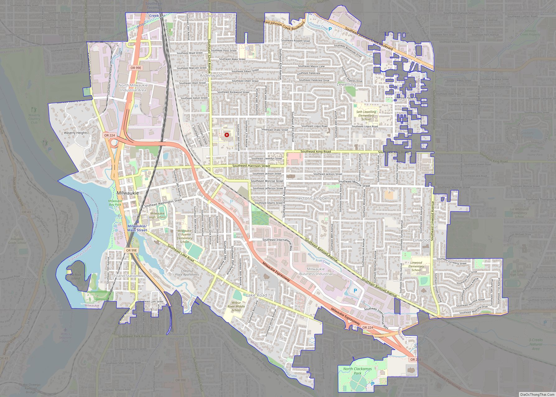
Milwaukie /mɪlˈwɔːki/ is a city mostly in Clackamas County, Oregon, United States; a very small portion of the city extends into Multnomah County. The population was 21,119 at the 2020 census. Founded in 1847 on the banks of the Willamette River, the city, known as the Dogwood City of the West, was incorporated in 1903 … Read more

Map of Milton-Freewater city

Map of Milton-Freewater city

Milton-Freewater is a city in Umatilla County, Oregon, United States. The city received its current name in 1951 when neighboring rival cities of Milton and Freewater voted to merge. The population was 7,151 at the 2020 census. It is part of the Pendleton–Hermiston Micropolitan Statistical Area. Milton-Freewater is home to a growing wine industry. Milton-Freewater … Read more

Map of Millersburg city, Oregon

Map of Millersburg city, Oregon

Millersburg is a city in Linn County, Oregon, United States. Millersburg originally was the name of a station on the Southern Pacific railroad line, which was named for a local farming family. The population was 1,329 at the 2010 census. Millersburg city overview: Name: Millersburg city LSAD Code: 25 LSAD Description: city (suffix) State: Oregon … Read more

Map of Mill City city

Map of Mill City

Mill City is a city in Linn and Marion counties in the U.S. state of Oregon on Oregon Route 22. The population was 1,971 at the 2020 census. It is on the North Santiam River, downstream from Detroit Lake. The Linn County portion of Mill City is part of the Albany–Lebanon Micropolitan Statistical Area, while … Read more

Map of Metzger CDP

Map of Metzger CDP

Metzger is a census-designated place and unincorporated community, in Washington County, Oregon, United States. As of the 2010 census, the CDP population was 3,765. It is named for Herman Metzger, who platted the community. It is a suburb located within Portland, Oregon. Metzger CDP overview: Name: Metzger CDP LSAD Code: 57 LSAD Description: CDP (suffix) … Read more

Map of Metolius city

Map of Metolius city

Metolius is a city in Jefferson County, Oregon, United States, named for the Metolius River, a nearby tributary of the Deschutes River. The name for both comes from the Warm Springs or Sahaptin word mitula, meaning white salmon and referring to a light colored Chinook salmon and not a whitefish. The population was 710 at … Read more

Map of Merrill city, Oregon

Map of Merrill city, Oregon

Merrill is a city in Klamath County, Oregon, United States. The population was 844 at the 2010 census. Merrill is an agricultural area and is home to an annual Potato Festival. The area was also part of the Klamath Basin water crisis pitting agricultural interests against endangered species water requirements, tribal interests, and environmentalists. Merrill … Read more

Map of Merlin CDP

Map of Merlin CDP

Merlin is an unincorporated community and census-designated place (CDP) in Josephine County, Oregon, United States. As of the 2010 census it had a population of 1,615. The area is known for sport fishing and whitewater rafting on the Rogue River. Merlin’s ZIP code is 97532. A new railroad station in this location in 1883 was … Read more

Map of Melrose CDP, Oregon

Map of Melrose CDP, Oregon

Melrose is an unincorporated community and census-designated place in Douglas County, Oregon, United States. As of the 2010 census, it had a population of 735. It was named by Henry Scott for Melrose Abbey in Scotland. Its post office, at first named Hogan, was established on May 18, 1887, and James McKinney was the first … Read more

Map of Mehama CDP

Map of Mehama CDP

Mehama is an unincorporated community in Marion County, Oregon, United States, located on Oregon Route 22 and the North Santiam River. For statistical purposes, the United States Census Bureau has defined Mehama as a census-designated place (CDP). The census definition of the area may not precisely correspond to local understanding of the area with the … Read more

Map of Monroe city, Oregon

Map of Monroe city, Oregon

Monroe is a city in Benton County, Oregon, United States. The population was 651 at the 2018 census. It is part of the Corvallis, Oregon Metropolitan Statistical Area. Monroe is located midway between Eugene and Corvallis along Highway 99W and the city experiences a strong friendly rivalry between fans of the Oregon Ducks and the … Read more

Map of Monmouth city, Oregon

Map of Monmouth city, Oregon

Monmouth (/ˈmɒnməθ/) is a city in Polk County in the U.S. state of Oregon. It was named for Monmouth, Illinois, the origin of its earliest settlers. The population is 11,110 at the 2020 Census and it is part of the Salem Metropolitan Statistical Area. Monmouth city overview: Name: Monmouth city LSAD Code: 25 LSAD Description: … Read more