Millersburg is a city in Linn County, Oregon, United States. Millersburg originally was the name of a station on the Southern Pacific railroad line, which was named for a local farming family. The population was 1,329 at the 2010 census.
| Name: | Millersburg city |
|---|---|
| LSAD Code: | 25 |
| LSAD Description: | city (suffix) |
| State: | Oregon |
| County: | Linn County |
| Incorporated: | 1974 |
| Elevation: | 235 ft (72 m) |
| Total Area: | 4.68 sq mi (12.12 km²) |
| Land Area: | 4.46 sq mi (11.56 km²) |
| Water Area: | 0.22 sq mi (0.56 km²) |
| Total Population: | 2,919 |
| Population Density: | 654.04/sq mi (252.53/km²) |
| ZIP code: | 97321 |
| Area code: | 458 and 541 |
| FIPS code: | 4148300 |
| GNISfeature ID: | 1637924 |
| Website: | cityofmillersburg.org |
Online Interactive Map
Click on ![]() to view map in "full screen" mode.
to view map in "full screen" mode.
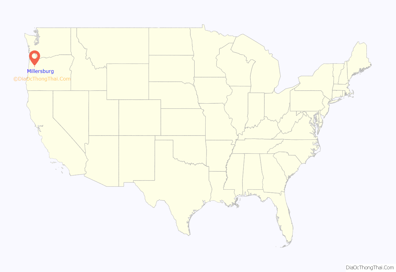
Millersburg location map. Where is Millersburg city?

History
Millersburg came into being in 1974, to prevent the city of Albany from attempting to extend its city limits to include where Wah Chang Corporation operated a zirconium processing plant for the United States Bureau of Mines.
Although now owned by Allegheny Technologies and until recently known as ATI Wah Chang, this processing plant is the city’s largest employer.
Millersburg’s infamous stench of past years, often attributed to the Wah Chang facility, is actually generated by the nearby Weyerhaeuser wood products processing mill. This has lent support to various attempts to close both plants. In August 2008, Weyerhauser sold the mill to International Paper. International Paper then closed the mill at the end of 2009, laying off 270 employees. As of summer 2010, the mill sits idle.
On July 22, 2010, the demolition of the paper mill, now owned by International Paper, began with the implosion of the number 4 recovery boiler.
In 2008, Peak Sun Silicon built a 10,000-square-foot (930 m) polysilicon production facility in Millersburg. They currently employ about 50 people with plans to expand up to 500 jobs by 2013. However Peak Sun Silicon’s land in Oregon was foreclosed on after they were unable to repay a loan from the Oregon Department of Energy.
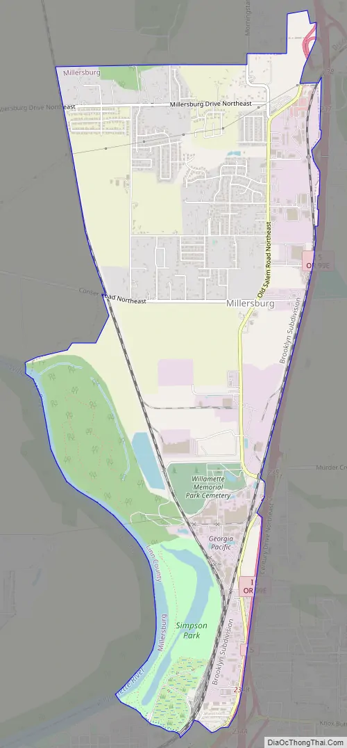
Millersburg Road Map
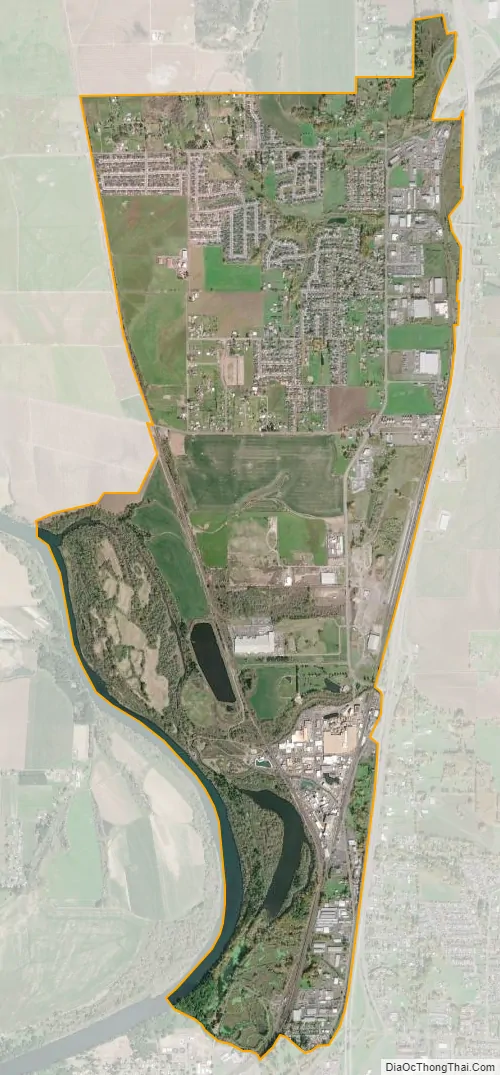
Millersburg city Satellite Map
Geography
According to the United States Census Bureau, the city has a total area of 4.65 square miles (12.04 km), of which 4.43 square miles (11.47 km) is land and 0.22 square miles (0.57 km) is water.
See also
Map of Oregon State and its subdivision: Map of other states:- Alabama
- Alaska
- Arizona
- Arkansas
- California
- Colorado
- Connecticut
- Delaware
- District of Columbia
- Florida
- Georgia
- Hawaii
- Idaho
- Illinois
- Indiana
- Iowa
- Kansas
- Kentucky
- Louisiana
- Maine
- Maryland
- Massachusetts
- Michigan
- Minnesota
- Mississippi
- Missouri
- Montana
- Nebraska
- Nevada
- New Hampshire
- New Jersey
- New Mexico
- New York
- North Carolina
- North Dakota
- Ohio
- Oklahoma
- Oregon
- Pennsylvania
- Rhode Island
- South Carolina
- South Dakota
- Tennessee
- Texas
- Utah
- Vermont
- Virginia
- Washington
- West Virginia
- Wisconsin
- Wyoming