Merrill is a city in Klamath County, Oregon, United States. The population was 844 at the 2010 census.
Merrill is an agricultural area and is home to an annual Potato Festival. The area was also part of the Klamath Basin water crisis pitting agricultural interests against endangered species water requirements, tribal interests, and environmentalists.
Merrill was the birthplace and boyhood home of Carl Barks, the Disney comics artist who created Scrooge McDuck, among other characters. It is home to the Raiders of Lost River Jr./Sr. High School.
| Name: | Merrill city |
|---|---|
| LSAD Code: | 25 |
| LSAD Description: | city (suffix) |
| State: | Oregon |
| County: | Klamath County |
| Incorporated: | 1903 |
| Elevation: | 4,071 ft (1,241 m) |
| Total Area: | 0.46 sq mi (1.19 km²) |
| Land Area: | 0.46 sq mi (1.19 km²) |
| Water Area: | 0.00 sq mi (0.00 km²) |
| Total Population: | 821 |
| Population Density: | 1,788.67/sq mi (690.66/km²) |
| ZIP code: | 97633 |
| Area code: | 541 |
| FIPS code: | 4147700 |
| GNISfeature ID: | 1124069 |
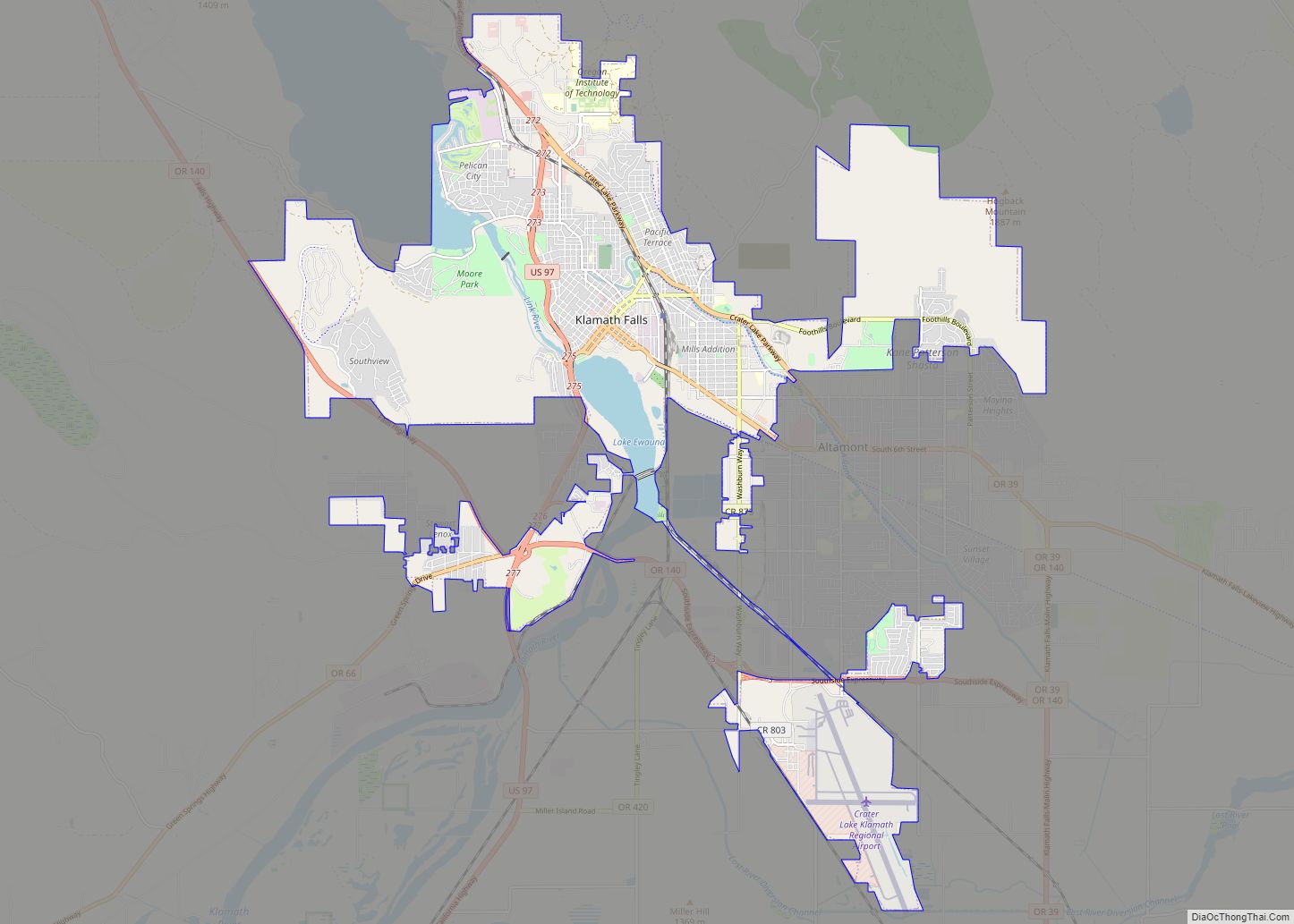
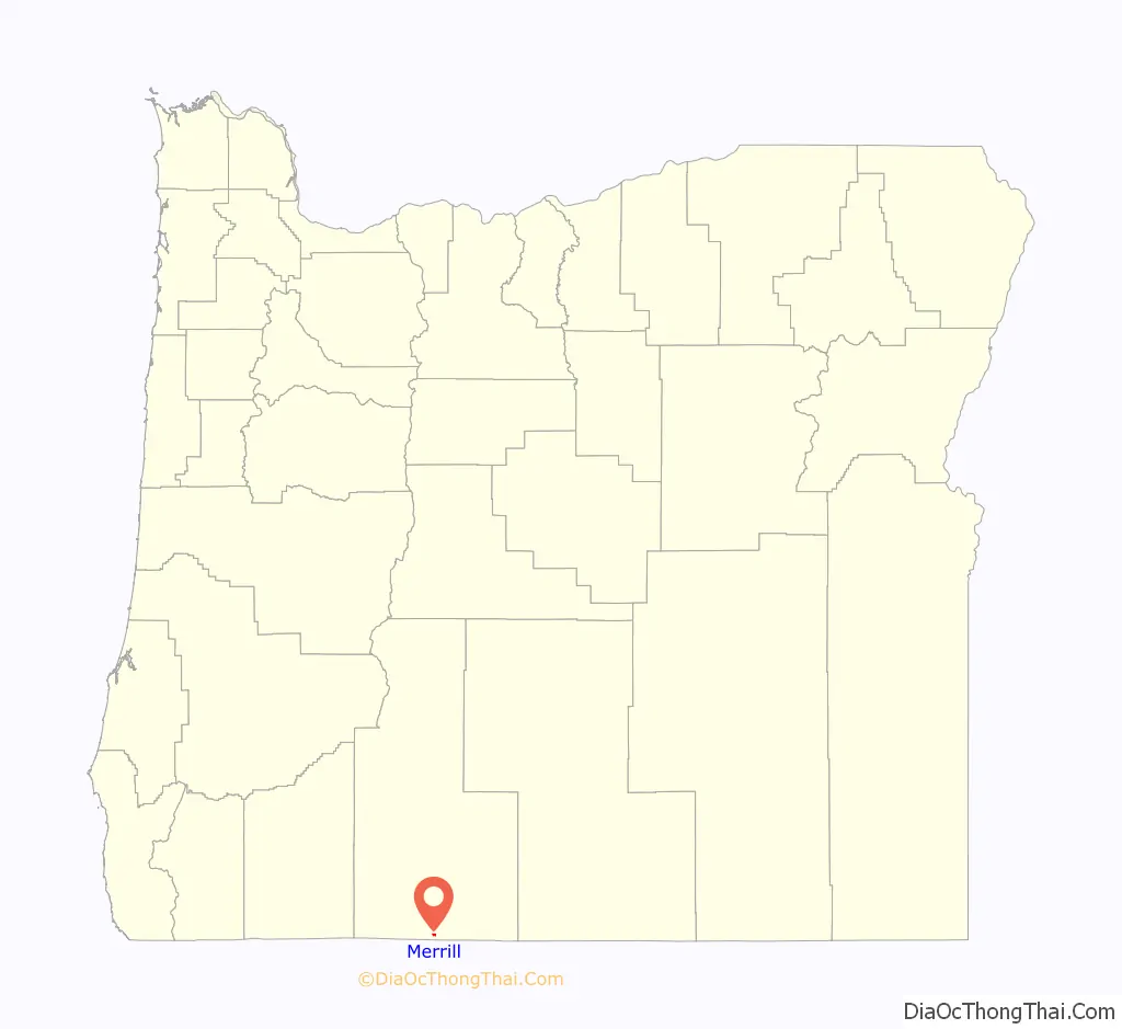
Online Interactive Map
Click on ![]() to view map in "full screen" mode.
to view map in "full screen" mode.
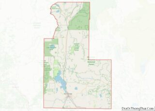
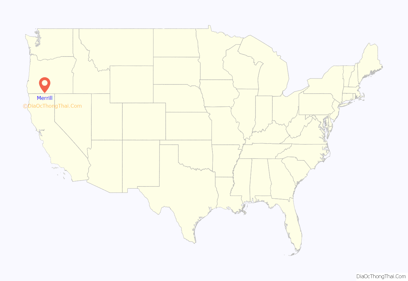
Merrill location map. Where is Merrill city?
History
Merrill was named for rancher Nathan S. Merrill, who settled at this location in 1890. A post office was established in Merrill in 1896. H. E. Momyre was the postmaster. The first business in Merrill was a grist mill.
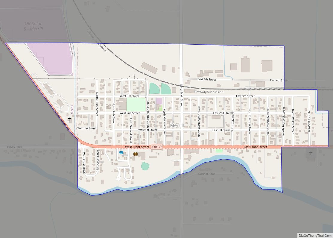
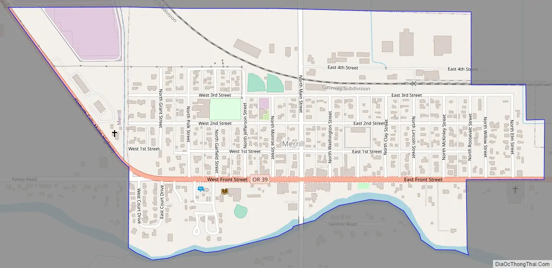
Merrill Road Map
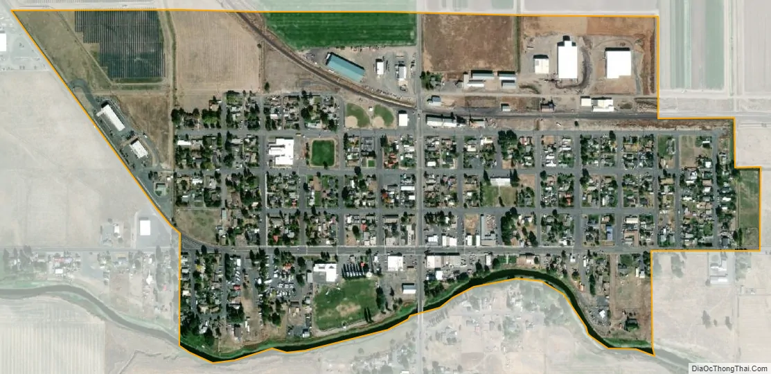
Merrill city Satellite Map
Geography
Merrill is at an elevation of 4,071 feet (1,241 m) in southern Klamath County, near the Oregon–California border. It is along Oregon Route 39 southeast of Klamath Falls and northwest of Tulelake. Lower Klamath Lake and Tule Lake, both in California, are slightly south of Merrill. By highway, the city is 20 miles (32 km) from Klamath Falls and 300 miles (480 km) from Portland.
The Lost River flows by Merrill. Mount Shasta in the Cascade Range southwest of Merrill, although it lies across the California state line, is visible from the city. According to the United States Census Bureau, the city has a total area of 0.46 square miles (1.19 km), all of it land.
Climate
The region experiences warm (but not hot) and dry summers, with no average monthly temperatures above 71.6 °F (22.0 °C). According to the Köppen Climate Classification system, Merrill has a warm-summer Mediterranean climate, abbreviated “Csb” on climate maps.
See also
Map of Oregon State and its subdivision: Map of other states:- Alabama
- Alaska
- Arizona
- Arkansas
- California
- Colorado
- Connecticut
- Delaware
- District of Columbia
- Florida
- Georgia
- Hawaii
- Idaho
- Illinois
- Indiana
- Iowa
- Kansas
- Kentucky
- Louisiana
- Maine
- Maryland
- Massachusetts
- Michigan
- Minnesota
- Mississippi
- Missouri
- Montana
- Nebraska
- Nevada
- New Hampshire
- New Jersey
- New Mexico
- New York
- North Carolina
- North Dakota
- Ohio
- Oklahoma
- Oregon
- Pennsylvania
- Rhode Island
- South Carolina
- South Dakota
- Tennessee
- Texas
- Utah
- Vermont
- Virginia
- Washington
- West Virginia
- Wisconsin
- Wyoming