Map of Seventh Mountain CDP

Map of Seventh Mountain CDP

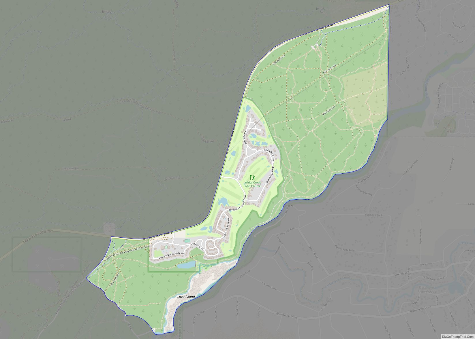
Seventh Mountain is an unincorporated community and census-designated place (CDP) in Deschutes County, in the U.S. state of Oregon. The community lies along the west bank of the Deschutes River southwest of Bend. Century Drive Highway, part of the Cascade Lakes Scenic Byway, connects Bend to Seventh Mountain. From Seventh Mountain, the byway runs west … Read more

Map of Seneca city, Oregon

Map of Seneca city, Oregon

Seneca is a city in Grant County, Oregon, United States. It is located in the Blue Mountains about 23 miles (37 km) south of Canyon City, on U.S. Route 395, on the edge of the Malheur National Forest. The population was 199 at the 2010 census. Seneca city overview: Name: Seneca city LSAD Code: 25 LSAD … Read more

Map of Selma CDP, Oregon

Map of Selma CDP, Oregon

Selma is an unincorporated community and census-designated place (CDP) in Josephine County, Oregon, United States. As of the 2010 census it had a population of 695. It is located in the ZIP code of 97538. Selma CDP overview: Name: Selma CDP LSAD Code: 57 LSAD Description: CDP (suffix) State: Oregon County: Josephine County Elevation: 1,325 ft … Read more

Map of Seaside city, Oregon

Map of Seaside city, Oregon

Seaside is a city in Clatsop County, Oregon, United States, on the coast of the Pacific Ocean. The name Seaside is derived from Seaside House, a historic summer resort built in the 1870s by railroad magnate Ben Holladay. The city’s population was 6,457 at the 2010 census. Seaside city overview: Name: Seaside city LSAD Code: … Read more

Map of South Lebanon CDP, Oregon

Map of South Lebanon CDP, Oregon

South Lebanon is a census-designated place (CDP) in Linn County, Oregon, United States, comprising unincorporated land on the south side of the city of Lebanon. The population was 1,005 at the 2010 census. The population and area of the CDP decreased between 2000 and 2010 as the city limits of Lebanon expanded southward. South Lebanon … Read more

Map of Sodaville city

Map of Sodaville city

Sodaville is a city in Linn County, Oregon, United States. The population was 308 at the 2010 census. The city’s name comes from the nearby Sodaville Mineral Springs. A post office at Sodaville operated from 1871 to 1933. Sodaville city overview: Name: Sodaville city LSAD Code: 25 LSAD Description: city (suffix) State: Oregon County: Linn … Read more

Map of Sisters city

Map of Sisters city

Sisters is a city in Deschutes County, Oregon, United States. It is part of the Bend, Oregon Metropolitan Statistical Area. The population was 2,038 at the 2010 census. Sisters city overview: Name: Sisters city LSAD Code: 25 LSAD Description: city (suffix) State: Oregon County: Deschutes County Incorporated: 1946 Elevation: 3,182 ft (970 m) Total Area: 1.93 sq mi (5.01 km²) … Read more

Map of Silverton city, Oregon

Map of Silverton city, Oregon

Silverton is a city in Marion County, Oregon, United States. The city is situated along the 45th parallel about 12 miles (19 km) northeast of Salem, in the eastern margins of the broad alluvial plain of the Willamette Valley. The city is named after Silver Creek, which flows through the town from Silver Falls into the … Read more

Map of Silver Lake CDP, Oregon

Map of Silver Lake CDP, Oregon

Silver Lake is an unincorporated community and census-designated place in western Lake County, Oregon, United States, along Oregon Route 31. As of the 2010 census, it had a population of 149. Facilities include a gas station and a small store, a post office, and a public school, North Lake School, serving grades K-12. Silver Lake … Read more

Map of Stafford CDP, Oregon

Map of Stafford CDP, Oregon

Stafford is an unincorporated community, classified as a hamlet, in Clackamas County, Oregon, United States. It is a census-designated place (CDP), with a population of 1,577 as of the 2010 census. The community covers approximately 15.7 km (3,900 acres) located in a rough triangle south of Lake Oswego, east of Tualatin, and west of West Linn. … Read more

Map of St. Paul city, Oregon

Map of St. Paul city, Oregon

St. Paul is a city in Marion County, Oregon, United States. It is named after the Saint Paul Mission founded by Archbishop François Norbert Blanchet, who arrived in the Oregon Country in 1838 to minister to the Catholic inhabitants of French Prairie. The population was 434 at the 2020 census. The city is part of … Read more

Map of St. Helens city

Map of St. Helens city

St. Helens is the county seat of Columbia County, Oregon. It was founded by Captain Henry Montgomery Knighton, a native of New England, in 1845, as “Plymouth”. The name was changed to St. Helens in the latter part of 1850 for its view of Mount St. Helens, roughly 39 miles (63 km) away in Washington. The … Read more