Silver Lake is an unincorporated community and census-designated place in western Lake County, Oregon, United States, along Oregon Route 31. As of the 2010 census, it had a population of 149. Facilities include a gas station and a small store, a post office, and a public school, North Lake School, serving grades K-12.
| Name: | Silver Lake CDP |
|---|---|
| LSAD Code: | 57 |
| LSAD Description: | CDP (suffix) |
| State: | Oregon |
| County: | Lake County |
| Elevation: | 4,354 ft (1,327 m) |
| Total Area: | 1.48 sq mi (3.83 km²) |
| Land Area: | 1.48 sq mi (3.83 km²) |
| Water Area: | 0.00 sq mi (0.00 km²) |
| Total Population: | 159 |
| Population Density: | 107.58/sq mi (41.52/km²) |
| ZIP code: | 97638 |
| FIPS code: | 4167600 |
| GNISfeature ID: | 2611778 |
Online Interactive Map
Click on ![]() to view map in "full screen" mode.
to view map in "full screen" mode.
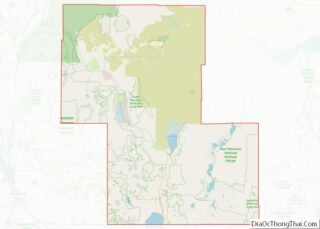
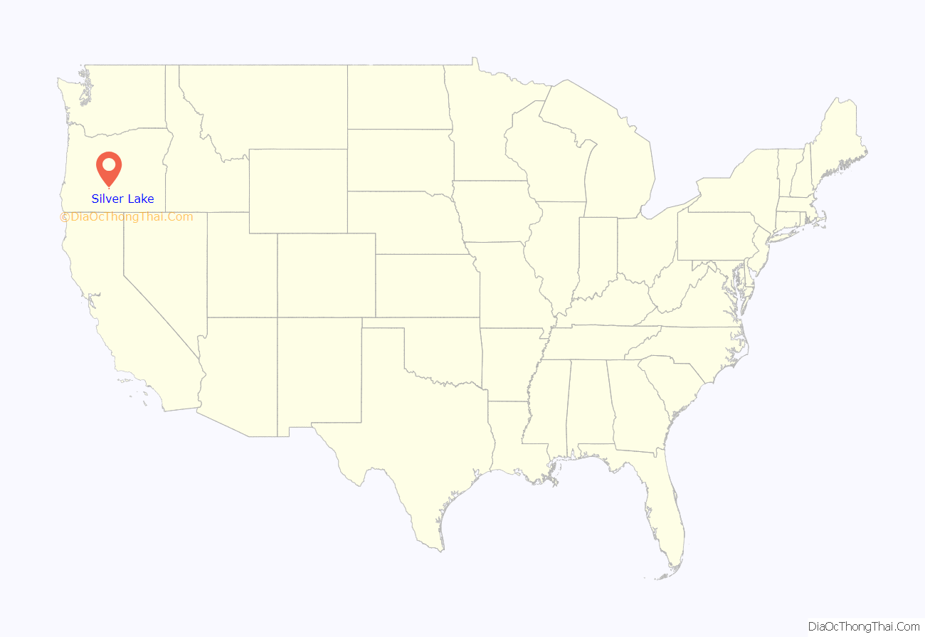
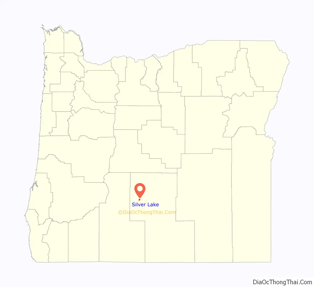
Silver Lake location map. Where is Silver Lake CDP?
History
Community church in Silver Lake
Cowboy herding cattle on Highway 31 near Silver Lake
The community of Silver Lake is located in the high desert of central Oregon. The town is named for a lake of the same name that is 6 miles (10 km) east of town. On December 9, 1875, the post office was established. The post office location has moved at least twice, depending on where the house of the postmaster was at the time.
According to Oregon Geographic Names, “The most important happening in the history of the community was a fire that occurred on December 24, 1894, in which 43 people lost their lives in the burning of one building.” A fire broke out at a Christmas Eve celebration inside the crowded second-floor hall above a store. Ed O’Farrell rode 100 miles (160 km) to Lakeview for medical help. After receiving the message, Doctor Bernard Daly drove his buggy over bad winter roads for 24 hours to reach Silver Lake. Doctor Daly’s efforts to reach and treat the victims earned statewide recognition.
North Lake School in Silver Lake serves approximately 260 students from the towns of Silver Lake, Christmas Valley, and Fort Rock and consists of a single K-12 school building, which opened in 1991.
Sparsely populated, but seeing an increase as Bend grows, the area is ideal for those interested in the outdoors; hunting, fishing, hiking, camping, skiing, and bird watching are favorite activities of local residents. Wildlife is abundant in the area, such as mule deer, pronghorn antelope, elk, coyotes, badgers, eagles, and hawks.
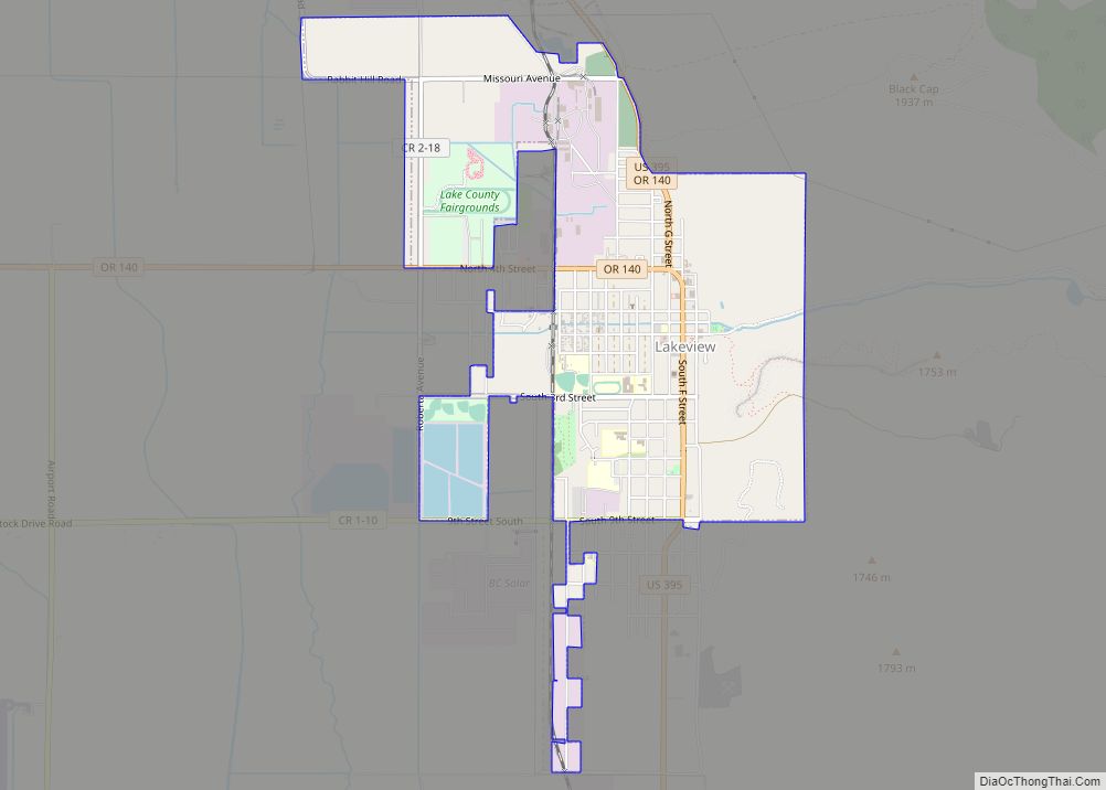
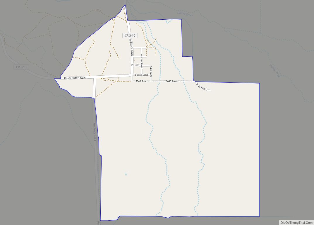
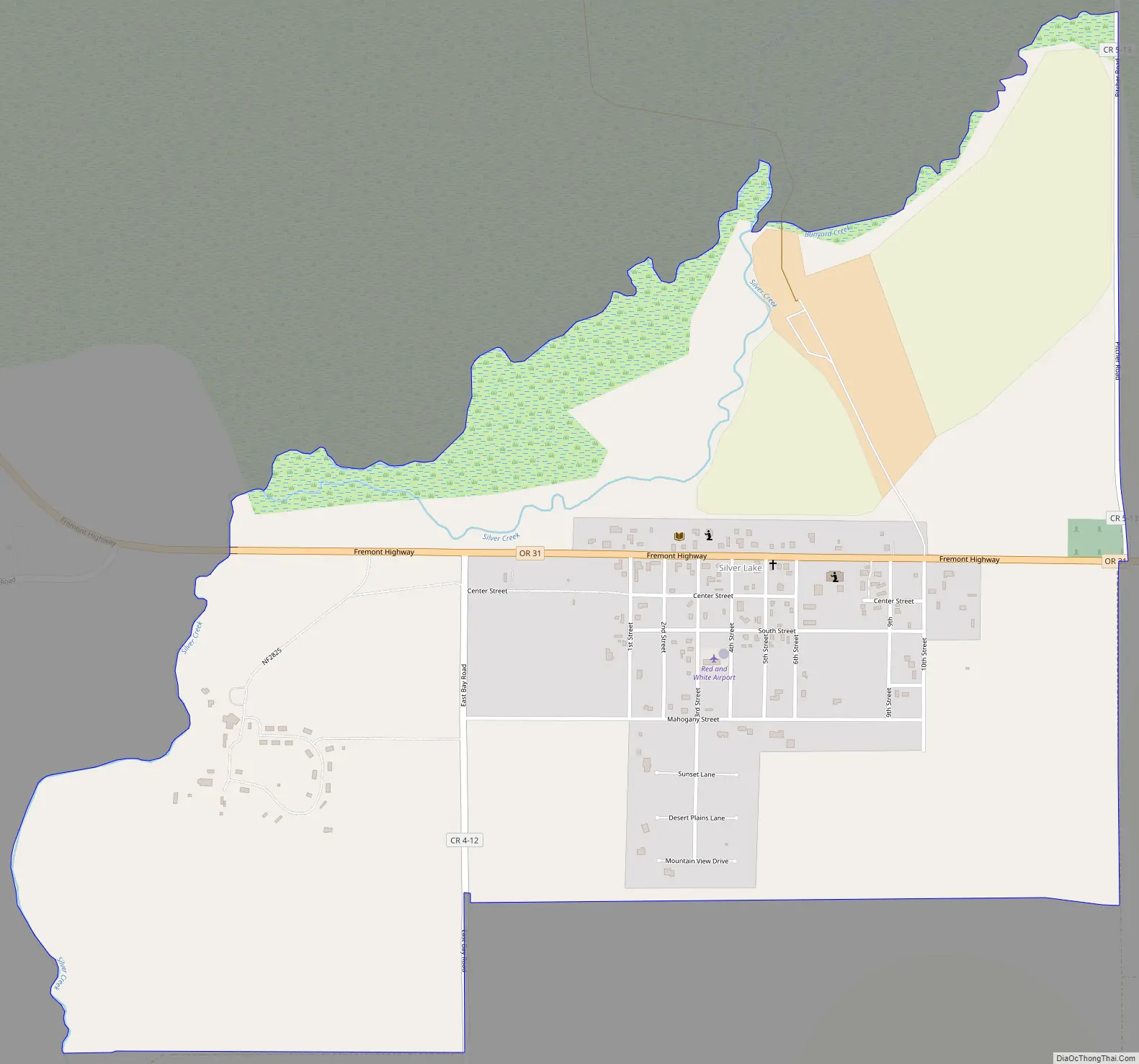
Silver Lake Road Map
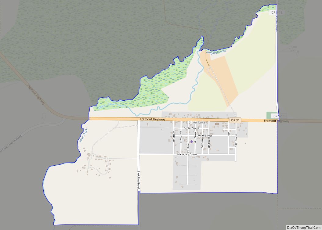
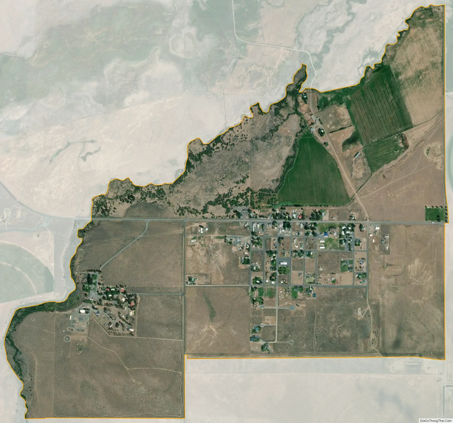
Silver Lake city Satellite Map
See also
Map of Oregon State and its subdivision: Map of other states:- Alabama
- Alaska
- Arizona
- Arkansas
- California
- Colorado
- Connecticut
- Delaware
- District of Columbia
- Florida
- Georgia
- Hawaii
- Idaho
- Illinois
- Indiana
- Iowa
- Kansas
- Kentucky
- Louisiana
- Maine
- Maryland
- Massachusetts
- Michigan
- Minnesota
- Mississippi
- Missouri
- Montana
- Nebraska
- Nevada
- New Hampshire
- New Jersey
- New Mexico
- New York
- North Carolina
- North Dakota
- Ohio
- Oklahoma
- Oregon
- Pennsylvania
- Rhode Island
- South Carolina
- South Dakota
- Tennessee
- Texas
- Utah
- Vermont
- Virginia
- Washington
- West Virginia
- Wisconsin
- Wyoming