Map of Brogan CDP

Map of Brogan CDP

Brogan is an unincorporated community and Census-designated place (CDP) in Malheur County, Oregon, United States, on U.S. Route 26. Brogan was founded by D. M. Brogan in 1909, and when a post office was established in the locality on April 23 that year, it was named for him. Brogan is located on the north end … Read more

Map of Bonanza town, Oregon

Map of Bonanza town, Oregon

Bonanza is a town in Klamath County, Oregon, United States, near Klamath Falls. The population was 415 at the 2010 census. Bonanza town overview: Name: Bonanza town LSAD Code: 43 LSAD Description: town (suffix) State: Oregon County: Klamath County Incorporated: 1901 Elevation: 4,127 ft (1,258 m) Total Area: 0.82 sq mi (2.12 km²) Land Area: 0.82 sq mi (2.12 km²) Water Area: 0.00 sq mi … Read more

Map of Boardman city, Oregon

Map of Boardman city, Oregon

Boardman is a city in Morrow County, Oregon, United States on the Columbia River and Interstate 84. As of the 2020 census the population was 3,828. It is currently the largest town in Morrow County, Oregon. Boardman city overview: Name: Boardman city LSAD Code: 25 LSAD Description: city (suffix) State: Oregon County: Morrow County Incorporated: … Read more

Map of Blodgett CDP, Oregon

Map of Blodgett CDP, Oregon

Blodgett is a census-designated place (CDP) and unincorporated community in Benton County, Oregon, United States, where Oregon Route 180 meets U.S. Route 20 in the Central Oregon Coast Range 15 miles (24 km) west of Corvallis. It is near the confluence of the Tumtum and Marys rivers. As of the 2010 census, the community had a … Read more

Map of Black Butte Ranch CDP

Map of Black Butte Ranch CDP

Black Butte Ranch is a census-designated place (CDP) and unincorporated private resort community in Deschutes County, Oregon, United States. It is located in the Cascade Range, 8 miles (13 km) northwest of Sisters. The population was 366 at the 2010 census. Black Butte Ranch allows public access to its restaurant, golf courses and horse stables, but … Read more

Map of Biggs Junction CDP

Map of Biggs Junction CDP

Biggs Junction is an unincorporated community in Sherman County, Oregon, United States. For statistical purposes, the United States Census Bureau has defined Biggs Junction as a census-designated place (CDP). The census definition of the area may not precisely correspond to local understanding of the area with the same name. Biggs Junction is located on the … Read more

Map of Bethany CDP, Oregon

Map of Bethany CDP, Oregon

Bethany is an unincorporated community and census-designated place in Washington County, Oregon, United States. It is situated north of U.S. Route 26 and Oak Hills, near Beaverton, approximately four miles northwest of Cedar Mill, and is within the Portland metropolitan area. Bethany CDP overview: Name: Bethany CDP LSAD Code: 57 LSAD Description: CDP (suffix) State: … Read more

Map of Bend city, Oregon

Map of Bend city, Oregon

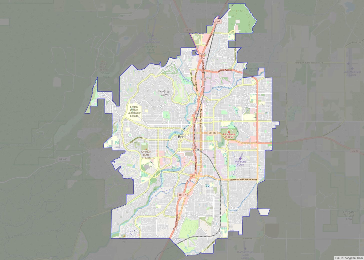
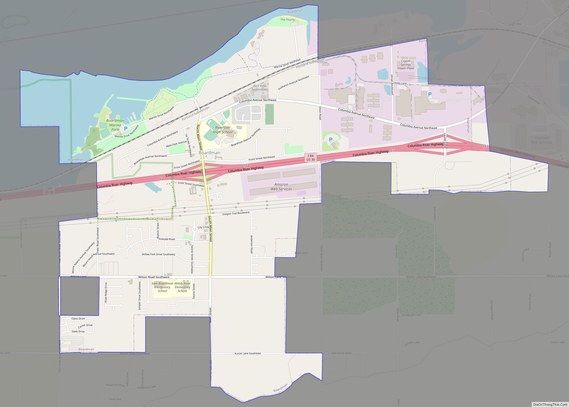
Bend is a city in and the county seat of Deschutes County, Oregon, United States. It is the principal city of the Bend Metropolitan Statistical Area. Bend is Central Oregon’s largest city, with a population of 99,178 at the time of the 2020 U.S. Census, up from 76,693 at the time of the 2010 U.S. … Read more

Map of Burns city, Oregon

Map of Burns city, Oregon

Burns is a city in and the county seat of Harney County, in the U.S. state of Oregon. According to the 2010 census, the population was 2,806. Burns and the nearby city of Hines are home to about 60 percent of the people in the sparsely populated county, by area the largest in Oregon and the … Read more

Map of Bunker Hill CDP, Oregon

Map of Bunker Hill CDP, Oregon

Bunker Hill is a census-designated place (CDP) in Coos County, Oregon, United States. As of the 2010 census the population was 1,444. Bunker Hill CDP overview: Name: Bunker Hill CDP LSAD Code: 57 LSAD Description: CDP (suffix) State: Oregon County: Coos County Elevation: 128 ft (39 m) Total Area: 1.59 sq mi (4.12 km²) Land Area: 1.46 sq mi (3.78 km²) Water Area: … Read more

Map of Bull Mountain CDP

Map of Bull Mountain CDP

Bull Mountain is an unincorporated community and census-designated place in Washington County, Oregon, United States. Bull Mountain is located mostly on a hill for which the community is named. It is bordered on the east by Tigard, on the south by King City, and Beaverton lies to the north. The north-eastern part of the Bull … Read more

Map of Brownsville city, Oregon

Map of Brownsville city, Oregon

Brownsville is a city in Linn County, Oregon, United States. As of the 2020 census the population was 1,694. It is the setting for the fictional town of Castle Rock, Oregon, in the 1986 film Stand by Me. Brownsville city overview: Name: Brownsville city LSAD Code: 25 LSAD Description: city (suffix) State: Oregon County: Linn … Read more