Boardman is a city in Morrow County, Oregon, United States on the Columbia River and Interstate 84. As of the 2020 census the population was 3,828. It is currently the largest town in Morrow County, Oregon.
| Name: | Boardman city |
|---|---|
| LSAD Code: | 25 |
| LSAD Description: | city (suffix) |
| State: | Oregon |
| County: | Morrow County |
| Incorporated: | May 20, 1921 |
| Elevation: | 308 ft (94 m) |
| Total Area: | 4.43 sq mi (11.47 km²) |
| Land Area: | 4.03 sq mi (10.43 km²) |
| Water Area: | 0.40 sq mi (1.04 km²) |
| Total Population: | 3,828 |
| Population Density: | 950.11/sq mi (366.86/km²) |
| ZIP code: | 97818 |
| Area code: | 541 |
| FIPS code: | 4107200 |
| GNISfeature ID: | 1136082 |
| Website: | cityofboardman.com |
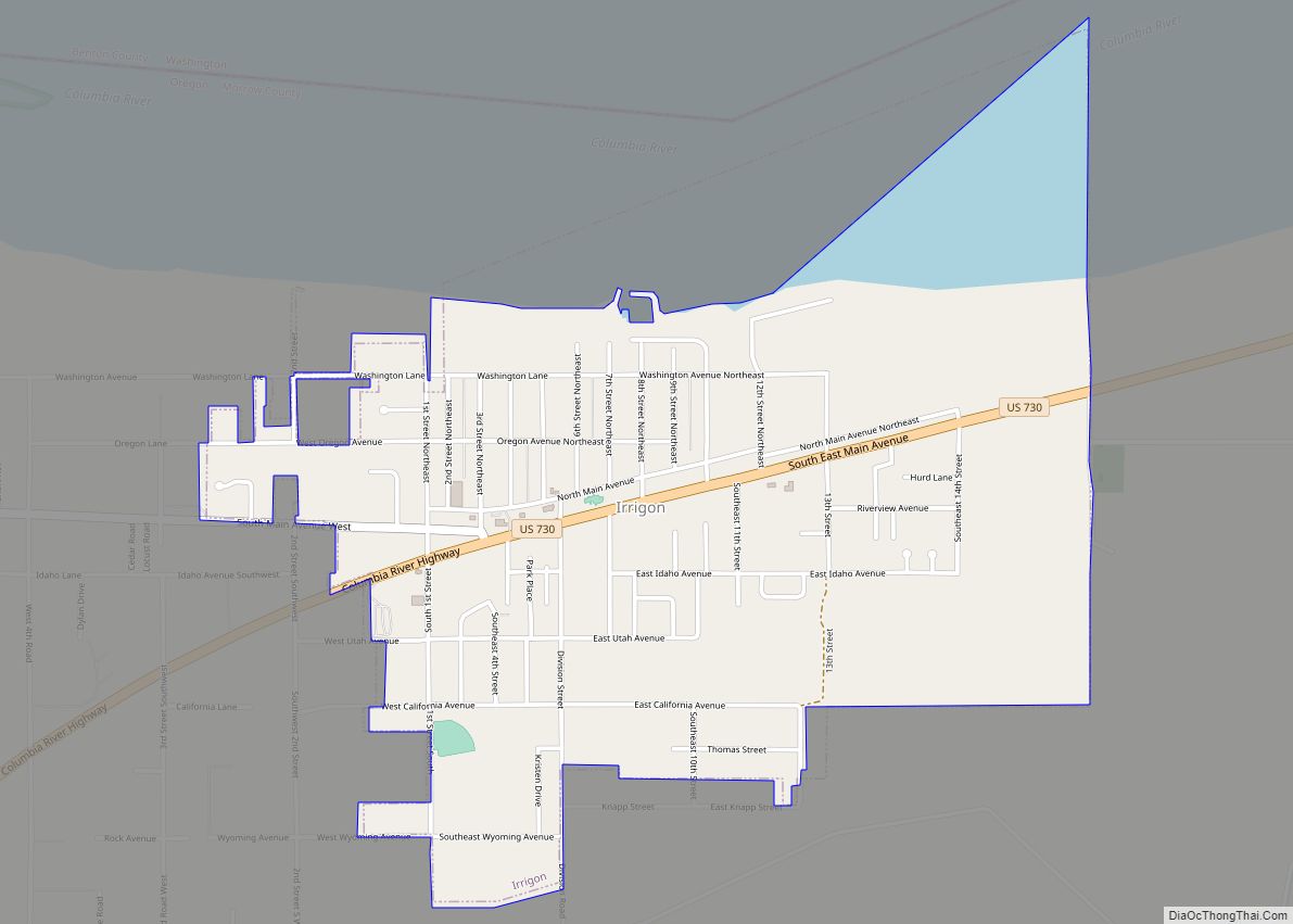
Online Interactive Map
Click on ![]() to view map in "full screen" mode.
to view map in "full screen" mode.
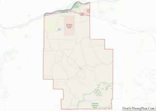
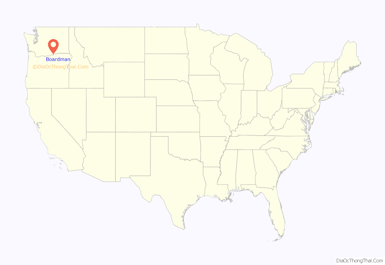
Boardman location map. Where is Boardman city?
History
Boardman was homesteaded in 1903 by Samuel H. Boardman, the first superintendent of the Oregon State Parks System. Boardman and his wife worked for 13 years to develop irrigation for their land; during those years his wife taught school, and Boardman at times worked on railroad construction projects. The Union Pacific Railroad passed through Boardman, where it had a station. The community was platted in 1916 at about the same time Samuel Boardman went to work for the Oregon State Highway Department and became involved in the development of roadside parks.
The Boardman post office opened in 1916. The city was incorporated in 1921. During construction of the John Day Dam on the Columbia River in the 1960s, the city had to be moved south, further from the water. Lake Umatilla, behind the dam, covered much of the original city.
South of Boardman, the U.S. Army Air Force established a training range in 1941. The Air Force transferred ownership of the range in 1960 to the U.S. Navy and it is now known as the Naval Weapons Systems Training Facility Boardman. The range is largely used by NAS Whidbey Island and the Oregon National Guard.
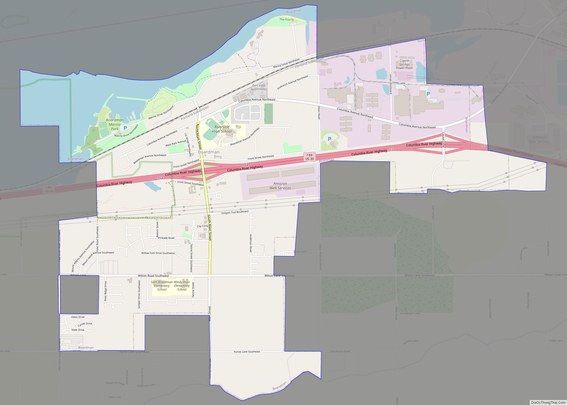
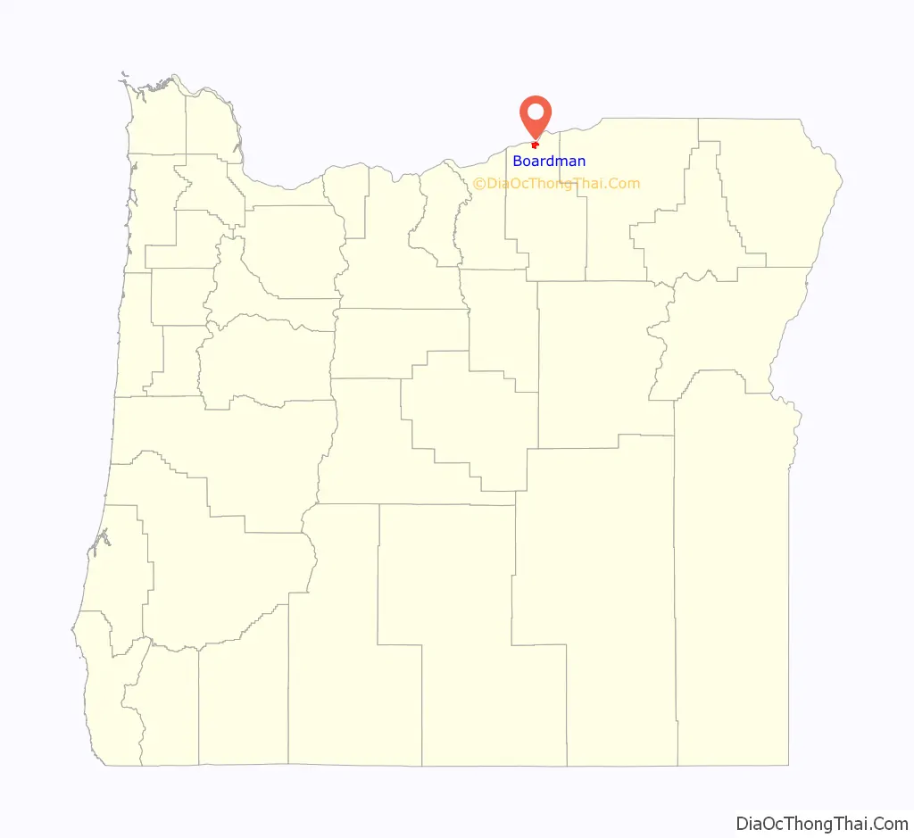
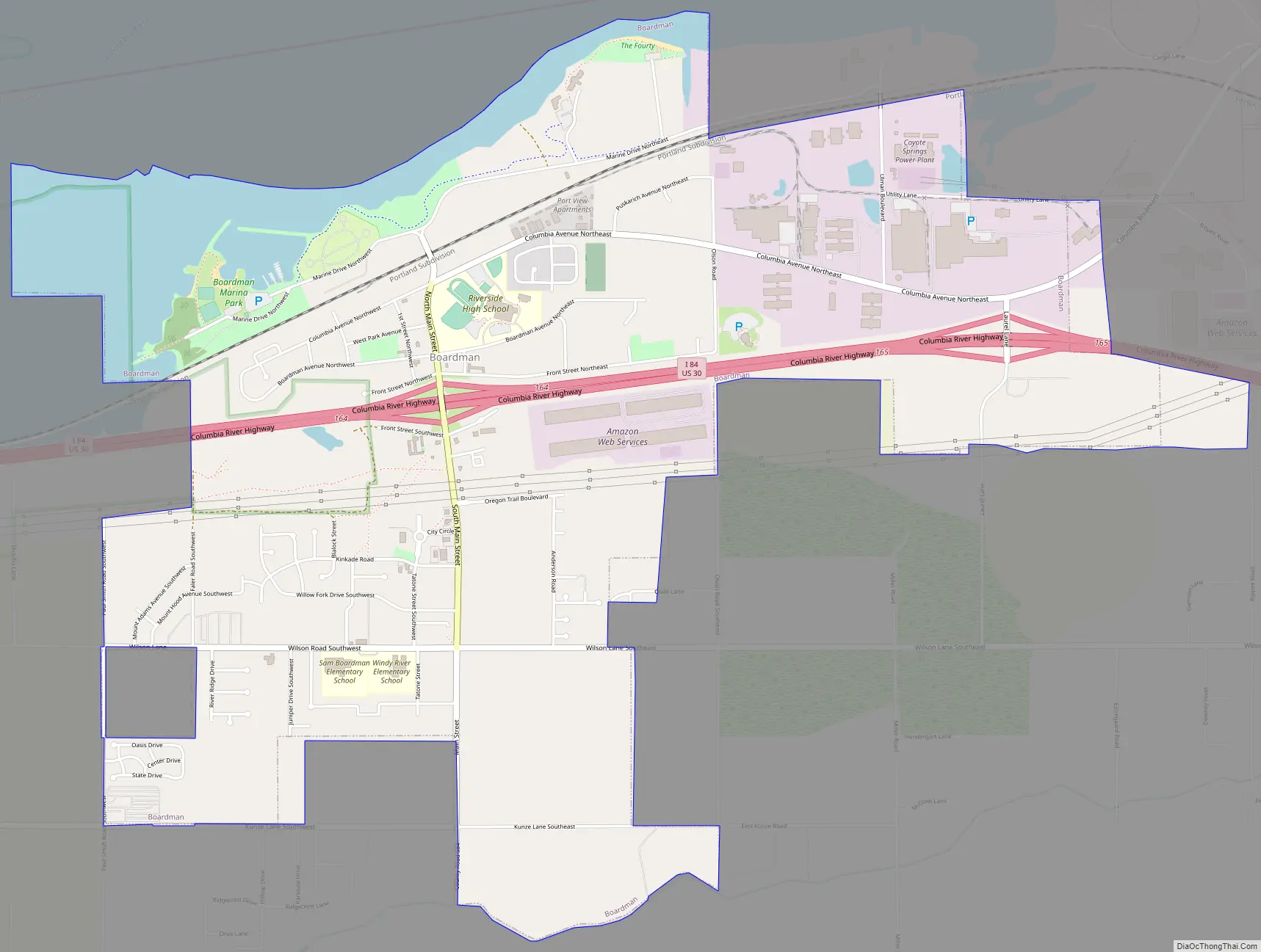
Boardman Road Map
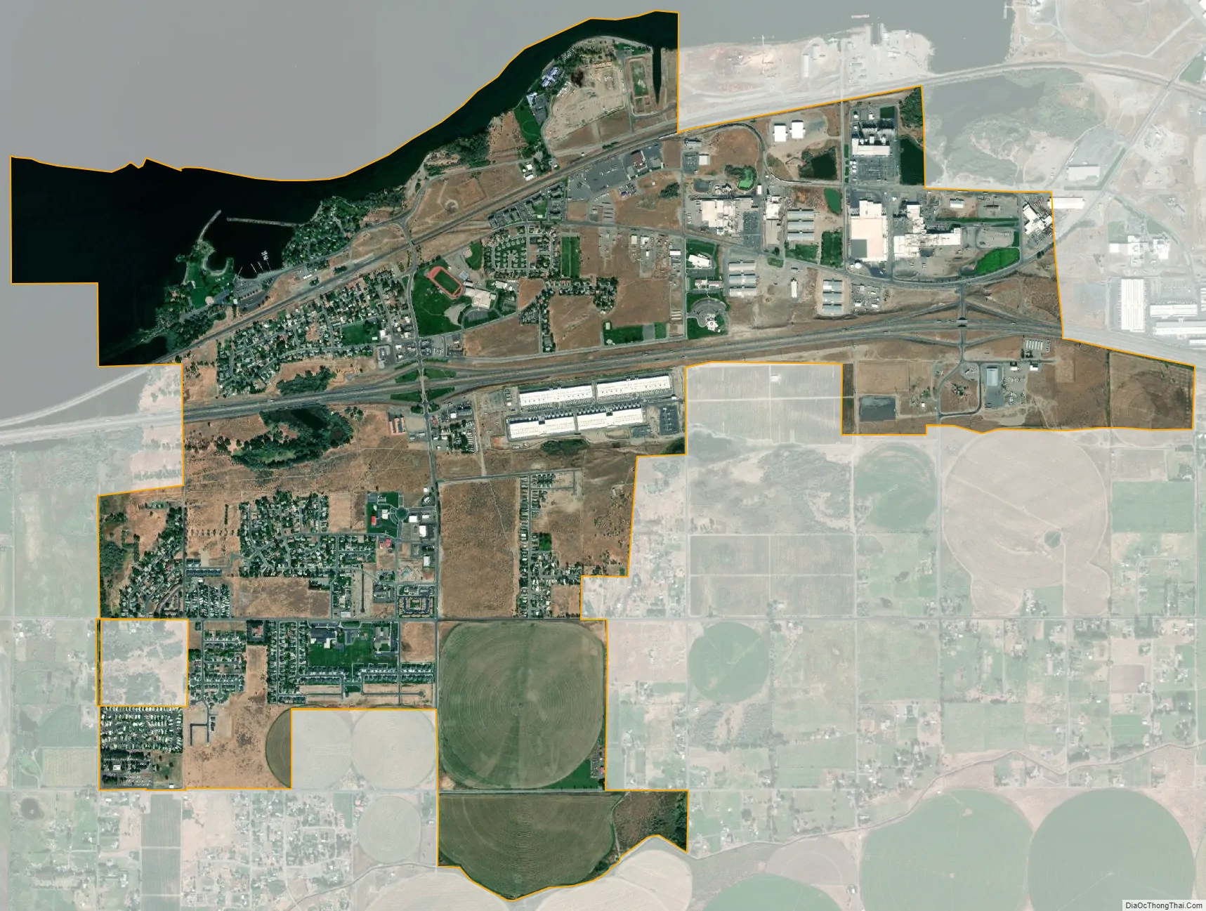
Boardman city Satellite Map
Geography
Boardman is in northeastern Oregon, along Interstate 84 south of the Columbia River. The city is 308 feet (94 m) above sea level. It is 25 miles (40 km) west of Hermiston and 164 miles (264 km) east of Portland. According to the United States Census Bureau, the city has a total area of 4.17 square miles (10.80 km), of which 3.79 square miles (9.82 km) is land and 0.38 square miles (0.98 km) is water.
Climate
Boardman has a steppe climate (Köppen BSk).
See also
Map of Oregon State and its subdivision: Map of other states:- Alabama
- Alaska
- Arizona
- Arkansas
- California
- Colorado
- Connecticut
- Delaware
- District of Columbia
- Florida
- Georgia
- Hawaii
- Idaho
- Illinois
- Indiana
- Iowa
- Kansas
- Kentucky
- Louisiana
- Maine
- Maryland
- Massachusetts
- Michigan
- Minnesota
- Mississippi
- Missouri
- Montana
- Nebraska
- Nevada
- New Hampshire
- New Jersey
- New Mexico
- New York
- North Carolina
- North Dakota
- Ohio
- Oklahoma
- Oregon
- Pennsylvania
- Rhode Island
- South Carolina
- South Dakota
- Tennessee
- Texas
- Utah
- Vermont
- Virginia
- Washington
- West Virginia
- Wisconsin
- Wyoming