Bend is a city in and the county seat of Deschutes County, Oregon, United States. It is the principal city of the Bend Metropolitan Statistical Area. Bend is Central Oregon’s largest city, with a population of 99,178 at the time of the 2020 U.S. Census, up from 76,693 at the time of the 2010 U.S. Census, and 52,029 at the 2000 census. The Bend metro population was 198,253 as of the 2020 census. It is the fifth largest metropolitan area in Oregon.
Bend is located on the eastern edge of the Cascade Range along the Deschutes River. There the Ponderosa pine forest transitions into the high desert, characterized by arid land, junipers, sagebrush, and bitterbrush. Originally a crossing point on the river, settlement began in the early 1900s. Bend was incorporated as a city in 1905. Economically, it started as a logging town but is now identified as a gateway for many outdoor sports, including mountain biking, fishing, hiking, camping, rock climbing, white-water rafting, skiing, paragliding, and golf. As of 2023 the city is also the home of the last Blockbuster video rental store.
| Name: | Bend city |
|---|---|
| LSAD Code: | 25 |
| LSAD Description: | city (suffix) |
| State: | Oregon |
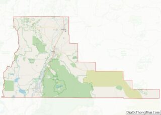
| County: | Deschutes County |
| Incorporated: | January 4, 1904 |
| Elevation: | 3,623 ft (1,104.3 m) |
| Total Area: | 34.89 sq mi (90.37 km²) |
| Land Area: | 34.65 sq mi (89.73 km²) |
| Water Area: | 0.24 sq mi (0.63 km²) |
| Total Population: | 99,178 |
| Population Density: | 2,862.61/sq mi (1,105.27/km²) |
| FIPS code: | 4105800 |
| GNISfeature ID: | 1137914 |
| Website: | www.bendoregon.gov |
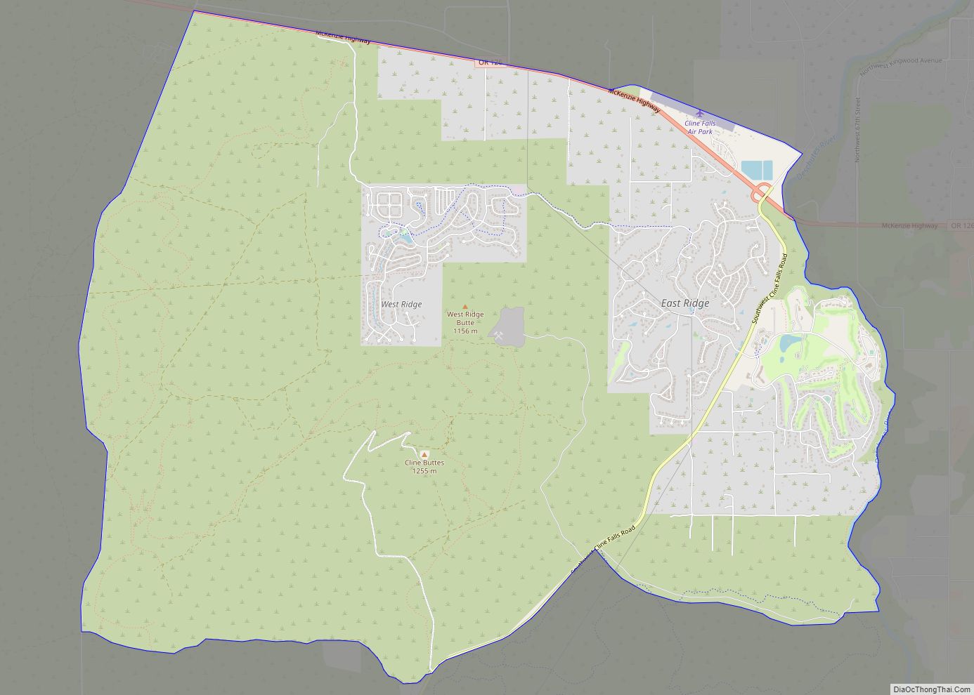
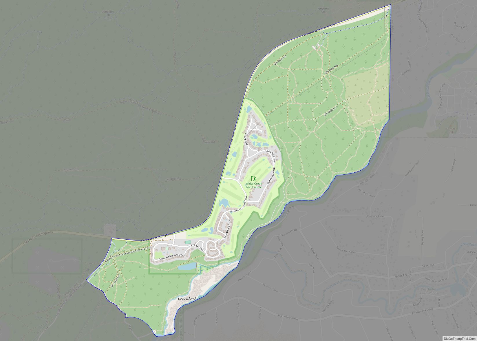
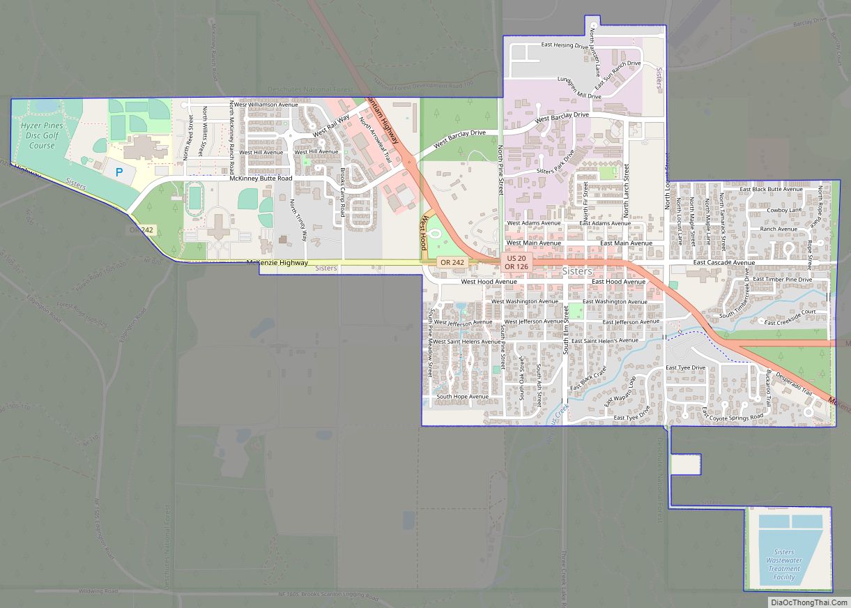
Online Interactive Map
Click on ![]() to view map in "full screen" mode.
to view map in "full screen" mode.
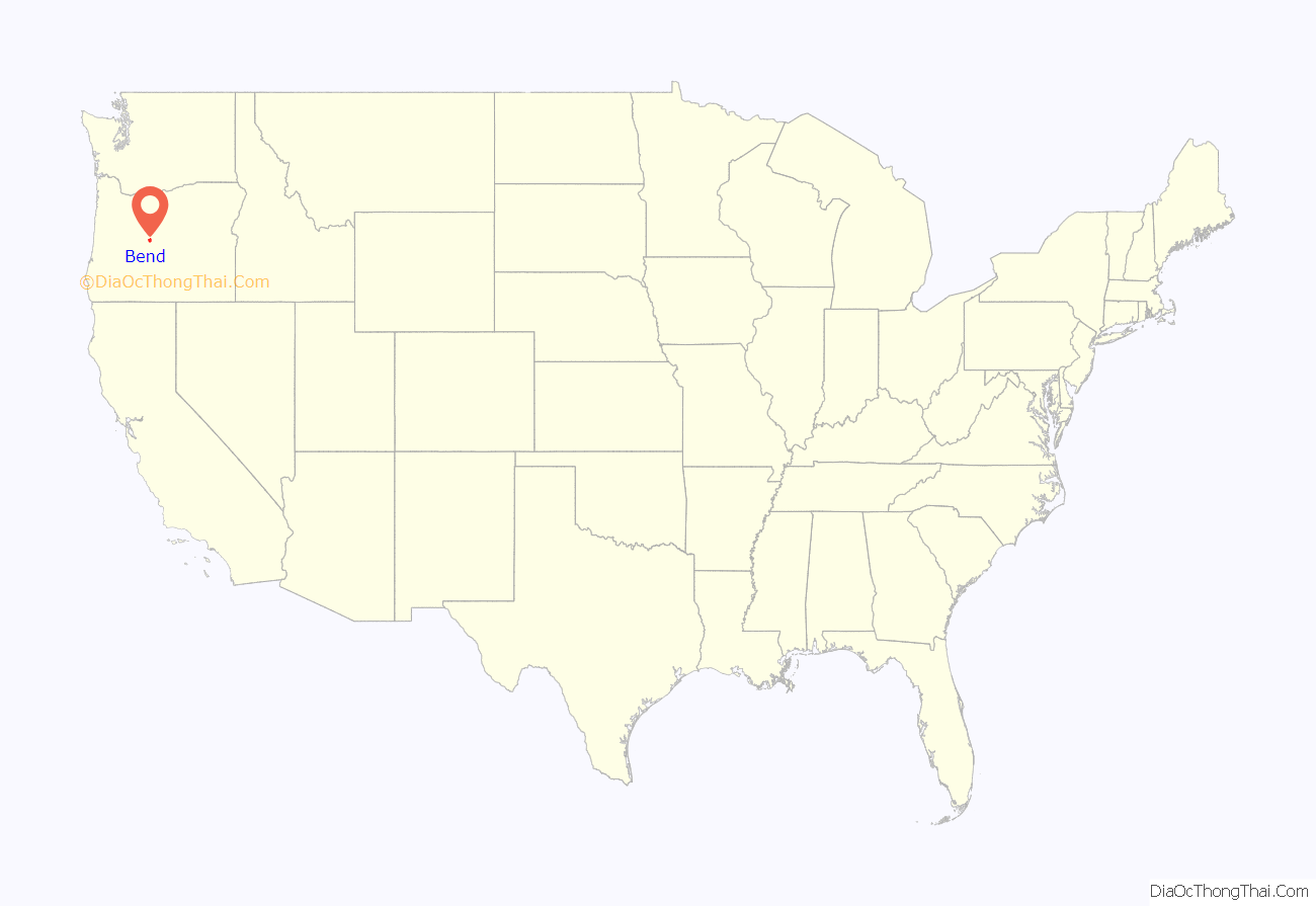
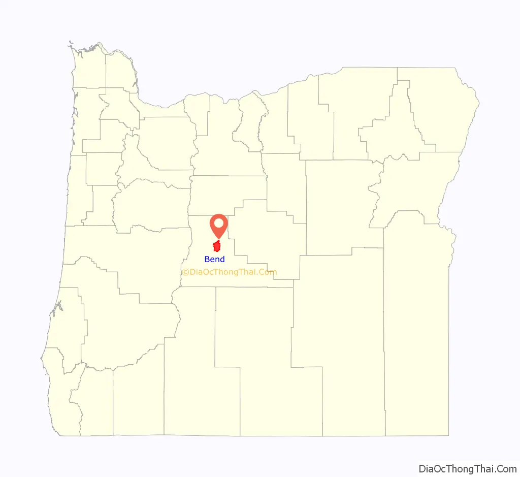
Bend location map. Where is Bend city?
History
The name “Bend” was derived from “Farewell Bend”, the designation used by early pioneers to refer to the location along the Deschutes River where the town was eventually platted, one of the few fordable points along the river.
Native Americans hunted and fished here. In the winter of 1824, members of a fur-trapping party led by Peter Skene Ogden visited the area. John C. Frémont, John Strong Newberry, and other Army survey parties came next. Then pioneers heading farther west passed through the area and forded the Deschutes River at Farewell Bend.
Constructed in May 1901, the Pilot Butte Development Company’s little plant was the first commercial sawmill in Bend. The original location was at the rear of the Pilot Butte Inn of later years. Steidl and Reed also set up a small mill in Bend in 1903. This was on the Deschutes River just below the Pioneer Park area. The mill was operated by water power.
A small community developed around the area. In 1904, a city was incorporated by a general vote of the community’s 300 residents. On January 4, 1905, the city held its first official meeting as an incorporated municipality, appointing A. H. Goodwillie as the first mayor. The settlement was originally called “Farewell Bend”, which was later shortened to “Bend” by the United States Post Office Department.
In 1910, Mirror Pond was created by the construction of the Bend Water, Light & Power Company dam on the Deschutes River in Bend. The dam provided the city with its initial source of electricity. The dam has been owned by Pacific Power since 1926 and still produces electricity that supplies approximately 200 Bend households. In 1916, Deschutes County was formed from the western half of Crook County and Bend was designated as the county seat. In 1929, Bend amended the charter and adopted the council–manager form of government.
On August 28, 2022, a mass shooting occurred at a Safeway grocery store in Bend. Two senior citizens, one of whom was an employee at the store, were killed, and two others were wounded before the gunman committed suicide.
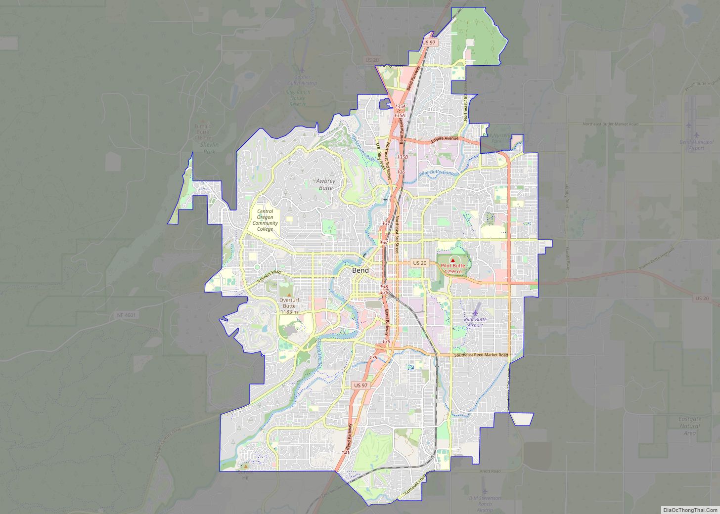
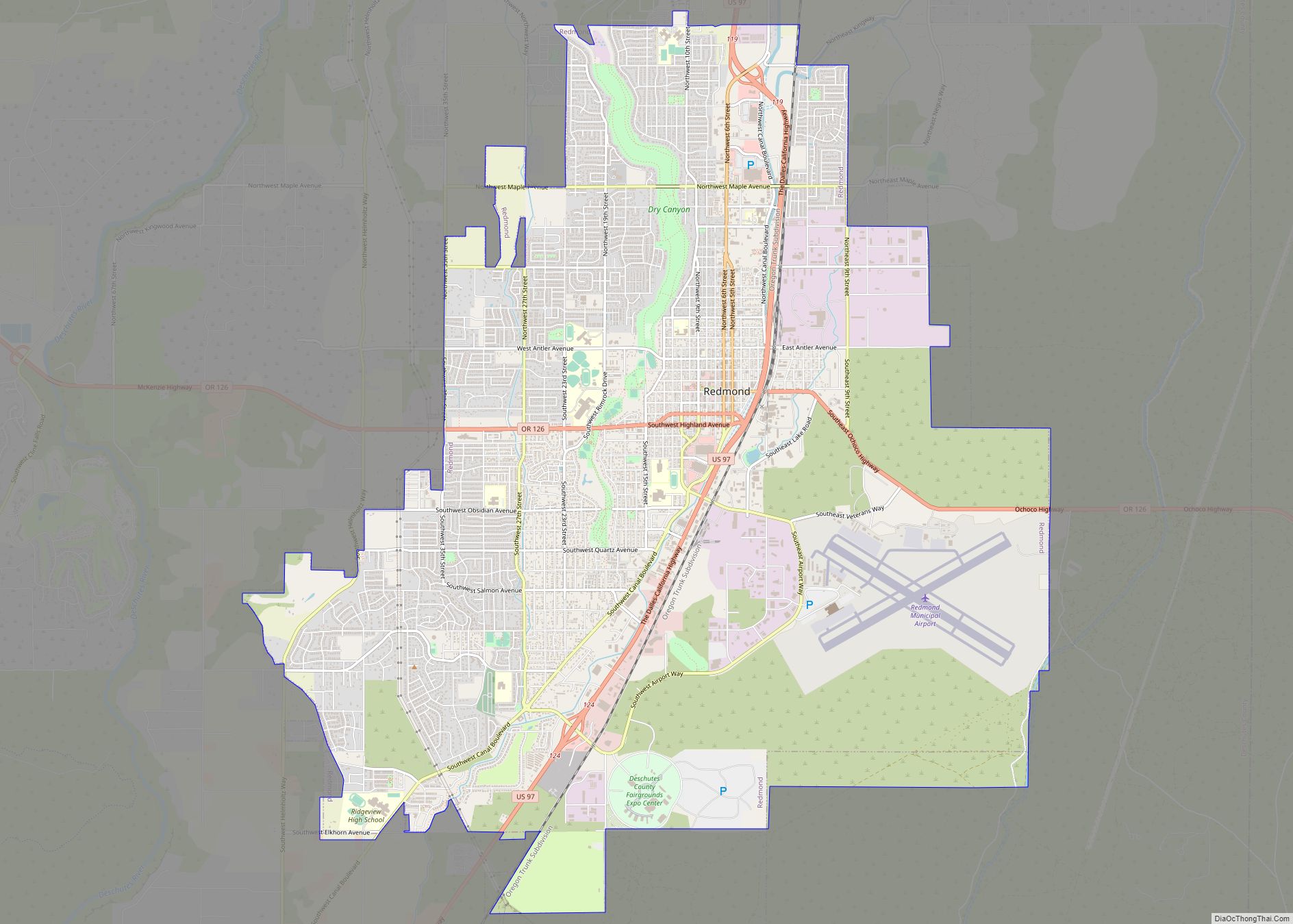
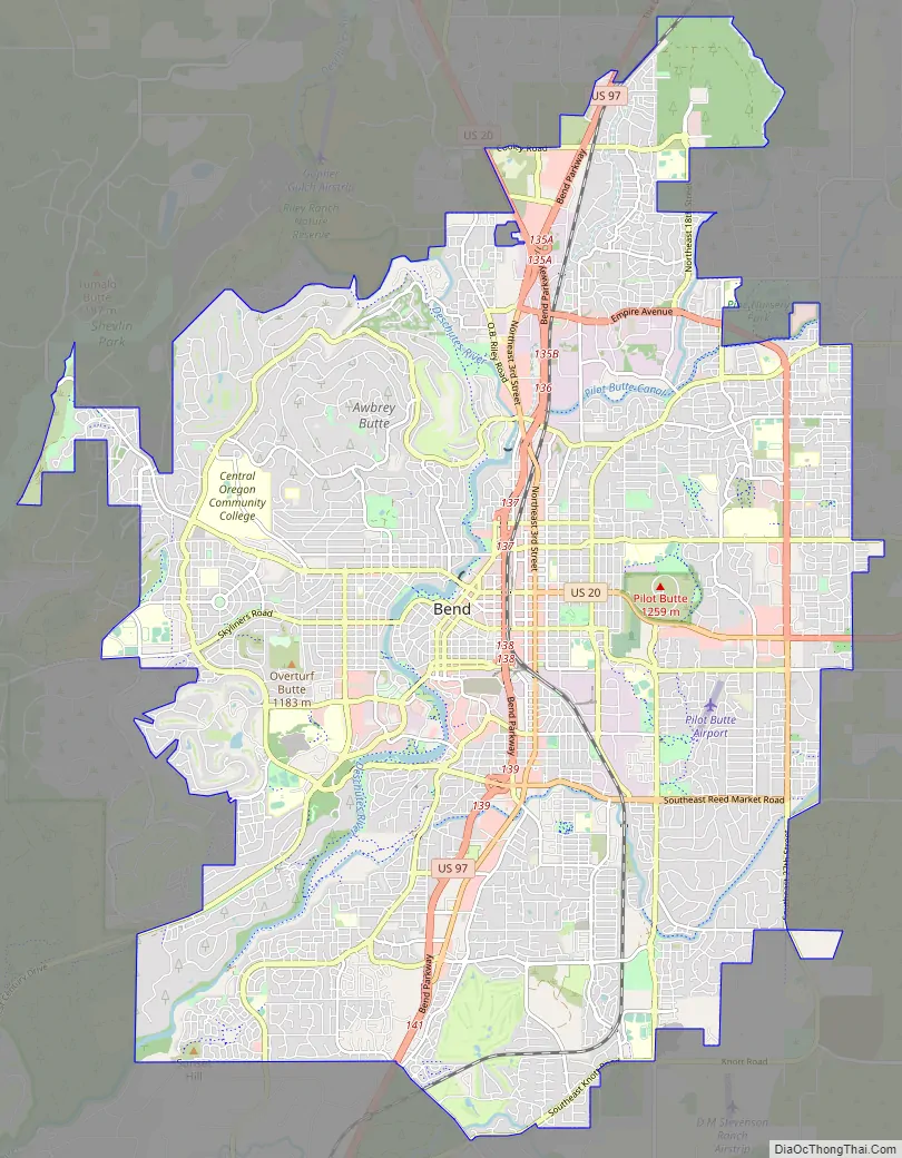
Bend Road Map
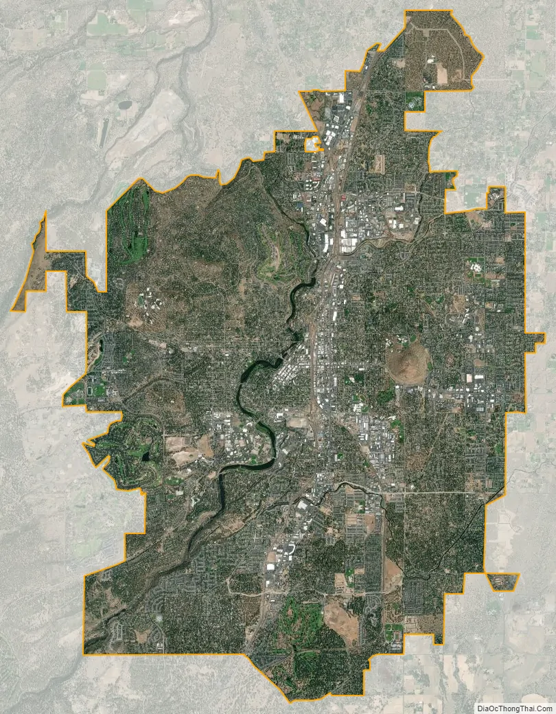
Bend city Satellite Map
Geography
Bend sits on the boundary of the Eastern Cascades Slopes and Foothills, a Level III ecoregion designated by the United States Environmental Protection Agency (EPA) in the U.S. states of Oregon, Washington, and California, and the Deschutes River Valley, a Level IV ecoregion within the Blue Mountains Level III ecoregion.
The Deschutes River runs through Bend, where it is dammed to form Mirror Pond. Bend’s elevation is 3,623 feet (1,104 metres) above sea level. The city has a total area of 33.27 square miles (86.17 square kilometres), of which 33.01 sq mi (85.50 km) is land and 0.26 sq mi (0.67 km) is water.
Inside the city limits is Pilot Butte State Scenic Viewpoint, an old cinder cone. Bend is one of three cities in the continental U.S. (with Portland, Oregon, and Jackson, Mississippi) to have an extinct volcano within its city limits. It is reached by U.S. Route 20. A lesser known characteristic of Bend, the Horse Lava Tube System enters and borders the eastern edge of the city. Just south of Bend is Newberry National Volcanic Monument on U.S. Route 97.
Climate
Bend’s climate is typical of the high desert with cool nights and sunny days, classified as semi-arid (Köppen climate classification BSk). Annual precipitation averages 11.2 in (280 mm). Annual average snowfall is 23.8 inches (60.5 cm). The winter season in Bend provides a mean temperature of 31.1 °F (−0.5 °C) in December. Nighttime temperatures are not much lower than daytime highs during the winter. Annually, the lowest nighttime temperature is typically −5 °F (−21 °C) to −10 °F (−23 °C) (Zone 6).
Central Oregon summers are marked by their very large diurnal temperature ranges, with a July daily average of 64.5 °F (18.1 °C), and an average diurnal temperature variation approaching 35 °F (19 °C). Hard frosts are not unheard of during the summer months. Autumn usually brings warm, dry days and cooler nights. Bend is known for its annual Indian summer.
Bend’s growing season is short; according to the U.S. Department of Agriculture’s National Resources Conservation Service, in half of the years between 1971 and 2000, the USDA weather station in Bend recorded the last below-freezing temperatures after July 3 and the first below-freezing temperatures before August 31. Based on 1981–2010 normals, the average window for freezing temperatures is September 13 through June 19.
See also
Map of Oregon State and its subdivision: Map of other states:- Alabama
- Alaska
- Arizona
- Arkansas
- California
- Colorado
- Connecticut
- Delaware
- District of Columbia
- Florida
- Georgia
- Hawaii
- Idaho
- Illinois
- Indiana
- Iowa
- Kansas
- Kentucky
- Louisiana
- Maine
- Maryland
- Massachusetts
- Michigan
- Minnesota
- Mississippi
- Missouri
- Montana
- Nebraska
- Nevada
- New Hampshire
- New Jersey
- New Mexico
- New York
- North Carolina
- North Dakota
- Ohio
- Oklahoma
- Oregon
- Pennsylvania
- Rhode Island
- South Carolina
- South Dakota
- Tennessee
- Texas
- Utah
- Vermont
- Virginia
- Washington
- West Virginia
- Wisconsin
- Wyoming