Map of Hillsborough town, North Carolina
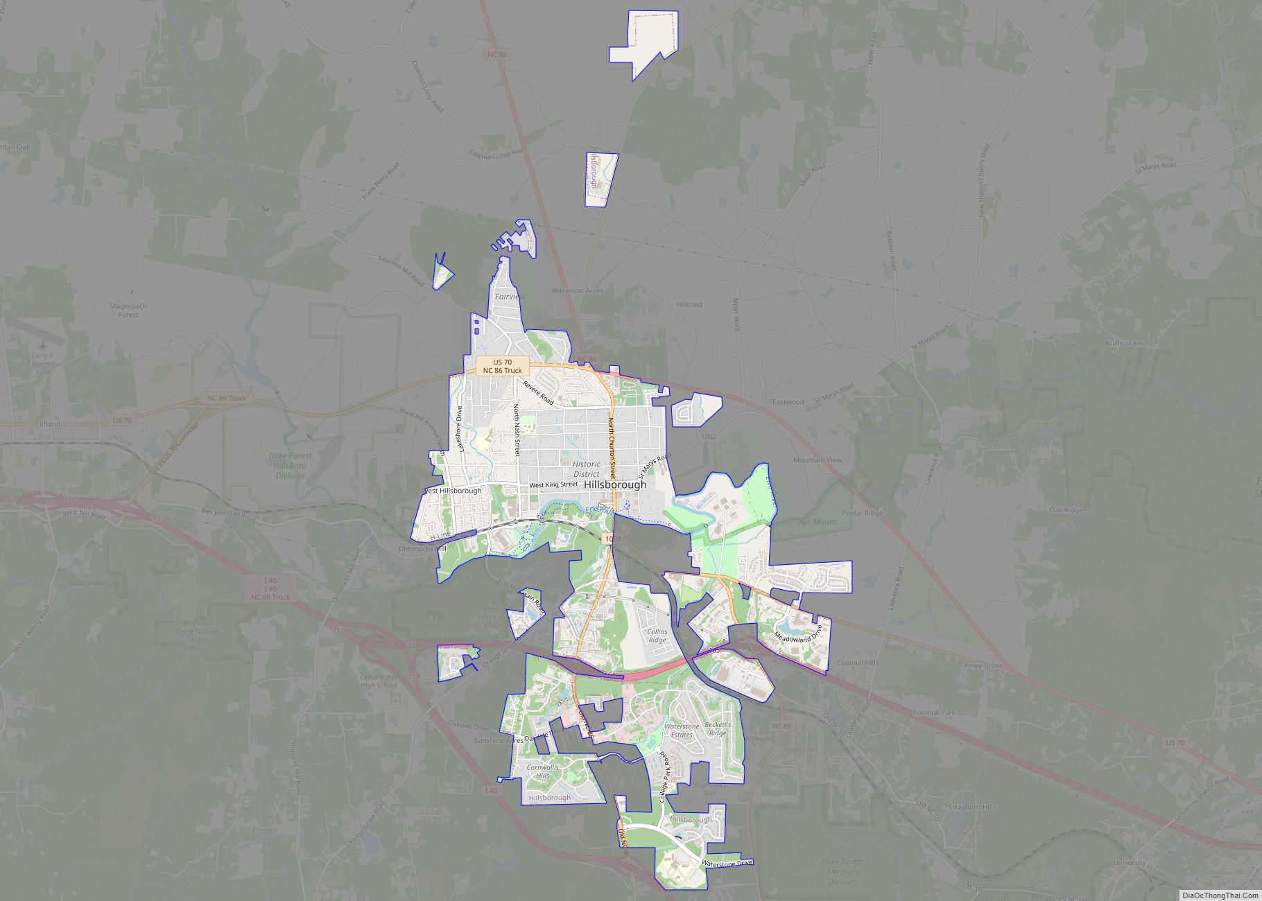
The town of Hillsborough is the county seat of Orange County, North Carolina, United States and is located along the Eno River. The population was 6,087 in 2010, but it grew rapidly to 9,660 by 2020. Its name was unofficially shortened to “Hillsboro” during the 19th century. In the late 1960s, residents voted to change ... Read more
Map of Hillsborough town, North Carolina
Map of Hildebran town
Hildebran is a town in Burke County, North Carolina, United States. The population was 2,023 at the 2010 census. It is part of the Hickory–Lenoir–Morganton Metropolitan Statistical Area. Hildebran town overview: Name: Hildebran town LSAD Code: 43 LSAD Description: town (suffix) State: North Carolina County: Burke County Incorporated: 1899 Elevation: 1,188 ft (362 m) Total Area: 2.83 sq mi ... Read more
Map of Hildebran town
Map of Hightsville CDP
Hightsville is a census-designated place (CDP) in New Hanover County, North Carolina, United States. The population was 739 at the 2010 census. It is part of the Wilmington Metropolitan Statistical Area. Hightsville CDP overview: Name: Hightsville CDP LSAD Code: 57 LSAD Description: CDP (suffix) State: North Carolina County: New Hanover County Elevation: 20 ft (6 m) Total ... Read more
Map of Hightsville CDP
Map of Highlands town, North Carolina
Highlands is an incorporated town in Macon County in the U.S. state of North Carolina. Located on a plateau in the southern Appalachian Mountains, within the Nantahala National Forest, it lies mostly in southeastern Macon County and slightly in southwestern Jackson County, in the Highlands and Cashiers Townships, respectively. The permanent population was 1,014 at ... Read more
Map of Highlands town, North Carolina
Map of Horse Shoe CDP
Horse Shoe is an unincorporated community and census-designated place (CDP) in Henderson County, North Carolina, United States. Its ZIP code is 28742. As of the 2010 census, its population was 2,351. The community took its name from a nearby meander in the French Broad River. Horse Shoe CDP overview: Name: Horse Shoe CDP LSAD Code: ... Read more
Map of Horse Shoe CDP
Map of Hope Mills town
Hope Mills is a town in Cumberland County, North Carolina, United States. Its population was 15,176 at the 2010 census. Hope Mills town overview: Name: Hope Mills town LSAD Code: 43 LSAD Description: town (suffix) State: North Carolina County: Cumberland County Elevation: 108 ft (33 m) Total Area: 8.64 sq mi (22.38 km²) Land Area: 8.48 sq mi (21.96 km²) Water Area: 0.16 sq mi ... Read more
Map of Hope Mills town
Map of Hoopers Creek CDP
Hoopers Creek is an unincorporated community and census-designated place (CDP) in Henderson County, North Carolina, United States. Its population was 1,056 as of the 2010 census. Hoopers Creek CDP overview: Name: Hoopers Creek CDP LSAD Code: 57 LSAD Description: CDP (suffix) State: North Carolina County: Henderson County Elevation: 2,159 ft (658 m) Total Area: 6.95 sq mi (18.01 km²) Land ... Read more
Map of Hoopers Creek CDP
Map of Hookerton town
Hookerton is a town in Greene County, North Carolina, United States. The population was 409 at the 2010 census. It is geographically located southeast of Snow Hill on North Carolina Highway 123. The town is part of the Greenville Metropolitan Area. Hookerton town overview: Name: Hookerton town LSAD Code: 43 LSAD Description: town (suffix) State: ... Read more
Map of Hookerton town
Map of Holly Springs town, North Carolina
Holly Springs is a town in Wake County, North Carolina, United States. As of the 2020 census, the town population was 41,239, a 67% increase from 2010. Holly Springs town overview: Name: Holly Springs town LSAD Code: 43 LSAD Description: town (suffix) State: North Carolina County: Wake County Elevation: 440 ft (130 m) Total Area: 18.69 sq mi (48.39 km²) ... Read more
Map of Holly Springs town, North Carolina
Map of Holly Ridge town
Holly Ridge is a town in Onslow County, North Carolina, United States. The 2010 population was 1,268. It is part of the Jacksonville, North Carolina Metropolitan Statistical Area. It is considered the gateway to Topsail Island. Population Boom: In 1940, the town had 28 residents. Just three years later in 1943, the town had ballooned ... Read more
Map of Holly Ridge town
Map of Hollister CDP, North Carolina
Hollister is a census-designated place and unincorporated community in Halifax County in northeastern North Carolina, United States. As of the 2010 census it had a population of 674. Hollister’s ZIP code is 27844. Hollister CDP overview: Name: Hollister CDP LSAD Code: 57 LSAD Description: CDP (suffix) State: North Carolina County: Halifax County Elevation: 246 ft (75 m) ... Read more
Map of Hollister CDP, North Carolina
Map of Holden Beach town
Holden Beach is a seaside town in Brunswick County, North Carolina. The population was 575 at the time of the 2010 census. It is part of the Myrtle Beach metropolitan area. Holden Beach town overview: Name: Holden Beach town LSAD Code: 43 LSAD Description: town (suffix) State: North Carolina County: Brunswick County Incorporated: 1969 Elevation: ... Read more
Map of Holden Beach town