Map of King city, North Carolina
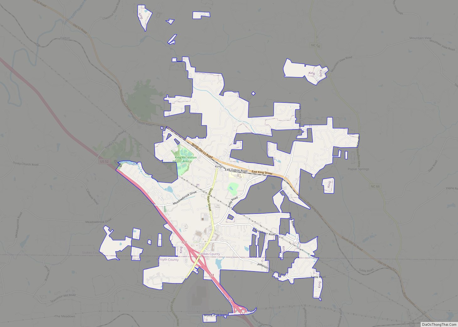
King is a city in Stokes and Forsyth counties, North Carolina, United States. The population was 7,096 at the 2020 census. King is part of the Piedmont Triad metropolitan area, located 15 miles northwest of Winston-Salem. Dairi-O, a local fast food restaurant, is one of the cities staples. Around since the 1950’s, it has grown ... Read more
Map of King city, North Carolina
Map of Kill Devil Hills town
Kill Devil Hills is a town in Dare County, North Carolina, United States. The population was 7,633 at the 2020 census, up from 6,683 in 2010. It is the most populous settlement in both Dare County and on the Outer Banks of North Carolina. The Kill Devil Hills Micropolitan Statistical Area is part of the ... Read more
Map of Kill Devil Hills town
Map of Kernersville town
Kernersville is a town in Forsyth County and the largest suburb of Winston-Salem. The town is located in the U.S. state of North Carolina. A small portion of the town is also in Guilford County. The population was 26,481 at the 2020 census, up from 23,123 in 2010. Kernersville is located at the center of ... Read more
Map of Kernersville town
Map of Kenly town
Kenly is a town in Johnston and Wilson counties in the U.S. state of North Carolina. It was named for John R. Kenly, Northern Division Superintendent of the Atlantic Coast Line Railroad, who later became president of the railroad in 1913. The population was 1,339 at the 2010 census, down from 1,569 in 2000. Kenly ... Read more
Map of Kenly town
Map of Kenansville town
Kenansville is a town in Duplin County, North Carolina, United States. Its population was 855 at the 2010 census. It is the county seat of Duplin County. The town was named for James Kenan, a member of the North Carolina Senate, whose family home Liberty Hall Plantation is in Kenansville. Kenansville town overview: Name: Kenansville ... Read more
Map of Kenansville town
Map of Kelly CDP, North Carolina
Kelly is a census-designated place (CDP) in Bladen County, North Carolina, United States. The population was 544 at the 2010 census. Kelly CDP overview: Name: Kelly CDP LSAD Code: 57 LSAD Description: CDP (suffix) State: North Carolina County: Bladen County Elevation: 23 ft (7 m) Total Area: 11.59 sq mi (30.02 km²) Land Area: 11.59 sq mi (30.02 km²) Water Area: 0.00 sq mi (0.00 km²) ... Read more
Map of Kelly CDP, North Carolina
Map of Kelford town
Kelford is a town in Bertie County, North Carolina, United States. The population was 251 at the 2010 census. Kelford town overview: Name: Kelford town LSAD Code: 43 LSAD Description: town (suffix) State: North Carolina County: Bertie County Elevation: 89 ft (27 m) Total Area: 0.48 sq mi (1.25 km²) Land Area: 0.48 sq mi (1.25 km²) Water Area: 0.00 sq mi (0.00 km²) Total Population: ... Read more
Map of Kelford town
Map of Lake Park village, North Carolina
Lake Park is a village in Union County, North Carolina, United States. The population was 3,422 at the 2010 census. Lake Park village overview: Name: Lake Park village LSAD Code: 47 LSAD Description: village (suffix) State: North Carolina County: Union County Elevation: 686 ft (209 m) Total Area: 0.76 sq mi (1.97 km²) Land Area: 0.73 sq mi (1.90 km²) Water Area: 0.03 sq mi ... Read more
Map of Lake Park village, North Carolina
Map of Lake Norman of Catawba CDP
Lake Norman of Catawba CDP overview: Name: Lake Norman of Catawba CDP LSAD Code: 57 LSAD Description: CDP (suffix) State: North Carolina County: Catawba County FIPS code: 3736511 Online Interactive Map Lake Norman of Catawba online map. Source: Basemap layers from Google Map, Open Street Map (OSM), Arcgisonline, Wmflabs. Boundary Data from Database of Global ... Read more
Map of Lake Norman of Catawba CDP
Map of Lake Lure town
Lake Lure is a town in Rutherford County, North Carolina, United States. In 2020 the town population was 1,634. Lake Lure was incorporated in 1927, and acquired the lake after which it is named in 1965. Lake Lure town overview: Name: Lake Lure town LSAD Code: 43 LSAD Description: town (suffix) State: North Carolina County: ... Read more
Map of Lake Lure town
Map of Lake Junaluska CDP
Lake Junaluska CDP overview: Name: Lake Junaluska CDP LSAD Code: 57 LSAD Description: CDP (suffix) State: North Carolina County: Haywood County FIPS code: 3736480 Online Interactive Map Lake Junaluska online map. Source: Basemap layers from Google Map, Open Street Map (OSM), Arcgisonline, Wmflabs. Boundary Data from Database of Global Administrative Areas. Lake Junaluska location map. ... Read more
Map of Lake Junaluska CDP
Map of La Grange town, North Carolina
La Grange is a town in Lenoir County, North Carolina, United States. The population was 2,873 based on the 2010 census. La Grange is located in North Carolina’s Inner Banks region. La Grange town overview: Name: La Grange town LSAD Code: 43 LSAD Description: town (suffix) State: North Carolina County: Lenoir County Elevation: 108 ft (33 m) ... Read more
Map of La Grange town, North Carolina