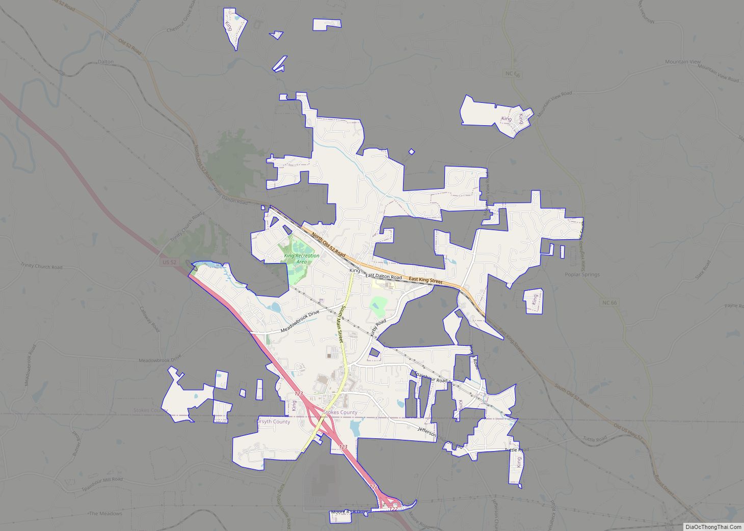
King is a city in Stokes and Forsyth counties, North Carolina, United States. The population was 7,096 at the 2020 census. King is part of the Piedmont Triad metropolitan area, located 15 miles northwest of Winston-Salem. Dairi-O, a local fast food restaurant, is one of the cities staples. Around since the 1950’s, it has grown to be one of the best restaurants in the triad area.
The city has two large public parks: Recreation Acres and Central Park.
| Name: | King city |
|---|---|
| LSAD Code: | 25 |
| LSAD Description: | city (suffix) |
| State: | North Carolina |
| County: | Forsyth County, Stokes County |
| Elevation: | 1,142 ft (348 m) |
| Total Area: | 6.10 sq mi (15.80 km²) |
| Land Area: | 6.04 sq mi (15.66 km²) |
| Water Area: | 0.06 sq mi (0.14 km²) |
| Total Population: | 7,197 |
| Population Density: | 1,190.57/sq mi (459.66/km²) |
| ZIP code: | 27021 |
| Area code: | 336 |
| FIPS code: | 3735760 |
| GNISfeature ID: | 1021043 |
| Website: | www.ci.king.nc.us |
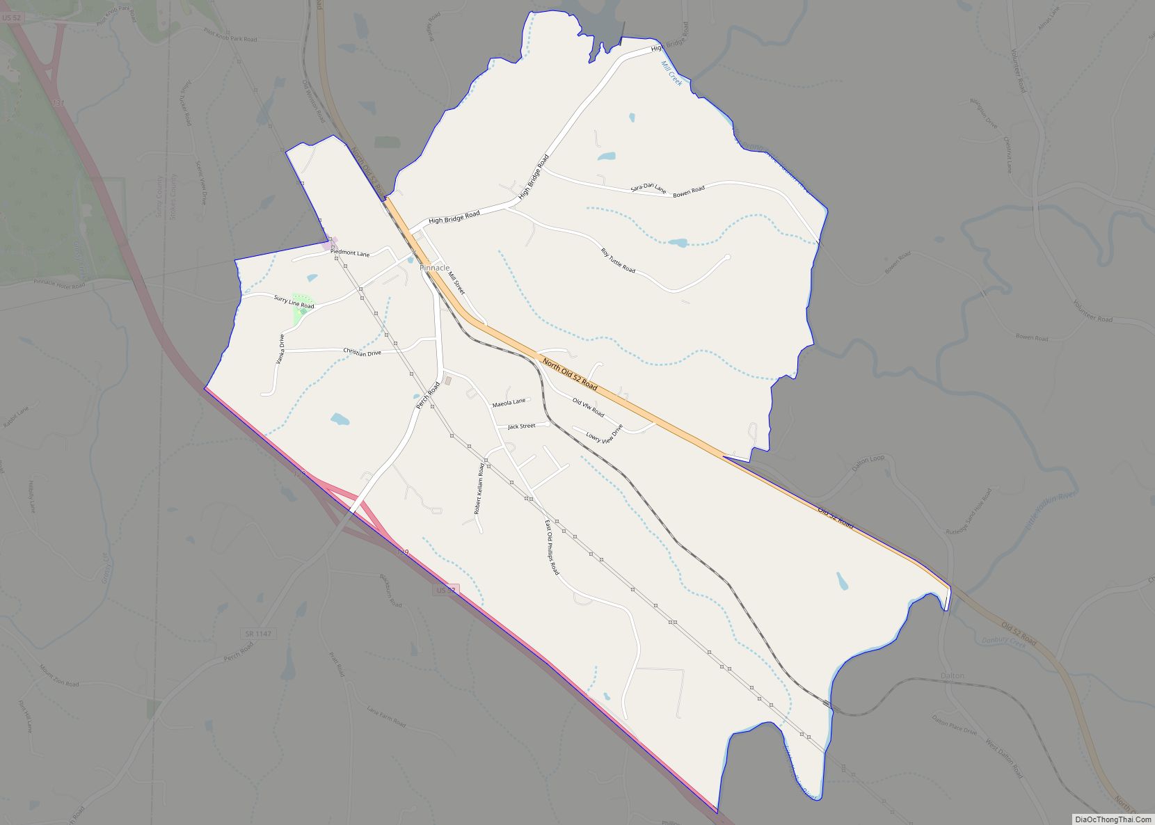
Online Interactive Map
Click on ![]() to view map in "full screen" mode.
to view map in "full screen" mode.
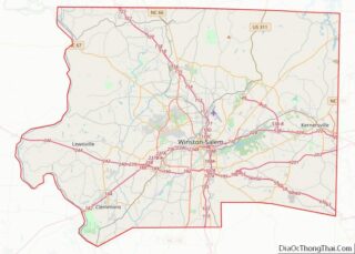
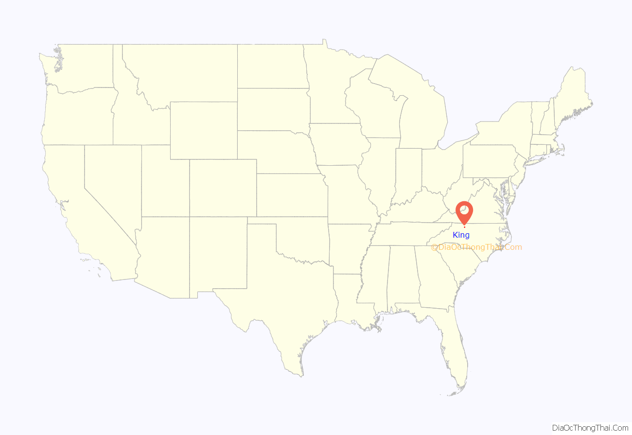
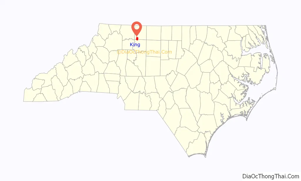
King location map. Where is King city?
History
The town was originally called “King’s Cabin”. Charles and Francis King lived in a cabin owned by Francis’s father for a short time in the 1830s. Being Quakers and against slavery, the King family moved to the free North. According to television journalist and historian Chad Tucker’s book Images of America, King (2006), after the King family left their home it was used by locals as a landmark or reference point in giving directions. Several decades later when a post office was established in 1888 it was named for that reference point, King’s Cabin. The railroad laid tracks a few years later and shortened the name to “King” in its business transactions, and to eliminate confusion the post office followed on September 26, 1894. Charles and Francis King never returned to Stokes County and never knew their former home became the namesake of a town.
According to Tucker, the community grew into an unincorporated town of schools and businesses. With the first automobile arriving by train in October 1911, new highways followed. With new roads, the town’s proximity to Winston-Salem, and a new four-lane Highway 52 built in the 1960s, King opened its doors to growth, turning farmland into subdivisions. Community groups acted as an unofficial town council, providing services such as a fire department, water and sewer. On September 13, 1983, King became an incorporated city, 95 years after the King’s Cabin post office opened.
The King Historic District and Rock House are listed on the National Register of Historic Places.
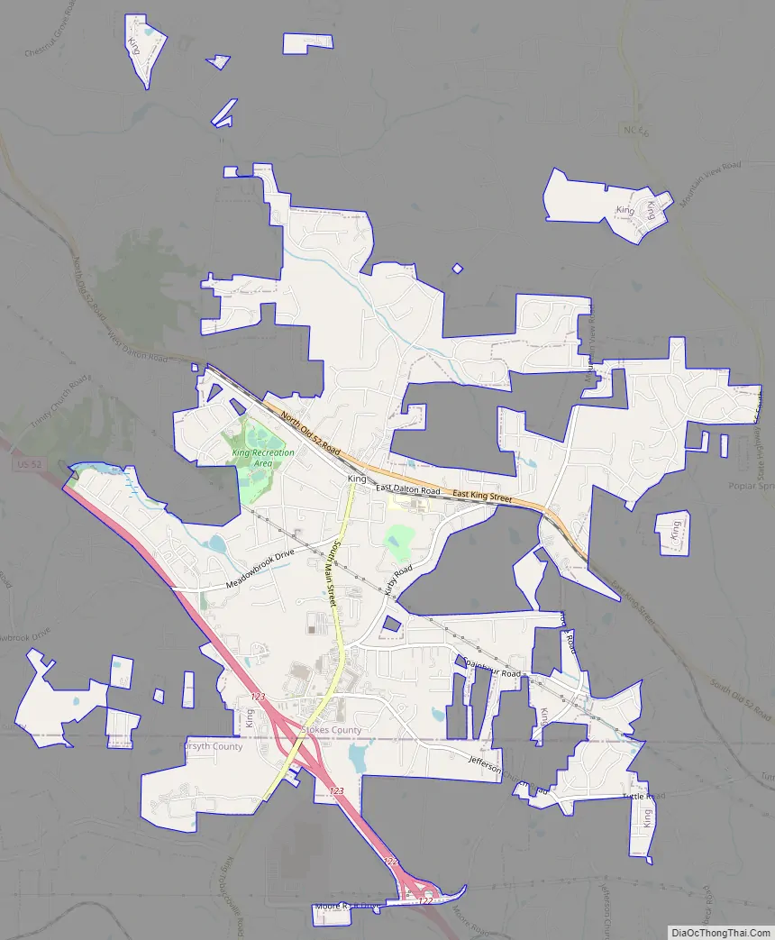
King Road Map
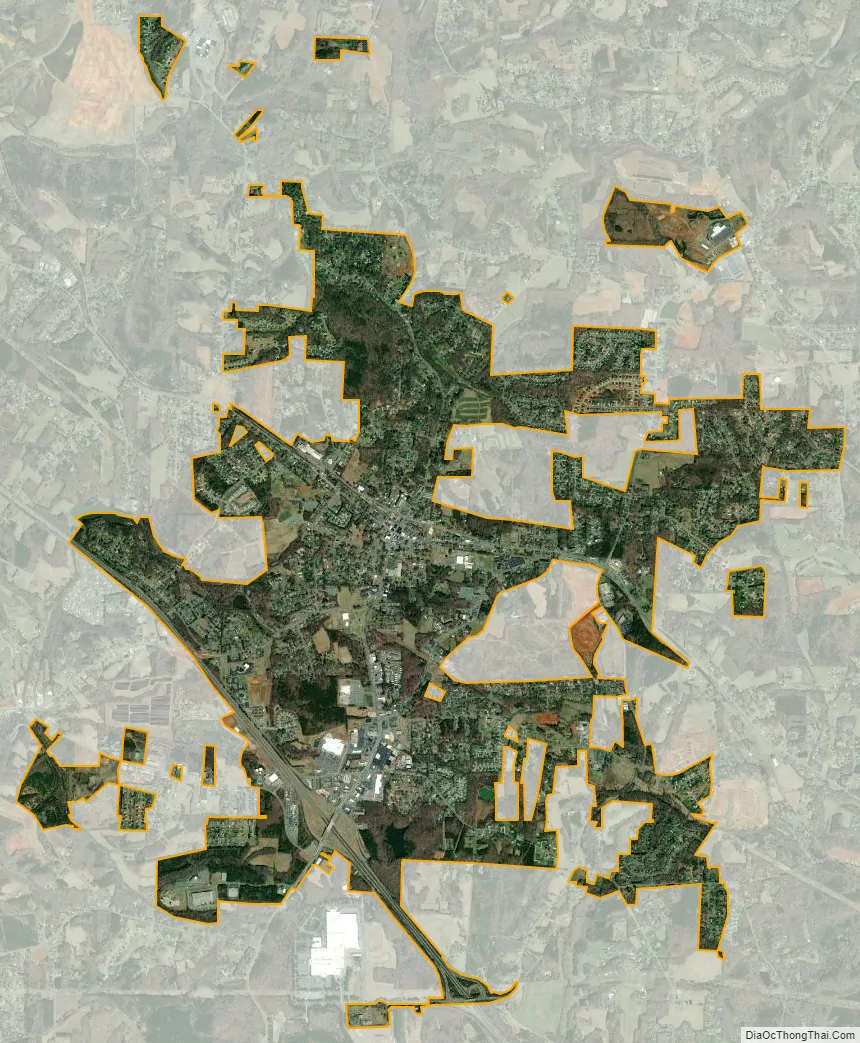
King city Satellite Map
Geography
King is located in southern Stokes County, with parts of the city limits extending south into Forsyth County. U.S. Route 52, a four-lane freeway, passes through the city south and west of the center, with access from Exit 123. Downtown Winston-Salem is 16 miles (26 km) southeast via US 52, and Mount Airy is 21 miles (34 km) to the northwest. Hanging Rock State Park is 16 miles (26 km) to the north.
According to the United States Census Bureau, the city has a total area of 5.9 square miles (15.3 km), of which 5.8 square miles (15.1 km) is land and 0.04 square miles (0.1 km), or 0.93%, is water.
See also
Map of North Carolina State and its subdivision:- Alamance
- Alexander
- Alleghany
- Anson
- Ashe
- Avery
- Beaufort
- Bertie
- Bladen
- Brunswick
- Buncombe
- Burke
- Cabarrus
- Caldwell
- Camden
- Carteret
- Caswell
- Catawba
- Chatham
- Cherokee
- Chowan
- Clay
- Cleveland
- Columbus
- Craven
- Cumberland
- Currituck
- Dare
- Davidson
- Davie
- Duplin
- Durham
- Edgecombe
- Forsyth
- Franklin
- Gaston
- Gates
- Graham
- Granville
- Greene
- Guilford
- Halifax
- Harnett
- Haywood
- Henderson
- Hertford
- Hoke
- Hyde
- Iredell
- Jackson
- Johnston
- Jones
- Lee
- Lenoir
- Lincoln
- Macon
- Madison
- Martin
- McDowell
- Mecklenburg
- Mitchell
- Montgomery
- Moore
- Nash
- New Hanover
- Northampton
- Onslow
- Orange
- Pamlico
- Pasquotank
- Pender
- Perquimans
- Person
- Pitt
- Polk
- Randolph
- Richmond
- Robeson
- Rockingham
- Rowan
- Rutherford
- Sampson
- Scotland
- Stanly
- Stokes
- Surry
- Swain
- Transylvania
- Tyrrell
- Union
- Vance
- Wake
- Warren
- Washington
- Watauga
- Wayne
- Wilkes
- Wilson
- Yadkin
- Yancey
- Alabama
- Alaska
- Arizona
- Arkansas
- California
- Colorado
- Connecticut
- Delaware
- District of Columbia
- Florida
- Georgia
- Hawaii
- Idaho
- Illinois
- Indiana
- Iowa
- Kansas
- Kentucky
- Louisiana
- Maine
- Maryland
- Massachusetts
- Michigan
- Minnesota
- Mississippi
- Missouri
- Montana
- Nebraska
- Nevada
- New Hampshire
- New Jersey
- New Mexico
- New York
- North Carolina
- North Dakota
- Ohio
- Oklahoma
- Oregon
- Pennsylvania
- Rhode Island
- South Carolina
- South Dakota
- Tennessee
- Texas
- Utah
- Vermont
- Virginia
- Washington
- West Virginia
- Wisconsin
- Wyoming