Map of Lake Waccamaw town
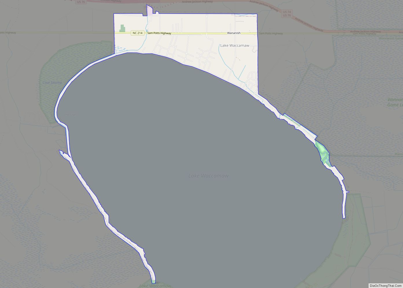
Lake Waccamaw is a town in Columbus County, North Carolina, United States. The 2010 census population was 1,480. Originally home to Native Americans, Europeans later colonized Lake Waccamaw in the 18th century. The Europeans built naval stores and the discovery of turpentine oil led to the Wilmington-Manchester railroad track being created. A shingle company was ... Read more
Map of Lake Waccamaw town
Map of Lake Santeetlah town
Lake Santeetlah is a town in Graham County, North Carolina, United States, 6 miles (10 km) northwest of Robbinsville on a peninsula surrounded by Lake Santeetlah—which in turn is largely surrounded by Nantahala National Forest. The town has more than two hundred residences, many of them second homes owned by permanent residents of Florida and Georgia. ... Read more
Map of Lake Santeetlah town
Map of Lake Royale CDP
Lake Royale is a census-designated place (CDP) in southeastern Franklin County, North Carolina, United States. The population was 3,392 at the 2020 census. It is a gated resort community which surrounds a man-made lake with the same name. The main entrance to Lake Royale is off Sledge Road (SR 1611), 3 miles (5 km) east of ... Read more
Map of Lake Royale CDP
Map of Lawndale town, North Carolina
Lawndale is a town in Cleveland County, North Carolina, United States, situated along the First Broad River. The population was 606 at the 2010 census. Lawndale town overview: Name: Lawndale town LSAD Code: 43 LSAD Description: town (suffix) State: North Carolina County: Cleveland County Elevation: 846 ft (258 m) Total Area: 0.86 sq mi (2.23 km²) Land Area: 0.81 sq mi (2.09 km²) ... Read more
Map of Lawndale town, North Carolina
Map of Lilesville town
Lilesville is a town in Anson County, North Carolina, United States. The population was 404 at the 2020 census. Lilesville town overview: Name: Lilesville town LSAD Code: 43 LSAD Description: town (suffix) State: North Carolina County: Anson County Founded: 1827 Incorporated: 1874 Elevation: 499 ft (152 m) Total Area: 0.99 sq mi (2.57 km²) Land Area: 0.99 sq mi (2.57 km²) Water Area: ... Read more
Map of Lilesville town
Map of Light Oak CDP
Light Oak is an unincorporated area and census-designated place (CDP) in Cleveland County, North Carolina, United States. The population was 691 at the 2010 census. Light Oak CDP overview: Name: Light Oak CDP LSAD Code: 57 LSAD Description: CDP (suffix) State: North Carolina County: Cleveland County Elevation: 837 ft (255 m) Total Area: 1.44 sq mi (3.72 km²) Land Area: ... Read more
Map of Light Oak CDP
Map of Liberty town, North Carolina
Liberty is a town in Randolph County, North Carolina, United States. Liberty town overview: Name: Liberty town LSAD Code: 43 LSAD Description: town (suffix) State: North Carolina County: Randolph County Elevation: 784 ft (239 m) Total Area: 3.15 sq mi (8.15 km²) Land Area: 3.13 sq mi (8.11 km²) Water Area: 0.01 sq mi (0.03 km²) Total Population: 2,655 Population Density: 847.70/sq mi (327.27/km²) ZIP code: 27298 ... Read more
Map of Liberty town, North Carolina
Map of Lexington city, North Carolina
Lexington is the county seat of Davidson County, North Carolina, United States. As of the 2010 census, the city had a population of 18,931. It is located in central North Carolina, 20 miles (32 km) south of Winston-Salem. Major highways include I-85, I-85B, U.S. Route 29, U.S. Route 70, U.S. Route 52 / I-285 and U.S. ... Read more
Map of Lexington city, North Carolina
Map of Lewisville town, North Carolina
Lewisville is a town in Forsyth County, North Carolina, United States of America. The population was 13,388 at the 2020 census, up from 12,639 in 2010. It is a Piedmont Triad community. Lewisville town overview: Name: Lewisville town LSAD Code: 43 LSAD Description: town (suffix) State: North Carolina County: Forsyth County Elevation: 974 ft (297 m) Total ... Read more
Map of Lewisville town, North Carolina
Map of Lewiston Woodville town
Lewiston Woodville is a town in Bertie County, North Carolina, United States. The population was 549 at the 2010 census. It is the location of Perdue Farms, one of the largest chicken-producing companies in North Carolina. Lewiston Woodville town overview: Name: Lewiston Woodville town LSAD Code: 43 LSAD Description: town (suffix) State: North Carolina County: ... Read more
Map of Lewiston Woodville town
Map of Lenoir city
Lenoir is a city in and the county seat of Caldwell County, North Carolina, United States. The population was 18,263 at the 2020 census. Lenoir is located in the foothills of the Blue Ridge Mountains. To the northeast are the Brushy Mountains, a spur of the Blue Ridge Mountains. Hibriten Mountain, located just east of ... Read more
Map of Lenoir city
Map of Leland town, North Carolina
Leland is the most populous town in Brunswick County, North Carolina, United States. The population was 23,504 at the 2020 census, up from 13,527 in 2010. As of 2020, it is considered to be one of the fastest growing towns in North Carolina. It is part of the Myrtle Beach Metropolitan Statistical Area. and the ... Read more
Map of Leland town, North Carolina