Lenoir is a city in and the county seat of Caldwell County, North Carolina, United States. The population was 18,263 at the 2020 census. Lenoir is located in the foothills of the Blue Ridge Mountains. To the northeast are the Brushy Mountains, a spur of the Blue Ridge Mountains. Hibriten Mountain, located just east of the city limits, marks the western end of the Brushy Mountains range.
Lenoir is one of the principal cities in the Hickory-Lenoir-Morganton, NC Metropolitan Statistical Area.
| Name: | Lenoir city |
|---|---|
| LSAD Code: | 25 |
| LSAD Description: | city (suffix) |
| State: | North Carolina |
| County: | Caldwell County |
| Elevation: | 1,171 ft (357 m) |
| Total Area: | 20.83 sq mi (53.95 km²) |
| Land Area: | 20.82 sq mi (53.94 km²) |
| Water Area: | 0.01 sq mi (0.02 km²) |
| Total Population: | 18,352 |
| Population Density: | 881.25/sq mi (340.25/km²) |
| Area code: | 828 |
| FIPS code: | 3737760 |
| GNISfeature ID: | 1021132 |
| Website: | www.cityoflenoir.com |
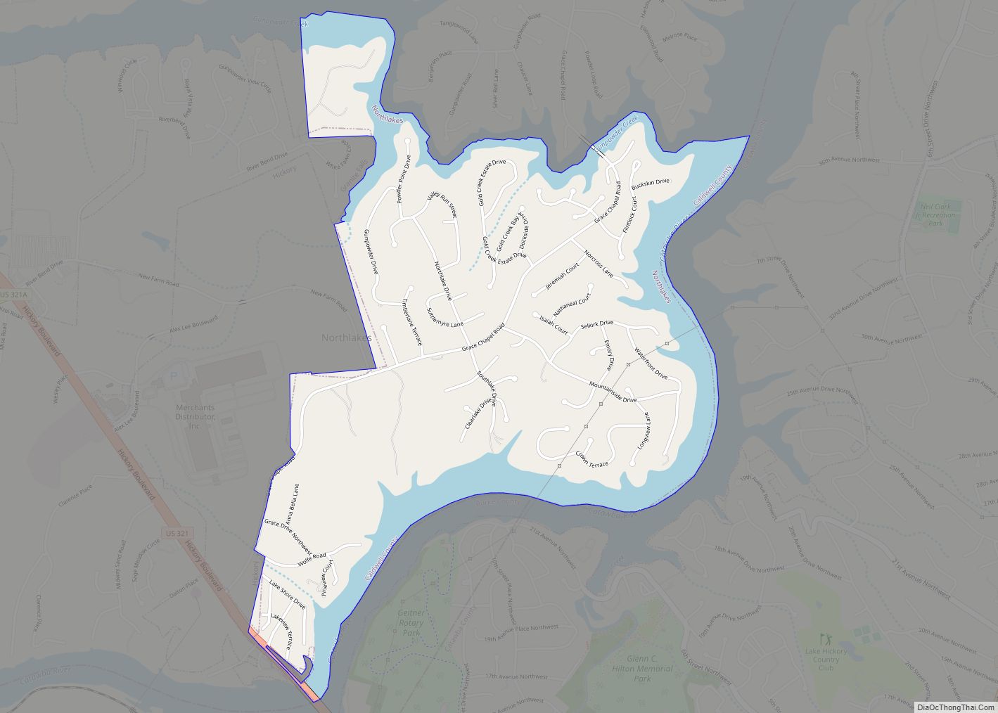
Online Interactive Map
Click on ![]() to view map in "full screen" mode.
to view map in "full screen" mode.
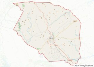
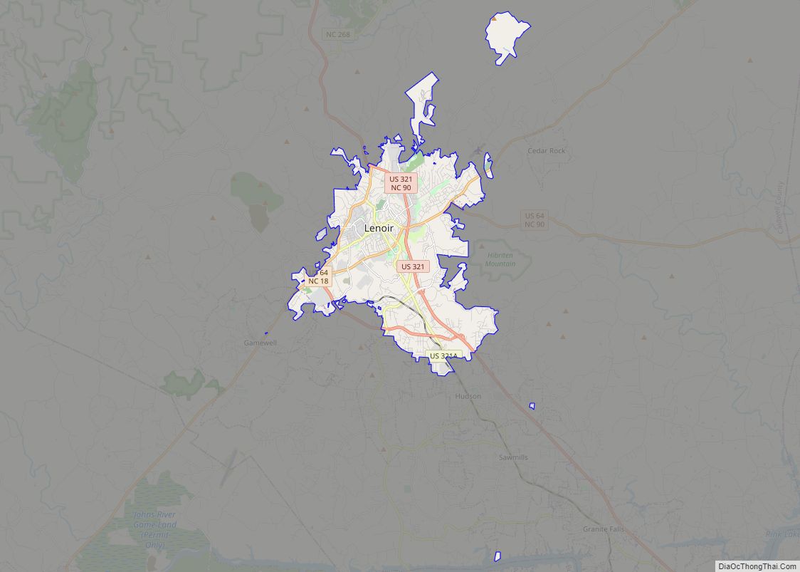
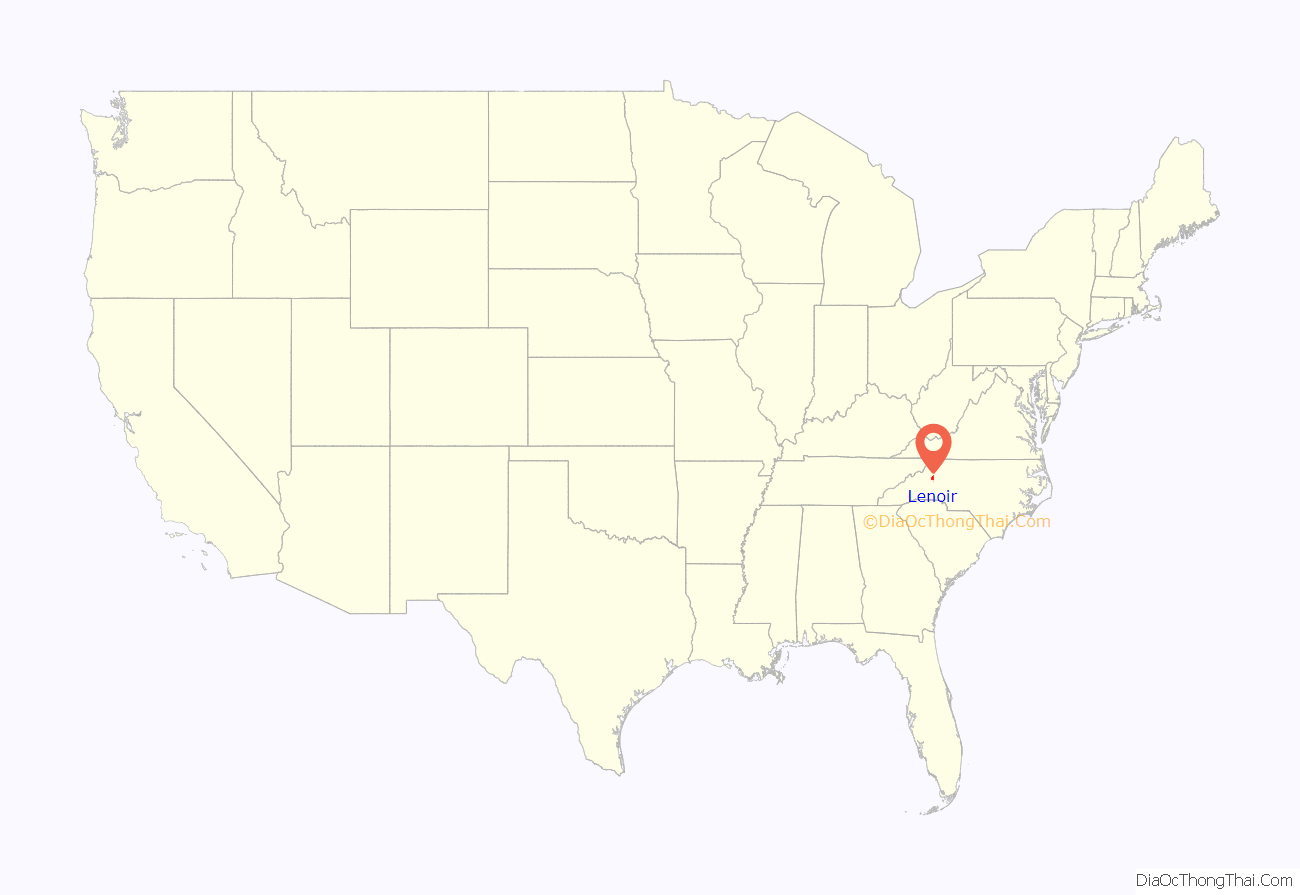
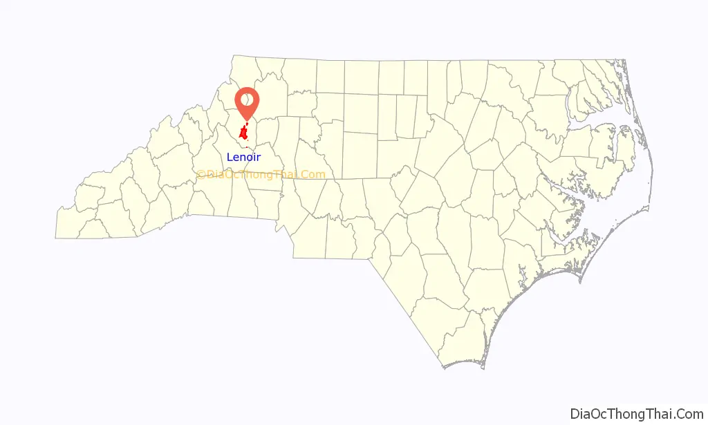
Lenoir location map. Where is Lenoir city?
History
Lenoir was established in 1841 and incorporated in 1851. The city was named for Revolutionary War general and early North Carolina statesman William Lenoir, who settled north of present-day Lenoir. His restored home, Fort Defiance, is a tourist attraction.
Early history
The original settlement of Lenoir was known as Tucker’s Barn, after a Tucker family that settled on the north side of Lower Creek around 1765. The homestead eventually served as a voting precinct, a muster ground, a store, and a place for celebrations. When Caldwell County was formed in 1841, a commission was appointed to choose a location for the county seat. One member proposed the south side of Lower Creek (today, the Whitnel area) because of its view of the Blue Ridge Mountains. However, since most of the county’s population was on the north side of Lower Creek, the Tucker’s Barn site was chosen, where Lenoir is today.
National Register of Historic Places locations
In addition to Fort Defiance, the Caldwell County Courthouse, Lenoir Downtown Historic District, Lenoir Grammar School, Lenoir High School, Mary’s Grove, and Edgar Allan Poe House are listed on the National Register of Historic Places.
Lenoir Road Map
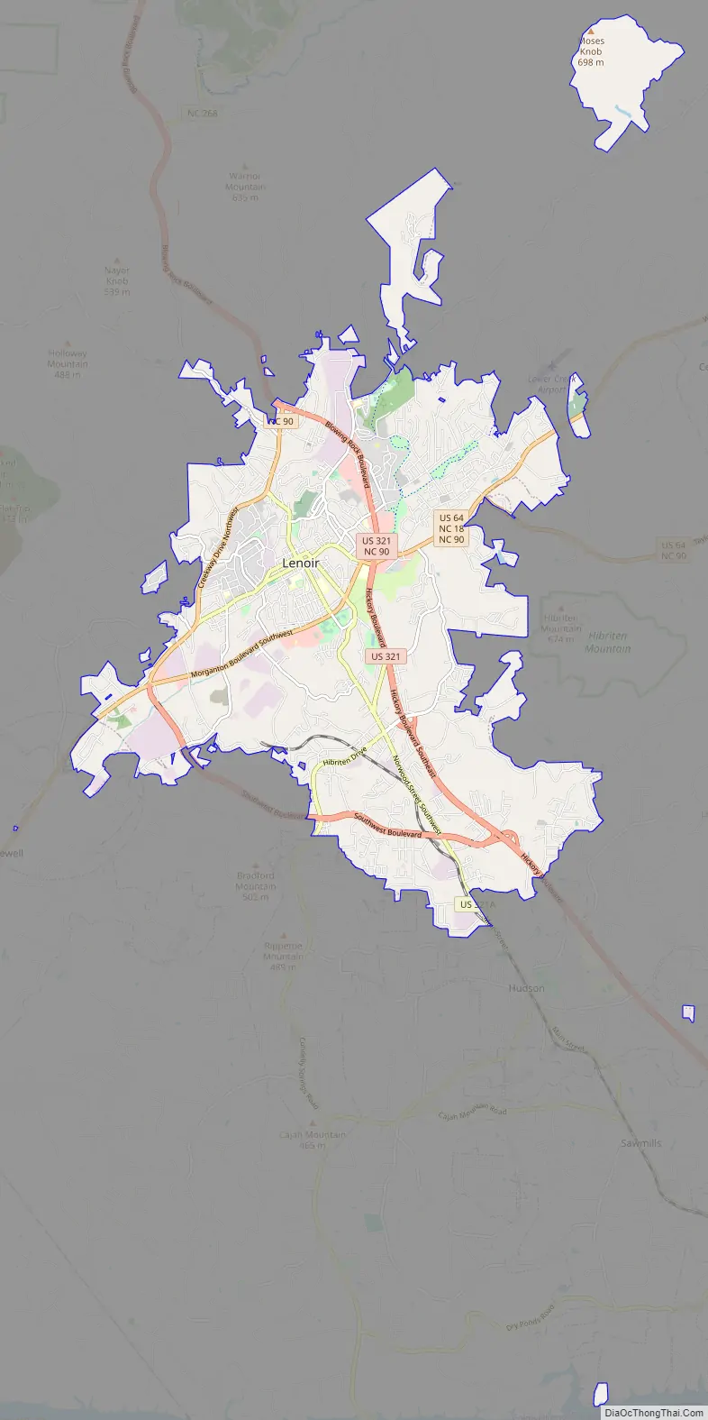
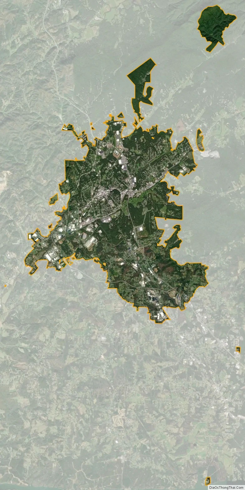
Lenoir city Satellite Map
Geography
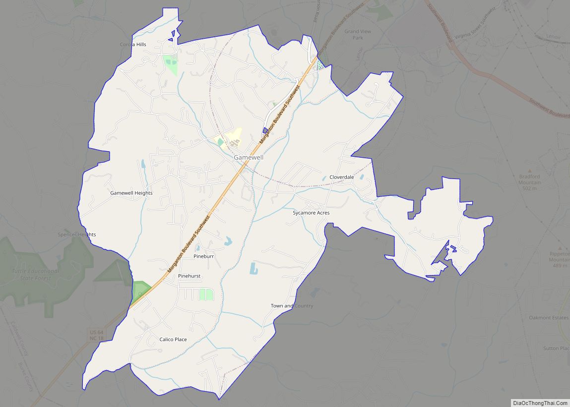
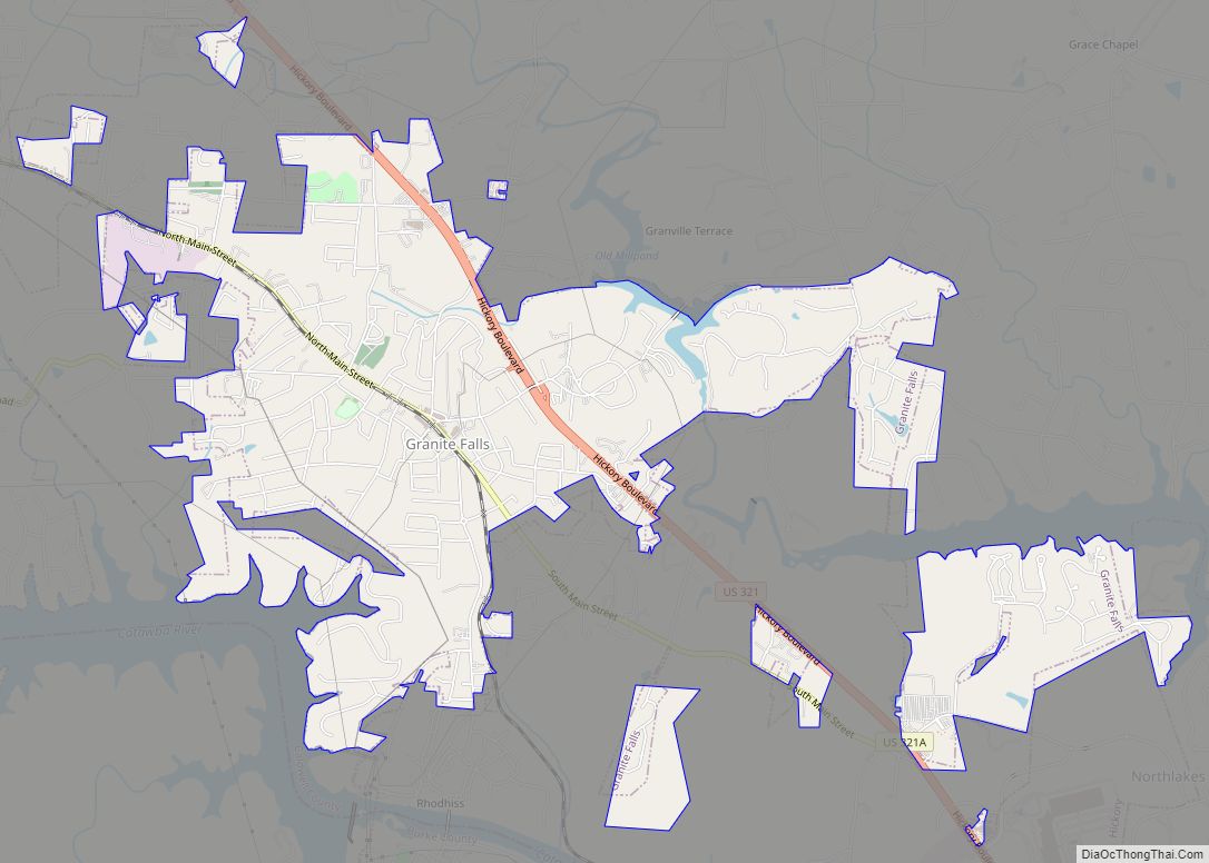
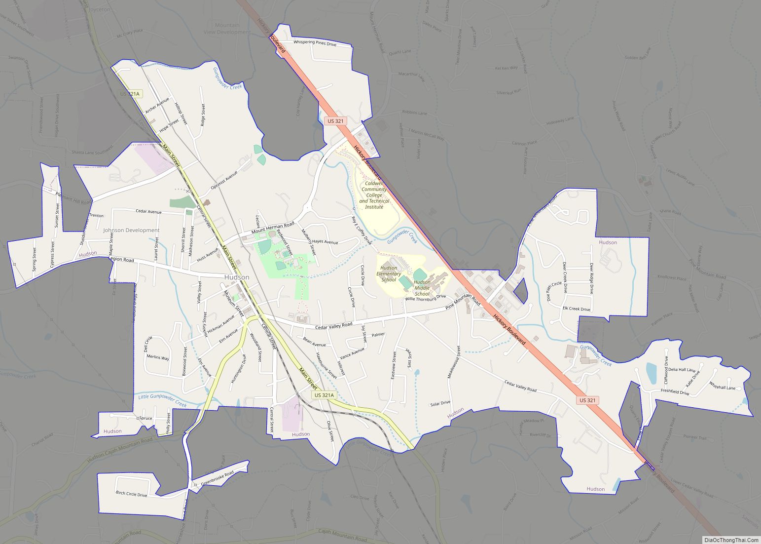
Lenoir is southeast of the center of Caldwell County, and is bordered to the south by the towns of Hudson and Cajah’s Mountain, and to the southwest by the town of Gamewell.
The city is at the intersection of U.S. Highways 64 and 321. US 64 leads east 42 miles (68 km) to Statesville and southwest 15 miles (24 km) to Morganton, while US 321 leads north 27 miles (43 km) to Boone and southeast 17 miles (27 km) to Hickory.
According to the United States Census Bureau, Lenoir has a total area of 19.7 square miles (50.9 km), all land. The city is in the valley of Lower Creek, between the Brushy Mountains to the east and the Blue Ridge Mountains to the west. Lower Creek flows southwest to the Catawba River valley.
Climate
Lenoir has a humid subtropical climate (Köppen climate classification Cfa), with cool to mild winters and warm, humid summers. Due to the city’s proximity to the Blue Ridge Mountains, temperatures tend to be slightly cooler than areas to the east.
See also
Map of North Carolina State and its subdivision:- Alamance
- Alexander
- Alleghany
- Anson
- Ashe
- Avery
- Beaufort
- Bertie
- Bladen
- Brunswick
- Buncombe
- Burke
- Cabarrus
- Caldwell
- Camden
- Carteret
- Caswell
- Catawba
- Chatham
- Cherokee
- Chowan
- Clay
- Cleveland
- Columbus
- Craven
- Cumberland
- Currituck
- Dare
- Davidson
- Davie
- Duplin
- Durham
- Edgecombe
- Forsyth
- Franklin
- Gaston
- Gates
- Graham
- Granville
- Greene
- Guilford
- Halifax
- Harnett
- Haywood
- Henderson
- Hertford
- Hoke
- Hyde
- Iredell
- Jackson
- Johnston
- Jones
- Lee
- Lenoir
- Lincoln
- Macon
- Madison
- Martin
- McDowell
- Mecklenburg
- Mitchell
- Montgomery
- Moore
- Nash
- New Hanover
- Northampton
- Onslow
- Orange
- Pamlico
- Pasquotank
- Pender
- Perquimans
- Person
- Pitt
- Polk
- Randolph
- Richmond
- Robeson
- Rockingham
- Rowan
- Rutherford
- Sampson
- Scotland
- Stanly
- Stokes
- Surry
- Swain
- Transylvania
- Tyrrell
- Union
- Vance
- Wake
- Warren
- Washington
- Watauga
- Wayne
- Wilkes
- Wilson
- Yadkin
- Yancey
- Alabama
- Alaska
- Arizona
- Arkansas
- California
- Colorado
- Connecticut
- Delaware
- District of Columbia
- Florida
- Georgia
- Hawaii
- Idaho
- Illinois
- Indiana
- Iowa
- Kansas
- Kentucky
- Louisiana
- Maine
- Maryland
- Massachusetts
- Michigan
- Minnesota
- Mississippi
- Missouri
- Montana
- Nebraska
- Nevada
- New Hampshire
- New Jersey
- New Mexico
- New York
- North Carolina
- North Dakota
- Ohio
- Oklahoma
- Oregon
- Pennsylvania
- Rhode Island
- South Carolina
- South Dakota
- Tennessee
- Texas
- Utah
- Vermont
- Virginia
- Washington
- West Virginia
- Wisconsin
- Wyoming