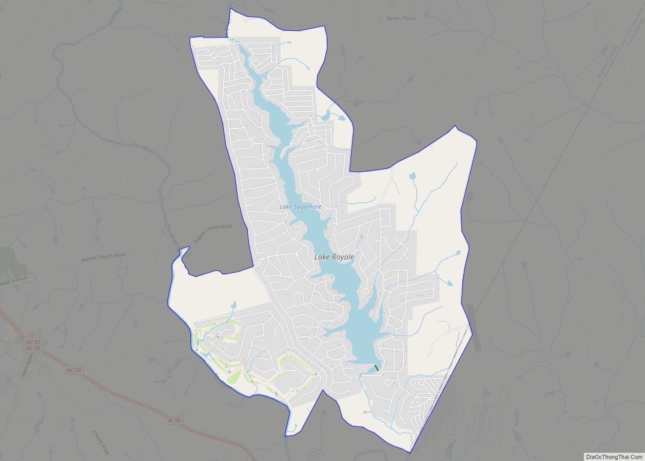
Lake Royale is a census-designated place (CDP) in southeastern Franklin County, North Carolina, United States. The population was 3,392 at the 2020 census.
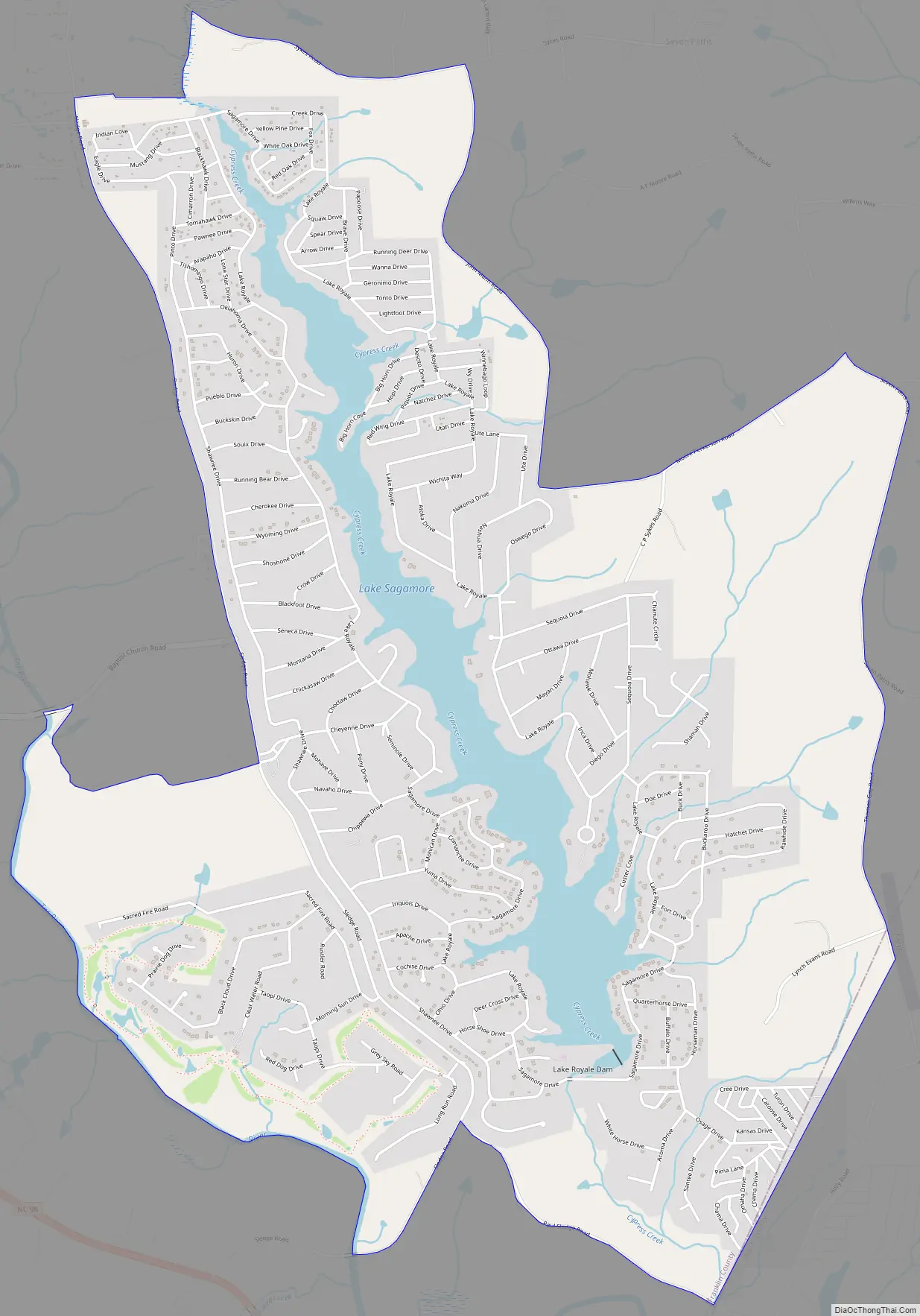
It is a gated resort community which surrounds a man-made lake with the same name. The main entrance to Lake Royale is off Sledge Road (SR 1611), 3 miles (5 km) east of Bunn.
| Name: | Lake Royale CDP |
|---|---|
| LSAD Code: | 57 |
| LSAD Description: | CDP (suffix) |
| State: | North Carolina |
| County: | Franklin County |
| Elevation: | 187 ft (57 m) |
| Total Area: | 7.05 sq mi (18.25 km²) |
| Land Area: | 6.51 sq mi (16.86 km²) |
| Water Area: | 0.54 sq mi (1.39 km²) |
| Total Population: | 3,392 |
| Population Density: | 521.12/sq mi (201.19/km²) |
| Area code: | 919, 984 and 252 |
| FIPS code: | 3736513 |
| GNISfeature ID: | 2584323 |
Online Interactive Map
Click on ![]() to view map in "full screen" mode.
to view map in "full screen" mode.
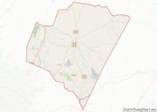
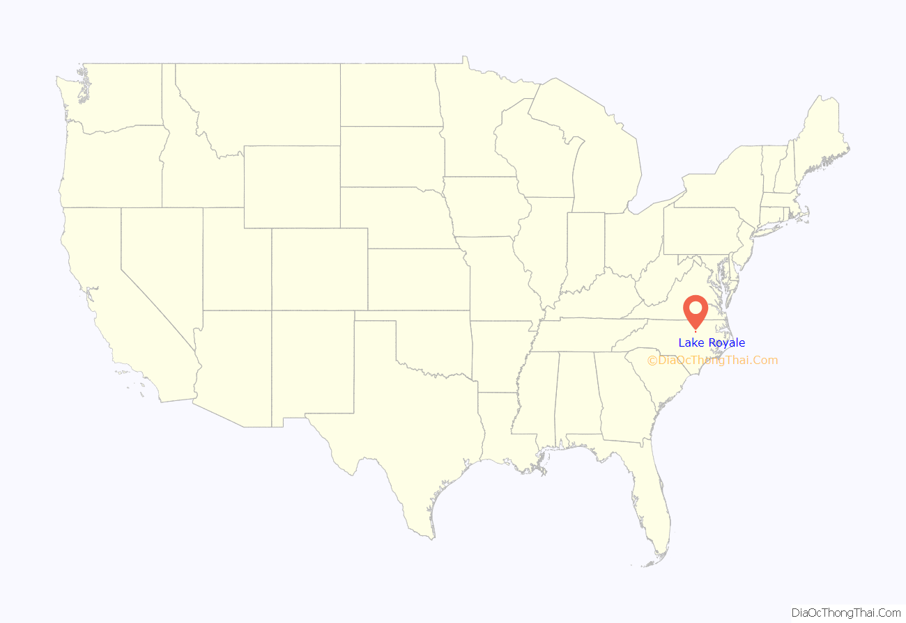
Lake Royale location map. Where is Lake Royale CDP?
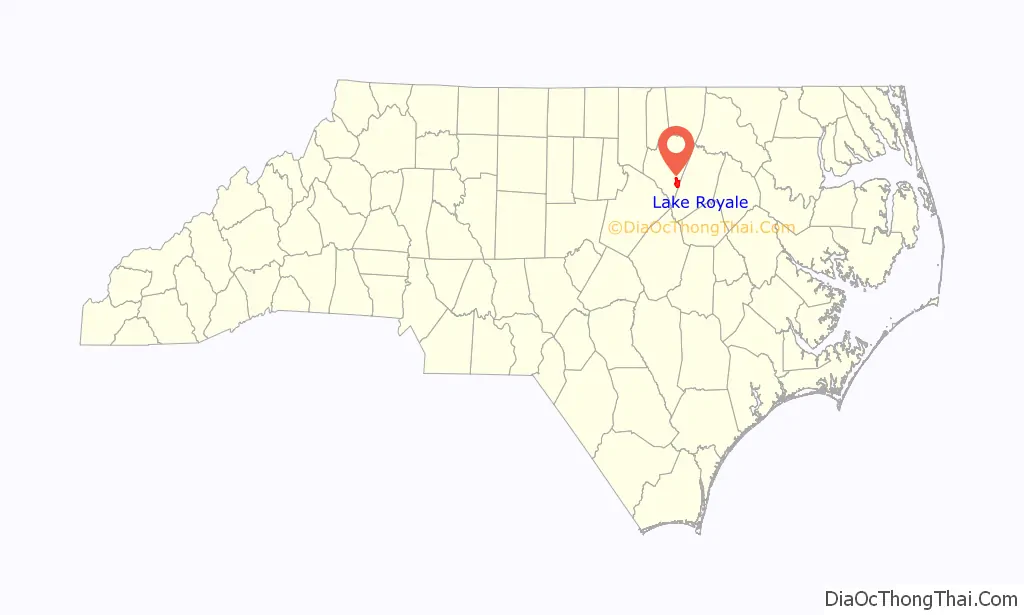
Lake Royale Road Map
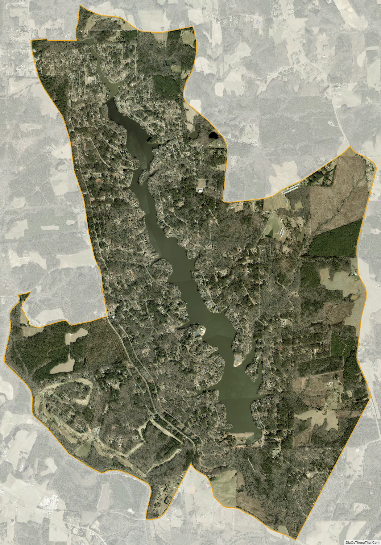
Lake Royale city Satellite Map
Geography
Lake Royale is located in southeastern Franklin County at 35°57′54″N 78°11′32″W / 35.964886°N 78.192232°W / 35.964886; -78.192232. The residential community that comprises the CDP surrounds Lake Royale, a reservoir on Cypress Creek and a tributary of the Tar River. The southeastern border of the CDP follows the Franklin County/Nash County line.
According to the United States Census Bureau, the CDP has a total area of 7.0 square miles (18.1 km), of which 6.4 square miles (16.7 km) is land and 0.54 square miles (1.4 km), or 7.69%, is water.
See also
Map of North Carolina State and its subdivision:- Alamance
- Alexander
- Alleghany
- Anson
- Ashe
- Avery
- Beaufort
- Bertie
- Bladen
- Brunswick
- Buncombe
- Burke
- Cabarrus
- Caldwell
- Camden
- Carteret
- Caswell
- Catawba
- Chatham
- Cherokee
- Chowan
- Clay
- Cleveland
- Columbus
- Craven
- Cumberland
- Currituck
- Dare
- Davidson
- Davie
- Duplin
- Durham
- Edgecombe
- Forsyth
- Franklin
- Gaston
- Gates
- Graham
- Granville
- Greene
- Guilford
- Halifax
- Harnett
- Haywood
- Henderson
- Hertford
- Hoke
- Hyde
- Iredell
- Jackson
- Johnston
- Jones
- Lee
- Lenoir
- Lincoln
- Macon
- Madison
- Martin
- McDowell
- Mecklenburg
- Mitchell
- Montgomery
- Moore
- Nash
- New Hanover
- Northampton
- Onslow
- Orange
- Pamlico
- Pasquotank
- Pender
- Perquimans
- Person
- Pitt
- Polk
- Randolph
- Richmond
- Robeson
- Rockingham
- Rowan
- Rutherford
- Sampson
- Scotland
- Stanly
- Stokes
- Surry
- Swain
- Transylvania
- Tyrrell
- Union
- Vance
- Wake
- Warren
- Washington
- Watauga
- Wayne
- Wilkes
- Wilson
- Yadkin
- Yancey
- Alabama
- Alaska
- Arizona
- Arkansas
- California
- Colorado
- Connecticut
- Delaware
- District of Columbia
- Florida
- Georgia
- Hawaii
- Idaho
- Illinois
- Indiana
- Iowa
- Kansas
- Kentucky
- Louisiana
- Maine
- Maryland
- Massachusetts
- Michigan
- Minnesota
- Mississippi
- Missouri
- Montana
- Nebraska
- Nevada
- New Hampshire
- New Jersey
- New Mexico
- New York
- North Carolina
- North Dakota
- Ohio
- Oklahoma
- Oregon
- Pennsylvania
- Rhode Island
- South Carolina
- South Dakota
- Tennessee
- Texas
- Utah
- Vermont
- Virginia
- Washington
- West Virginia
- Wisconsin
- Wyoming