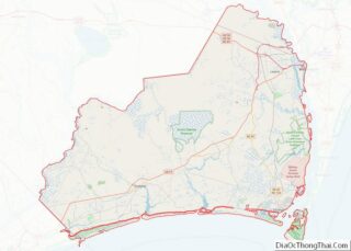
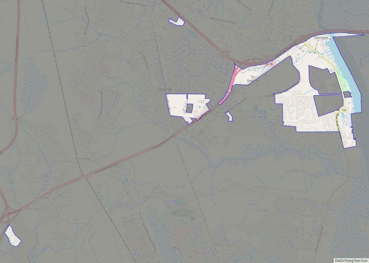
Leland is the most populous town in Brunswick County, North Carolina, United States. The population was 23,504 at the 2020 census, up from 13,527 in 2010. As of 2020, it is considered to be one of the fastest growing towns in North Carolina. It is part of the Myrtle Beach Metropolitan Statistical Area. and the Cape Fear Council of Governments. The town of Leland is in the northeastern part of Brunswick County, with the town of Navassa to the north, Belville to east, and Boiling Springs Lake to the south. It is part of the Town Creek township, and Cape Fear region of North Carolina, a short distance north of the South Carolina state line. Leland is located five miles (8.0 km) west of Wilmington, 71 miles (114 km) north of Myrtle Beach, 84 miles (135 km) southeast of Fayetteville, and 135 miles (217 km) southeast of Raleigh.
| Name: | Leland town |
|---|---|
| LSAD Code: | 43 |
| LSAD Description: | town (suffix) |
| State: | North Carolina |
| County: | Brunswick County |
| Incorporated: | September 5, 1989 (1989-09-05) |
| Elevation: | 23 ft (7 m) |
| Total Area: | 22.68 sq mi (58.73 km²) |
| Land Area: | 22.33 sq mi (57.83 km²) |
| Water Area: | 0.35 sq mi (0.90 km²) |
| Population Density: | 1,025.98/sq mi (396.14/km²) |
| ZIP code: | 28451 |
| FIPS code: | 3737680 |
| GNISfeature ID: | 0988344 |
| Website: | www.townofleland.com |
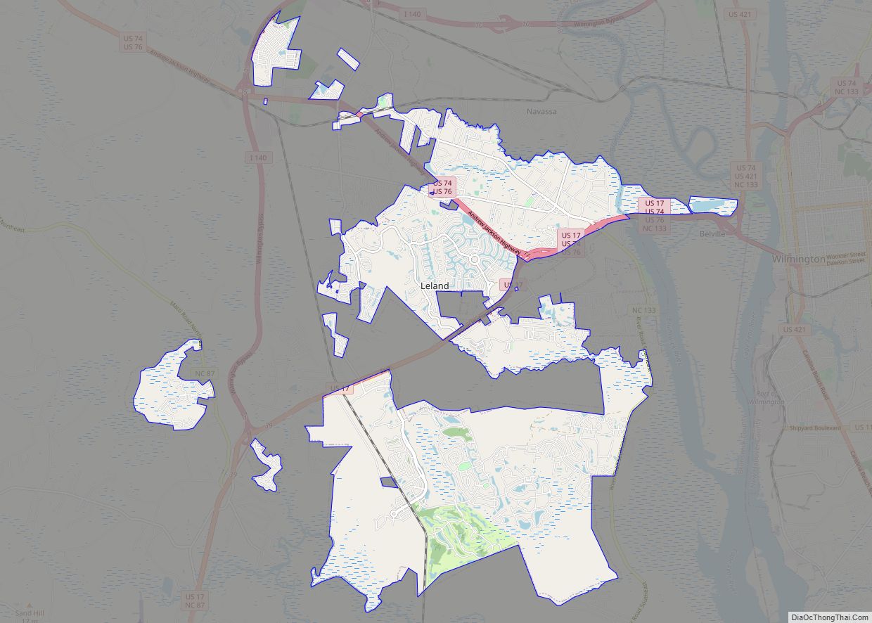
Online Interactive Map
Click on ![]() to view map in "full screen" mode.
to view map in "full screen" mode.
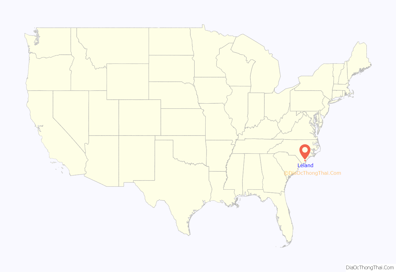
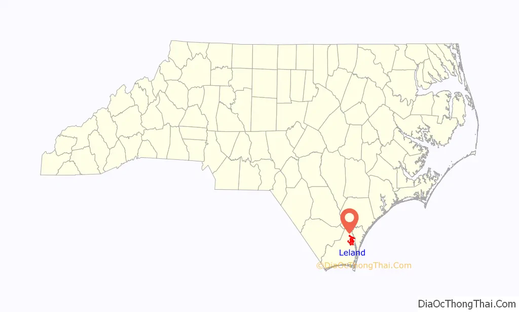
Leland location map. Where is Leland town?
History
Settlement
What is today known as Leland was once a small settlement built upon where Village Road crossed the Augusta, Columbia and Wilmington railroad lines. The town is named after (Joseph W. Gay) the first postmaster’s nephew, Leland Adams. Leland benefited greatly from its proximity to the Brunswick River, allowing it to serve as an early transportation center, giving travelers the ability to traverse the Brunswick and Cape Fear rivers.
Incorporation
The citizens of Leland voted down an attempt at incorporation in 1979. Leland was ultimately incorporated as a town on September 5, 1989, in a passing vote of 472–42. After the ordinance passed to incorporate the town of Leland, Leland was governed by twelve members of the Leland Town Charter Commission until Election Day of 1989. Leland has been governed by a mayor-council government since its first general election.
Dispute with Belville
In March and April 1989, Belville made unsuccessful attempts to annex the area known as Leland. This, in turn resulted in the Leland civic association making proactive attempts to incorporate to avoid annexation. Belville‘s commissioners voted to annex a business district roughly an hour before Leland had finalized the vote to incorporate. Leland’s first mayor, Russell Baldwin, when questioned about the matter, stated: “It was kind of a dirty trick. They made a mockery of the annexation laws.”
Merger attempts
In 2012, according to Jack Batson, the mayor of Belville at the time, “It’s something that’s always on people’s minds because you see the way the maps are laid out. It makes sense.” Belville is effectively an enclave township surrounded by Leland’s borders to the left and the Brunswick River to the right. In April 1996, during Leland mayor Franky Thomas’ tenure, an unsuccessful attempt was made to merge the Leland sanitary district, Leland, Belville, and Navassa into one large town. In 2000, Leland made an unsuccessful attempt to merge with Navassa, Belville, and the North Brunswick sanitary district. Another attempt was made in 2012 to merge with Belville. Leland officials attempted to entice Belville officials, citing the town’s contract issues with Urban Smart Growth that Belville had entered into years before to develop its downtown. If Leland and Belville were to merge, Belville would have the funds to buy out the contract, or fight it out in court. Jack Batson, the mayor of Belville at the time, faced heavy criticism for discussing the subject matter with Leland officials. One Belville resident stated; “When I voted for Mr. Batson, I thought I was voting for the position of mayor, not God.”
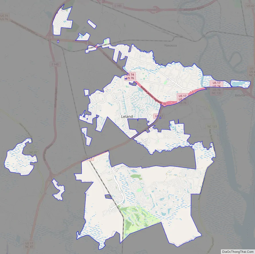
Leland Road Map
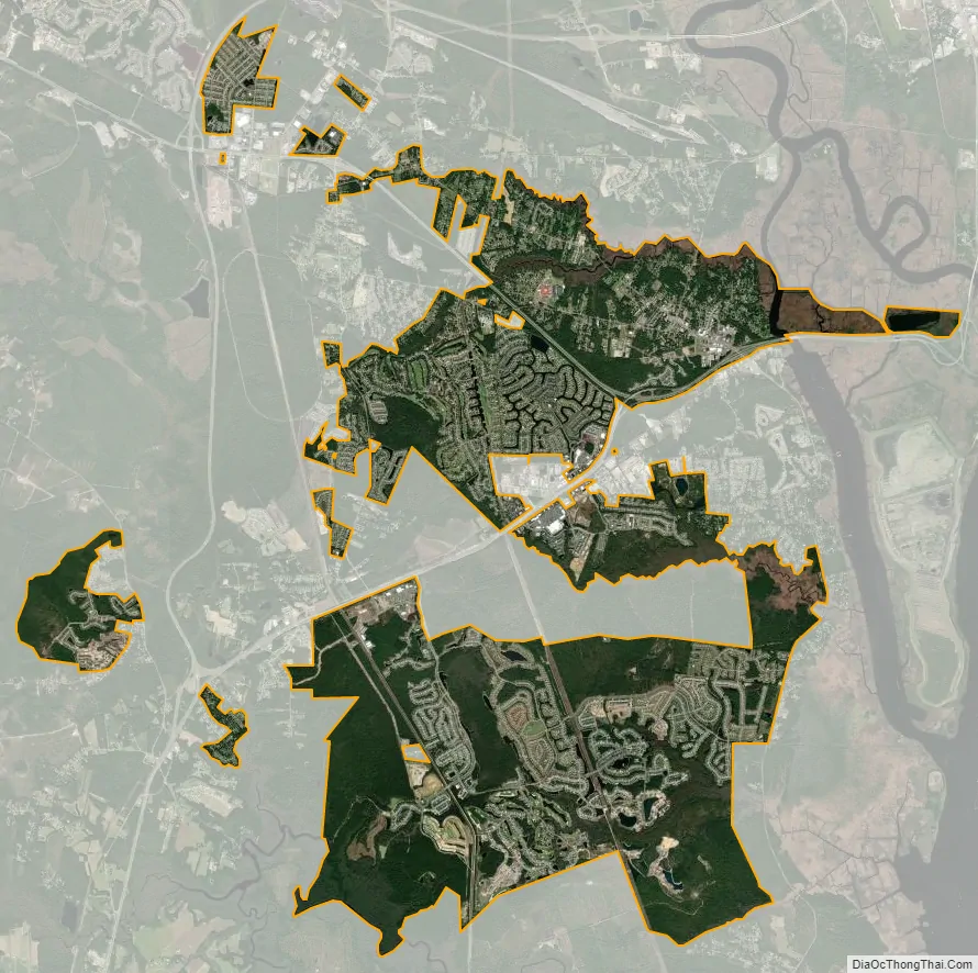
Leland city Satellite Map
Geography
Leland is located at 34°14′11″N 78°1′11″W / 34.23639°N 78.01972°W / 34.23639; -78.01972 (34.236375, -78.019664) in northern Brunswick County to the west of the Brunswick River and directly west of downtown Wilmington. Leland surrounds the town of Belville on three sides (to the north, west, and south).
According to the 2010 United States Census Bureau, the town of Leland has a total area of 19.9 square miles (51.5 km), of which 19.8 square miles (51.2 km) is land and 0.077 square miles (0.2 km), or 0.46%, is water.
Green space
Leland has three officially designated parks: Founders Park, Cypress Cove Park, and Westgate Park. Founders Park, formerly known as Municipal Park, is Leland’s first park. The eight acre park includes such features as a playground, disc golf courses, benches, community gardens, open green spaces and a paved multi-used path. Cypress Cove park, previously known as Sturgeon Creek Park, was donated by Mr. Kirby Sullivan to the town of Leland in 2005. Cypress Cove Park is made up of 27 acres of wetlands and 1.2 acres of uplands. Cypress Cove Park is the first water access site for Leland, and features a fixed overlook deck, outdoor classroom, a floating dock, and handicap accessible fishing area. Westgate Nature Park consists of approximately 150 acres of wetlands and uplands. Construction of the park was funded by a $500,000 grant provided by the North Carolina Parks and Recreation Trust Fund.
See also
Map of North Carolina State and its subdivision:- Alamance
- Alexander
- Alleghany
- Anson
- Ashe
- Avery
- Beaufort
- Bertie
- Bladen
- Brunswick
- Buncombe
- Burke
- Cabarrus
- Caldwell
- Camden
- Carteret
- Caswell
- Catawba
- Chatham
- Cherokee
- Chowan
- Clay
- Cleveland
- Columbus
- Craven
- Cumberland
- Currituck
- Dare
- Davidson
- Davie
- Duplin
- Durham
- Edgecombe
- Forsyth
- Franklin
- Gaston
- Gates
- Graham
- Granville
- Greene
- Guilford
- Halifax
- Harnett
- Haywood
- Henderson
- Hertford
- Hoke
- Hyde
- Iredell
- Jackson
- Johnston
- Jones
- Lee
- Lenoir
- Lincoln
- Macon
- Madison
- Martin
- McDowell
- Mecklenburg
- Mitchell
- Montgomery
- Moore
- Nash
- New Hanover
- Northampton
- Onslow
- Orange
- Pamlico
- Pasquotank
- Pender
- Perquimans
- Person
- Pitt
- Polk
- Randolph
- Richmond
- Robeson
- Rockingham
- Rowan
- Rutherford
- Sampson
- Scotland
- Stanly
- Stokes
- Surry
- Swain
- Transylvania
- Tyrrell
- Union
- Vance
- Wake
- Warren
- Washington
- Watauga
- Wayne
- Wilkes
- Wilson
- Yadkin
- Yancey
- Alabama
- Alaska
- Arizona
- Arkansas
- California
- Colorado
- Connecticut
- Delaware
- District of Columbia
- Florida
- Georgia
- Hawaii
- Idaho
- Illinois
- Indiana
- Iowa
- Kansas
- Kentucky
- Louisiana
- Maine
- Maryland
- Massachusetts
- Michigan
- Minnesota
- Mississippi
- Missouri
- Montana
- Nebraska
- Nevada
- New Hampshire
- New Jersey
- New Mexico
- New York
- North Carolina
- North Dakota
- Ohio
- Oklahoma
- Oregon
- Pennsylvania
- Rhode Island
- South Carolina
- South Dakota
- Tennessee
- Texas
- Utah
- Vermont
- Virginia
- Washington
- West Virginia
- Wisconsin
- Wyoming