Map of Wentworth town, North Carolina
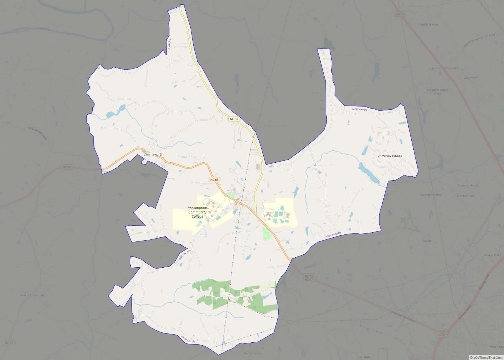
Wentworth is a town in Rockingham County, North Carolina, United States. The population was 2,646 at the 2020 census. Wentworth is the county seat of Rockingham County and is part of the Greensboro–High Point metropolitan area of the Piedmont Triad. On May 6, 2022, and EF-1 Tornado hit Wentworth. The storm traveled as a supercell ... Read more
Map of Wentworth town, North Carolina
Map of Wendell town, North Carolina
Wendell is a town in Wake County, North Carolina, United States. It is a satellite town of Raleigh, the state capital. The population was 5,845 at the 2010 census. Wendell town overview: Name: Wendell town LSAD Code: 43 LSAD Description: town (suffix) State: North Carolina County: Wake County Incorporated: 1903 Elevation: 318 ft (97 m) Total Area: ... Read more
Map of Wendell town, North Carolina
Map of Weldon town, North Carolina
Weldon is a town in Halifax County, North Carolina, United States. The population was 1,655 at the 2010 census. It is part of the Roanoke Rapids, North Carolina Micropolitan Statistical Area. Weldon town overview: Name: Weldon town LSAD Code: 43 LSAD Description: town (suffix) State: North Carolina County: Halifax County Elevation: 72 ft (22 m) Total Area: ... Read more
Map of Weldon town, North Carolina
Map of Welcome CDP, North Carolina
Welcome is a census-designated place (CDP) in Davidson County, North Carolina, United States. The population was 4,162 at the 2010 census. It is nationally known as the home of Richard Childress Racing. In addition, Walker and Associates, Inc., a nationwide communication value-add distribution is headquartered here. The town motto is “Welcome to Welcome, A Friendly ... Read more
Map of Welcome CDP, North Carolina
Map of Weddington town
Weddington is a suburban town in Union County, North Carolina, United States. A small portion of the town extends into Mecklenburg County. The population was 9,459 at the 2010 census. It is a suburb in the Charlotte metropolitan area. The current mayor of Weddington is Craig Horn. Weddington town overview: Name: Weddington town LSAD Code: ... Read more
Map of Weddington town
Map of Webster town, North Carolina
Webster is a town in Jackson County, North Carolina, United States. As of the 2010 census, the population was 363, down from 486 in 2000. Webster was the first county seat of Jackson County, until Sylva assumed the role in 1913. Webster town overview: Name: Webster town LSAD Code: 43 LSAD Description: town (suffix) State: ... Read more
Map of Webster town, North Carolina
Map of Weaverville town, North Carolina
Weaverville is a town in Buncombe County, North Carolina, United States. The population was 3,120 at the 2010 census. It is part of the Asheville Metropolitan Statistical Area. Weaverville town overview: Name: Weaverville town LSAD Code: 43 LSAD Description: town (suffix) State: North Carolina County: Buncombe County Elevation: 2,178 ft (664 m) Total Area: 3.89 sq mi (10.07 km²) Land ... Read more
Map of Weaverville town, North Carolina
Map of White Oak CDP, North Carolina
White Oak is a census-designated place (CDP) in Bladen County, North Carolina, United States. The population was 338 at the 2010 census. White Oak CDP overview: Name: White Oak CDP LSAD Code: 57 LSAD Description: CDP (suffix) State: North Carolina County: Bladen County Elevation: 59 ft (18 m) Total Area: 5.11 sq mi (13.23 km²) Land Area: 5.11 sq mi (13.23 km²) Water ... Read more
Map of White Oak CDP, North Carolina
Map of White Lake town, North Carolina
White Lake is a town in Bladen County, North Carolina, United States. The population was 802 at the 2010 census, up from 529 in 2000. White Lake town overview: Name: White Lake town LSAD Code: 43 LSAD Description: town (suffix) State: North Carolina County: Bladen County Elevation: 69 ft (21 m) Total Area: 2.66 sq mi (6.89 km²) Land Area: ... Read more
Map of White Lake town, North Carolina
Map of Whitakers town
Whitakers /ˈhwɪtəkərz/ is a town in Edgecombe and Nash Counties in the U.S. state of North Carolina. It is divided between the two counties by railroad tracks and is the northernmost town in the two counties. It is part of the Rocky Mount, North Carolina Metropolitan Statistical Area. The population was 744 in 2010. Whitakers ... Read more
Map of Whitakers town
Map of Whispering Pines village, North Carolina
Whispering Pines is a village in Moore County, North Carolina, United States. The population was 2,928 at the 2010 census. Whispering Pines village overview: Name: Whispering Pines village LSAD Code: 47 LSAD Description: village (suffix) State: North Carolina County: Moore County Elevation: 371 ft (113 m) Total Area: 4.42 sq mi (11.44 km²) Land Area: 3.79 sq mi (9.82 km²) Water Area: 0.63 sq mi ... Read more
Map of Whispering Pines village, North Carolina
Map of Westport CDP, North Carolina
Westport is an unincorporated community and census-designated place (CDP) located in Lincoln County, North Carolina, United States. The population of the CDP was 4,026 at the 2010 census, up from 2,006 at the 2000 census. The community’s name comes from its location on the west side of Lake Norman. Westport CDP overview: Name: Westport CDP ... Read more
Map of Westport CDP, North Carolina