Wendell is a town in Wake County, North Carolina, United States. It is a satellite town of Raleigh, the state capital. The population was 5,845 at the 2010 census.
| Name: | Wendell town |
|---|---|
| LSAD Code: | 43 |
| LSAD Description: | town (suffix) |
| State: | North Carolina |
| County: | Wake County |
| Incorporated: | 1903 |
| Elevation: | 318 ft (97 m) |
| Total Area: | 6.96 sq mi (18.03 km²) |
| Land Area: | 6.95 sq mi (17.99 km²) |
| Water Area: | 0.02 sq mi (0.04 km²) |
| Total Population: | 9,793 |
| Population Density: | 1,409.88/sq mi (544.35/km²) |
| ZIP code: | 27591 |
| Area code: | 919 |
| FIPS code: | 3771860 |
| GNISfeature ID: | 1023154 |
| Website: | http://townofwendell.com/ |
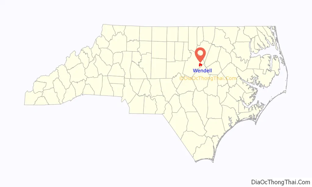
Online Interactive Map
Click on ![]() to view map in "full screen" mode.
to view map in "full screen" mode.
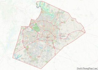
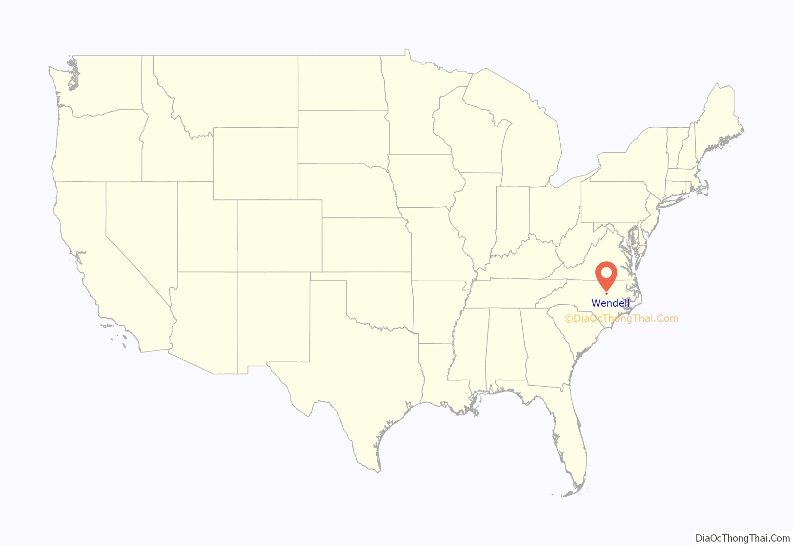
Wendell location map. Where is Wendell town?
History
Incorporated in 1903, Wendell was settled in the 1850s, when farmers in Granville County were victims of a blight that came to be known as the Granville County Wilt. Their tobacco crops failed, and they chose to move to a new location with more fertile land for their crops.
As settlement increased, a small village took form. The villagers asked the local schoolteacher, M.A. Griffin, to choose a name. Griffin suggested they call it Wendell, in honor of his favorite poet, Oliver Wendell Holmes. However, the townspeople pronounce each syllable with equal emphasis, not as the poet’s middle name is said. The Town seal was adopted on April 4, 1963.
The first post office was built in 1891, and has been restored by the Wendell Historical Society. The oldest institution in Wendell is Hephzibah Baptist Church, founded in 1809. The first newspaper was the Wendell Clarion, founded in 1911, which was succeeded by the Gold Leaf Farmer and currently the Eastern Wake News.
Wendell has four buildings and two districts that are listed on the National Register of Historic Places. These are the Dr. Thomas H. Avera House, Harmony Plantation, Riley Hill School, Sunnyside, Wendell Boulevard Historic District, and the Wendell Commercial Historic District:.
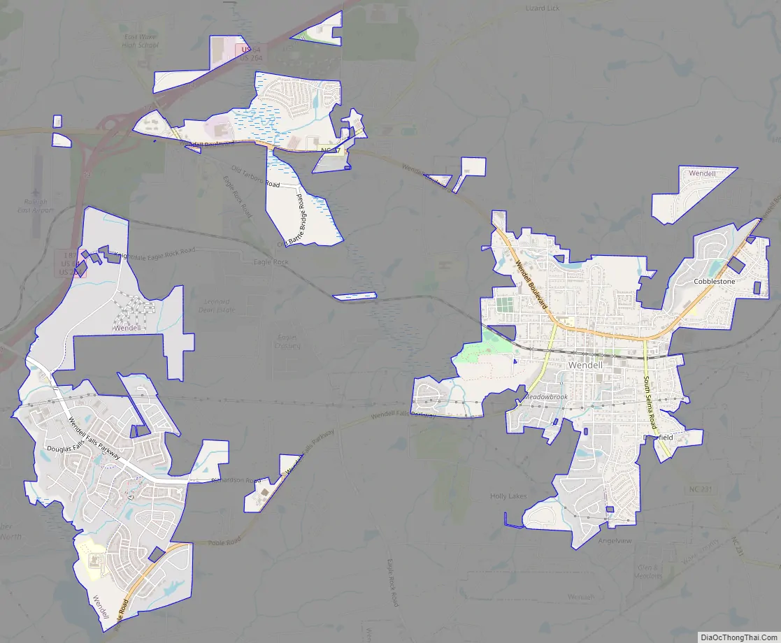
Wendell Road Map
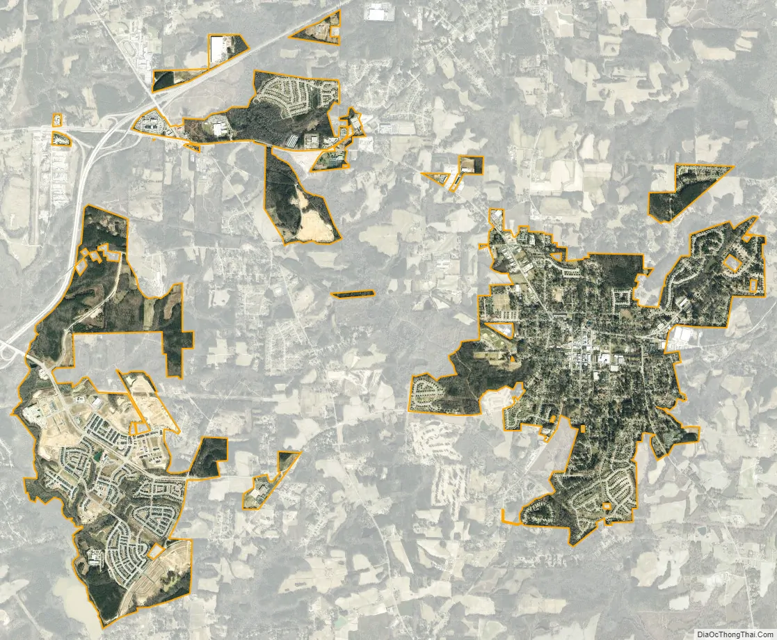
Wendell city Satellite Map
Geography
According to the United States Census Bureau, the town has a total area of 5.2 square miles (13.5 km), all land.
Wendell is located in the northeast-central region of North Carolina, where the Piedmont and Atlantic Coastal Plain regions meet. This area is known as the “Fall Line” because it marks the elevation inland at which rapids and small waterfalls begin to appear in creeks and rivers. Its central Piedmont location situates Wendell approximately two and a half hours (via car) west of Atlantic Beach, and four hours east of the Great Smoky Mountains.
Climate
Wendell enjoys a moderate subtropical climate, with moderate temperatures in the spring, fall, and winter. Summers are typically hot with high humidity. Winter highs generally range in the low 50s°F (10 to 13 °C) with lows in the low-to-mid 30s°F (-2 to 2 °C), although an occasional 60 °F (15 °C) or warmer winter day is not uncommon. Spring and fall days usually reach the low-to-mid 70s°F (low 20s°C), with lows at night in the lower 50s°F (10 to 14 °C). Summer daytime highs often reach the upper 80s to low 90s°F (29 to 35 °C). The rainiest months are July and August.
See also
Map of North Carolina State and its subdivision:- Alamance
- Alexander
- Alleghany
- Anson
- Ashe
- Avery
- Beaufort
- Bertie
- Bladen
- Brunswick
- Buncombe
- Burke
- Cabarrus
- Caldwell
- Camden
- Carteret
- Caswell
- Catawba
- Chatham
- Cherokee
- Chowan
- Clay
- Cleveland
- Columbus
- Craven
- Cumberland
- Currituck
- Dare
- Davidson
- Davie
- Duplin
- Durham
- Edgecombe
- Forsyth
- Franklin
- Gaston
- Gates
- Graham
- Granville
- Greene
- Guilford
- Halifax
- Harnett
- Haywood
- Henderson
- Hertford
- Hoke
- Hyde
- Iredell
- Jackson
- Johnston
- Jones
- Lee
- Lenoir
- Lincoln
- Macon
- Madison
- Martin
- McDowell
- Mecklenburg
- Mitchell
- Montgomery
- Moore
- Nash
- New Hanover
- Northampton
- Onslow
- Orange
- Pamlico
- Pasquotank
- Pender
- Perquimans
- Person
- Pitt
- Polk
- Randolph
- Richmond
- Robeson
- Rockingham
- Rowan
- Rutherford
- Sampson
- Scotland
- Stanly
- Stokes
- Surry
- Swain
- Transylvania
- Tyrrell
- Union
- Vance
- Wake
- Warren
- Washington
- Watauga
- Wayne
- Wilkes
- Wilson
- Yadkin
- Yancey
- Alabama
- Alaska
- Arizona
- Arkansas
- California
- Colorado
- Connecticut
- Delaware
- District of Columbia
- Florida
- Georgia
- Hawaii
- Idaho
- Illinois
- Indiana
- Iowa
- Kansas
- Kentucky
- Louisiana
- Maine
- Maryland
- Massachusetts
- Michigan
- Minnesota
- Mississippi
- Missouri
- Montana
- Nebraska
- Nevada
- New Hampshire
- New Jersey
- New Mexico
- New York
- North Carolina
- North Dakota
- Ohio
- Oklahoma
- Oregon
- Pennsylvania
- Rhode Island
- South Carolina
- South Dakota
- Tennessee
- Texas
- Utah
- Vermont
- Virginia
- Washington
- West Virginia
- Wisconsin
- Wyoming