Map of Brocket city
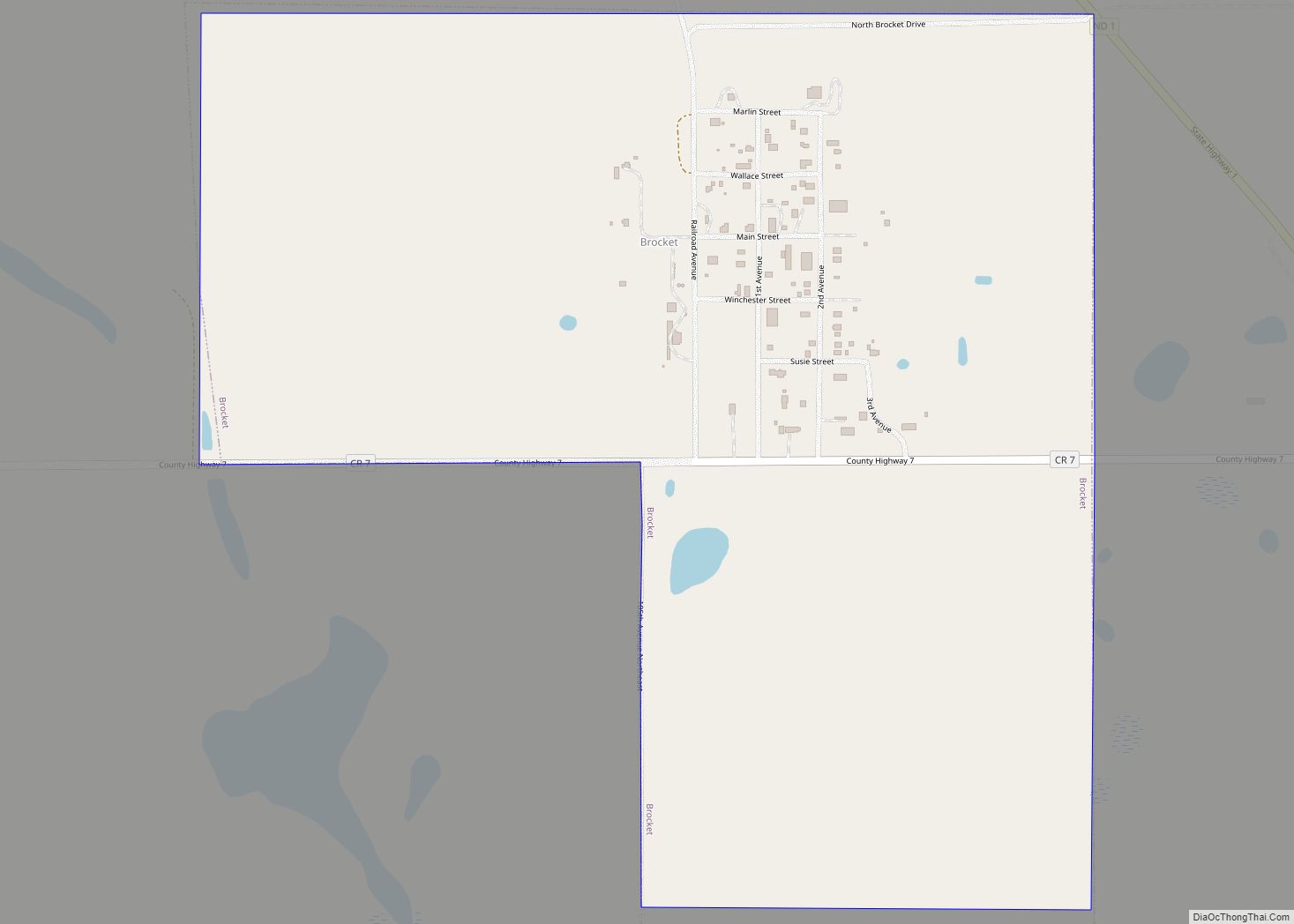
Brocket is a city in Ramsey County, North Dakota, United States. The population was 34 at the 2020 census. Brocket was founded in 1901. Brocket city overview: Name: Brocket city LSAD Code: 25 LSAD Description: city (suffix) State: North Dakota County: Ramsey County Founded: 1901 Elevation: 1,512 ft (461 m) Total Area: 0.76 sq mi (1.96 km²) Land Area: 0.76 sq mi ... Read more
Map of Brocket city
Map of Brinsmade city
Brinsmade is a city in Benson County, North Dakota, United States. The population was 30 at the 2020 census. Brinsmade was founded in 1889. Brinsmade city overview: Name: Brinsmade city LSAD Code: 25 LSAD Description: city (suffix) State: North Dakota County: Benson County Founded: October 7, 1889 Incorporated: April 4, 1904 Elevation: 1,562 ft (476 m) Total ... Read more
Map of Brinsmade city
Map of Briarwood city, North Dakota
Briarwood is a city in Cass County, North Dakota, United States. The population was 57 at the 2020 census. Briarwood was founded in 1973. It is a suburb directly adjacent to the city of Fargo. Briarwood city overview: Name: Briarwood city LSAD Code: 25 LSAD Description: city (suffix) State: North Dakota County: Cass County Elevation: ... Read more
Map of Briarwood city, North Dakota
Map of Braddock city, North Dakota
Braddock is a city in Emmons County, North Dakota, United States. The population was 18 at the 2020 census. Braddock was founded in 1898. Braddock city overview: Name: Braddock city LSAD Code: 25 LSAD Description: city (suffix) State: North Dakota County: Emmons County Founded: 1898 Elevation: 1,864 ft (568 m) Total Area: 0.25 sq mi (0.65 km²) Land Area: 0.25 sq mi ... Read more
Map of Braddock city, North Dakota
Map of Cannon Ball CDP
Cannon Ball is a census-designated place (CDP) on the Standing Rock Indian Reservation and in Sioux County, North Dakota, United States. It is located in the northeastern part of Sioux County, having developed at the confluence of the Cannonball River and Lake Oahe of the Missouri River. The population was 875 at the 2010 census. ... Read more
Map of Cannon Ball CDP
Map of Cando city
Cando (/ˈkænduː/ KAN-doo) is a city in Towner County, North Dakota, United States. It is the county seat of Towner County. The population was 1,117 at the 2020 census. Cando was founded in 1884. Cando city overview: Name: Cando city LSAD Code: 25 LSAD Description: city (suffix) State: North Dakota County: Towner County Founded: 1884 ... Read more
Map of Cando city
Map of Calvin city, North Dakota
Calvin is a city in Cavalier County, North Dakota, United States. The population was 15 at the 2020 census. Calvin was founded in 1905. Likely the most historic structure left in town, the Calvin AF & AM Corinthian Masonic Lodge Number 78, was burned and razed in May 2014, after the upper floor had collapsed ... Read more
Map of Calvin city, North Dakota
Map of Calio city
Calio is a city in Cavalier County, North Dakota, United States. The population was 8 at the 2020 census. Calio was founded in 1905. Calio city overview: Name: Calio city LSAD Code: 25 LSAD Description: city (suffix) State: North Dakota County: Cavalier County Founded: 1905 Elevation: 1,562 ft (476 m) Total Area: 8.91 sq mi (23.08 km²) Land Area: 8.17 sq mi ... Read more
Map of Calio city
Map of Caledonia CDP, North Dakota
Caledonia is a census-designated place in Traill County, North Dakota, United States. A former boomtown of the 1870s and the era of the Hudson’s Bay Company steamship trade, the community has now all but virtually disappeared. An unincorporated community, it was designated as part of the U.S. Census Bureau’s Participant Statistical Areas Program on March ... Read more
Map of Caledonia CDP, North Dakota
Map of Buxton city, North Dakota
Buxton is a city in Traill County, North Dakota, United States. The population was 348 at the 2020 census. Buxton was founded in 1880. Today, it has become a bedroom community for the nearby Greater Grand Forks metropolitan area. Buxton city overview: Name: Buxton city LSAD Code: 25 LSAD Description: city (suffix) State: North Dakota ... Read more
Map of Buxton city, North Dakota
Map of Carson city, North Dakota
Carson is a city in and the county seat of Grant County, North Dakota, United States. The population was 254 at the 2020 census. Carson city overview: Name: Carson city LSAD Code: 25 LSAD Description: city (suffix) State: North Dakota County: Grant County Founded: 1910 Elevation: 2,300 ft (701 m) Total Area: 3.99 sq mi (10.34 km²) Land Area: 3.99 sq mi ... Read more
Map of Carson city, North Dakota
Map of Carrington city
Carrington is a city in Foster County, North Dakota, United States. It is the county seat of Foster County. A part of Carrington Township and Wyard Township The population was 2,080 at the 2020 census. Carrington was founded in 1883. Carrington is home to Dakota Growers Pasta Company, Inc. Carrington city overview: Name: Carrington city ... Read more
Map of Carrington city