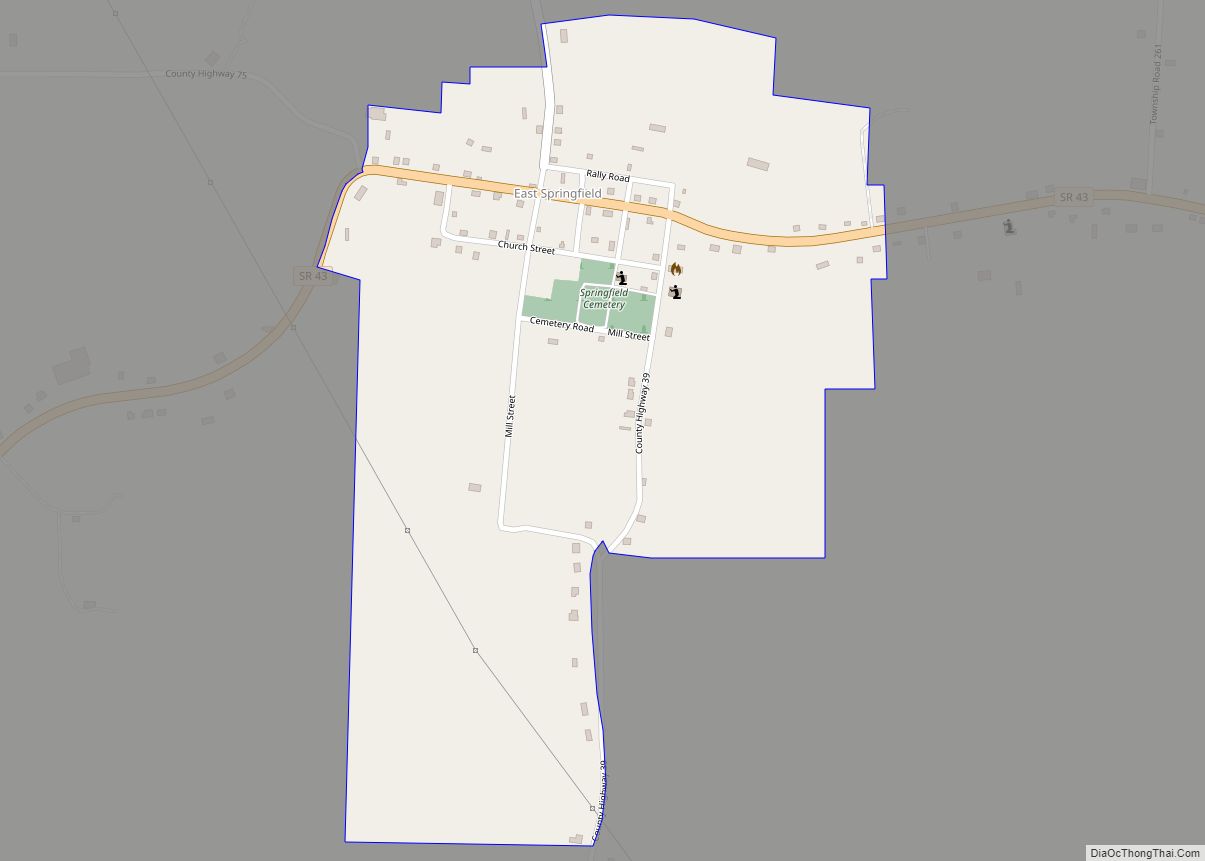
Map of East Sparta village
East Sparta is a village in Stark County, Ohio, United States. The population was 819 at the 2010 census. It is part of the Canton–Massillon Metropolitan Statistical Area. East Sparta village overview: Name: East Sparta village LSAD Code: 47 LSAD Description: village (suffix) State: Ohio County: Stark County Elevation: 968 ft (295 m) Total Area: 1.82 sq mi (4.71 km²) ... Read more
Map of East Sparta village
Map of East Rochester CDP, Ohio
East Rochester is an unincorporated community and census-designated place (CDP) in southern West Township, Columbiana County, Ohio, United States. The population was 224 as of the 2020 census. It lies along U.S. Route 30, and has a post office with the ZIP code 44625. It is part of the Salem micropolitan area and the greater ... Read more
Map of East Rochester CDP, Ohio
Map of East Palestine village
East Palestine (/ˌpæləˈstiːn/ PAL-ə-STEEN) is a village in northeastern Columbiana County, Ohio, United States. The population was 4,761 at the 2020 census. Located on the state’s border with Pennsylvania, East Palestine is about 20 miles (32 km) south of Youngstown and 40 miles (64 km) northwest of Pittsburgh. It is part of the Salem micropolitan area. The ... Read more
Map of East Palestine village
Map of East Liverpool city
East Liverpool is a city in southeastern Columbiana County, Ohio, United States. The population was 9,958 at the 2020 census. It lies along the Ohio River within the Upper Ohio Valley and borders Pennsylvania to the east and West Virginia to the south. East Liverpool is included in the Salem micropolitan area, about 34 miles ... Read more
Map of East Liverpool city
Map of East Liberty CDP
East Liberty is an unincorporated community and census-designated place (CDP) located in Perry Township, Logan County, Ohio, United States. As of the 2010 census, it had a population of 366. It is located just off U.S. Route 33, 10 miles (16 km) east of Bellefontaine and 46 miles (74 km) northwest of Columbus. It has a post ... Read more
Map of East Liberty CDP
Map of East Fultonham CDP
East Fultonham is a census-designated place in central Newton Township, Muskingum County, Ohio, United States. It has a post office with the ZIP code 43735. It is located along U.S. Route 22 a short distance east of the village of Fultonham. East Fultonham had its start when the railroad was extended to that point. The ... Read more
Map of East Fultonham CDP
Map of Edison village, Ohio
Edison is a village in Morrow County, Ohio, United States. The population was 437 at the 2010 census. Edison is adjacent to and west of Mount Gilead, Ohio, the county seat. Edison village overview: Name: Edison village LSAD Code: 47 LSAD Description: village (suffix) State: Ohio County: Morrow County Elevation: 1,063 ft (324 m) Total Area: 0.29 sq mi ... Read more
Map of Edison village, Ohio
Map of Edgewood CDP, Ohio
Edgewood is a census-designated place (CDP) in Ashtabula County, Ohio, United States. The population was 4,185 at the 2020 census. Edgewood CDP overview: Name: Edgewood CDP LSAD Code: 57 LSAD Description: CDP (suffix) State: Ohio County: Ashtabula County Elevation: 682 ft (208 m) Total Area: 6.85 sq mi (17.73 km²) Land Area: 6.84 sq mi (17.71 km²) Water Area: 0.01 sq mi (0.02 km²) Total Population: ... Read more
Map of Edgewood CDP, Ohio
Map of Edgerton village, Ohio
Edgerton is a village in Williams County, Ohio, United States in the extreme northwest corner of the state. The population was 2,012 at the 2010 census. Edgerton village overview: Name: Edgerton village LSAD Code: 47 LSAD Description: village (suffix) State: Ohio County: Williams County Elevation: 840 ft (256 m) Total Area: 1.72 sq mi (4.46 km²) Land Area: 1.71 sq mi (4.44 km²) ... Read more
Map of Edgerton village, Ohio
Map of Elmwood Place village
Elmwood Place is a village in Hamilton County, Ohio, United States. The population was 2,087 at the 2020 census. Except for a small portion which touches neighboring St. Bernard, Elmwood Place is nearly surrounded by the city of Cincinnati. Elmwood Place village overview: Name: Elmwood Place village LSAD Code: 47 LSAD Description: village (suffix) State: ... Read more
Map of Elmwood Place village
Map of Elmore village, Ohio
Elmore is a village in Ottawa and Sandusky counties in the U.S. state of Ohio. The population was 1,410 at the 2010 census. The Ottawa County portion of Elmore is part of the Toledo Metropolitan Statistical Area, while the Sandusky County portion is part of the Fremont Micropolitan Statistical Area. Elmore village overview: Name: Elmore ... Read more
Map of Elmore village, Ohio
Map of Elizabethtown CDP, Ohio
Elizabethtown is a census-designated place (CDP) in Whitewater Township, Hamilton County, Ohio, United States. The population was 323 at the 2020 census. Elizabethtown CDP overview: Name: Elizabethtown CDP LSAD Code: 57 LSAD Description: CDP (suffix) State: Ohio County: Hamilton County Elevation: 491 ft (150 m) Total Area: 0.90 sq mi (2.34 km²) Land Area: 0.89 sq mi (2.30 km²) Water Area: 0.01 sq mi (0.04 km²) ... Read more
Map of Elizabethtown CDP, Ohio