East Liverpool is a city in southeastern Columbiana County, Ohio, United States. The population was 9,958 at the 2020 census. It lies along the Ohio River within the Upper Ohio Valley and borders Pennsylvania to the east and West Virginia to the south. East Liverpool is included in the Salem micropolitan area, about 34 miles (55 km) from both Youngstown and downtown Pittsburgh.
East Liverpool is notable for its pottery industry, which was at one time the largest in the United States. Holly Black’s ceramic-themed novel Doll Bones is set in East Liverpool.
| Name: | East Liverpool city |
|---|---|
| LSAD Code: | 25 |
| LSAD Description: | city (suffix) |
| State: | Ohio |
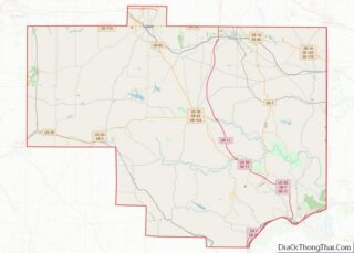
| County: | Columbiana County |
| Elevation: | 768 ft (234 m) |
| Total Area: | 4.90 sq mi (12.68 km²) |
| Land Area: | 4.70 sq mi (12.18 km²) |
| Water Area: | 0.20 sq mi (0.51 km²) |
| Total Population: | 9,958 |
| Population Density: | 2,118.27/sq mi (817.86/km²) |
| ZIP code: | 43920 |
| Area code: | 330, 234 |
| FIPS code: | 3923730 |
| GNISfeature ID: | 1061038 |
| Website: | http://www.eastliverpool.com/ |
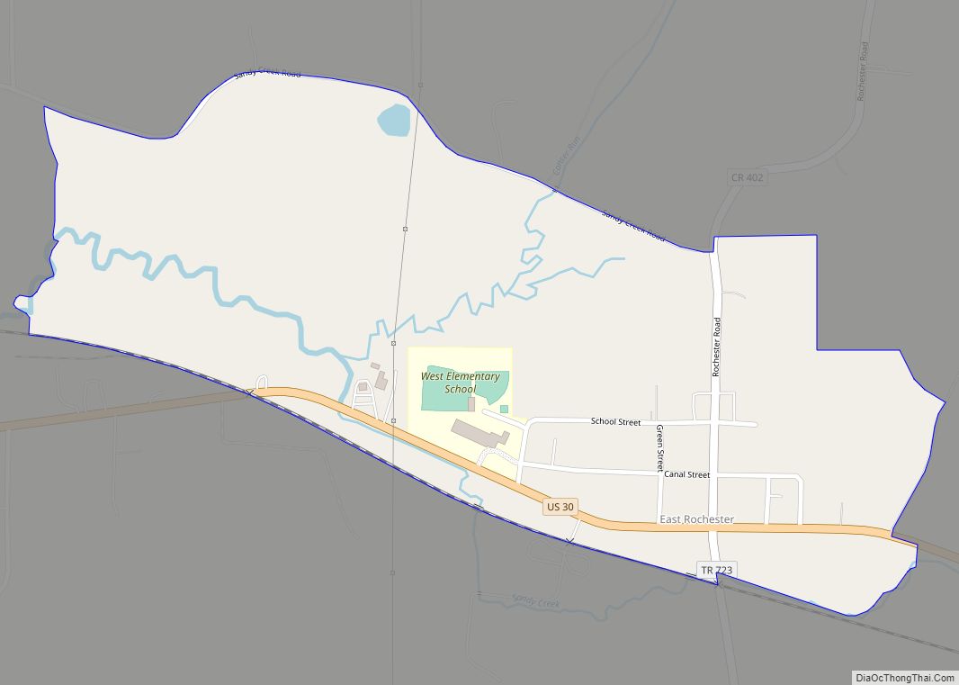
Online Interactive Map
Click on ![]() to view map in "full screen" mode.
to view map in "full screen" mode.
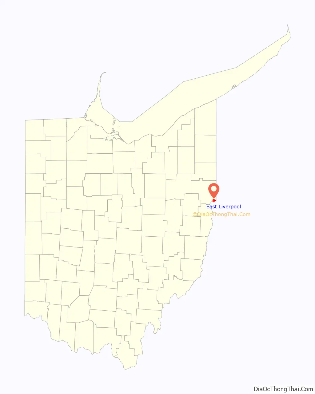
East Liverpool location map. Where is East Liverpool city?

History
Native American petroglyphs exist in the area surrounding East Liverpool, including on Babbs Island and near the Little Beaver Creek. Before the arrival of European Americans, Mingo, Lenape, and Wyandot peoples lived in the area until the Battle of Fallen Timbers led to the Ohio Country’s settlement. The Public Land Survey System of the United States was established by Congressional legislation in 1785, in order to provide an orderly mechanism for opening the Northwest Territory for settlement. The ordinance directed the Geographer of the United States, Thomas Hutchins, to survey an initial east–west base line. Hutchins began in 1786, using as his starting point a stake on north bank of the Ohio River placed by a 1785 survey team from Virginia and Pennsylvania to fix their common north–south boundary. Hutchins’ work, completed in 1787, established the Seven Ranges, with a baseline about 45 miles (72 km) line. This survey is believed to be “the first mathematically designed system and nationally conducted cadastral survey in any modern country.”
East Liverpool traces its founding to 1798, when Irish immigrant Thomas Fawcett purchased 1,100 acres of land along the Ohio River in what was then Jefferson County. In 1802, he platted the town of St. Clair, named for Governor Arthur St. Clair of the Northwest Territory. It was called Fawcettstown for a time, before being renamed Liverpool in 1816, after Liverpool, England. Over its first few decades, a grist mill, multiple stores, and wharves opened in the town. The first schoolhouse opened in 1820, and the first religious center opened in 1834 when the Episcopalians erected a building on a 4th Street site provided by town developers. Liverpool was incorporated as East Liverpool in 1834 when Liverpool Township in Medina County objected to possible confusion.
Although Pittsburgh-based entrepreneurs invested in the town, it was smaller during this period than nearby Wellsville and New Lisbon. The arrival of English potter James Bennett in 1839 brought the establishment of the first bottle kiln site in East Liverpool, launching the town’s largest industry and bringing in multiple waves of Western European immigration throughout the late 19th century. Another large employer outside of that industry was the Crucible Steel Company in nearby Midland, Pennsylvania. By 1880, East Liverpool had grown to be the largest city in the county. In 1905, the first city hospital opened. As of 1914, East Liverpool was served by the Cleveland and Pittsburgh Railroad. On October 22, 1934, local police and FBI agents led by Melvin Purvis shot and killed notorious bank robber Pretty Boy Floyd in a cornfield going toward Clarkson, Ohio, after Floyd fled East Liverpool, and his body was returned to the town for embalming.
In the 1960s, much of the downtown area was cleared to make way for the 4-lane expansion of Ohio State Route 11. The city reached its peak population of more than 26,000 in 1970, but its pottery industry had already begun to decline by the mid-1960s. As with other industries, production moved to developing countries where labor costs were cheaper. This cost many jobs and, ultimately, population in the Upper Ohio Valley area, as people moved away in search of work. Furthermore, many of the city’s downtown businesses withdrew to strip malls in nearby Calcutta or left the area outright.
In 1963, a toxic waste incinerator was erected at an S. H. Bell Company warehouse in East Liverpool. Local investors believed the incinerator could be an alternative to the declining ceramics industry. In 2008, concerns were raised about toxic particles affecting East Liverpool residents’ health, particularly manganese, which was found in high concentrations. East Liverpool residents were found to have higher than normal levels of manganese, cadmium, and lead in their blood, and the community was considered to be in a health crisis due to the presence of these toxic elements. Government agencies worked with S. H. Bell to decrease the toxic metals being released into the surrounding air and land, and from 2006 to 2013 air quality improved. In 2014, hazardous and toxic particles in air quality assessments increased. Activism to reduce the toxic waste began. In 2005, the EPA declared the area surrounding the incinerator a “potential environmental justice area”.
In the mid-1990s, the city renovated its downtown district. To improve its urban design, it installed Depression-era lightposts, developed a new center called Devon’s Diamond, and reconstructed the old high school’s clock tower. In 2010, East Liverpool lost its position as the most populous city in the county to Salem after 130 years and was later withdrawn from being a principal city in the micropolitan area.
Pottery industry
The potteries of East Liverpool became the national center of ceramic toilet and table wares, with 85 firms operating at one time or another making two-thirds of the national output from 1880 to 1950. East Liverpool’s pottery district encompasses East Liverpool and the surrounding towns of Wellsville, Ohio, and Chester and Newell, West Virginia, directly across the Ohio River. In 1887, East Liverpool had 21 general ware potteries that employed 2,558 operatives. By 1923 the 17 firms had 7,000 employees and operated 270 kilns, with $25,000,000 in annual output.
Englishman James Bennett established the industry in 1839, making use of good transportation and rich local clays. It quickly became the community’s leading industry. East Liverpool became known as “The Crockery City.” Potters from Staffordshire, England, began pouring into East Liverpool, attracted by higher wages and the prospect of land ownership. By 1879, there were 24 potteries in East Liverpool, nearly all operated by English immigrants. As late as 1900, East Liverpool remained “essentially a transplanted potting town of Englishmen”. Until the turn of the century about 85% percent of the population could trace its heritage to England. After the English, the second largest ethnic group in East Liverpool were German settlers. From 1870 to 1890, the city more than doubled in population each decade as it attracted new industrial workers with the growth of the pottery industry. By 1910, its population exceeded 20,000. At various times, some of the largest potteries included the East Liverpool Pottery, Knowles, Taylor & Knowles; Taylor, Smith & Taylor; The Hall China Company, and Homer Laughlin China Company.
Of these potteries, two continue to operate in the area: the American Mug & Stein Company and the Fiesta Tableware Company, formerly Homer Laughlin. In the mid-19th century, East Liverpool also produced most of the yellowware pottery used in the United States. Among the most famous of East Liverpool’s ceramics was the porcelain known as Lotus Ware. Produced by Knowles, Taylor & Knowles in the 1890s, this Moorish- and Persian-influenced artware swept the competition at the 1893 World’s Fair in Chicago. The Museum of Ceramics in downtown East Liverpool has the world’s largest public display of Lotus Ware.
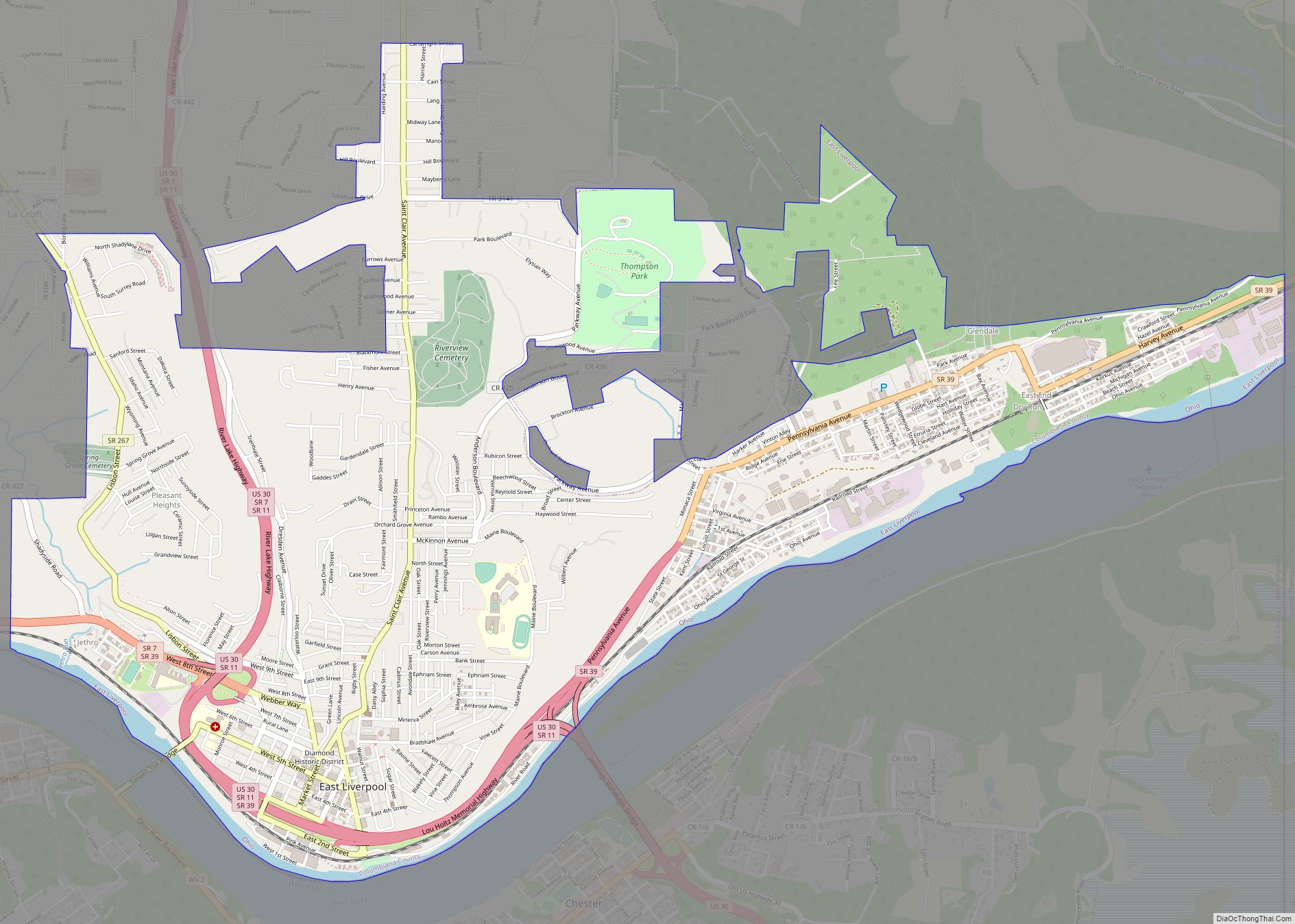
East Liverpool Road Map

East Liverpool city Satellite Map

Geography
According to the United States Census Bureau, the city has an area of 4.76 square miles (12.33 km), of which 4.56 square miles (11.81 km) is land and 0.20 square miles (0.52 km) is water.
Neighborhoods include:
- Beechwood
- Downtown
- East End
- Fisher Park
- Klondyke
- Pleasant Heights
- Thompson
- West End
- Sunnyside
- Jethro
See also
Map of Ohio State and its subdivision:- Adams
- Allen
- Ashland
- Ashtabula
- Athens
- Auglaize
- Belmont
- Brown
- Butler
- Carroll
- Champaign
- Clark
- Clermont
- Clinton
- Columbiana
- Coshocton
- Crawford
- Cuyahoga
- Darke
- Defiance
- Delaware
- Erie
- Fairfield
- Fayette
- Franklin
- Fulton
- Gallia
- Geauga
- Greene
- Guernsey
- Hamilton
- Hancock
- Hardin
- Harrison
- Henry
- Highland
- Hocking
- Holmes
- Huron
- Jackson
- Jefferson
- Knox
- Lake
- Lake Erie
- Lawrence
- Licking
- Logan
- Lorain
- Lucas
- Madison
- Mahoning
- Marion
- Medina
- Meigs
- Mercer
- Miami
- Monroe
- Montgomery
- Morgan
- Morrow
- Muskingum
- Noble
- Ottawa
- Paulding
- Perry
- Pickaway
- Pike
- Portage
- Preble
- Putnam
- Richland
- Ross
- Sandusky
- Scioto
- Seneca
- Shelby
- Stark
- Summit
- Trumbull
- Tuscarawas
- Union
- Van Wert
- Vinton
- Warren
- Washington
- Wayne
- Williams
- Wood
- Wyandot
- Alabama
- Alaska
- Arizona
- Arkansas
- California
- Colorado
- Connecticut
- Delaware
- District of Columbia
- Florida
- Georgia
- Hawaii
- Idaho
- Illinois
- Indiana
- Iowa
- Kansas
- Kentucky
- Louisiana
- Maine
- Maryland
- Massachusetts
- Michigan
- Minnesota
- Mississippi
- Missouri
- Montana
- Nebraska
- Nevada
- New Hampshire
- New Jersey
- New Mexico
- New York
- North Carolina
- North Dakota
- Ohio
- Oklahoma
- Oregon
- Pennsylvania
- Rhode Island
- South Carolina
- South Dakota
- Tennessee
- Texas
- Utah
- Vermont
- Virginia
- Washington
- West Virginia
- Wisconsin
- Wyoming