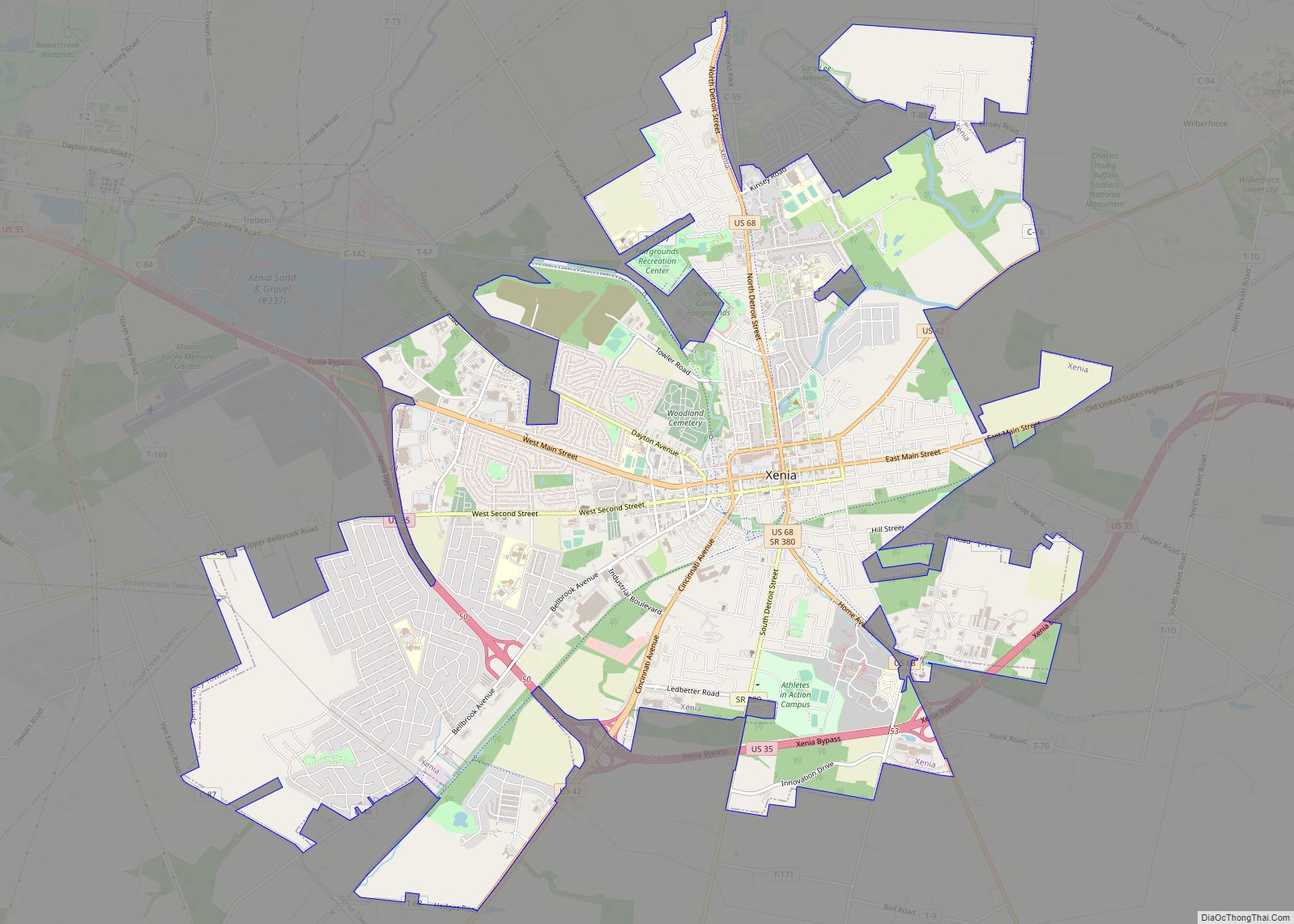
Xenia (/ˈziːniə/ ZEE-nee-ə) is a city in southwestern Ohio and the county seat of Greene County, Ohio, United States. It is 15 miles (24 km) east of Dayton and is part of the Dayton Metropolitan Statistical Area, as well as the Miami Valley region. The name comes from the Greek word Xenia (ξενία), which means “hospitality”. ... Read more
Map of US Cities and Places
Wyoming is a city in Hamilton County, Ohio; It is located approximately 12 miles north of downtown Cincinnati and is part of the Cincinnati metropolitan area. The population was 8,756 at the 2020 census. Wyoming city overview: Name: Wyoming city LSAD Code: 25 LSAD Description: city (suffix) State: Ohio County: Hamilton County Elevation: 574 ft (175 m) ... Read more
Wright-Patterson Air Force Base (WPAFB) (IATA: FFO, ICAO: KFFO, FAA LID: FFO) is a United States Air Force base and census-designated place just east of Dayton, Ohio, in Greene and Montgomery counties. It includes both Wright and Patterson Fields, which were originally Wilbur Wright Field and Fairfield Aviation General Supply Depot. Patterson Field is approximately ... Read more
Wren is a village in Van Wert County, Ohio, United States. The population was 194 at the 2010 census. It is included within the Van Wert, Ohio Micropolitan Statistical Area. Wren village overview: Name: Wren village LSAD Code: 47 LSAD Description: village (suffix) State: Ohio County: Van Wert County Total Area: 0.28 sq mi (0.72 km²) Land Area: ... Read more
Worthington is a city in Franklin County, Ohio, United States, and is a northern suburb of Columbus. The population in the 2020 Census was 14,786. The city was founded in 1803 by the Scioto Company led by James Kilbourne, who was later elected to the United States House of Representatives, and named in honor of ... Read more
Wooster (/ˈwʊstər/ WUUS-tər) is the county seat of Wayne County, Ohio, United States. Located in northeastern Ohio, the city lies approximately 50 mi (80 km) south-southwest of Cleveland, 35 mi (56 km) southwest of Akron and 30 mi (48 km) west of Canton. The population was 27,232 at the 2020 census. It is the largest in Wayne County, and the center ... Read more
Woodville is a village in Sandusky County, Ohio, United States. The population was 2,135 at the 2010 census. The National Arbor Day Foundation has designated Woodville as a Tree City USA. Woodville village overview: Name: Woodville village LSAD Code: 47 LSAD Description: village (suffix) State: Ohio County: Sandusky County Total Area: 1.35 sq mi (3.49 km²) Land Area: ... Read more
Woodstock is a village in Champaign County, Ohio, United States. The population was 305 at the 2010 census. Woodstock village overview: Name: Woodstock village LSAD Code: 47 LSAD Description: village (suffix) State: Ohio County: Champaign County Total Area: 0.28 sq mi (0.73 km²) Land Area: 0.28 sq mi (0.73 km²) Water Area: 0.00 sq mi (0.00 km²) Total Population: 287 Population Density: 1,014.13/sq mi (392.23/km²) ... Read more
Woodsfield is a village and the county seat of Monroe County, Ohio, United States, located about 30 miles (48 km) northeast of Marietta. The population was 2,210 at the 2020 census. Woodsfield village overview: Name: Woodsfield village LSAD Code: 47 LSAD Description: village (suffix) State: Ohio County: Monroe County Elevation: 1,204 ft (367 m) Total Area: 2.02 sq mi (5.22 km²) ... Read more
Woodmere is a village in Cuyahoga County, Ohio, United States. As of the 2020 census, Woodmere had a population of 641 residents. An eastern suburb of Cleveland, it is part of the Cleveland metropolitan area. Woodmere village overview: Name: Woodmere village LSAD Code: 47 LSAD Description: village (suffix) State: Ohio County: Cuyahoga County Elevation: 1,210 ft ... Read more
Yorkville is a village in Belmont and Jefferson counties in the U.S. state of Ohio. The population was 968 at the 2020 census. Yorkville lies within two Metropolitan Statistical Areas; the Belmont County portion is part of the Wheeling metropolitan area, while the Jefferson County portion is part of the Weirton–Steubenville metropolitan area. Yorkville village ... Read more
Yorkshire is a village in Darke County, Ohio, United States. The population was 99 at the 2010 census. Yorkshire village overview: Name: Yorkshire village LSAD Code: 47 LSAD Description: village (suffix) State: Ohio County: Darke County Total Area: 0.27 sq mi (0.70 km²) Land Area: 0.27 sq mi (0.70 km²) Water Area: 0.00 sq mi (0.00 km²) Total Population: 95 Population Density: 351.85/sq mi (135.94/km²) ... Read more