Xenia (/ˈziːniə/ ZEE-nee-ə) is a city in southwestern Ohio and the county seat of Greene County, Ohio, United States. It is 15 miles (24 km) east of Dayton and is part of the Dayton Metropolitan Statistical Area, as well as the Miami Valley region. The name comes from the Greek word Xenia (ξενία), which means “hospitality”.
As of the United States Census 2020, the city had a population of 25,441. As of the United States Census 2010, Xenia is the third-largest city by population in Greene County, behind Fairborn and Beavercreek. At the geographical center of the county, it is the county seat and houses the County Courthouse, County Sheriff’s Department, Jail, and other regional departments. It is also the largest city in the United States beginning with the letter X.
| Name: | Xenia city |
|---|---|
| LSAD Code: | 25 |
| LSAD Description: | city (suffix) |
| State: | Ohio |
| County: | Greene County |
| Founded: | 1803; 220 years ago (1803) |
| Elevation: | 935 ft (285 m) |
| Total Area: | 13.07 sq mi (33.87 km²) |
| Land Area: | 13.06 sq mi (33.83 km²) |
| Water Area: | 0.01 sq mi (0.03 km²) |
| Total Population: | 25,441 |
| Population Density: | 1,947.71/sq mi (751.99/km²) |
| ZIP code: | 45385 |
| Area code: | 937, 326 |
| FIPS code: | 3986772 |
| GNISfeature ID: | 1061805 |
| Website: | https://www.ci.xenia.oh.us/ |
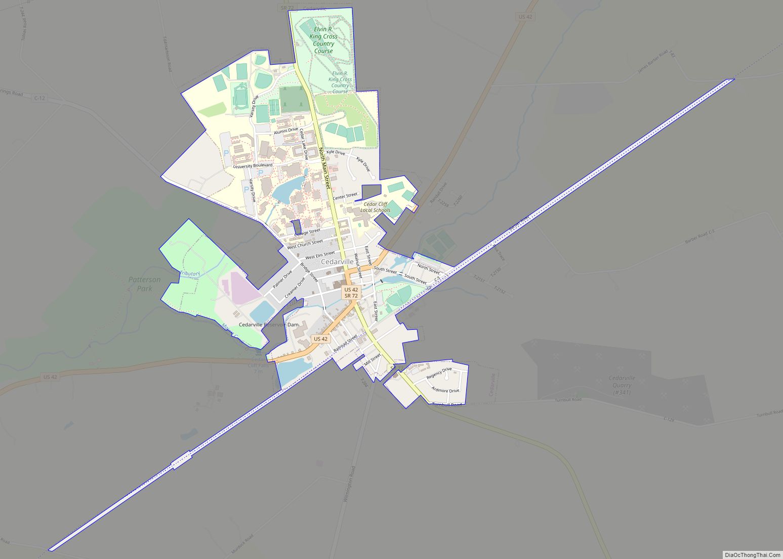
Online Interactive Map
Click on ![]() to view map in "full screen" mode.
to view map in "full screen" mode.
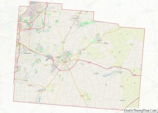
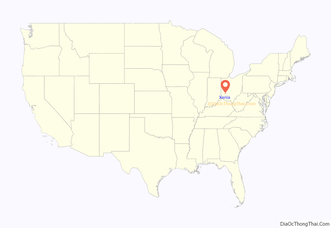
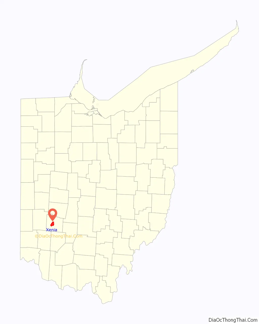
Xenia location map. Where is Xenia city?
History
Xenia was founded in 1803, the same year Ohio was admitted to the Union. In that year, European-American pioneer John Paul bought 2,000 acres (8.1 km) of land from Thomas and Elizabeth Richardson of Hanover County, Virginia, for “1050 pounds current moneys of Virginia.” Paul influenced county commissioners to locate the county seat on this land at the forks of the Shawnee creeks, stimulating development of the settlement here.
Joseph C. Vance was named to survey the site and lay out the town. The following year, he bought the town site of 257 acres (1.04 km) from John Paul for $250. The name of the new village was chosen in typically democratic fashion. Vance called a town meeting to discuss possible names. The committee had considered several suggestions without reaching any decision. Then the Rev. Robert Armstrong proposed the name “Xenia,” meaning “hospitality” in Greek, because of the fine hospitality extended to him in this friendly community. When a tie vote occurred, Laticia Davis, wife of Owen Davis, was invited to cast the deciding ballot. She voted for “Xenia.”
The first session of the Ohio General Assembly created Greene County from the Northwest Territory. It took in the homeland of the Shawnee Indians. Their chief tribal village was north of Xenia at Old Chillicothe, now called Old Town. The Shawnee war chief Tecumseh was born there in 1768. The Catawba also lived in and around Xenia, many of their descendants, such as the Jeffries family intermarried with the local free Black community and the White community as well.
William Beattie was Xenia’s first businessman. In 1804, he opened a tavern which became a center of community affairs. In 1804, John Marshall built Xenia’s first house. The first log school house was constructed in 1805, and, that same year, the Rev. James Towler became the town’s first postmaster. The growing community soon attracted many pioneer industries – flour mills, sawmills, woolen mills, pork packing plants, oil mills, and tow mills.
A petition for incorporation, dated March 24, 1817, was circulated among the 88 households of Xenia, and on July 21, 1817, that petition, containing 66 signatures, was filed with the Court of Common Pleas of Greene County. On October 27, 1817, the petition for incorporation was granted by the Court and Xenia became a municipal corporation.
The arrival of the Little Miami Railroad (now the site of the Little Miami Scenic Trail, which passed through Xenia Station) in 1843, stimulated the development of additional industries and connected the city to other markets. On March 2, 1850, the Ohio General Assembly rode from Columbus, Ohio to Xenia and back on the newly completed Columbus and Xenia Railroad.
From the summer of 1851, tourists would come from Cincinnati, as well as plantations from the South, to visit the nearby Xenia Springs and Tawawa House, a hotel and health spa about three miles away. It was established as a summer resort to draw on interest in the medicinal properties of the springs. Skin specialist Dr. Samuel Spilsbee from Cincinnati served as Superintendent of the hotel. It was three stories high, and the grounds of the complex also included separate cottages. After it went out of business, the complex was purchased for use as Wilberforce College, a historically black college founded by a collaboration between the African Methodist Episcopal Church (AME) and the Cincinnati Conference of the Methodist Church. By 1860 most of the 200 students were mixed-race children of wealthy white fathers from the South, planters and businessmen who were prevented from getting them educated there. In the early years of the war, the college closed briefly after Southerners withdrew their children. The AME Church took it over, and continued to operate it.
On Wednesday morning, February 13, 1861, President-Elect Abraham Lincoln made a brief appearance in the city as his inaugural train traveled from Cincinnati east to Columbus. He gave a short speech; the traveling reporter from the New York Times did not record it as Lincoln expressed sentiments that he had repeated in previous stops. According to the Times writer, “a very large crowd assembled, and amid the firing of a cannon and enthusiasm, Mr. Lincoln addressed them from the rear car, reiterating what he had said before.”.
The town progressed rapidly during the mid-19th century. Artificial gas was provided in the 1840s and continued in use until natural gas was made available in 1905. The first fire engine house was built in 1831; the telephone came to Xenia in 1879; electricity in 1881 and a water works system in 1886. Xenia opened its first free public library in 1899. By 1900, the city was operating its own sewage system.
Following the Civil War, the Ohio Soldiers’ and Sailors’ Orphans’ Home was built in Xenia. Some of its building remains in use by a Christian ministry organization.
Xenia elected Cornelius Clark as its first mayor in 1834. On January 1, 1918, the current city commission-manager plan succeeded the old form of municipal government.
Tornadoes
Xenia has a history of severe storm activity. According to local legend, the Shawnee referred to the area as “the place of the devil wind” or “the land of the crazy winds” (depending upon the translation).
On April 3, 1974, a tornado a verified F5 rated tornado on the Fujita scale cut a path directly through the middle of Xenia during the 1974 Super Outbreak, the second largest series of tornadoes in recorded history. The disaster killed 34 people (including two Ohio National Guardsmen who died days later in a related fire), injured an additional 1,150, destroyed almost half of the city’s buildings, and left 10,000 people homeless. Five schools, including Xenia High School, Central Junior High School, McKinley Elementary, Simon Kenton Elementary, and Saint Brigid Catholic School were destroyed, as were nine churches and 180 businesses. Ted Fujita himself rated the tornado an F6 in an essay he wrote, but the rating was never confirmed.
The city’s plight was featured in the national news, including a 1974 NBC television documentary, Tornado!, hosted by Floyd Kalber. President Richard Nixon visited stricken areas of Xenia following the devastation. Comedian Bob Hope organized a benefit to raise funds for Xenia and, in appreciation, the new Xenia High School Auditorium was named the “Bob Hope Auditorium.” In recognition of their coverage of this tornado, the staff of the Xenia Daily Gazette won the Pulitzer Prize for Spot News Reporting in 1975.
Xenia was struck by an F2 tornado on April 25, 1989, and again by an F4 tornado on September 20, 2000. The 1989 tornado caused over $2 million in damage, but no one was killed. The twister of 2000 killed one person, and injured 100 people. This tornado followed a path roughly parallel to that of the 1974 tornado.
Xenia currently has a system of tornado sirens. After the 1974 tornado outbreak, the city purchased a system of five Federal Signal Thunderbolt sirens for warning. During the 2000 tornado strike, the lack of backup power silenced the Thunderbolts, so the city purchased five Federal Signal 2001-SRNB series sirens with battery backup to reinforce/replace the Thunderbolts.
Railroads
Several railroad lines owned by the Baltimore & Ohio (B&O) and Pennsylvania (PRR) railroads once served Xenia, for both freight and passenger service. Since restructuring of the railroad industry in the mid-twentieth century, all lines have since been abandoned, the last being dismantled by 1989.
The lines that previously served Xenia were:
- B&O Wellston subdivision, between Washington Court House and Dayton.
- PRR Little Miami branch, between Cincinnati and Springfield; a portion of the line ran down Detroit Street and was the first section to be dismantled.
- PRR Pittsburgh-St. Louis mainline; Amtrak operated the National Limited passenger service over this line until 1979.
The roadbeds of five of Xenia’s six rail lines were converted for rail trail use. The one exception — the B&O line west of town — was not converted because it closely paralleled the PRR mainline for most of its length.
Xenia was served by two interurban railways until the 1940s:
- Dayton & Xenia Transit Company
- Springfield & Xenia Railway
In the postwar period, automobile ownership increased, and the federal government subsidized the construction of numerous interstate highways. Both changes influenced the decline of regional transit, such as the interurban railways.
Xenia Road Map
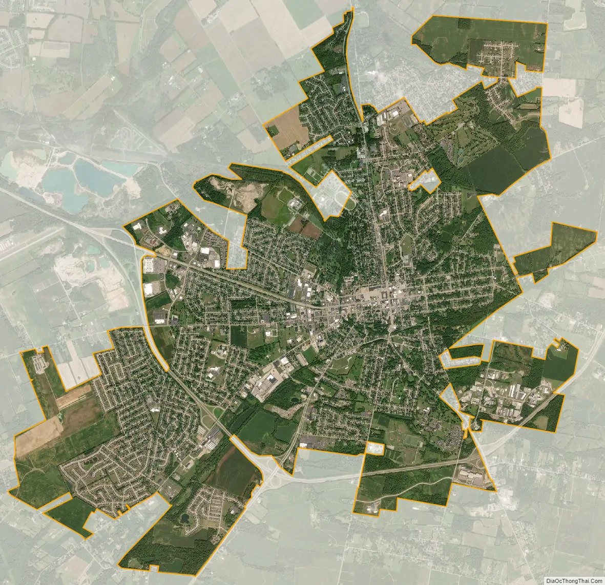
Xenia city Satellite Map
Geography
Today Xenia is centrally located in the “transportation triangle” formed by three major interstate highways: I-70, I-71, and I-75. These north-south, east–west arteries are within minutes of Xenia via U.S. Routes 35, 42, and 68, tying the community to one of the nation’s largest 90-minute highway markets. Before the creation of the U.S. Interstate Highway system, U.S. 68 was one of the main southward routes from the major city of Detroit, Michigan. Within Xenia, U.S. 68 is named “Detroit Street”.
According to the United States Census Bureau, the city has a total area of 13.29 square miles (34.42 km), of which, 13.28 square miles (34.40 km) is land and 0.01 square miles (0.03 km) is water.
Climate
See also
Map of Ohio State and its subdivision:- Adams
- Allen
- Ashland
- Ashtabula
- Athens
- Auglaize
- Belmont
- Brown
- Butler
- Carroll
- Champaign
- Clark
- Clermont
- Clinton
- Columbiana
- Coshocton
- Crawford
- Cuyahoga
- Darke
- Defiance
- Delaware
- Erie
- Fairfield
- Fayette
- Franklin
- Fulton
- Gallia
- Geauga
- Greene
- Guernsey
- Hamilton
- Hancock
- Hardin
- Harrison
- Henry
- Highland
- Hocking
- Holmes
- Huron
- Jackson
- Jefferson
- Knox
- Lake
- Lake Erie
- Lawrence
- Licking
- Logan
- Lorain
- Lucas
- Madison
- Mahoning
- Marion
- Medina
- Meigs
- Mercer
- Miami
- Monroe
- Montgomery
- Morgan
- Morrow
- Muskingum
- Noble
- Ottawa
- Paulding
- Perry
- Pickaway
- Pike
- Portage
- Preble
- Putnam
- Richland
- Ross
- Sandusky
- Scioto
- Seneca
- Shelby
- Stark
- Summit
- Trumbull
- Tuscarawas
- Union
- Van Wert
- Vinton
- Warren
- Washington
- Wayne
- Williams
- Wood
- Wyandot
- Alabama
- Alaska
- Arizona
- Arkansas
- California
- Colorado
- Connecticut
- Delaware
- District of Columbia
- Florida
- Georgia
- Hawaii
- Idaho
- Illinois
- Indiana
- Iowa
- Kansas
- Kentucky
- Louisiana
- Maine
- Maryland
- Massachusetts
- Michigan
- Minnesota
- Mississippi
- Missouri
- Montana
- Nebraska
- Nevada
- New Hampshire
- New Jersey
- New Mexico
- New York
- North Carolina
- North Dakota
- Ohio
- Oklahoma
- Oregon
- Pennsylvania
- Rhode Island
- South Carolina
- South Dakota
- Tennessee
- Texas
- Utah
- Vermont
- Virginia
- Washington
- West Virginia
- Wisconsin
- Wyoming