Map of Golden Shores CDP
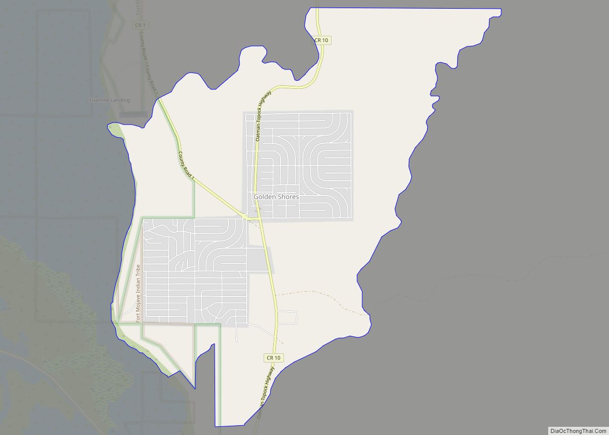
Golden Shores is a census-designated place (CDP) in Mohave County, Arizona, United States. The population was 1,927 at the 2020 census. Residents are part of the 86436 ZIP code area, with a mailing address of Topock. Golden Shores CDP overview: Name: Golden Shores CDP LSAD Code: 57 LSAD Description: CDP (suffix) State: Arizona County: Mohave ... Read more
Map of Golden Shores CDP
Map of Gold Canyon CDP
Gold Canyon is a census-designated place (CDP) and unincorporated community in Pinal County, Arizona, United States. The community is sometimes incorrectly called Gold Camp. The town name is referred to as Gold Camp on weather statements issued by the National Weather Service (as seen in citation). The closest city to Gold Canyon is Apache Junction, ... Read more
Map of Gold Canyon CDP
Map of Grand Canyon Village CDP
Grand Canyon Village is a census-designated place (CDP) located on the South Rim of the Grand Canyon, in Coconino County, Arizona, United States. Its population was 2,004 at the 2010 Census. Located in Grand Canyon National Park, it is wholly focused on accommodating tourists visiting the canyon. Its origins trace back to the railroad completed ... Read more
Map of Grand Canyon Village CDP
Map of Goodyear city
Goodyear (O’odham: Valin Thak) is a city in Maricopa County, Arizona, United States. It is a suburb of Phoenix and at the 2020 census had a population of 95,294, up from 65,275 in 2010 and 18,911 in 2000. It was the third-fastest-growing city in Arizona between 1990 and 2000. The city is home to the ... Read more
Map of Goodyear city
Map of Goodyear Village CDP
Goodyear Village (O’odham: Valin Dak) is a census-designated place (CDP) in Pinal County, Arizona, United States, located in the Gila River Indian Community. The population was 457 at the 2010 census. Goodyear Village CDP overview: Name: Goodyear Village CDP LSAD Code: 57 LSAD Description: CDP (suffix) State: Arizona County: Pinal County Total Area: 3.35 sq mi (8.68 km²) ... Read more
Map of Goodyear Village CDP
Map of Green Valley CDP, Arizona
Green Valley is an unincorporated community and census-designated place (CDP) in Pima County, Arizona, United States. The population was 22,616 at the 2020 census. Green Valley CDP overview: Name: Green Valley CDP LSAD Code: 57 LSAD Description: CDP (suffix) State: Arizona County: Pima County Elevation: 2,980 ft (908 m) Total Area: 19.75 sq mi (51.14 km²) Land Area: 19.73 sq mi (51.10 km²) ... Read more
Map of Green Valley CDP, Arizona
Map of Greasewood CDP
Greasewood (Navajo: Díwózhii Biiʼ Tó) is a census-designated place (CDP) in Navajo County, Arizona, United States. The population was 547 at the 2010 census. Greasewood CDP overview: Name: Greasewood CDP LSAD Code: 57 LSAD Description: CDP (suffix) State: Arizona County: Navajo County Elevation: 5,912 ft (1,802 m) Total Area: 5.34 sq mi (13.84 km²) Land Area: 5.34 sq mi (13.83 km²) Water Area: ... Read more
Map of Greasewood CDP
Map of Grand Canyon West CDP
Grand Canyon West is a census-designated place (CDP) in Mohave County, Arizona, United States, located on the Hualapai Reservation. The population was reported as 0 at the 2020 census. Grand Canyon West is home to the tribe’s Grand Canyon business operations, including the Grand Canyon West Airport and the Grand Canyon Skywalk. Typically, they are ... Read more
Map of Grand Canyon West CDP
Map of Guadalupe town, Arizona
Guadalupe is a town in Maricopa County, Arizona, United States and part of the great Phoenix metropolitan area. The town motto, “where three cultures flourish”, recognizes the town’s roots in the Yaquis, Mexicans and descendants of the original farmers. Since its founding, Guadalupe has been known as a center of Yaqui culture, and it is ... Read more
Map of Guadalupe town, Arizona
Map of Gu Oidak CDP
Gu Oidak (also known as Big Fields or Kuoitak) is a census-designated place (CDP) located within the Tohono O’odham Nation Division in Pima County, Arizona, United States. The population was 198 at the 2020 census. The name “Gu Oidak” is the O’odham term for “big field” and located on the Tohono O’odham Nation reservation. Gu ... Read more
Map of Gu Oidak CDP
Map of Greer CDP, Arizona
Greer is an unincorporated community and census-designated place in Apache County, Arizona, United States. Located within the White Mountains of Arizona and surrounded by the Apache-Sitgreaves National Forest, Greer is the highest town in the state at an elevation of approximately 8,400 feet (2,560 m). As of the 2020 census it had a population of ... Read more
Map of Greer CDP, Arizona
Map of Haivana Nakya CDP
Haivana Nakya is a census-designated place (CDP) in Pima County, Arizona, United States. The population was 96 at the 2010 census. Haivana Nakya CDP overview: Name: Haivana Nakya CDP LSAD Code: 57 LSAD Description: CDP (suffix) State: Arizona County: Pima County Elevation: 2,854 ft (87 m) Total Area: 1.86 sq mi (4.82 km²) Land Area: 1.86 sq mi (4.82 km²) Water Area: 0.00 sq mi ... Read more
Map of Haivana Nakya CDP