Goodyear (O’odham: Valin Thak) is a city in Maricopa County, Arizona, United States. It is a suburb of Phoenix and at the 2020 census had a population of 95,294, up from 65,275 in 2010 and 18,911 in 2000. It was the third-fastest-growing city in Arizona between 1990 and 2000.
The city is home to the Goodyear Ballpark, where the Cleveland Guardians and Cincinnati Reds of Major League Baseball hold spring training.
In 2008, Goodyear won the All-America City Award, sponsored by the National Civic League. The city is named after the Goodyear Tire and Rubber Company. The company cultivated extensive farmland here to grow cotton for use in its tires.
| Name: | Goodyear city |
|---|---|
| LSAD Code: | 25 |
| LSAD Description: | city (suffix) |
| State: | Arizona |
| County: | Maricopa County |
| Elevation: | 968 ft (295 m) |
| Total Area: | 191.33 sq mi (495.54 km²) |
| Land Area: | 191.30 sq mi (495.46 km²) |
| Water Area: | 0.03 sq mi (0.08 km²) |
| Total Population: | 95,294 |
| Population Density: | 498.14/sq mi (192.33/km²) |
| ZIP code: | 85338, 85395 |
| Area code: | 623 |
| FIPS code: | 0428380 |
| GNISfeature ID: | 5172 |
| Website: | www.goodyearaz.gov |
Online Interactive Map
Click on ![]() to view map in "full screen" mode.
to view map in "full screen" mode.
Goodyear location map. Where is Goodyear city?


History
Goodyear was established in 1917 with the purchase of 16,000 acres (65 km) of land by the Goodyear Tire and Rubber Company to cultivate cotton for vehicle tire cords. World War II was important to Goodyear in the 1940s as the current Phoenix Goodyear Airport was built, but after the war, the economy suffered. Goodyear became a town on November 19, 1946. At the time, it had 151 homes and 250 apartments, a grocery store, a barber shop, beauty shop and a gas station.
World War II
Luke Field Auxiliary #6 (Goodyear Field) was built by the United States Army Air Forces in 1943. It served as a satellite airfield for Luke Army Air Field (AAF). According to the History of Luke AFB, this airfield boasted the most facilities. It had separate buildings for crew chiefs, operations, supply, barracks, pit latrine, crash truck shed, generator shed and a control tower. Luke AF Auxiliary #6 ceased operations by 1971.
The property, which is in a state of complete abandonment, is owned by the State of Arizona, which has worked with developers on proposals for use.
Modern history
In January 1965, the Phoenix Trotting Park, a harness racing track, opened. The current Interstate 10 passes north of the site. As the region lacked major roads from Phoenix to Goodyear, there was not enough business and the track closed two years later. The park was demolished in 2017.
The town became a city in 1985. In the same decade, the remaining 10,000 acres (40 km) of the original farmland was sold for future development. The Phoenix Goodyear Airport received its current name in 1986.
Although Goodyear was founded in 1917, the majority of construction and population growth happened after 1990. 22 communities that are completed and under construction have a total area of approximately 20,000 acres (31 sq mi). These communities, along with another 21 communities for future suburban development, will contain almost 200,000 homes, with only 25,000 built.
Goodyear was affected by the 2000s American housing bubble, reducing home values. Since then, the housing market has rebounded considerably. According to Opendoor, ZIP code 85338 in Goodyear was the fifth most popular place in the Phoenix metro area to buy a home, based on home sales. There are also a variety of home options in 2019 to accommodate families, those who are single, and seniors. As the population in Goodyear grows faster than ever, home builders and community developers are working quickly to keep up with the demand.
Estrella is the largest community in Goodyear, at 20,000 acres (31 sq mi). The master-planned community is home to about 10,000 residents. Palm Valley, located north of Interstate 10, is 9,000 acres (14 sq mi), with variously-sized homes. PebbleCreek is a community for active adult living, with 54 holes of championship golf, fitness centers, and restaurants.
From the 1990s through the 2010s, residential development has stimulated the growth of Goodyear as a suburb of Phoenix. Goodyear’s population is projected to be 358,000 by 2035.
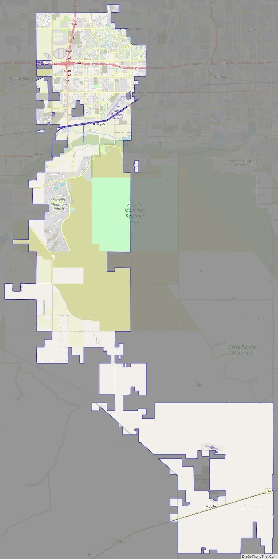
Goodyear Road Map
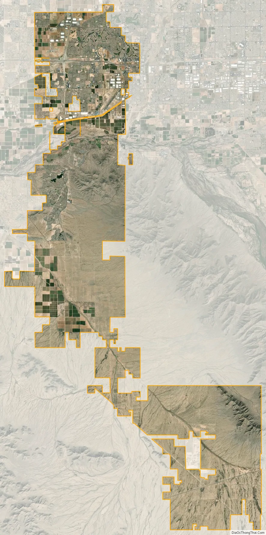
Goodyear city Satellite Map
Geography
Goodyear is approximately 17 miles (27 km) west of downtown Phoenix. Nearby cities include Avondale, Litchfield Park, Tolleson and Buckeye. From the original town center, the Goodyear city limits extend north 5 miles (8 km) to a border with Glendale and south-southeast into the Rainbow Valley 30 miles (48 km) to an area south of Arizona State Route 238.
According to the United States Census Bureau, the city has a total area of 191.3 square miles (495 km), of which 0.03 square miles (0.08 km), or 0.02%, are water. The Gila River passes through the city. The largest master-planned community is Estrella, south of the Gila River, located near the Estrella Mountains.
The Estrella Mountain Regional Park covers almost 20,000 acres (81 km), most of which is still desert. It contains eight trails over 30 mi (48 km) in combined length, two baseball fields, and a 9.5-mile (15.3 km) track.
Climate
Goodyear has a hot desert climate (Köppen: BWh) due to its location in the Sonoran Desert. The city receives somewhere around ten inches of rain annually. The city has more than 300 sunny days per year.
Winters are sunny with mild temperatures—nighttime lows averaging between 40 °F and 50 °F (4 °C and 10 °C) and daytime highs ranging from 60 °F to 75 °F (16 °C to 24 °C). The lowest temperature ever recorded in Goodyear is 16 °F (-9 °C). Summers are very hot, with daily high temperatures at or above 100 °F (38 °C) for the entirety of June, July, and August, as well as many days in May and September. An occasional heat wave will spike temperatures over 115 °F (46 °C) briefly. Nighttime lows in the summer months average between 70 °F and 80 °F (21 °C and 27 °C), with an occasional overnight low above 80 °F (27 °C) not uncommon. The highest recorded temperature in Goodyear is 125 °F (52 °C).
Snow is rare in the area, occurring once every several years. Lows in the winter occasionally dip below freezing, which may damage some desert plants such as saguaros and other cacti. In the summer (mainly July, August and early September), the North American Monsoon can hit the Phoenix area in the afternoon and evening (possibly continuing overnight), causing thunderstorms and heavy rain even from a sunny morning. Dust storms are occasional, mainly during the summer.
See also
Map of Arizona State and its subdivision: Map of other states:- Alabama
- Alaska
- Arizona
- Arkansas
- California
- Colorado
- Connecticut
- Delaware
- District of Columbia
- Florida
- Georgia
- Hawaii
- Idaho
- Illinois
- Indiana
- Iowa
- Kansas
- Kentucky
- Louisiana
- Maine
- Maryland
- Massachusetts
- Michigan
- Minnesota
- Mississippi
- Missouri
- Montana
- Nebraska
- Nevada
- New Hampshire
- New Jersey
- New Mexico
- New York
- North Carolina
- North Dakota
- Ohio
- Oklahoma
- Oregon
- Pennsylvania
- Rhode Island
- South Carolina
- South Dakota
- Tennessee
- Texas
- Utah
- Vermont
- Virginia
- Washington
- West Virginia
- Wisconsin
- Wyoming


