Map of Solomon CDP, Arizona
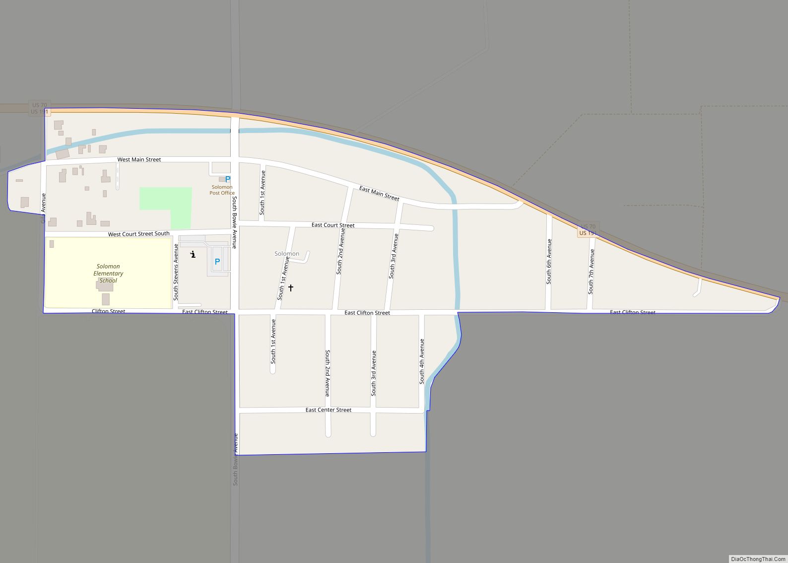
Solomon is a census-designated place in Graham County, Arizona, United States. Its population was 399 as of the 2020 census. It is part of the Safford Micropolitan Statistical Area. Solomon CDP overview: Name: Solomon CDP LSAD Code: 57 LSAD Description: CDP (suffix) State: Arizona County: Graham County Elevation: 2,972 ft (906 m) Total Area: 0.21 sq mi (0.54 km²) Land ... Read more
Map of Solomon CDP, Arizona
Map of So-Hi CDP
So-Hi is an unincorporated community and census-designated place in Mohave County, in the U.S. state of Arizona. The population was 428 at the 2020 census, down from 477 in 2010. So-Hi CDP overview: Name: So-Hi CDP LSAD Code: 57 LSAD Description: CDP (suffix) State: Arizona County: Mohave County Total Area: 0.88 sq mi (2.27 km²) Land Area: 0.88 sq mi ... Read more
Map of So-Hi CDP
Map of South Tucson city
South Tucson is a city in Pima County, Arizona, United States and an enclave of the much larger city of Tucson. South Tucson is known for being heavily influenced by Hispanic, and especially Mexican, culture; restaurants and shops which sell traditional Mexican food and other goods can be found throughout the city. According to the ... Read more
Map of South Tucson city
Map of South Komelik CDP
South Komelik (O’odham) name translates as “South Flat”, is a census-designated place in Pima County, in the U.S. state of Arizona. The population was 117 as of the 2020 census. It’s located in the southern part of the Tohono O’odham Nation reservation near the border with Mexico. South Komelik CDP overview: Name: South Komelik CDP ... Read more
Map of South Komelik CDP
Map of Sonoita CDP
Sonoita (/səˈnɔɪ.tə/; O’odham: Ṣon ʼOidag) is a census-designated place (CDP) in Santa Cruz County, Arizona, United States. The population was 818 at the 2010 census. The origin of the name of the CDP is the O’odham Ṣon ʼOidag, which may be best translated as “spring field”. Sonoita CDP overview: Name: Sonoita CDP LSAD Code: 57 ... Read more
Map of Sonoita CDP
Map of St. David CDP, Arizona
St. David is a census-designated place (CDP) in Cochise County, Arizona, United States. The population was 1,699 at the 2010 census. St. David CDP overview: Name: St. David CDP LSAD Code: 57 LSAD Description: CDP (suffix) State: Arizona County: Cochise County Founded: 1877 Elevation: 3,691 ft (1,125 m) Total Area: 6.06 sq mi (15.71 km²) Land Area: 6.05 sq mi (15.67 km²) Water ... Read more
Map of St. David CDP, Arizona
Map of Springerville town
Springerville is a town in Apache County, Arizona, United States, within the White Mountains. Its postal ZIP Code is 85938. As of the 2010 census, the population of the town was 1,961. Springerville sits at an elevation of 6,974 feet (2,126 m) above sea level. Along with its neighbor Eagar, the communities make up the place ... Read more
Map of Springerville town
Map of Spring Valley CDP, Arizona
Spring Valley is a census-designated place (CDP) in Yavapai County, Arizona, United States. The population was 1,019 at the 2000 census. Spring Valley CDP overview: Name: Spring Valley CDP LSAD Code: 57 LSAD Description: CDP (suffix) State: Arizona County: Yavapai County Elevation: 3,940 ft (1,201 m) Total Area: 1.02 sq mi (2.64 km²) Land Area: 1.02 sq mi (2.64 km²) Water Area: 0.00 sq mi ... Read more
Map of Spring Valley CDP, Arizona
Map of St. Michaels CDP, Arizona
St. Michaels (Navajo: Tsʼíhootso) is a chapter of the Navajo Nation and a census-designated place (CDP) in Apache County, Arizona, United States. The Navajo Nation Government Campus is located within the chapter at Window Rock. The population was 1,443 at the 2010 census. St. Michaels CDP overview: Name: St. Michaels CDP LSAD Code: 57 LSAD ... Read more
Map of St. Michaels CDP, Arizona
Map of St. Johns CDP, Arizona
St. Johns is a census-designated place (CDP) in Maricopa County, Arizona, United States, located in the Gila River Indian Community. The population was 690 at the 2020 census, up from 476 at the 2010 census. St. Johns CDP overview: Name: St. Johns CDP LSAD Code: 57 LSAD Description: CDP (suffix) State: Arizona County: Maricopa County ... Read more
Map of St. Johns CDP, Arizona
Map of Stanfield CDP, Arizona
Stanfield (English: /ˈstænfiːld/) is a census-designated place (CDP) in Pinal County, Arizona, United States. The population was 651 at the 2000 census. Shamrock Farms operates a farm in Stanfield. Stanfield CDP overview: Name: Stanfield CDP LSAD Code: 57 LSAD Description: CDP (suffix) State: Arizona County: Pinal County Elevation: 1,302 ft (397 m) Total Area: 3.93 sq mi (10.19 km²) Land ... Read more
Map of Stanfield CDP, Arizona
Map of Stotonic Village CDP
Stotonic (O’odham: S-totoñigk) is a census-designated place (CDP) in Pinal County, Arizona, United States, located in the Gila River Indian Community. The population was 659 at the 2010 census. Stotonic Village has a median household income of $2,499 – the lowest of any CDP in Arizona [1] Stotonic Village CDP overview: Name: Stotonic Village CDP ... Read more
Map of Stotonic Village CDP