Springerville is a town in Apache County, Arizona, United States, within the White Mountains. Its postal ZIP Code is 85938. As of the 2010 census, the population of the town was 1,961.
Springerville sits at an elevation of 6,974 feet (2,126 m) above sea level. Along with its neighbor Eagar, the communities make up the place known as Round Valley, which is in the central-eastern part of Arizona close to the New Mexico border.
| Name: | Springerville town |
|---|---|
| LSAD Code: | 43 |
| LSAD Description: | town (suffix) |
| State: | Arizona |
| County: | Apache County |
| Elevation: | 6,967 ft (2,124 m) |
| Total Area: | 11.67 sq mi (30.22 km²) |
| Land Area: | 11.50 sq mi (29.79 km²) |
| Water Area: | 0.16 sq mi (0.42 km²) |
| Total Population: | 1,717 |
| Population Density: | 149.27/sq mi (57.63/km²) |
| ZIP code: | 85938 |
| Area code: | 928 |
| FIPS code: | 0468990 |
| GNISfeature ID: | 34747 |
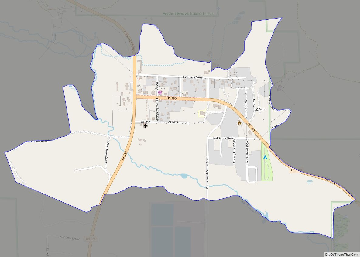
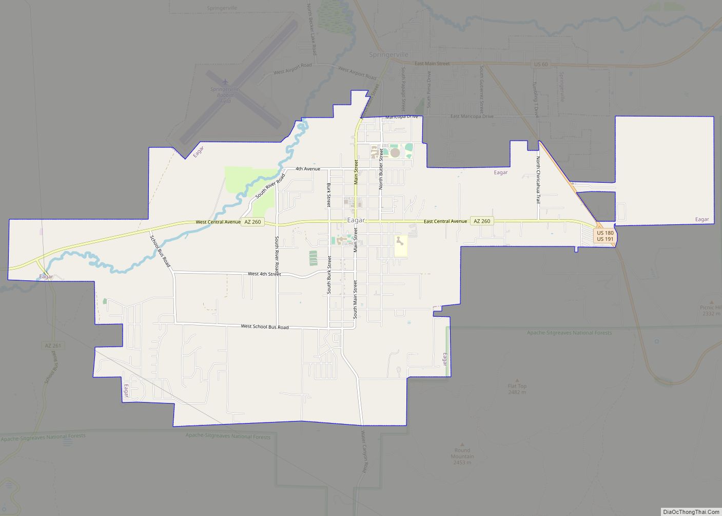
Online Interactive Map
Click on ![]() to view map in "full screen" mode.
to view map in "full screen" mode.
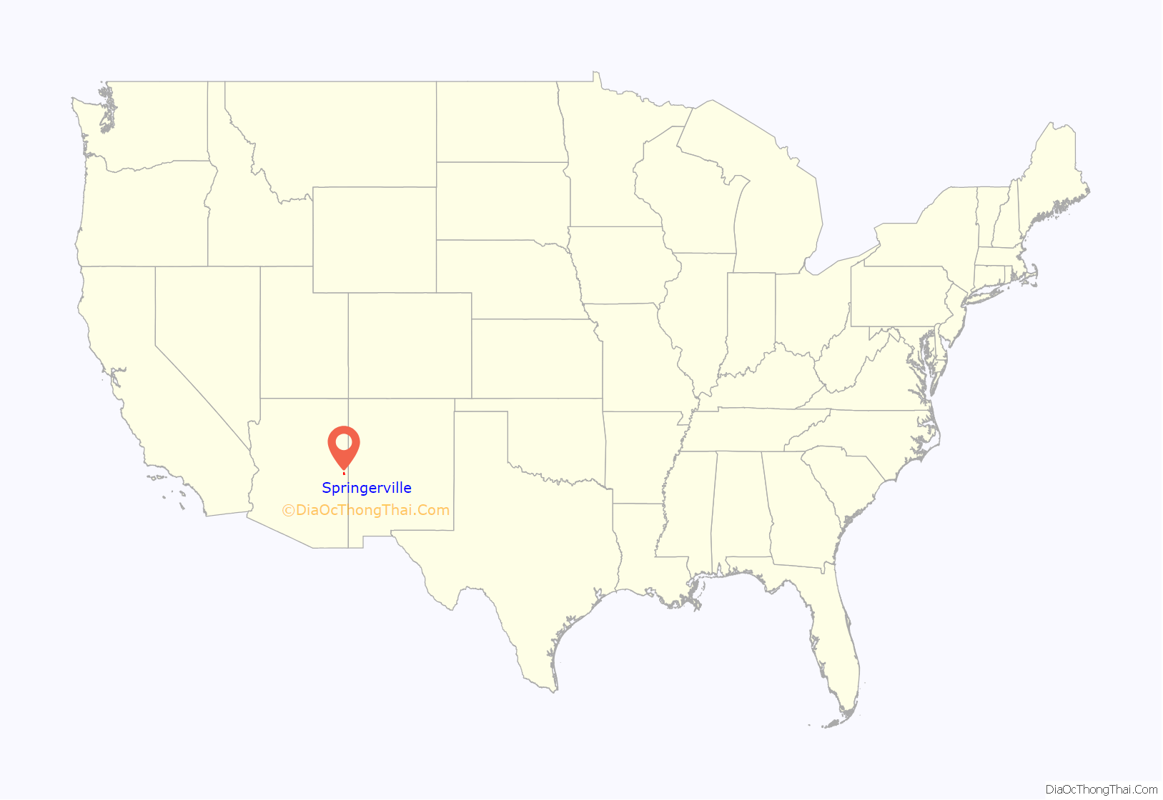
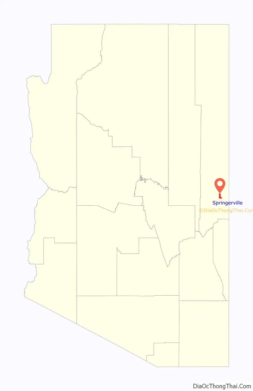
Springerville location map. Where is Springerville town?
History
The town that grew around Henry Springer’s trading post was officially given its name on May 10, 1876. Before that time it had gone by names such as Colorado Chiquito, Milligan Settlement, and Valle Redondo (Round Valley).
Outlaw Cowboy Ike Clanton, who was present at the Gunfight at the O.K. Corral, was shot dead in Springerville on June 1, 1887, by detective Jonas V. Brighton when he resisted arrest on charges of cattle rustling.
Springerville is the home of Arizona’s Madonna of the Trail statue, unveiled on September 29, 1928.
The town was incorporated in 1948.
In 1951, Twentieth Century Fox filmed an adaptation of Fred Gipson’s novel The Home Place titled Return of the Texan at several locations in and around Springerville.
In June 2011, most of the town was evacuated due to a nearby wildfire some stayed and met with each other alongside residents of Eagar in the round valley dome.
Springerville Road Map

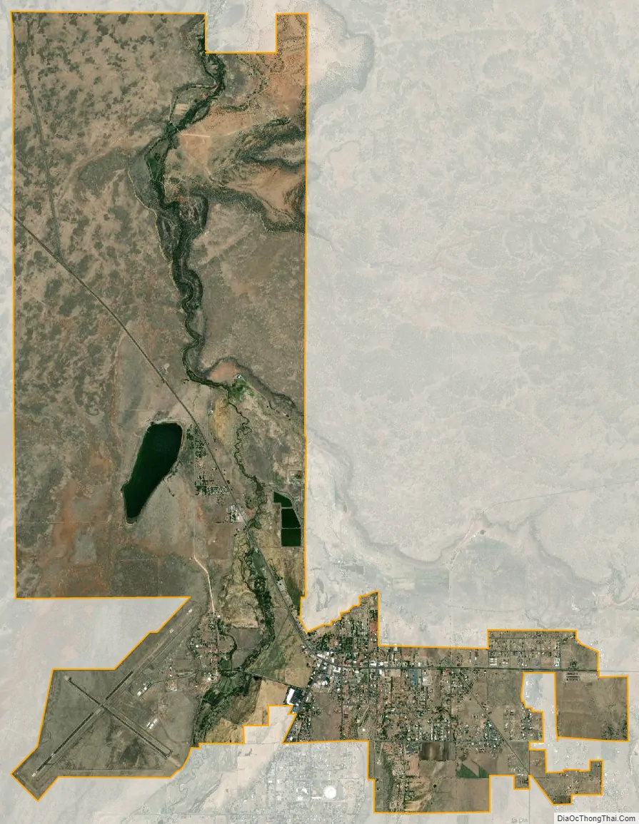
Springerville city Satellite Map
Geography
Springerville is located at 34°8′11″N 109°16′45″W / 34.13639°N 109.27917°W / 34.13639; -109.27917 (34.136342, -109.279227).
According to the United States Census Bureau, the town has a total area of 11.7 square miles (30 km), of which 11.6 square miles (30 km) is land and 0.1 square miles (0.26 km), or 1.4%, is water. Springerville has a Mediterranean climate (Köppen Csb).
See also
Map of Arizona State and its subdivision: Map of other states:- Alabama
- Alaska
- Arizona
- Arkansas
- California
- Colorado
- Connecticut
- Delaware
- District of Columbia
- Florida
- Georgia
- Hawaii
- Idaho
- Illinois
- Indiana
- Iowa
- Kansas
- Kentucky
- Louisiana
- Maine
- Maryland
- Massachusetts
- Michigan
- Minnesota
- Mississippi
- Missouri
- Montana
- Nebraska
- Nevada
- New Hampshire
- New Jersey
- New Mexico
- New York
- North Carolina
- North Dakota
- Ohio
- Oklahoma
- Oregon
- Pennsylvania
- Rhode Island
- South Carolina
- South Dakota
- Tennessee
- Texas
- Utah
- Vermont
- Virginia
- Washington
- West Virginia
- Wisconsin
- Wyoming