Map of Sedona city
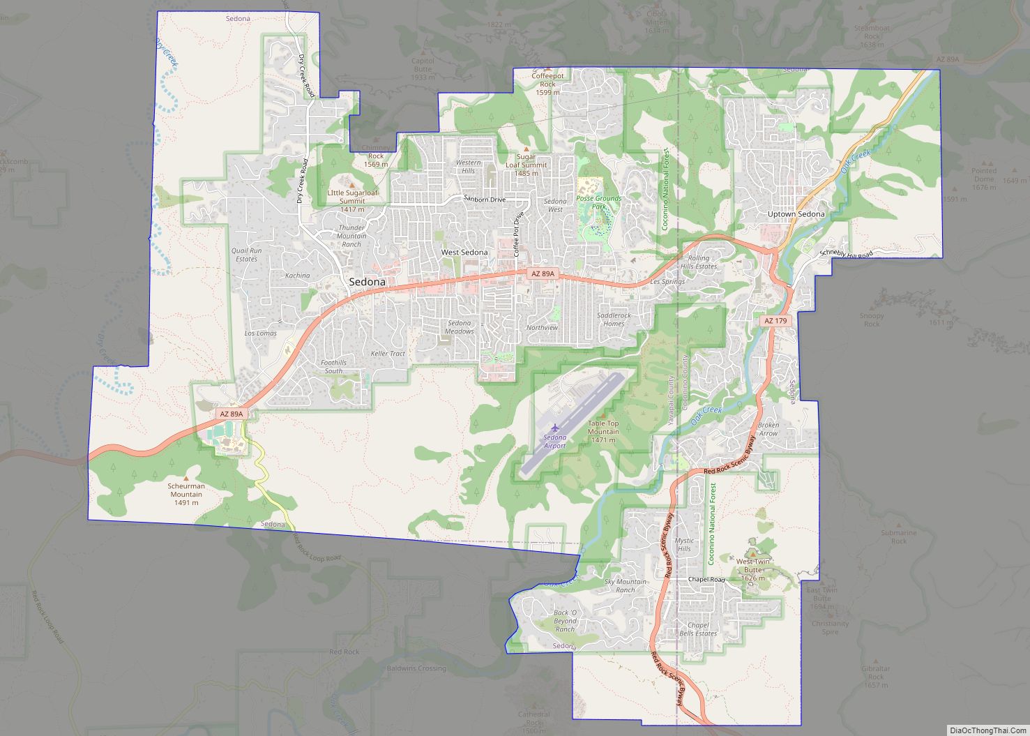
Sedona /sɪˈdoʊnə/ is a city that straddles the county line between Coconino and Yavapai counties in the northern Verde Valley region of the U.S. state of Arizona. As of the 2010 census, its population was 10,031. It is within the Coconino National Forest. Sedona’s main attraction is its array of red sandstone formations. The formations ... Read more
Map of Sedona city
Map of Second Mesa CDP
Second Mesa is a census-designated place (CDP) in Navajo County, Arizona, on the Hopi Reservation, atop the 5,700-foot (1,740 m) mesa. As of the 2010 census, the CDP population was 962, spread among three Hopi Indian villages, Musungnuvi (or Mishongnovi), Supawlavi (or Sipaulovi), and Songoopavi (or Shungopavi). The Hopi Cultural Center is on Second Mesa. ... Read more
Map of Second Mesa CDP
Map of Seven Mile CDP, Arizona
Seven Mile is a census-designated place in Navajo County, in the U.S. state of Arizona, on the Fort Apache Indian Reservation. The population was 707 at the 2010 census. Seven Mile CDP overview: Name: Seven Mile CDP LSAD Code: 57 LSAD Description: CDP (suffix) State: Arizona County: Navajo County Total Area: 2.27 sq mi (5.89 km²) Land Area: ... Read more
Map of Seven Mile CDP, Arizona
Map of Sells CDP
Sells (O’odham: Komkcʼeḍ ʼe-Wa:ʼosidk) is an unincorporated community and census-designated place (CDP) in Pima County, Arizona, United States. The population was 2,799 at the 2000 census. It is the capital of the Tohono O’odham Nation and the home of several of their tribal businesses, such as Tohono O’Odham Ki:Ki Association. Originally named Indian Oasis, by ... Read more
Map of Sells CDP
Map of Seligman CDP, Arizona
Seligman (Havasupai: Thavgyalyal) is a census-designated place (CDP) on the northern border of Yavapai County, in northwestern Arizona, United States. The population was 456 at the 2020 census. Seligman CDP overview: Name: Seligman CDP LSAD Code: 57 LSAD Description: CDP (suffix) State: Arizona County: Yavapai County Elevation: 5,242 ft (1,598 m) Total Area: 6.42 sq mi (16.62 km²) Land Area: ... Read more
Map of Seligman CDP, Arizona
Map of Shongopovi CDP
Shongopovi (Hopi: Songòopavi) is a census-designated place (CDP) in Navajo County, Arizona, United States. It is located on the Second Mesa, within the Hopi Reservation. The population was 632 at the 2000 census. Shongopovi CDP overview: Name: Shongopovi CDP LSAD Code: 57 LSAD Description: CDP (suffix) State: Arizona County: Navajo County Elevation: 6,341 ft (1,933 m) Total ... Read more
Map of Shongopovi CDP
Map of Show Low city
Show Low is a city in Navajo County, Arizona. It lies on the Mogollon Rim in east central Arizona, at an elevation of 6,345 feet (1,934 m). The city was established in 1870 and incorporated in 1953. According to the 2010 census, the population of the city was 10,660. Show Low city overview: Name: Show ... Read more
Map of Show Low city
Map of Shonto CDP
Shonto (Navajo: Shą́ą́ʼtóhí) is a census-designated place (CDP) in Navajo County, Arizona, United States, in the Navajo Nation. The population was 591 at the 2010 census. Shonto CDP overview: Name: Shonto CDP LSAD Code: 57 LSAD Description: CDP (suffix) State: Arizona County: Navajo County Elevation: 6,240 ft (1,902 m) Total Area: 4.57 sq mi (11.83 km²) Land Area: 4.56 sq mi (11.81 km²) ... Read more
Map of Shonto CDP
Map of Snowflake town
Snowflake is a town in Navajo County, Arizona, United States. It was founded in 1878 by Erastus Snow and William Jordan Flake, Mormon pioneers Snowflake is 25 miles (40 km) south of Interstate 40 (formerly U.S. Route 66) via Highway 77. The Apache Railway provides freight service. Snowflake town overview: Name: Snowflake town LSAD Code: 43 ... Read more
Map of Snowflake town
Map of Six Shooter Canyon CDP
Six Shooter Canyon is a census-designated place (CDP) in Gila County, Arizona, United States. The population was 1,019 at the 2010 census. Six Shooter Canyon CDP overview: Name: Six Shooter Canyon CDP LSAD Code: 57 LSAD Description: CDP (suffix) State: Arizona County: Gila County Elevation: 3,740 ft (1,140 m) Total Area: 2.96 sq mi (7.67 km²) Land Area: 2.96 sq mi (7.67 km²) ... Read more
Map of Six Shooter Canyon CDP
Map of Sierra Vista Southeast CDP
Sierra Vista Southeast, often referred to as Hereford or Nicksville, is a census-designated place (CDP) in Cochise County, Arizona, United States. The population was 14,797 at the 2010 census. It includes the neighborhoods Ramsey Canyon, and Sierra Vista Estates within its boundaries. Sierra Vista Southeast CDP overview: Name: Sierra Vista Southeast CDP LSAD Code: 57 ... Read more
Map of Sierra Vista Southeast CDP
Map of Somerton city
Somerton is a city in Yuma County, Arizona, United States. As of the 2010 census the population was 14,287. It is part of the Yuma Metropolitan Statistical Area. Somerton was established in 1898 and incorporated in 1918. Somerton’s economy is based on agriculture, medical services, and tourism. Somerton city overview: Name: Somerton city LSAD Code: ... Read more
Map of Somerton city