Map of Grantsville city, Utah
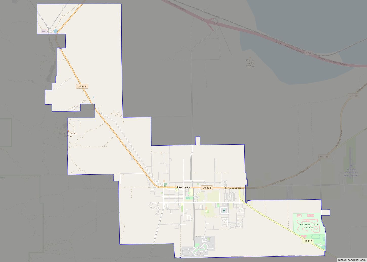
Grantsville is the second most populous city in Tooele County, Utah, United States. It is part of the Salt Lake City, Utah Metropolitan Statistical Area. The population was 12,617 at the 2020 census. The city has grown slowly and steadily throughout most of its existence, but rapid increases in growth occurred during the 1970s, 1990s, ... Read more
Map of Grantsville city, Utah
Map of Granite CDP, Utah
Granite is a census-designated place (CDP) in Salt Lake County, Utah, United States, adjoining the City of Sandy on the east. As of the 2000 census, the CDP population was 2,018, a decrease from the 1990 population of 3,300 largely due to annexations by Sandy. Salt Lake County has designated a Granite “Community Council” for ... Read more
Map of Granite CDP, Utah
Map of Goshen town, Utah
Goshen is a town in Utah County, Utah, United States. It is part of the Provo–Orem Metropolitan Statistical Area. The population was 921 at the 2010 census. Goshen town overview: Name: Goshen town LSAD Code: 43 LSAD Description: town (suffix) State: Utah County: Utah County Incorporated: 1910 Elevation: 4,551 ft (1,387 m) Total Area: 0.83 sq mi (2.14 km²) Land ... Read more
Map of Goshen town, Utah
Map of Hatch town, Utah
Hatch is a town in Garfield County, Utah, United States. The population was 133 at the 2010 census. It is 260 miles (420 km) south of Salt Lake City. Hatch town overview: Name: Hatch town LSAD Code: 43 LSAD Description: town (suffix) State: Utah County: Garfield County Incorporated: January 3, 1934 Elevation: 6,919 ft (2,109 m) Total Area: ... Read more
Map of Hatch town, Utah
Map of Halls Crossing CDP
Halls Crossing is a census-designated place (CDP) on the western edge of San Juan County, Utah, United States. The population was six at the 2010 Census. State Route 276 crosses the Colorado River at Halls Crossing using the Charles Hall Ferry. Halls Crossing CDP overview: Name: Halls Crossing CDP LSAD Code: 57 LSAD Description: CDP ... Read more
Map of Halls Crossing CDP
Map of Halchita CDP
Halchita is a census-designated place (CDP) in San Juan County, Utah, United States. The population was 270 at the 2000 census. Halchita CDP overview: Name: Halchita CDP LSAD Code: 57 LSAD Description: CDP (suffix) State: Utah County: San Juan County Elevation: 4,380 ft (1,335 m) Total Area: 17.1 sq mi (44.3 km²) Land Area: 17.1 sq mi (44.3 km²) Water Area: 0.0 sq mi (0.0 km²) ... Read more
Map of Halchita CDP
Map of Holden town, Utah
Holden is a town in Millard County, Utah, United States. The population was 378 at the 2010 census. Holden town overview: Name: Holden town LSAD Code: 43 LSAD Description: town (suffix) State: Utah County: Millard County Incorporated: 1923 Elevation: 5,102 ft (1,555 m) Total Area: 0.54 sq mi (1.39 km²) Land Area: 0.54 sq mi (1.39 km²) Water Area: 0.00 sq mi (0.00 km²) Total Population: ... Read more
Map of Holden town, Utah
Map of Hinckley town, Utah
Hinckley is a town in Millard County, Utah, United States, in the middle of the Sevier Desert. Irrigation water from the Sevier River, passing nearby, has been used to turn Hinckley into a farming oasis. The mountains that are common in Utah are seen only in the distance, and beyond the reach of the river, ... Read more
Map of Hinckley town, Utah
Map of Hildale city
Hildale is a city in Washington County, Utah, United States. The population was 1,127 at the 2020 census. Hildale is located on the border of Utah and Arizona. Hildale city overview: Name: Hildale city LSAD Code: 25 LSAD Description: city (suffix) State: Utah County: Washington County Incorporated: 1962 Elevation: 5,043 ft (1,537 m) Total Area: 5.60 sq mi (14.51 km²) ... Read more
Map of Hildale city
Map of Highland city, Utah
Highland is a city in Utah County, Utah, United States. It is approximately 30 miles (48 km) south of Salt Lake City and is part of the Provo–Orem Metropolitan Statistical Area. According to the 2010 census the population was 15,523, a 90.0% increase over the 2000 figure of 8,172. Highland city overview: Name: Highland city LSAD ... Read more
Map of Highland city, Utah
Map of Hideout town
Hideout is a town in the northwestern corner of Wasatch County, Utah, United States, in the northern part of the state. Lying just to the north and east of Jordanelle Reservoir along Utah State Route 248 (SR-248), the town was incorporated in 2008 under short-lived state law. The population was 656 at the 2010 census. ... Read more
Map of Hideout town
Map of Herriman city
Herriman (/ˈhɛrɪmən/ HERR-ih-mən) is a city in southwestern Salt Lake County, Utah. The population was 55,144 as of the 2020 census. Although Herriman was a town in 2000, it has since been classified as a fourth-class city by state law. The city has experienced rapid growth since incorporation in 1999, as its population was just ... Read more
Map of Herriman city