Grantsville is the second most populous city in Tooele County, Utah, United States. It is part of the Salt Lake City, Utah Metropolitan Statistical Area. The population was 12,617 at the 2020 census. The city has grown slowly and steadily throughout most of its existence, but rapid increases in growth occurred during the 1970s, 1990s, and 2010s. Recent rapid growth has been attributed to being close to Salt Lake City, small town community feel, lower housing costs than Salt Lake County, the nearby Deseret Peak recreational center, the Utah Motorsports Campus raceway, and the newly built Wal-Mart distribution center located just outside the city. It is quickly becoming a bedroom community for commuters into the Salt Lake Valley.
| Name: | Grantsville city |
|---|---|
| LSAD Code: | 25 |
| LSAD Description: | city (suffix) |
| State: | Utah |
| County: | Tooele County |
| Elevation: | 4,304 ft (1,312 m) |
| Total Area: | 37.59 sq mi (97.36 km²) |
| Land Area: | 37.47 sq mi (97.05 km²) |
| Water Area: | 0.12 sq mi (0.30 km²) |
| Total Population: | 12,617 |
| Population Density: | 335.65/sq mi (129.59/km²) |
| ZIP code: | 84029 |
| Area code: | 435 |
| FIPS code: | 4931120 |
| GNISfeature ID: | 1428338 |
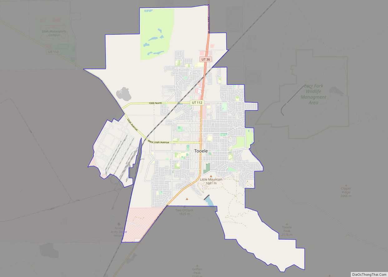
Online Interactive Map
Click on ![]() to view map in "full screen" mode.
to view map in "full screen" mode.
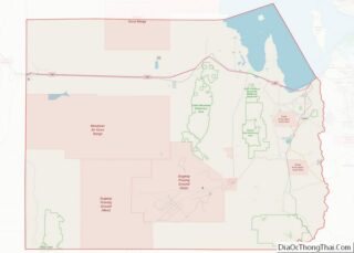
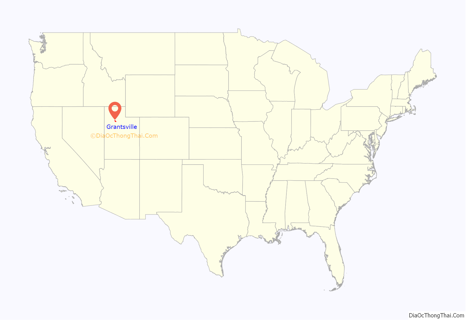
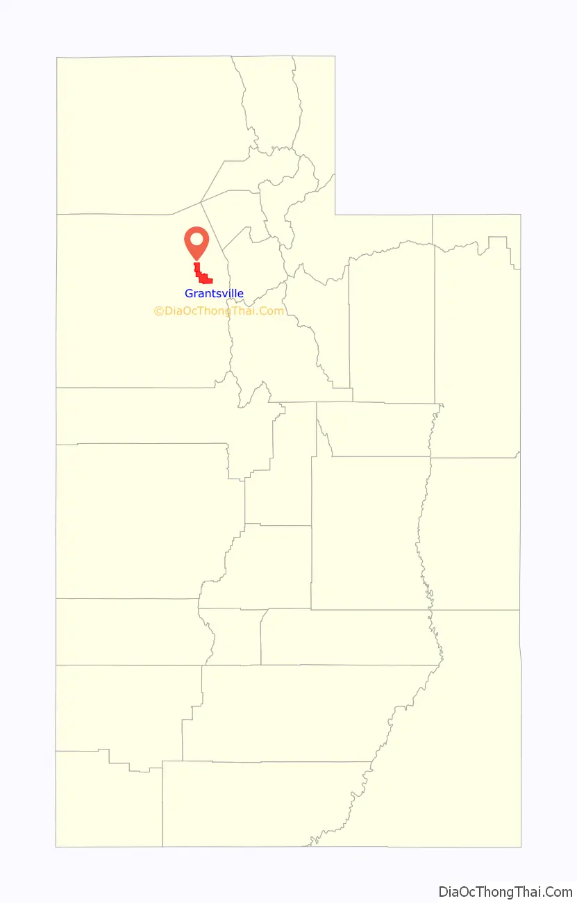
Grantsville location map. Where is Grantsville city?
History
The area of Grantsville was originally populated by the Goshute tribe.
Grantsville was originally called “Willow Creek”, and has also been called “Twenty Wells” due to the natural wells that give fresh water to the area. Grantsville was settled by Mormon pioneers in 1850, with the arrival of the brothers-in-law James McBride and Harrison Severe, with their wives and families. The present name, after Col. George D. Grant, a leader in the Church of Jesus Christ of Latter-day Saints, was adopted c. 1853. A post office called Grantsville has been in operation since 1864. The Anderson–Clark Farmstead has outbuildings dating back from 1880, and was first owned by the pioneer James McBride.
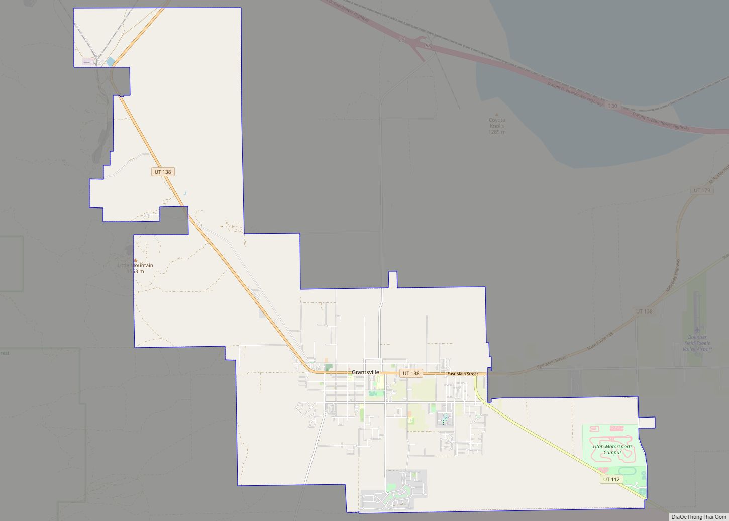
Grantsville Road Map

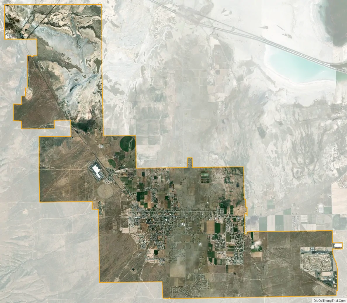
Grantsville city Satellite Map
Geography
Grantsville is bordered on the south by South Mountain, which separates Rush Valley from Tooele Valley. To the north is Stansbury Island, and on the east are the Oquirrh Mountains and the Great Salt Lake, and on the west side the Stansbury Mountains. SR-138 passes through the city, heading northwest to intersect with I-80 and east to Stansbury Park.
The climate is hot during the summer and cold and snowy during the winter. Although Grantsville can be affected by lake-effect snow from the Great Salt Lake, most of the time, it is too far southwest.
According to the United States Census Bureau, the city has a total area of 19.34 square miles (50.1 km), of which 19.2 square miles (50 km) is land and 0.04 square miles (0.10 km) (0.22%) is water.
See also
Map of Utah State and its subdivision: Map of other states:- Alabama
- Alaska
- Arizona
- Arkansas
- California
- Colorado
- Connecticut
- Delaware
- District of Columbia
- Florida
- Georgia
- Hawaii
- Idaho
- Illinois
- Indiana
- Iowa
- Kansas
- Kentucky
- Louisiana
- Maine
- Maryland
- Massachusetts
- Michigan
- Minnesota
- Mississippi
- Missouri
- Montana
- Nebraska
- Nevada
- New Hampshire
- New Jersey
- New Mexico
- New York
- North Carolina
- North Dakota
- Ohio
- Oklahoma
- Oregon
- Pennsylvania
- Rhode Island
- South Carolina
- South Dakota
- Tennessee
- Texas
- Utah
- Vermont
- Virginia
- Washington
- West Virginia
- Wisconsin
- Wyoming