Map of Moorefield town, West Virginia
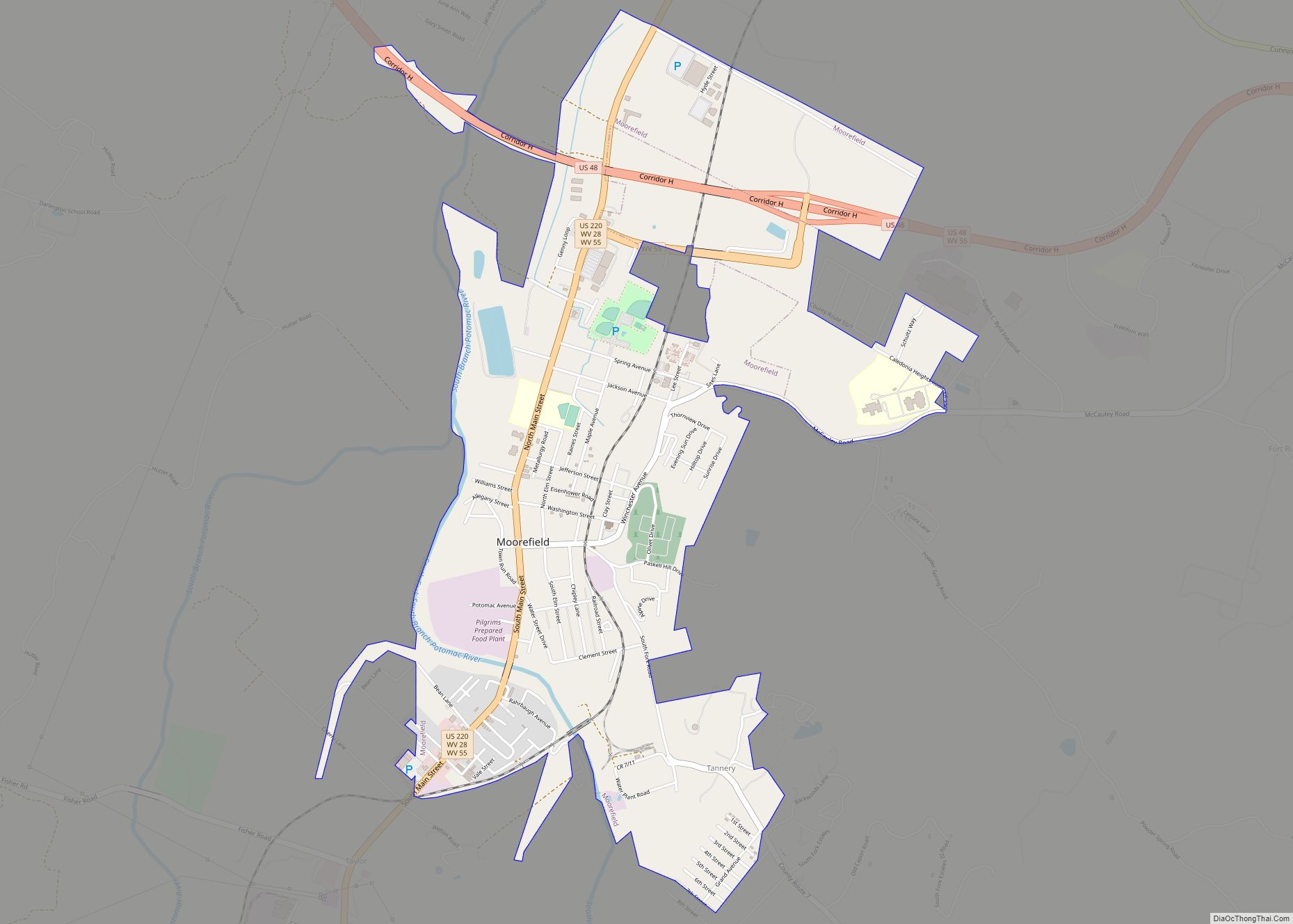
Moorefield is a town and the county seat of Hardy County, West Virginia, United States. It is located at the confluence of the South Branch Potomac River and the South Fork South Branch Potomac River. Moorefield was originally chartered in 1777; it was named for Conrad Moore, who owned the land upon which the town ... Read more
Map of Moorefield town, West Virginia
Map of Montrose town, West Virginia
Montrose is a town in Randolph County, West Virginia, United States. The population was 141 at the 2020 census. The town was so named on account of wild rose bushes near the original town site. Montrose town overview: Name: Montrose town LSAD Code: 43 LSAD Description: town (suffix) State: West Virginia County: Randolph County Elevation: ... Read more
Map of Montrose town, West Virginia
Map of Montgomery city, West Virginia
Montgomery is a city in West Virginia, along the Kanawha River. Most of the city is in Fayette County, with the remainder in Kanawha County. The population was 1,280 at the 2020 census. From 1876 to 1890, the town was called Coal Valley Post Office. The name then changed to Montgomery’s Landing, then to Coal ... Read more
Map of Montgomery city, West Virginia
Map of Montcalm CDP
Montcalm is a census-designated place (CDP) in Mercer County, West Virginia, United States. The population was 726 at the 2010 census. It is part of the Bluefield, WV-VA micropolitan area which has a population of 107,342. Residents of Montcalm are called Montcalmers. Montcalm CDP overview: Name: Montcalm CDP LSAD Code: 57 LSAD Description: CDP (suffix) ... Read more
Map of Montcalm CDP
Map of Monaville CDP
Monaville is an unincorporated community and census-designated place (CDP) in Logan County, West Virginia, United States. As of the 2010 census, its population was 309. Monaville CDP overview: Name: Monaville CDP LSAD Code: 57 LSAD Description: CDP (suffix) State: West Virginia County: Logan County Elevation: 712 ft (217 m) Total Area: 0.464 sq mi (1.20 km²) Land Area: 0.457 sq mi (1.18 km²) ... Read more
Map of Monaville CDP
Map of Mitchell Heights town
Mitchell Heights is a town in Logan County, West Virginia, United States. The population was 315 at the 2020 census. The town was named for an early farm on which it was established. Mitchell Heights town overview: Name: Mitchell Heights town LSAD Code: 43 LSAD Description: town (suffix) State: West Virginia County: Logan County Elevation: ... Read more
Map of Mitchell Heights town
Map of Neibert CDP
Neibert is an unincorporated community and census-designated place (CDP) in Logan County, West Virginia, United States. Its population was 183 as of the 2010 census. Neibert CDP overview: Name: Neibert CDP LSAD Code: 57 LSAD Description: CDP (suffix) State: West Virginia County: Logan County Elevation: 718 ft (219 m) Total Area: 0.630 sq mi (1.63 km²) Land Area: 0.612 sq mi (1.59 km²) ... Read more
Map of Neibert CDP
Map of Middleway CDP
Middleway is a census-designated place (CDP) in Jefferson County, West Virginia, United States, in the lower Shenandoah Valley. As of the 2010 census, its population was 441. Middleway CDP overview: Name: Middleway CDP LSAD Code: 57 LSAD Description: CDP (suffix) State: West Virginia County: Jefferson County Total Area: 1.123 sq mi (2.91 km²) Land Area: 1.123 sq mi (2.91 km²) Water ... Read more
Map of Middleway CDP
Map of Omar CDP
Omar is an unincorporated community and census-designated place (CDP) in Logan County, West Virginia, United States. Omar is located along West Virginia Route 44 and Island Creek, 6.5 miles (10.5 km) south of Logan. Omar has a post office with ZIP code 25638. As of the 2010 census, its population was 552. The community was named ... Read more
Map of Omar CDP
Map of Oceana town
Oceana is a town in Wyoming County, West Virginia. The population was 1,462 at the time of the 2020 census. Oceana is the oldest city in Wyoming County and was the county seat until 1907. Oceana was the eponym of the film Oxyana. The town has a town hall and a local police department. It ... Read more
Map of Oceana town
Map of Oakvale town
Oakvale is a town in Mercer County, West Virginia, United States, along the East River. The population was 137 at the 2020 census. It is part of the Bluefield, WV-VA micropolitan area which has a population of 107,578. Oakvale town overview: Name: Oakvale town LSAD Code: 43 LSAD Description: town (suffix) State: West Virginia County: ... Read more
Map of Oakvale town
Map of Oak Hill city, West Virginia
Oak Hill is a city in Fayette County, West Virginia, United States. The population was 8,179 at the 2020 census. It is part of the Beckley metropolitan area. The city is also home to the historic Oak Hill Railroad Depot which still stands today as an artisan shop. Country singer Hank Williams died in Oak ... Read more
Map of Oak Hill city, West Virginia