Bruno is a census-designated place (CDP) in Logan County, West Virginia, United States. Bruno is located on the west bank of the Guyandotte River, 3.5 miles (5.6 km) south of Man. Bruno has a post office with ZIP code 25611. As of the 2010 census, its population was 544. Bruno CDP overview: Name: Bruno CDP LSAD ... Read more
Map of US Cities and Places
Cedar Grove is a town in Kanawha County, West Virginia, United States. The population was 714 at the 2020 census. Cedar Grove was incorporated in 1902. Its name is derived from the time the town was established, when a large juniper forest, misidentified as cedars by early settlers, was growing at that location. Cedar Grove ... Read more
Cass is a census-designated place (CDP) and unincorporated community on the Greenbrier River in Pocahontas County, West Virginia, United States. The population was 38 at the 2020 census. The community, founded in 1901, was named for Joseph Kerr Cass, vice president and cofounder of the West Virginia Pulp and Paper Company. Cass CDP overview: Name: ... Read more
Carolina is a census-designated place (CDP) in Marion County, West Virginia, United States. Carolina is 2 miles (3.2 km) north-northwest of Worthington. Carolina has a post office with ZIP code 26563. As of the 2010 census, its population was 411. The community was named after Caroline Watson, a daughter of mining executive James Watson. Carolina CDP ... Read more
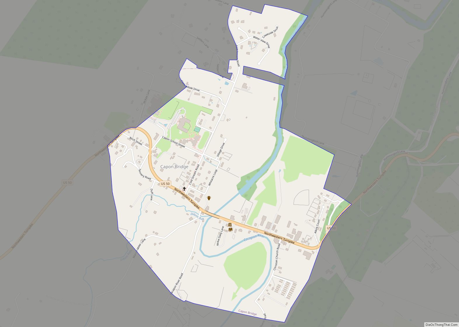
Capon Bridge is a town in eastern Hampshire County, West Virginia, United States, along the Northwestern Turnpike (U.S. Route 50), approximately 20 miles (32 km) west of Winchester, Virginia. The population was 418 at the 2020 census. Originally known as “Glencoe”, Capon Bridge was incorporated in 1902 by the Hampshire County Circuit Court. It is named ... Read more
Chelyan (/ˈʃiːljən/ SHEEL-yən) is a census-designated place (CDP) in Kanawha County, West Virginia, United States. Chelyan is located on the south bank of the Kanawha River, southeast of Chesapeake. It is served by Exit 85 of the West Virginia Turnpike. As of the 2010 census, its population was 776. The community has the name of ... Read more
Chauncey is a census-designated place (CDP) in Logan County, West Virginia, United States. Chauncey is located along West Virginia Route 44 and Island Creek, 5.5 miles (8.9 km) south of Logan. Chauncey had a post office, which opened on August 23, 1913, and closed on June 27, 2009. As of the 2010 census, its population is ... Read more
Charlton Heights is a census-designated place (CDP) in Fayette County, West Virginia, United States. Charlton Heights is located on the north bank of the Kanawha River, 4 miles (6.4 km) southwest of Gauley Bridge. Charlton Heights has a post office with ZIP code 25040. As of the 2010 census, its population was 406. Charlton Heights CDP ... Read more
Covel is a census-designated place (CDP) in Wyoming County, West Virginia, United States. As of the 2010 census, its population is 142. Covel CDP overview: Name: Covel CDP LSAD Code: 57 LSAD Description: CDP (suffix) State: West Virginia County: Wyoming County Total Area: 0.212 sq mi (0.55 km²) Land Area: 0.212 sq mi (0.55 km²) Water Area: 0 sq mi (0 km²) Total Population: ... Read more
Corinne is a census-designated place (CDP) in Wyoming County, West Virginia, United States. As of the 2010 census, Corinne’s population was 362. It has a post office, established in 1916, with a zip code of 25826. Corinne CDP overview: Name: Corinne CDP LSAD Code: 57 LSAD Description: CDP (suffix) State: West Virginia County: Wyoming County ... Read more
Chapmanville is a town in Logan County, West Virginia, United States. The population was 1,025 at the 2020 census. Chapmanville is named for Ned Chapman, an early settler who operated a store and post office. It was incorporated in 1947. Chapmanville town overview: Name: Chapmanville town LSAD Code: 43 LSAD Description: town (suffix) State: West ... Read more
Coal Fork is an unincorporated census-designated place (CDP) in Kanawha County, West Virginia, United States. It is part of a larger unincorporated community known as Campbells Creek, approximately 10 minutes east of Charleston. The population was 1,233 at the 2010 census. Coal Fork CDP overview: Name: Coal Fork CDP LSAD Code: 57 LSAD Description: CDP ... Read more