Chesapeake is a town in Kanawha County, West Virginia, United States. The population was 1,336 at the 2020 census. The town is situated on the Kanawha River. Chesapeake was incorporated on November 1, 1948 as recorded in Book 67 Page 123-124, and named for the Chesapeake and Ohio Railway, which has served the community since 1873. It is also the hometown of NFL player Chris Massey, long snapper for the St. Louis Rams. The current Mayor of Chesapeake is Paul Bradshaw.
| Name: | Chesapeake town |
|---|---|
| LSAD Code: | 43 |
| LSAD Description: | town (suffix) |
| State: | West Virginia |
| County: | Kanawha County |
| Elevation: | 607 ft (185 m) |
| Total Area: | 0.64 sq mi (1.66 km²) |
| Land Area: | 0.48 sq mi (1.25 km²) |
| Water Area: | 0.16 sq mi (0.42 km²) |
| Total Population: | 1,336 |
| Population Density: | 2,939.71/sq mi (1,134.12/km²) |
| Area code: | 304 |
| FIPS code: | 5415028 |
| GNISfeature ID: | 1554120 |
Online Interactive Map
Click on ![]() to view map in "full screen" mode.
to view map in "full screen" mode.
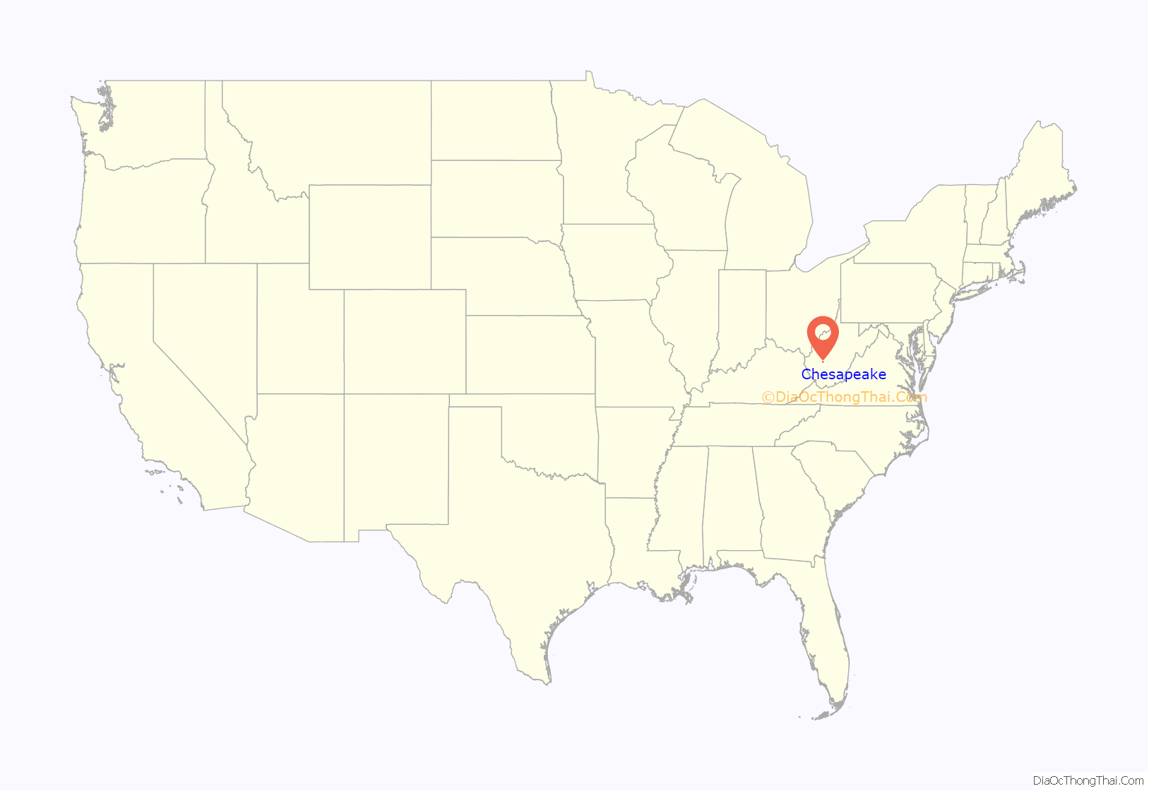
Chesapeake location map. Where is Chesapeake town?

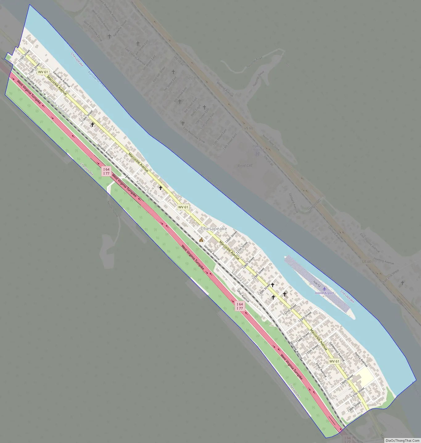
Chesapeake Road Map
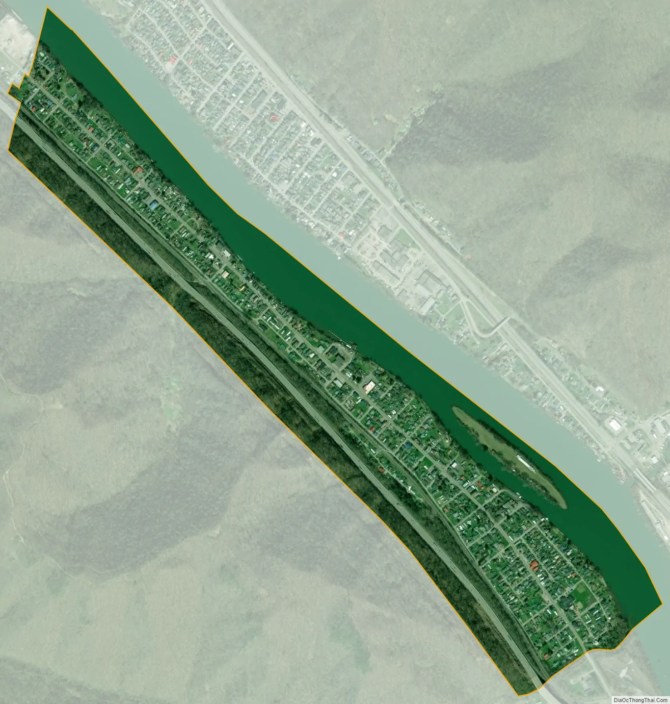
Chesapeake city Satellite Map
Geography
According to the United States Census Bureau, the town has a total area of 0.64 square miles (1.66 km), of which 0.48 square miles (1.24 km) is land and 0.16 square miles (0.41 km) is water.
See also
Map of West Virginia State and its subdivision:- Barbour
- Berkeley
- Boone
- Braxton
- Brooke
- Cabell
- Calhoun
- Clay
- Doddridge
- Fayette
- Gilmer
- Grant
- Greenbrier
- Hampshire
- Hancock
- Hardy
- Harrison
- Jackson
- Jefferson
- Kanawha
- Lewis
- Lincoln
- Logan
- Marion
- Marshall
- Mason
- McDowell
- Mercer
- Mineral
- Mingo
- Monongalia
- Monroe
- Morgan
- Nicholas
- Ohio
- Pendleton
- Pleasants
- Pocahontas
- Preston
- Putnam
- Raleigh
- Randolph
- Ritchie
- Roane
- Summers
- Taylor
- Tucker
- Tyler
- Upshur
- Wayne
- Webster
- Wetzel
- Wirt
- Wood
- Wyoming
- Alabama
- Alaska
- Arizona
- Arkansas
- California
- Colorado
- Connecticut
- Delaware
- District of Columbia
- Florida
- Georgia
- Hawaii
- Idaho
- Illinois
- Indiana
- Iowa
- Kansas
- Kentucky
- Louisiana
- Maine
- Maryland
- Massachusetts
- Michigan
- Minnesota
- Mississippi
- Missouri
- Montana
- Nebraska
- Nevada
- New Hampshire
- New Jersey
- New Mexico
- New York
- North Carolina
- North Dakota
- Ohio
- Oklahoma
- Oregon
- Pennsylvania
- Rhode Island
- South Carolina
- South Dakota
- Tennessee
- Texas
- Utah
- Vermont
- Virginia
- Washington
- West Virginia
- Wisconsin
- Wyoming