Map of Crawford town, Colorado
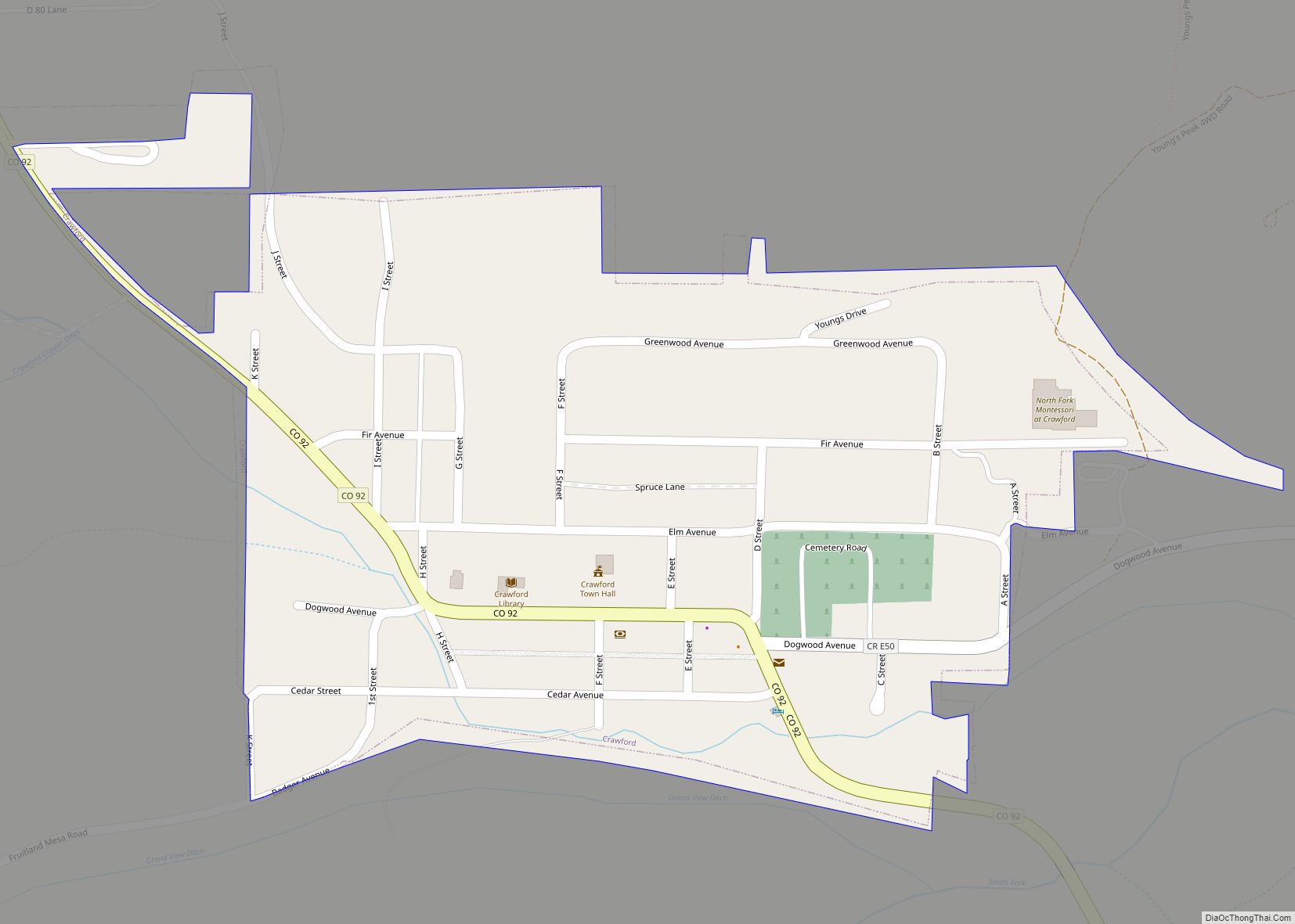
The Town of Crawford is a Statutory Town in Delta County, Colorado, United States. The town population was 403 at the 2020 United States Census. The surrounding mesas and valleys support a farming and ranching community. Crawford town overview: Name: Crawford town LSAD Code: 43 LSAD Description: town (suffix) State: Colorado County: Delta County Incorporated: ... Read more
Map of Crawford town, Colorado
Map of Craig city, Colorado
Craig is a home rule municipality that is the county seat and the most populous municipality of Moffat County, Colorado, United States. The city population was 9,060 at the 2020 United States Census. Craig is the principal city of the Craig, CO Micropolitan Statistical Area. Craig city overview: Name: Craig city LSAD Code: 25 LSAD ... Read more
Map of Craig city, Colorado
Map of Crisman CDP
Crisman is an unincorporated community and a census-designated place (CDP) located in and governed by Boulder County, Colorado, United States. The CDP is a part of the Boulder, CO Metropolitan Statistical Area. The population of the Crisman CDP was 179 at the United States Census 2020. The Boulder post office (Zip Code 80302) serves the ... Read more
Map of Crisman CDP
Map of Cripple Creek city
Cripple Creek is a statutory city that is the county seat of Teller County, Colorado, United States. The city population was 1,155 at the 2020 United States Census. Cripple Creek is a former gold mining camp located 20 miles (32 km) southwest of Colorado Springs near the base of Pikes Peak. The Cripple Creek Historic District, ... Read more
Map of Cripple Creek city
Map of Crestone town
The Town of Crestone is a Statutory Town in Saguache County, Colorado. According to the 2020 United States Census the town population was 141. Crestone is located at the foot of the western slope of the Sangre de Cristo Range, in the northern part of the San Luis Valley. Crestone was platted in 1880 by ... Read more
Map of Crestone town
Map of Dacono city
Dacono is a home rule municipality located in southwestern Weld County, Colorado, United States. The city population was 6,297 at the 2020 United States Census, an increase of +51.66% since the 2010 United States Census. Dacono is a part of the Greeley, CO Metropolitan Statistical Area and the Front Range Urban Corridor. Dacono city overview: ... Read more
Map of Dacono city
Map of Crowley town, Colorado
The Town of Crowley is a Statutory Town in Crowley County, Colorado, United States. The town population was 166 at the 2020 United States Census. Crowley town overview: Name: Crowley town LSAD Code: 43 LSAD Description: town (suffix) State: Colorado County: Crowley County Incorporated: October 10, 1921 Elevation: 4,354 ft (1,327 m) Total Area: 0.225 sq mi (0.584 km²) Land ... Read more
Map of Crowley town, Colorado
Map of Crook town
The Town of Crook is a Statutory Town in Logan County, Colorado, United States. The town population was 133 at the 2020 United States Census. Crook is a part of the Sterling, CO Micropolitan Statistical Area. Crook town overview: Name: Crook town LSAD Code: 43 LSAD Description: town (suffix) State: Colorado County: Logan County Incorporated: ... Read more
Map of Crook town
Map of Dakota Ridge CDP
Dakota Ridge is an unincorporated community and a census-designated place (CDP) located in and governed by Jefferson County, Colorado, United States. The CDP is a part of the Denver–Aurora–Lakewood, CO Metropolitan Statistical Area. The population of the Dakota Ridge CDP was 33,892 at the United States Census 2020. In 1988, voters turned down a proposal ... Read more
Map of Dakota Ridge CDP
Map of Deer Trail town
The Town of Deer Trail is a Statutory Town located in eastern Arapahoe County, Colorado, United States. The town population was 1,068 at the 2020 United States Census, a +95.60% increase since the 2010 United States Census. Deer Trail is a part of the Denver–Aurora–Lakewood, CO Metropolitan Statistical Area and the Front Range Urban Corridor. ... Read more
Map of Deer Trail town
Map of De Beque town
The Town of De Beque is a statutory town located in Mesa County, Colorado. The population was 493 at the time of the 2020 census. De Beque is a part of the Grand Junction, CO Metropolitan Statistical Area. The town consists of a small grid, including a historic downtown featuring a town hall, a tavern, ... Read more
Map of De Beque town
Map of Derby CDP, Colorado
Derby is an unincorporated community and a census-designated place (CDP) located in and governed by Adams County, Colorado, United States. The CDP is a part of the Denver–Aurora–Lakewood, CO Metropolitan Statistical Area. The population of the Derby CDP was 8,407 at the United States Census 2020. The Commerce City post office (Zip code 80022) serves ... Read more
Map of Derby CDP, Colorado