The City of Loveland is the home rule municipality that is the second most populous municipality in Larimer County, Colorado, United States. Loveland is situated 46 miles (74 km) north of the Colorado State Capitol in Denver and is the 14th most populous city in Colorado. As of the 2020 census the population of Loveland was 76,378. The city forms part of the Fort Collins-Loveland Metropolitan Statistical Area and the Front Range Urban Corridor. The city’s public schools are part of the Thompson R2-J School District.
| Name: | Loveland city |
|---|---|
| LSAD Code: | 25 |
| LSAD Description: | city (suffix) |
| State: | Colorado |
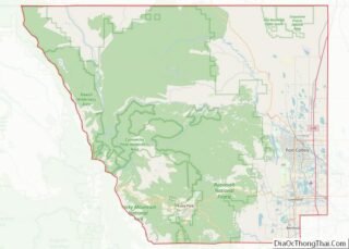
| County: | Larimer County |
| Founded: | 1877 |
| Incorporated: | April 30, 1881 |
| Elevation: | 4,982 ft (1,519 m) |
| Total Area: | 35.88 sq mi (92.94 km²) |
| Land Area: | 34.41 sq mi (89.11 km²) |
| Water Area: | 1.48 sq mi (3.83 km²) 4.13% |
| Total Population: | 76,378 |
| Population Density: | 2,100/sq mi (820/km²) |
| ZIP code: | 80534, 80537-80539 |
| Area code: | 970 |
| FIPS code: | 0846465 |
| GNISfeature ID: | 0177720 |
| Website: | www.cityofloveland.org |
Online Interactive Map
Click on ![]() to view map in "full screen" mode.
to view map in "full screen" mode.
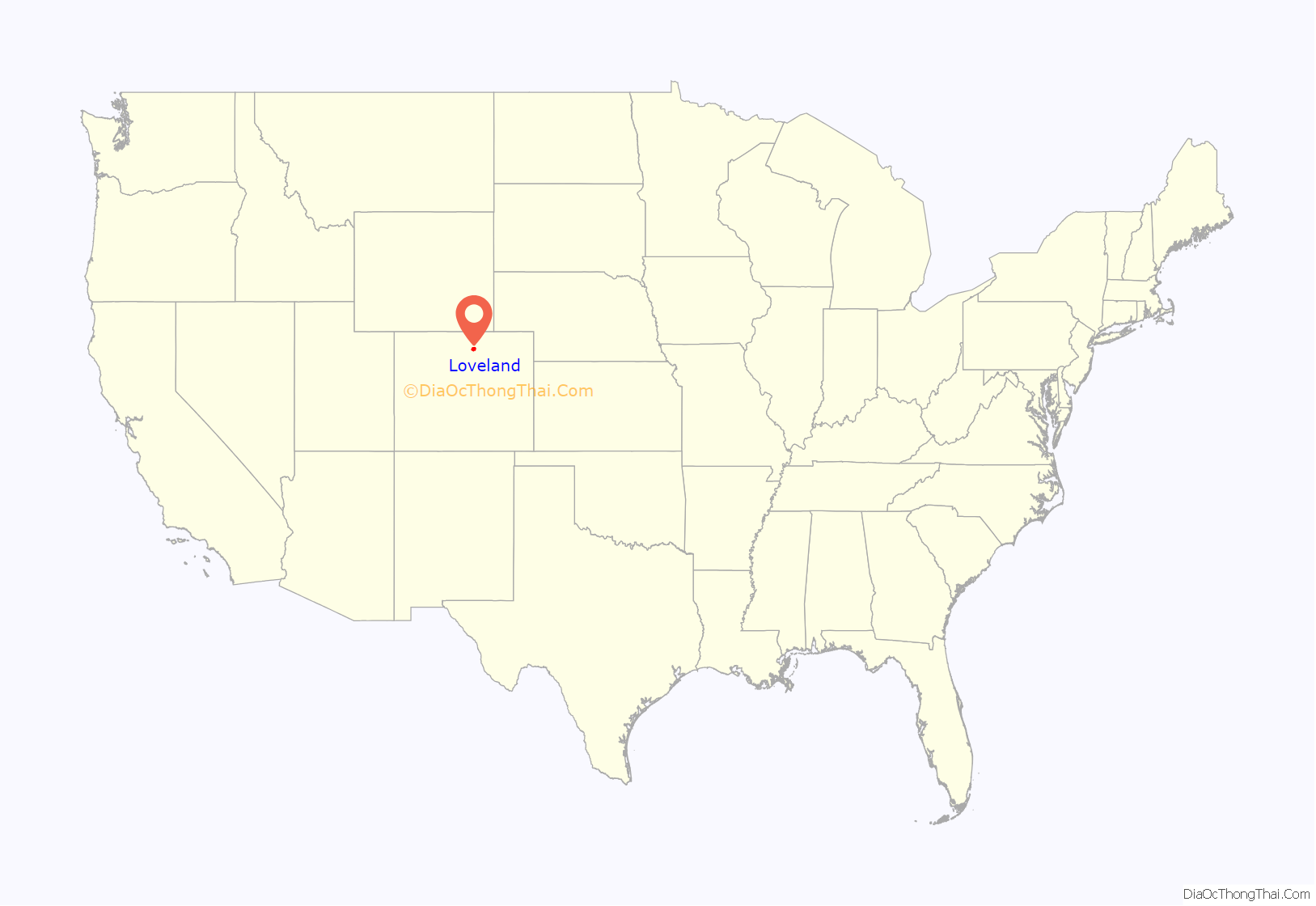
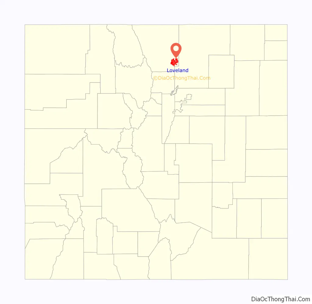
Loveland location map. Where is Loveland city?
History
Mariano Medina built the first settlement in the area, Fort Namaqua, in 1858. It was a trading post and stage station, and the site is now Namaqua Park. Prior to that time it was a hub for French fur trappers dating back to the late 1700s.
The city was officially founded in 1877 along the newly constructed line of the Colorado Central Railroad, near its crossing of the Big Thompson River. It was named in honor of William A.H. Loveland, the president of the Colorado Central Railroad. The city was founded one mile (1.6 km) upstream from the existing small settlement of St. Louis, the buildings of which were moved to the site of Loveland. For the first half of the 20th century, the town was dependent on agriculture. The primary crops in the area were sugar beets and sour cherries. In 1901 the Great Western Sugar Company built a factory in Loveland, which remained as a source of employment until its closure in 1977. During the late 1920s, the Spring Glade Orchard was the largest cherry orchard west of the Mississippi River. At that time the cherry orchards produced more than $1 million worth of cherries per year. A series of droughts, attacks of blight, competition from growers in other states (particularly Michigan), and finally a killer freeze destroyed the industry. By the late 1960s, cherries were no longer farmed at scale, although orchards remained in southeast Loveland and nearby Masonville into the 1990s. In the late 20th century, the economy diversified with the arrival of manufacturing facilities by Hewlett-Packard, Teledyne, and Hach, a water quality analysis equipment manufacturer. A new medical center has added a substantial amount of employment in that sector.
2013 & 1976 floods
On September 12, 2013, a historic flood affected numerous areas in Colorado. It rained heavily for four consecutive days, causing most rivers and creeks to overfill their banks. Estes Park received 8 to 12 inches (200 to 300 mm) of rain, causing Lake Estes to overfill its banks. This prompted a lot of water to be released out of the dam, causing the Big Thompson River to swell. The flooding river caused sections of U.S. Highway 34, the main highway from Loveland to Estes Park, to collapse. The Big Thompson caused major flooding in Loveland, and caused numerous road closures because of flood waters. The Loveland/Fort Collins area received about 4 inches (100 mm), which is relatively less significant compared to the amount of rain other places received. This flood is often compared to the Big Thompson Flood of 1976, both of which are considered to be about a 1 in 500 chance of occurring in a given year, also called a “500-year flood”, by the USGS and Colorado Department of Natural Resources standards and data respectively. Two people died as a result of the 2013 flooding in Larimer county while 144 people were killed in the 1976 flood, with 5 bodies in the 1976 incident never found.
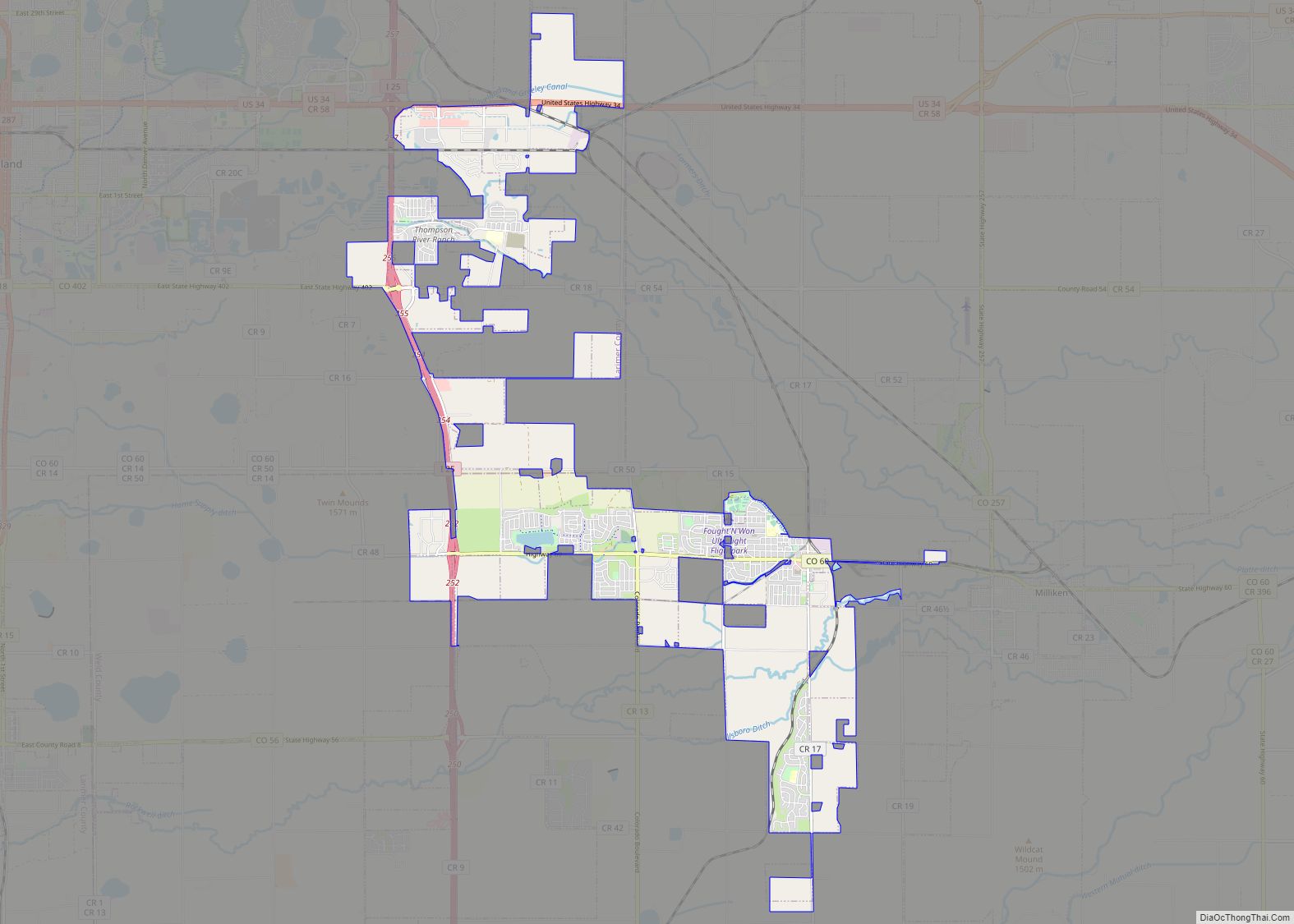
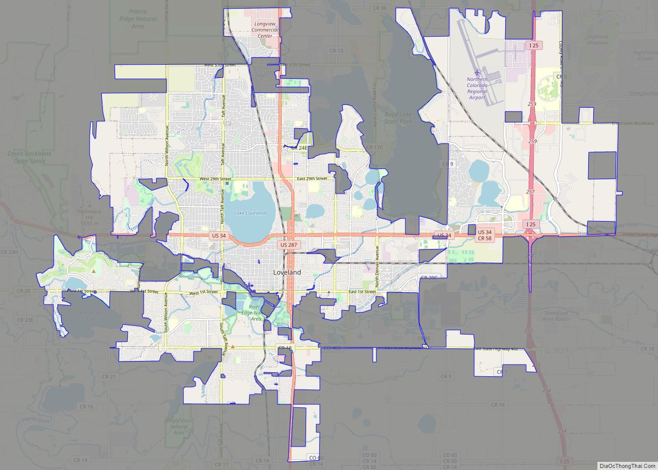
Loveland Road Map
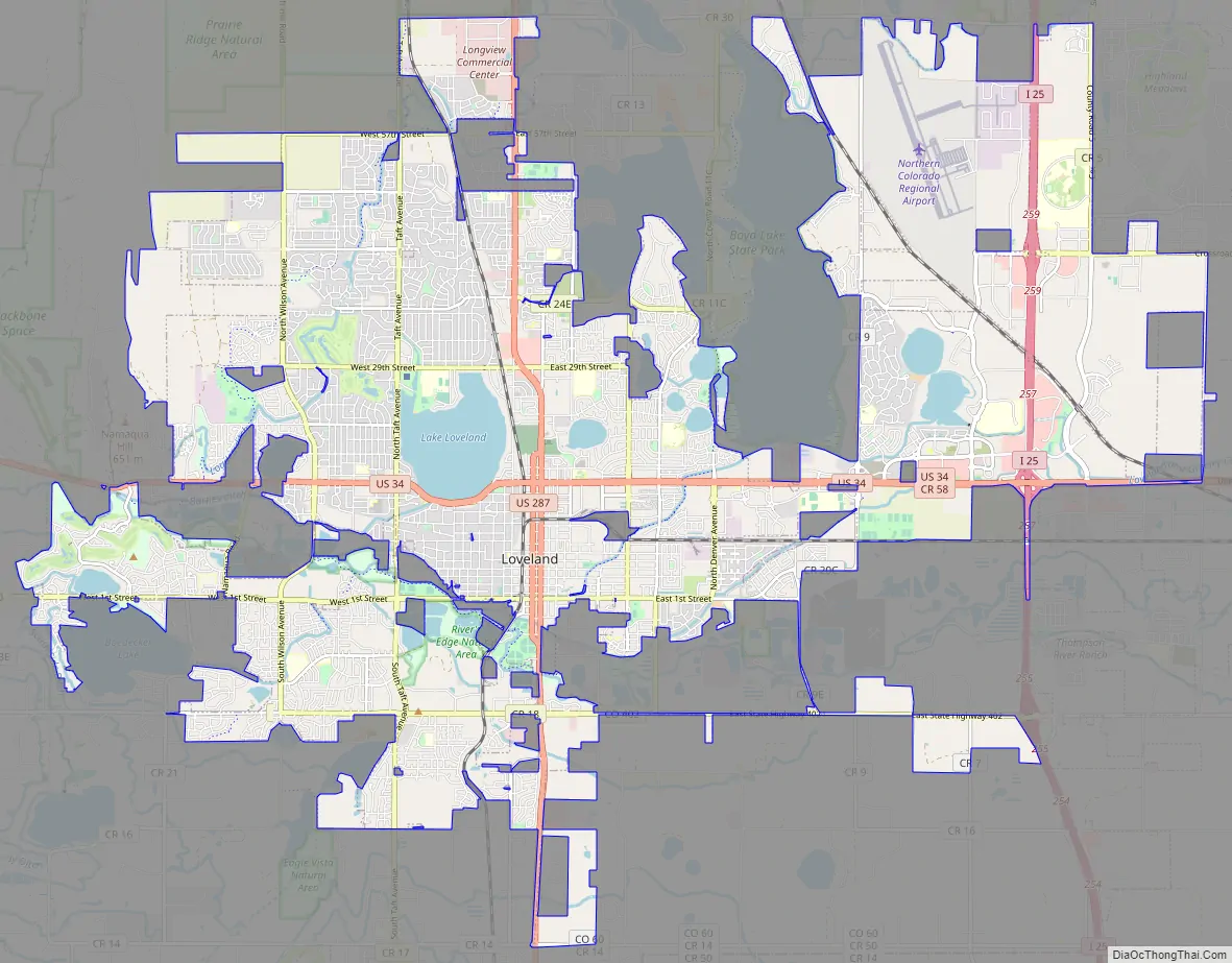
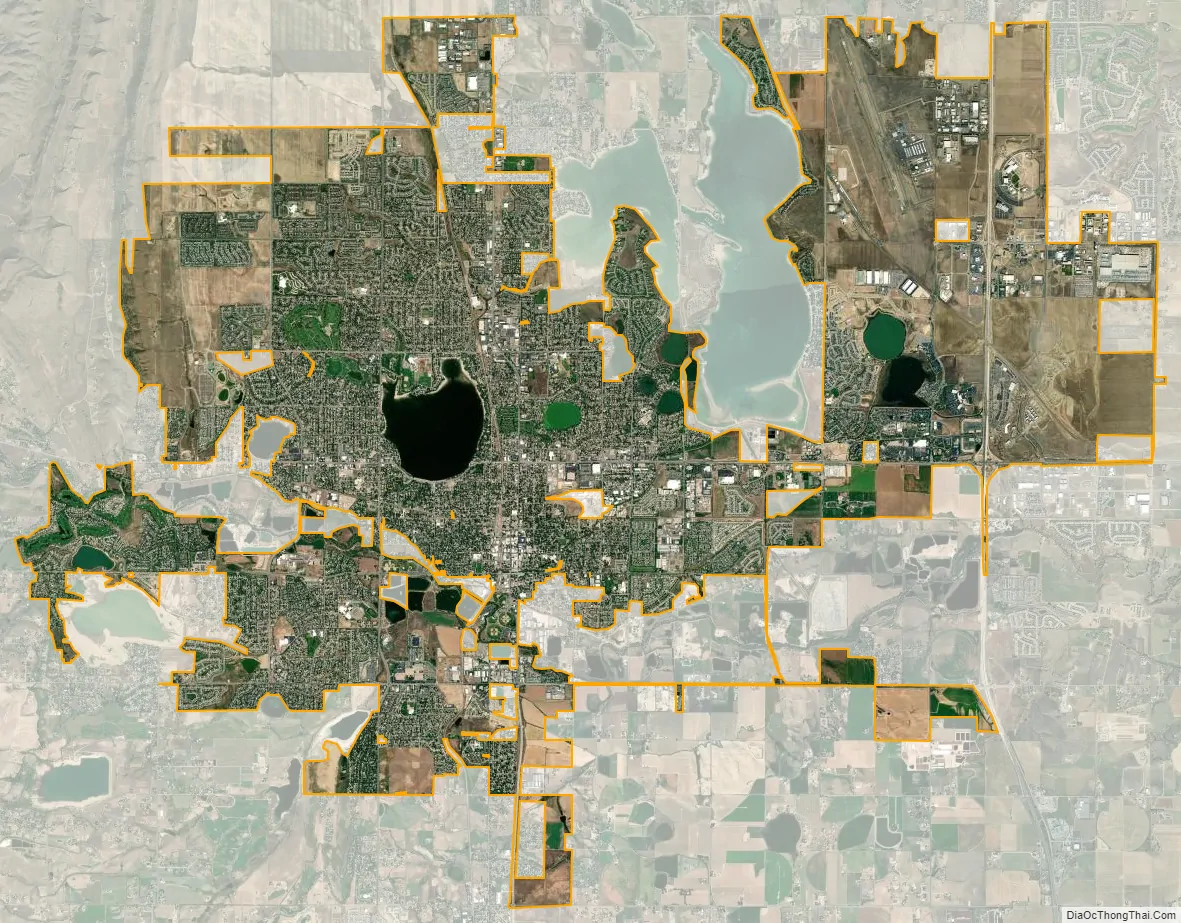
Loveland city Satellite Map
Geography
The city is located in the Colorado Front Range region at the base of the foothills just east of the mouth of Big Thompson River Canyon at the intersection of U.S. Highway 34 and U.S. Highway 287. Longs Peak and other mountains of the Front Range are visible from much of the city.
Loveland is in southeastern Larimer County. Located south of Fort Collins, its larger neighbor and the county seat of Larimer County, both cities have expanded steadily towards each other. They are considered a single metropolitan area by the U.S. government. The establishment of county-owned open space between the two communities in the 1990s was intended to create a permanent buffer. The northern city limits are now contiguous with those of Windsor, which has expanded westward from Weld County across Interstate 25.
According to the United States Census Bureau, the city has a total area of 25.5 square miles (66 km), of which 24.6 square miles (64 km) is land, and 0.9 square miles (2.3 km) (3.68%) is water.
Loveland Pass, also named after William A.H. Loveland, is not located near the town of Loveland.
Climate
Loveland has a semi-arid climate (Köppen climate classification BSk). Its climate is characterized by warm to hot summer and long and moderately cold winter (sometimes severely). Due to its annual precipitation of over 15 inches, Loveland’s climate can sometimes be categorized as humid continental.
Loveland, Colorado has an annual snowfall of 47.0 inches (1,190 mm).
The hottest temperature recorded in Loveland was 106 °F (41 °C) on July 19, 2022, while the coldest temperature recorded was −31 °F (−35 °C) on December 22, 1990.
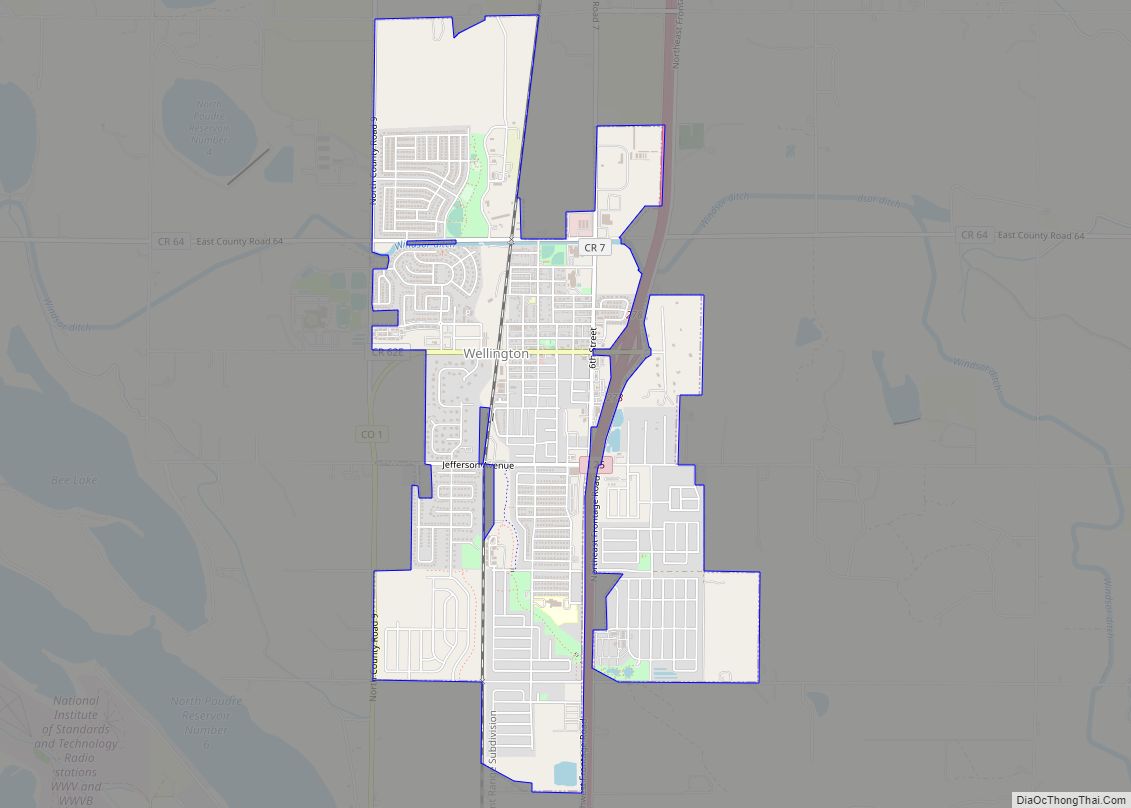
Neighboring towns
See also
Map of Colorado State and its subdivision:- Adams
- Alamosa
- Arapahoe
- Archuleta
- Baca
- Bent
- Boulder
- Broomfield
- Chaffee
- Cheyenne
- Clear Creek
- Conejos
- Costilla
- Crowley
- Custer
- Delta
- Denver
- Dolores
- Douglas
- Eagle
- El Paso
- Elbert
- Fremont
- Garfield
- Gilpin
- Grand
- Gunnison
- Hinsdale
- Huerfano
- Jackson
- Jefferson
- Kiowa
- Kit Carson
- La Plata
- Lake
- Larimer
- Las Animas
- Lincoln
- Logan
- Mesa
- Mineral
- Moffat
- Montezuma
- Montrose
- Morgan
- Otero
- Ouray
- Park
- Phillips
- Pitkin
- Prowers
- Pueblo
- Rio Blanco
- Rio Grande
- Routt
- Saguache
- San Juan
- San Miguel
- Sedgwick
- Summit
- Teller
- Washington
- Weld
- Yuma
- Alabama
- Alaska
- Arizona
- Arkansas
- California
- Colorado
- Connecticut
- Delaware
- District of Columbia
- Florida
- Georgia
- Hawaii
- Idaho
- Illinois
- Indiana
- Iowa
- Kansas
- Kentucky
- Louisiana
- Maine
- Maryland
- Massachusetts
- Michigan
- Minnesota
- Mississippi
- Missouri
- Montana
- Nebraska
- Nevada
- New Hampshire
- New Jersey
- New Mexico
- New York
- North Carolina
- North Dakota
- Ohio
- Oklahoma
- Oregon
- Pennsylvania
- Rhode Island
- South Carolina
- South Dakota
- Tennessee
- Texas
- Utah
- Vermont
- Virginia
- Washington
- West Virginia
- Wisconsin
- Wyoming