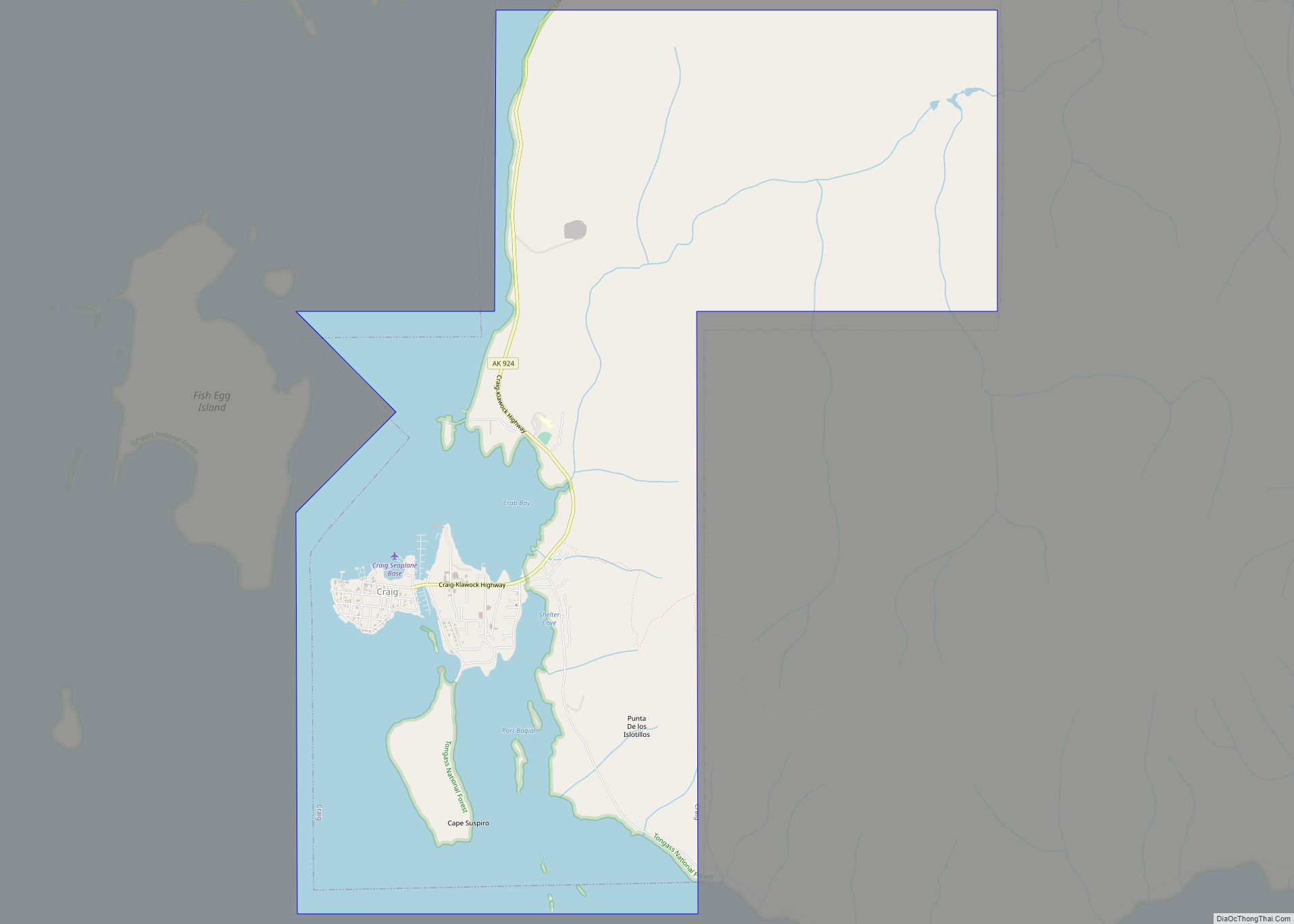
Map of Covenant Life CDP

Map of Covenant Life CDP

Covenant Life is a census-designated place (CDP) in Haines Borough, Alaska, United States. At the 2020 census the population was 25, down from 86 at the 2010 census. It is a community of people with common religious beliefs, with a panel of church elders who set policy for the community’s common church, K-12 school, and … Read more

Map of Cordova city

Map of Cordova city, Alaska

Cordova (/kɔːrˈdoʊvə, ˈkɔːrdəvə/ kor-DOH-və, KOR-də-və) is a city in Chugach Census Area, Alaska, United States. It lies near the mouth of the Copper River, at the head of Orca Inlet on the east side of Prince William Sound. The population was 2,609 at the 2020 census, up from 2,239 in 2010. Cordova was named Puerto … Read more

Map of Deering city

Map of Deering city, Alaska

Deering (Inupiaq: Ipnatchiaq or Ipnasiaq) is a city in the Northwest Arctic Borough in the U.S. state of Alaska. It is located on a sandy spit on the Seward Peninsula where the Inmachuk River flows into Kotzebue Sound, 92 km (57 mi) southwest of Kotzebue. As of the 2020 census, the population was 182, up from 136 … Read more

Map of Crown Point CDP

Map of Crown Point CDP, Alaska

Crown Point is a census-designated place (CDP) in Kenai Peninsula Borough, Alaska, United States. The population was 74 at the 2010 census. Land access to this area is by either the Alaska Railroad or the Seward Highway. Crown Point CDP overview: Name: Crown Point CDP LSAD Code: 57 LSAD Description: CDP (suffix) State: Alaska County: … Read more

Map of Crooked Creek CDP

Map of Crooked Creek CDP, Alaska

Crooked Creek (Central Yupik: Qipcarpak) is a census-designated place (CDP) in Bethel Census Area, Alaska, United States. As of the 2010 census, the population of the CDP was 105, down from 137 in 2000. Crooked Creek CDP overview: Name: Crooked Creek CDP LSAD Code: 57 LSAD Description: CDP (suffix) State: Alaska County: Bethel Census Area … Read more

Map of Deltana CDP

Map of Deltana CDP

Deltana is a census-designated place (CDP) in Southeast Fairbanks Census Area, Alaska, United States. At the 2020 census the population was 2,359, up from 2,251 in 2010. Native inhabitants are Tanana Athabaskans. Deltana CDP overview: Name: Deltana CDP LSAD Code: 57 LSAD Description: CDP (suffix) State: Alaska County: Southeast Fairbanks Census Area Total Area: 570.14 sq mi … Read more

Map of Delta Junction city

Map of Delta Junction city

Delta Junction (Russian: Делта-Джанкшен; Ukrainian: Делта-Джанкшен, romanized: Delta Dzhankshen) is a city in the Southeast Fairbanks Census Area, Alaska, United States. As of the 2010 census, the population was 958, up from 840 in 2000. The 2018 estimate was down to 931. The city is located a short distance south of the confluence of the Delta … Read more

Map of Denali Park CDP

Map of Denali Park CDP

Denali Park, formerly McKinley Park, is a census-designated place (CDP) in Denali Borough, in the U.S. state of Alaska. As of the 2020 census, the population of the CDP was 163, down from 185 at the 2010 census. Denali Park CDP overview: Name: Denali Park CDP LSAD Code: 57 LSAD Description: CDP (suffix) State: Alaska … Read more

Map of Diomede city

Map of Diomede city

Diomede (Inupiaq: Iŋaliq, Russian: Диомид) is a city in the Nome Census Area of the Unorganized Borough of the U.S. state of Alaska, legally coterminous with Little Diomede Island. All the buildings are on the west coast of Little Diomede, which is the smaller of the two Diomede Islands located in the middle of the … Read more

Map of Dillingham city

Map of Dillingham city

Dillingham /ˈdɪlɪŋhæm/ (Central Yupik: Curyung; Russian: Диллингхем), also known as Curyung, is a city in Dillingham Census Area, Alaska, United States. Incorporated in 1963, it is an important commercial fishing port on Nushagak Bay. As of the 2020 census, the population of the city was 2,249, down from 2,329 in 2010. Dillingham city overview: Name: … Read more

Map of Diamond Ridge CDP

Map of Diamond Ridge CDP

Diamond Ridge (Dena’ina: Ch’aqiniggech’) is a census-designated place (CDP) just outside Homer in Kenai Peninsula Borough, Alaska, United States. At the 2010 census the population was 1,156, down from 1,802 in 2000. Diamond Ridge CDP overview: Name: Diamond Ridge CDP LSAD Code: 57 LSAD Description: CDP (suffix) State: Alaska County: Kenai Peninsula Borough Elevation: 1,060 ft … Read more

Map of Dry Creek CDP

Map of Dry Creek CDP, Alaska

Dry Creek is a census-designated place (CDP) in Southeast Fairbanks Census Area, Alaska, United States. At the 2010 census the population was 94, down from 128 in 2000. Dry Creek CDP overview: Name: Dry Creek CDP LSAD Code: 57 LSAD Description: CDP (suffix) State: Alaska County: Southeast Fairbanks Census Area Elevation: 1,857 ft (566 m) Total Area: … Read more