Map of Palm Harbor CDP
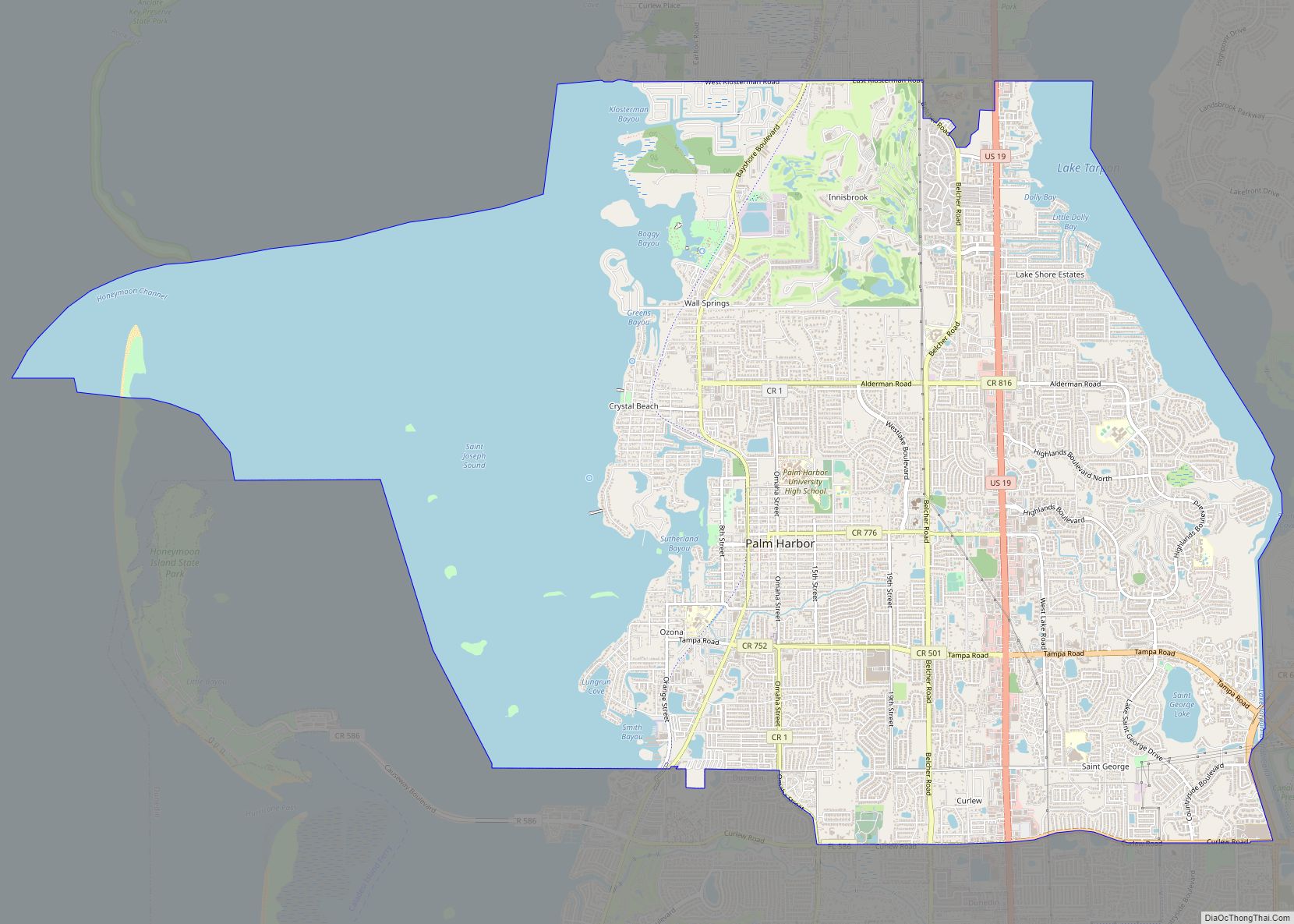
Palm Harbor is a census-designated place and unincorporated community in Pinellas County, Florida, United States. As of the 2016 American Community Survey, the CDP had a population of 60,236. Palm Harbor CDP overview: Name: Palm Harbor CDP LSAD Code: 57 LSAD Description: CDP (suffix) State: Florida County: Pinellas County Elevation: 49 ft (15 m) Total Area: 28.10 sq mi ... Read more
Map of Palm Harbor CDP
Map of Palm Coast city
Palm Coast is a city in Flagler County, Florida. As of the 2010 United States Census, the population was 75,180, more than twice the 32,832 counted in 2000. The population was estimated to be 89,800 in 2019. It is the most populous city in Flagler County. Palm Coast is part of the Deltona–Daytona Beach–Ormond Beach, ... Read more
Map of Palm Coast city
Map of Palm Springs village, Florida
Palm Springs is a village in Palm Beach County, Florida, United States, situated approximately 61 mi (98 km) north of Miami. The village’s name was likely derived from the resort city of Palm Springs, California. Located in the east-central part of the county, Palm Springs is situated north of Atlantis, east of Greenacres, west of Lake Clarke ... Read more
Map of Palm Springs village, Florida
Map of Palm Springs North CDP
Palm Springs North is an unincorporated community and census-designated place (CDP) in Miami-Dade County, Florida, United States. The population was 5,030 at the 2020 census. Palm Springs North CDP overview: Name: Palm Springs North CDP LSAD Code: 57 LSAD Description: CDP (suffix) State: Florida County: Miami-Dade County Elevation: 8 ft (2 m) Total Area: 1.00 sq mi (2.59 km²) Land ... Read more
Map of Palm Springs North CDP
Map of Palm Shores town
Palm Shores is a town in Brevard County, Florida. The population was 900 at the 2010 United States Census. It is part of the Palm Bay–Melbourne–Titusville Metropolitan Statistical Area. Palm Shores town overview: Name: Palm Shores town LSAD Code: 43 LSAD Description: town (suffix) State: Florida County: Brevard County Elevation: 13 ft (4 m) Total Area: 0.60 sq mi ... Read more
Map of Palm Shores town
Map of Palm Valley CDP, Florida
Palm Valley is a census-designated place (CDP) in St. Johns County, Florida, United States. The population was 19,860 at the 2000 census. Palm Valley CDP overview: Name: Palm Valley CDP LSAD Code: 57 LSAD Description: CDP (suffix) State: Florida County: St. Johns County Elevation: 7 ft (2 m) Total Area: 13.61 sq mi (35.25 km²) Land Area: 12.20 sq mi (31.59 km²) Water ... Read more
Map of Palm Valley CDP, Florida
Map of Palmetto Estates CDP
Palmetto Estates is an unincorporated area and census-designated place (CDP) in Miami-Dade County, Florida, United States. The population was 13,498 at the 2020 census. Palmetto Estates CDP overview: Name: Palmetto Estates CDP LSAD Code: 57 LSAD Description: CDP (suffix) State: Florida County: Miami-Dade County Elevation: 10 ft (3 m) Total Area: 2.21 sq mi (5.71 km²) Land Area: 2.16 sq mi (5.59 km²) ... Read more
Map of Palmetto Estates CDP
Map of Palmetto Bay village
Palmetto Bay is a suburban incorporated village in Miami-Dade County, Florida, United States. The population was 24,439 as of the 2020 US census. Palmetto Bay includes three neighborhoods that were former census-designated places, Cutler, Rockdale and East Perrine. Palmetto Bay village overview: Name: Palmetto Bay village LSAD Code: 47 LSAD Description: village (suffix) State: Florida ... Read more
Map of Palmetto Bay village
Map of Panacea CDP
Panacea is an unincorporated community in Wakulla County, Florida, United States. Panacea CDP overview: Name: Panacea CDP LSAD Code: 57 LSAD Description: CDP (suffix) State: Florida County: Wakulla County Founded: 1895 Elevation: 7 ft (2 m) Total Area: 816 ZIP code: 32346 Area code: 850 FIPS code: 1254625 Website: www.visitpanacea.com Online Interactive Map Panacea online map. Source: ... Read more
Map of Panacea CDP
Map of Palmona Park CDP
Palmona Park is a census-designated place (CDP) in Lee County, Florida, United States. The population was 1,146 at the 2010 census, down from 1,353 at the 2000 census. It is part of the Cape Coral-Fort Myers, Florida Metropolitan Statistical Area. Palmona Park CDP overview: Name: Palmona Park CDP LSAD Code: 57 LSAD Description: CDP (suffix) ... Read more
Map of Palmona Park CDP
Map of Palmetto city, Florida
Palmetto is a city in Manatee County, Florida, United States. As of the 2020 census, the population was listed as 13,323. It is part of the North Port–Sarasota–Bradenton metropolitan statistical area. Palmetto city overview: Name: Palmetto city LSAD Code: 25 LSAD Description: city (suffix) State: Florida County: Manatee County Elevation: 12 ft (4 m) Total Area: 5.83 sq mi ... Read more
Map of Palmetto city, Florida
Map of Paradise Heights CDP
Paradise Heights is a census-designated place and an unincorporated area in Orange County, Florida, United States. The population was 1,215 at the 2010 census. It is part of the Orlando–Kissimmee Metropolitan Statistical Area. Paradise Heights CDP overview: Name: Paradise Heights CDP LSAD Code: 57 LSAD Description: CDP (suffix) State: Florida County: Orange County Elevation: 98 ft ... Read more
Map of Paradise Heights CDP