Palm Coast is a city in Flagler County, Florida. As of the 2010 United States Census, the population was 75,180, more than twice the 32,832 counted in 2000. The population was estimated to be 89,800 in 2019. It is the most populous city in Flagler County. Palm Coast is part of the Deltona–Daytona Beach–Ormond Beach, FL metropolitan statistical area.
| Name: | Palm Coast city |
|---|---|
| LSAD Code: | 25 |
| LSAD Description: | city (suffix) |
| State: | Florida |
| County: | Flagler County |
| Elevation: | 31 ft (9 m) |
| Land Area: | 95.37 sq mi (247.00 km²) |
| Water Area: | 1.20 sq mi (3.12 km²) |
| Population Density: | 935.92/sq mi (361.36/km²) |
| ZIP code: | 32135, 32137, 32142, 32164 |
| Area code: | 386 |
| FIPS code: | 1254200 |
| GNISfeature ID: | 0295049 |
| Website: | www.palmcoast.gov |
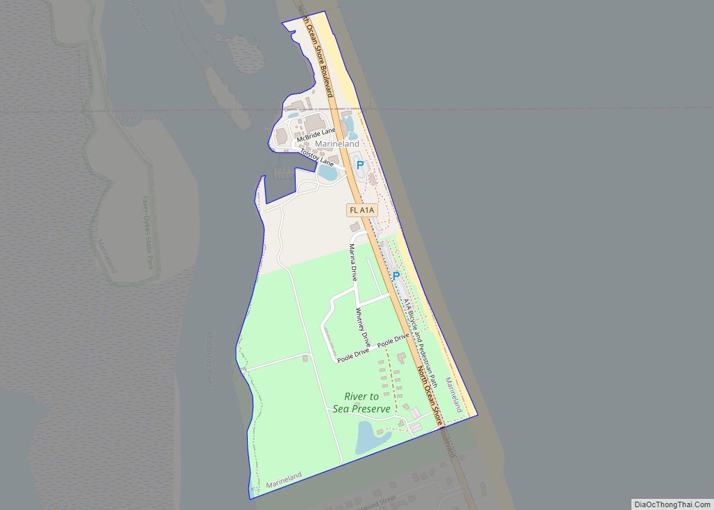
Online Interactive Map
Click on ![]() to view map in "full screen" mode.
to view map in "full screen" mode.
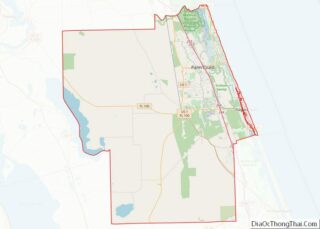
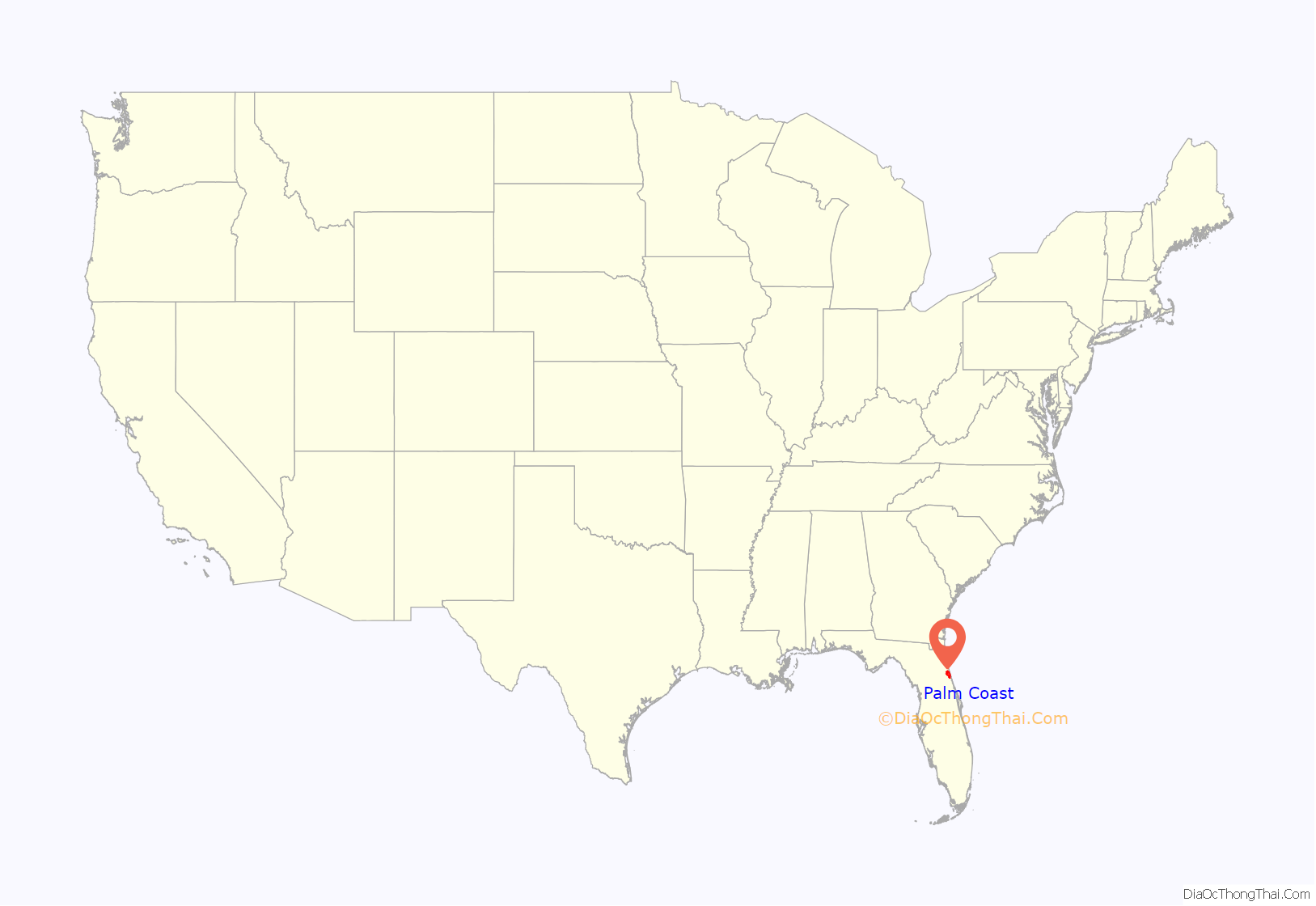
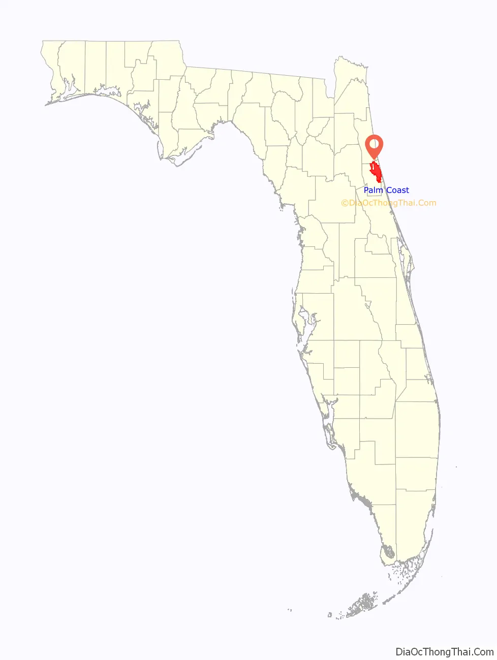
Palm Coast location map. Where is Palm Coast city?
History
In the late 1950s, most of the land that would become Palm Coast consisted of swamp and pine forest, with only a few farms and beach houses as well as a turpentine distillery. Business activity was concentrated along Florida State Road 100. Tourists paid fees to hunt and fish in the area.
Developed by ITT Community Development Corporation (Levitt) in 1969, the original development plan encompassed 48,000 home sites on approximately 42,000 acres (17,000 ha) of the 68,000 acres (28,000 ha) owned by ITT. Paved streets and central water and sewer served all lots developed within the plan. An extensive water management system was designed to replenish the area’s water table, which includes 46 miles (74 km) of freshwater canals and 23 miles (37 km) of saltwater canals. On October 29, 1970, ITT built Palm Coast’s welcome center. This date is now celebrated as Founder’s Day.
In 1975, the Flagler County Board of County Commissioners established Palm Coast Service District, which included almost 40,000 acres (16,000 ha). Funds for the district were derived primarily from ad valorem taxes and were used to provide fire services, fire hydrants, street lighting, animal control and emergency services.
Florida had its first serious “wildland urban interface” fire in 1985 with the Palm Coast Fire, which burned 131 homes. Research on this fire indicated that the most important factor was the proximity of heavy ground vegetation to the structures. Thirteen years later, fires struck the same Palm Coast subdivision. The 1998 fires were national news because the whole county was ordered to evacuate, and 45,000 people were displaced. Fire suppression organizations responded from 44 states, and Florida hosted the largest aerial suppression operation ever conducted in the United States. Because of the massive effort, only 71 homes were destroyed.
In September 1999, the citizenry of Palm Coast voted by a margin of two to one to incorporate as a council/manager form of government. On December 31, 1999, the City of Palm Coast was officially incorporated. On October 1, 2000, all services were officially transferred from the former Service District to the city of Palm Coast. The five-member City Council is elected at large and serves staggered four-year terms. One member is elected as mayor. The promulgation and adoption of policy are the responsibility of the council and the execution of such policy is the responsibility of the council-appointed city manager. The city hired its first city manager on April 17, 2000.
The city provides a wide range of services including development services, fire services, street construction and maintenance, parks and recreational activities. Palm Coast contracts with the Flagler County Sheriff’s Office for law enforcement services. As of 2012, the city has plans under way for a new city hall, a town center, new fire stations, and additional lands for parks. Preservation and protection of environmentally sensitive lands is a key goal of this city as it prepares for the future.
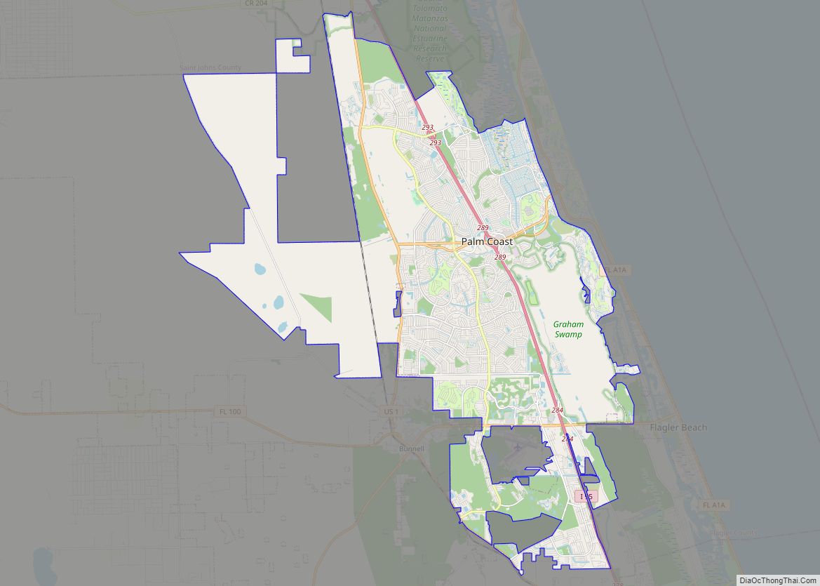
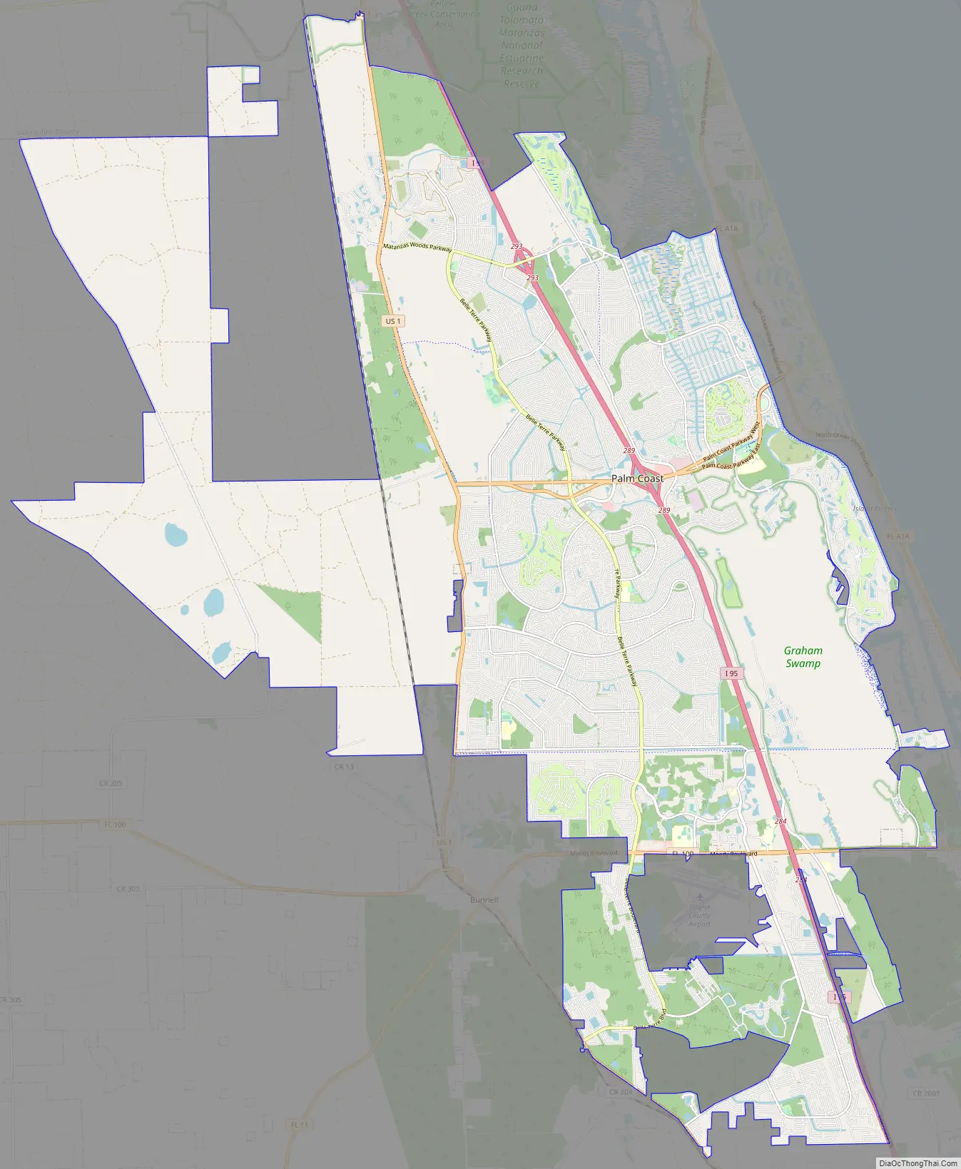
Palm Coast Road Map
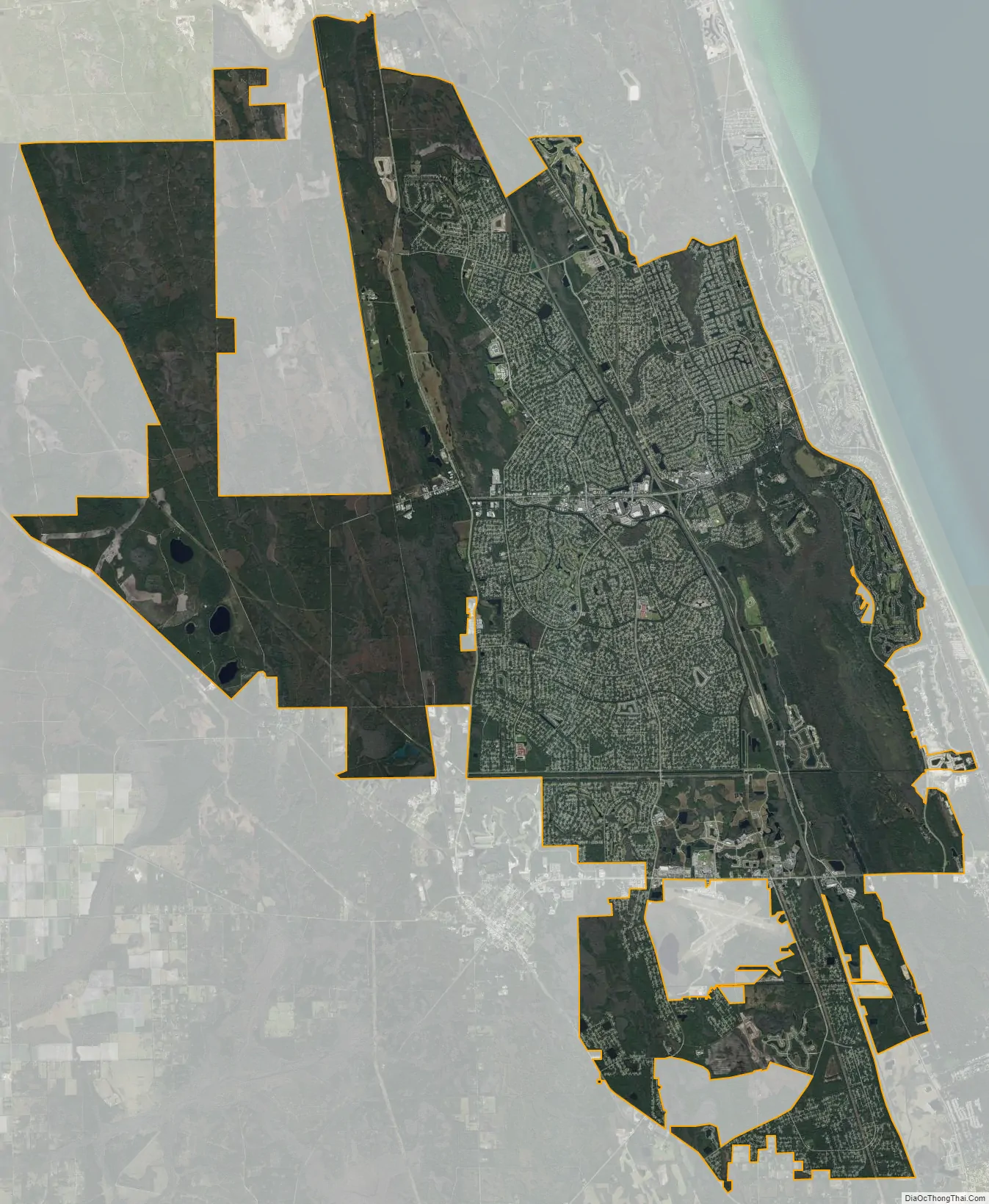
Palm Coast city Satellite Map
Geography
Palm Coast is located in northeastern Flagler County at 29°32′17″N 81°13′24″W / 29.538128°N 81.223385°W / 29.538128; -81.223385. According to the United States Census Bureau, the city has a total area of 90.8 square miles (235.3 km), of which 89.9 square miles (232.8 km) is land and 0.97 square miles (2.5 km), or 1.06%, is water. The city extends north to the Flagler County line, southwest to the Bunnell city limits, and southeast to touch the city of Flagler Beach.
Interstate 95 crosses Palm Coast from north to south, with access from Exit 293 (Matanzas Woods Parkway), Exit 289 (Palm Coast Parkway), and Exit 284 (Florida State Road 100). U.S. Route 1 runs parallel to I-95 through the western side of Palm Coast, leading into Bunnell.
The area around Palm Coast last saw a direct hit from a tropical cyclone in 2004 when Hurricane Charley passed directly over the area. Since 1851 when hurricane tracking data began, 33 hurricanes and tropical storms have directly affected the area.
Palm Coast has become a bedroom community for St. Augustine, 25 miles (40 km) to the north, and Daytona Beach, 30 miles (48 km) to the south, while some residents also work in Orlando and Jacksonville.
Climate
See also
Map of Florida State and its subdivision:- Alachua
- Baker
- Bay
- Bradford
- Brevard
- Broward
- Calhoun
- Charlotte
- Citrus
- Clay
- Collier
- Columbia
- Desoto
- Dixie
- Duval
- Escambia
- Flagler
- Franklin
- Gadsden
- Gilchrist
- Glades
- Gulf
- Hamilton
- Hardee
- Hendry
- Hernando
- Highlands
- Hillsborough
- Holmes
- Indian River
- Jackson
- Jefferson
- Lafayette
- Lake
- Lee
- Leon
- Levy
- Liberty
- Madison
- Manatee
- Marion
- Martin
- Miami-Dade
- Monroe
- Nassau
- Okaloosa
- Okeechobee
- Orange
- Osceola
- Palm Beach
- Pasco
- Pinellas
- Polk
- Putnam
- Saint Johns
- Saint Lucie
- Santa Rosa
- Sarasota
- Seminole
- Sumter
- Suwannee
- Taylor
- Union
- Volusia
- Wakulla
- Walton
- Washington
- Alabama
- Alaska
- Arizona
- Arkansas
- California
- Colorado
- Connecticut
- Delaware
- District of Columbia
- Florida
- Georgia
- Hawaii
- Idaho
- Illinois
- Indiana
- Iowa
- Kansas
- Kentucky
- Louisiana
- Maine
- Maryland
- Massachusetts
- Michigan
- Minnesota
- Mississippi
- Missouri
- Montana
- Nebraska
- Nevada
- New Hampshire
- New Jersey
- New Mexico
- New York
- North Carolina
- North Dakota
- Ohio
- Oklahoma
- Oregon
- Pennsylvania
- Rhode Island
- South Carolina
- South Dakota
- Tennessee
- Texas
- Utah
- Vermont
- Virginia
- Washington
- West Virginia
- Wisconsin
- Wyoming