Map of Panama City
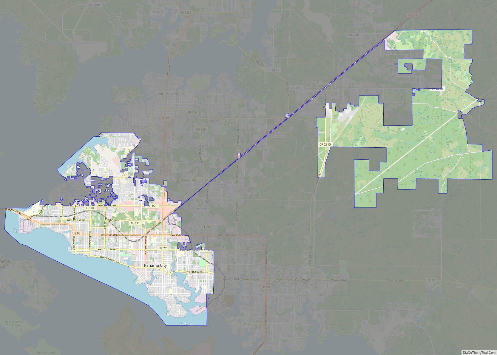
Panama City is a city in and the county seat of Bay County, Florida, United States. Located along U.S. Highway 98 (US 98), it is the largest city between Tallahassee and Pensacola. It is also the most populated city of the Panama City–Lynn Haven, Florida metropolitan statistical area. Panama City was severely damaged when Hurricane Michael ... Read more
Map of Panama City
Map of Panama City Beach city
Panama City Beach is a resort town in Bay County, Florida, United States, on the Gulf of Mexico coast. As of the 2010 census it had a population of 12,018. The city is often referred to under the umbrella term of “Panama City“. Panama City Beach’s slogan is “The World’s Most Beautiful Beaches” due to ... Read more
Map of Panama City Beach city
Map of Pasadena Hills CDP, Florida
Pasadena Hills is an unincorporated community and census-designated place in Pasco County, Florida, United States. Its population was 7,570 as of the 2010 census. The community was originally planned in 1925. Pasadena Hills CDP overview: Name: Pasadena Hills CDP LSAD Code: 57 LSAD Description: CDP (suffix) State: Florida County: Pasco County Elevation: 187 ft (57 m) Total ... Read more
Map of Pasadena Hills CDP, Florida
Map of Parkland city, Florida
Parkland is a suburban city, 42 miles northwest of Miami, in northern Broward County, Florida, United States. As of the 2020 census, the population of Parkland was 34,670. Parkland is part of the Miami metropolitan area, which was home to 6,166,488 people in 2020. Parkland’s zoning laws are designed to protect the “park-like” character of ... Read more
Map of Parkland city, Florida
Map of Parker city, Florida
Parker is a city in Bay County, Florida, United States. As of the 2010 census it had a population of 4,317. It is part of the Panama City–Lynn Haven–Panama City Beach Metropolitan Statistical Area. Parker city overview: Name: Parker city LSAD Code: 25 LSAD Description: city (suffix) State: Florida County: Bay County Incorporated: 1967 Elevation: ... Read more
Map of Parker city, Florida
Map of Pea Ridge CDP, Florida
Pea Ridge is community in Santa Rosa County, Florida, United States, located along U.S. Highway 90, east of Pace. It was designated a Census-designated place (CDP) by the Census Bureau after the 2010 census. The CDP had a total area of 2.82 square miles (7.3 km) and a population 3,587 in 2010. Pea Ridge is located ... Read more
Map of Pea Ridge CDP, Florida
Map of Paxton town, Florida
Paxton is a town in Walton County, Florida, United States. The population was 644 as of the 2010 census. Located near Britton Hill on the Alabama–Florida state line, the town has the highest elevation of any in Florida. Paxton town overview: Name: Paxton town LSAD Code: 43 LSAD Description: town (suffix) State: Florida County: Walton ... Read more
Map of Paxton town, Florida
Map of Patrick AFB CDP
Patrick AFB CDP overview: Name: Patrick AFB CDP LSAD Code: 57 LSAD Description: CDP (suffix) State: Florida County: Brevard County FIPS code: 1255375 Online Interactive Map Patrick AFB online map. Source: Basemap layers from Google Map, Open Street Map (OSM), Arcgisonline, Wmflabs. Boundary Data from Database of Global Administrative Areas. Patrick AFB location map. Where ... Read more
Map of Patrick AFB CDP
Map of Pembroke Park town
Pembroke Park is a town in Broward County, Florida, United States. The town took its name from its location along Pembroke Road. As of the 2020 census, the population was 6,260. It is part of the South Florida metropolitan area, which was home to 5,564,635 people at the 2010 census. Almost one-half of its residents ... Read more
Map of Pembroke Park town
Map of Pelican Bay CDP, Florida
Pelican Bay is a census-designated place (CDP) in Collier County, Florida, United States. The population was 6,346 at the 2010 census. It is part of the Naples–Marco Island Metropolitan Statistical Area. Pelican Bay CDP overview: Name: Pelican Bay CDP LSAD Code: 57 LSAD Description: CDP (suffix) State: Florida County: Collier County Elevation: 13 ft (4 m) Total ... Read more
Map of Pelican Bay CDP, Florida
Map of Pebble Creek CDP
Pebble Creek is a census-designated place (CDP) in Hillsborough County, Florida, United States. The population was 9,624 at the 2020 census, up from 7,622 at the 2010 census. Pebble Creek is located in the unincorporated portion of New Tampa, and is primarily a residential zone. Pebble Creek CDP overview: Name: Pebble Creek CDP LSAD Code: ... Read more
Map of Pebble Creek CDP
Map of Pierson town, Florida
Pierson is a town in Volusia County, Florida, United States. The population was 1,542 as of the 2020 census. Pierson bills itself as the “Fern Capital of the World”. The town is heavily reliant on agriculture which mainly consists of fern growing. Its ferns are exported worldwide for use in floral arrangements and other decorations. ... Read more
Map of Pierson town, Florida