Map of South Pasadena city, Florida
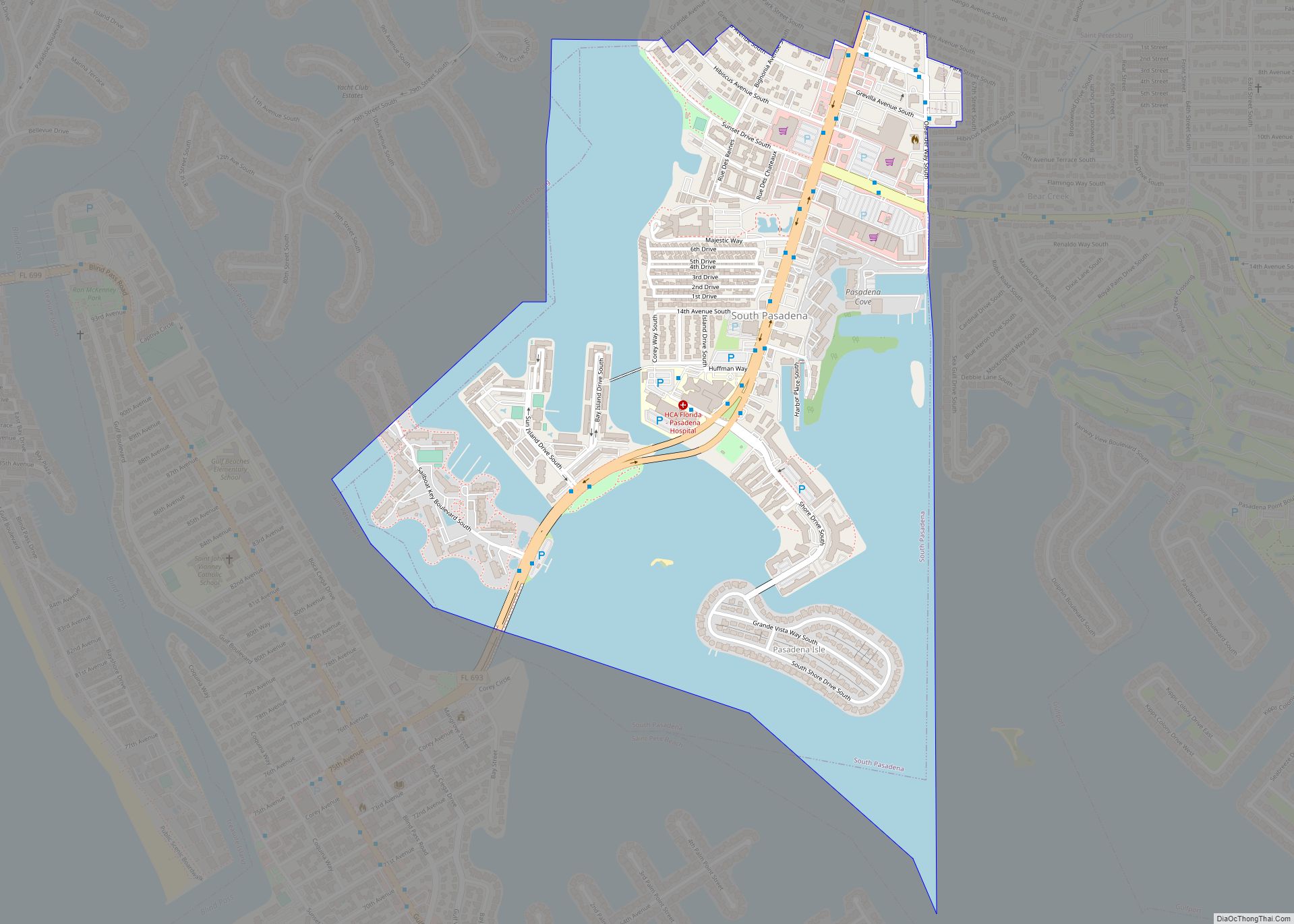
South Pasadena is a city in southern Pinellas County, Florida, United States, near St. Pete Beach and Gulfport. The population was 5,353 at the 2020 census. Gulfport is part of the Tampa–St. Petersburg–Clearwater metropolitan statistical area. South Pasadena city overview: Name: South Pasadena city LSAD Code: 25 LSAD Description: city (suffix) State: Florida County: Pinellas ... Read more
Map of South Pasadena city, Florida
Map of South Palm Beach town
South Palm Beach is a town located in Palm Beach County, Florida, United States. The town is situated on a barrier island between the Atlantic Ocean and the Intracoastal Waterway. The entire town is approximately 5⁄8 of a mile (1.0 km) long along South Ocean Boulevard (Florida State Road A1A), its only street. It is between ... Read more
Map of South Palm Beach town
Map of Southchase CDP
Southchase is a census-designated place and an unincorporated area in Orange County, Florida, United States. The population was 15,921 at the 2010 census. It is part of the Orlando–Kissimmee–Sanford, Florida Metropolitan Statistical Area. Southchase CDP overview: Name: Southchase CDP LSAD Code: 57 LSAD Description: CDP (suffix) State: Florida County: Orange County Elevation: 89 ft (27 m) Total ... Read more
Map of Southchase CDP
Map of South Venice CDP
South Venice is a census-designated place (CDP) in Sarasota County, Florida, United States. The population was 13,949 at the 2010 census. It is part of the Bradenton–Sarasota–Venice Metropolitan Statistical Area. South Venice CDP overview: Name: South Venice CDP LSAD Code: 57 LSAD Description: CDP (suffix) State: Florida County: Sarasota County Elevation: 13 ft (4 m) Total Area: ... Read more
Map of South Venice CDP
Map of South Sarasota CDP
South Sarasota is a census-designated place (CDP) in Sarasota County, Florida, United States. The population was 4,950 at the 2010 census. It is part of the Bradenton–Sarasota–Venice Metropolitan Statistical Area. South Sarasota CDP overview: Name: South Sarasota CDP LSAD Code: 57 LSAD Description: CDP (suffix) State: Florida County: Sarasota County Elevation: 13 ft (4 m) Total Area: ... Read more
Map of South Sarasota CDP
Map of Southwest Ranches town
Southwest Ranches is a town in Broward County, Florida, United States. It is a suburban community part of the Miami metropolitan area and is located on the eastern edge of the Everglades, 15 miles (24 km) southwest of Fort Lauderdale and about 22 miles (35 km) northwest of Miami. It is unusual in that it consists of ... Read more
Map of Southwest Ranches town
Map of Southgate CDP, Florida
Southgate is a census-designated place (CDP) in Sarasota County, Florida, United States. The population was 7,173 at the 2010 census. It is part of the Bradenton–Sarasota–Venice Metropolitan Statistical Area. Southgate CDP overview: Name: Southgate CDP LSAD Code: 57 LSAD Description: CDP (suffix) State: Florida County: Sarasota County Elevation: 0 ft (0 m) Total Area: 1.74 sq mi (4.50 km²) Land ... Read more
Map of Southgate CDP, Florida
Map of Southeast Arcadia CDP
Southeast Arcadia is a census-designated place (CDP) in DeSoto County, Florida, United States. The population was 6,554 at the 2010 census. Southeast Arcadia CDP overview: Name: Southeast Arcadia CDP LSAD Code: 57 LSAD Description: CDP (suffix) State: Florida County: DeSoto County Total Area: 7.24 sq mi (18.75 km²) Land Area: 7.24 sq mi (18.75 km²) Water Area: 0.00 sq mi (0.00 km²) Total Population: ... Read more
Map of Southeast Arcadia CDP
Map of Spring Ridge CDP, Florida
Spring Ridge is an unincorporated community and census-designated place (CDP) in Gilchrist County, Florida, United States. The population was 442 at the 2020 census. Spring Ridge CDP overview: Name: Spring Ridge CDP LSAD Code: 57 LSAD Description: CDP (suffix) State: Florida County: Gilchrist County Elevation: 50 ft (20 m) Total Area: 3.21 sq mi (8.32 km²) Land Area: 3.21 sq mi (8.32 km²) ... Read more
Map of Spring Ridge CDP, Florida
Map of Spring Lake CDP, Florida
Spring Lake is an unincorporated community and census-designated place (CDP) in Hernando County, Florida, United States. The population was 458 at the 2010 census, up from 327 at the 2000 census. Spring Lake CDP overview: Name: Spring Lake CDP LSAD Code: 57 LSAD Description: CDP (suffix) State: Florida County: Hernando County Elevation: 310 ft (90 m) Total ... Read more
Map of Spring Lake CDP, Florida
Map of Spring Hill CDP, Florida
Spring Hill is a census-designated place (CDP) in Hernando County, Florida, United States. The population was 113,568 at the 2020 census, up from 98,621 at the 2010 census. Spring Hill belongs to Florida’s Nature Coast region and is in the Tampa-St. Petersburg-Clearwater metro area. It is east of Hernando Beach, southwest of Brooksville, and north ... Read more
Map of Spring Hill CDP, Florida
Map of Springhill CDP, Florida
Spring Hill (also known as Springhill) is an unincorporated community and census-designated place in Santa Rosa County, Florida, United States. Its population was 160 as of the 2010 census. Springhill CDP overview: Name: Springhill CDP LSAD Code: 57 LSAD Description: CDP (suffix) State: Florida County: Santa Rosa County Elevation: 200 ft (60 m) Total Area: 12.523 sq mi (32.43 km²) ... Read more
Map of Springhill CDP, Florida