Map of Westminster CDP, Louisiana
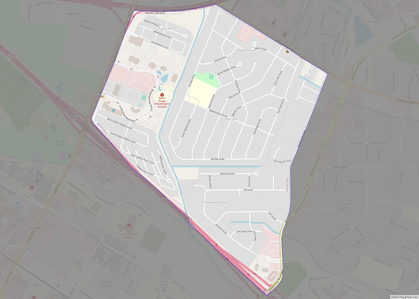
Westminster is a census-designated place (CDP) in East Baton Rouge Parish, Louisiana, United States. The population was 3,008 at the 2010 census, up from 2,515 in 2000. It is part of the Baton Rouge Metropolitan Statistical Area. It is in the proposed City of St. George. Westminster CDP overview: Name: Westminster CDP LSAD Code: 57 ... Read more
Map of Westminster CDP, Louisiana
Map of Winnfield city
Winnfield is a small city in, and the parish seat of, Winn Parish, Louisiana, United States. The population was 5,749 at the 2000 census, and 4,840 in 2010. Three governors of the state of Louisiana were from Winnfield. Winnfield city overview: Name: Winnfield city LSAD Code: 25 LSAD Description: city (suffix) State: Louisiana County: Winn ... Read more
Map of Winnfield city
Map of Wilson village, Louisiana
Wilson is a village in East Feliciana Parish, Louisiana, United States. The population was 595 at the 2010 census, down from 668 in 2000. It is part of the Baton Rouge Metropolitan Statistical Area. Wilson village overview: Name: Wilson village LSAD Code: 47 LSAD Description: village (suffix) State: Louisiana County: East Feliciana Parish Elevation: 256 ft ... Read more
Map of Wilson village, Louisiana
Map of White Castle town
White Castle is a town in Iberville Parish, Louisiana, United States. At the 2010 U.S. census the town population was 1,883, and 1,640 at the 2020 population estimates program. It is part of the Baton Rouge metropolitan area. White Castle town overview: Name: White Castle town LSAD Code: 43 LSAD Description: town (suffix) State: Louisiana ... Read more
Map of White Castle town
Map of Woodmere CDP, Louisiana
Woodmere is an unincorporated community and census-designated place (CDP) in Jefferson Parish, Louisiana, United States. The population was 12,080 at the 2010 census, and 11,238 at the 2020 census. It is part of the New Orleans–Metairie–Kenner metropolitan statistical area. Woodmere CDP overview: Name: Woodmere CDP LSAD Code: 57 LSAD Description: CDP (suffix) State: Louisiana County: ... Read more
Map of Woodmere CDP, Louisiana
Map of Wisner town, Louisiana
Wisner is a town in Franklin Parish, Louisiana, United States. The population was 964 at the 2010 census, down from 1,140 in 2000. Wisner town overview: Name: Wisner town LSAD Code: 43 LSAD Description: town (suffix) State: Louisiana County: Franklin Parish Elevation: 75 ft (23 m) Total Area: 0.80 sq mi (2.06 km²) Land Area: 0.80 sq mi (2.06 km²) Water Area: 0.00 sq mi ... Read more
Map of Wisner town, Louisiana
Map of Winnsboro city, Louisiana
Winnsboro is a city in, and the parish seat of Franklin Parish, Louisiana, United States. As of 2020, its population was 4,862. Winnsboro city overview: Name: Winnsboro city LSAD Code: 25 LSAD Description: city (suffix) State: Louisiana County: Franklin Parish Total Area: 4.06 sq mi (10.52 km²) Land Area: 4.00 sq mi (10.35 km²) Water Area: 0.06 sq mi (0.16 km²) Total Population: 4,862 ... Read more
Map of Winnsboro city, Louisiana
Map of Zachary city
Zachary is a city in East Baton Rouge Parish, Louisiana, United States. It lies 16 miles (26 km) north of the city of Baton Rouge, and had a population of 14,960 at the 2010 census, up from 11,275 in 2000. At the 2020 census, Zachary’s population increased to 19,316. Zachary city overview: Name: Zachary city LSAD ... Read more
Map of Zachary city
Map of Youngsville city, Louisiana
Youngsville is a city in Lafayette Parish, Louisiana, United States, and is part of the Lafayette metropolitan statistical area. The population was 8,105 at the 2010 U.S. census, and 15,929 at the 2020 United States census. Youngsville was the birthplace of Louisiana businessman and politician Dudley J. LeBlanc, the entrepreneur of the Hadacol fortune of ... Read more
Map of Youngsville city, Louisiana
Map of Woodworth town, Louisiana
Woodworth is a town in Rapides Parish, Louisiana, United States. It is part of the Alexandria, Louisiana Metropolitan Statistical Area. The population was 1,096 at the 2010 census. This town is growing rapidly with a number of residential subdivisions under development. Woodworth is emerging as a bedroom community for nearby Alexandria, to the northeast. Louisiana ... Read more
Map of Woodworth town, Louisiana
Map of Zwolle town
Zwolle (/zəˈwɒli/ zə-WOL-ee) is a small town in Sabine Parish, Louisiana, United States. The population was 1,759 at the 2010 census, down from 1,783 in 2000. It was named after Zwolle, a Dutch city in Overijssel. Zwolle town overview: Name: Zwolle town LSAD Code: 43 LSAD Description: town (suffix) State: Louisiana County: Sabine Parish Total ... Read more
Map of Zwolle town
Map of Acushnet Center CDP
Acushnet Center CDP overview: Name: Acushnet Center CDP LSAD Code: 57 LSAD Description: CDP (suffix) State: Massachusetts County: Bristol County FIPS code: 2500530 Online Interactive Map Acushnet Center online map. Source: Basemap layers from Google Map, Open Street Map (OSM), Arcgisonline, Wmflabs. Boundary Data from Database of Global Administrative Areas. Acushnet Center location map. Where ... Read more
Map of Acushnet Center CDP