Youngsville is a city in Lafayette Parish, Louisiana, United States, and is part of the Lafayette metropolitan statistical area. The population was 8,105 at the 2010 U.S. census, and 15,929 at the 2020 United States census.
Youngsville was the birthplace of Louisiana businessman and politician Dudley J. LeBlanc, the entrepreneur of the Hadacol fortune of the 1950s. Bernard LeBas of Ville Platte has represented Evangeline and St. Landry parishes in the Louisiana House of Representatives since 2008. He is a former resident of Youngsville.
| Name: | Youngsville city |
|---|---|
| LSAD Code: | 25 |
| LSAD Description: | city (suffix) |
| State: | Louisiana |
| County: | Lafayette Parish |
| Elevation: | 26 ft (8 m) |
| Total Area: | 12.45 sq mi (32.25 km²) |
| Land Area: | 12.45 sq mi (32.25 km²) |
| Water Area: | 0.00 sq mi (0.00 km²) |
| Total Population: | 15,929 |
| Population Density: | 1,279.23/sq mi (493.90/km²) |
| Area code: | 337 |
| FIPS code: | 2283335 |
| Website: | www.youngsville.us |
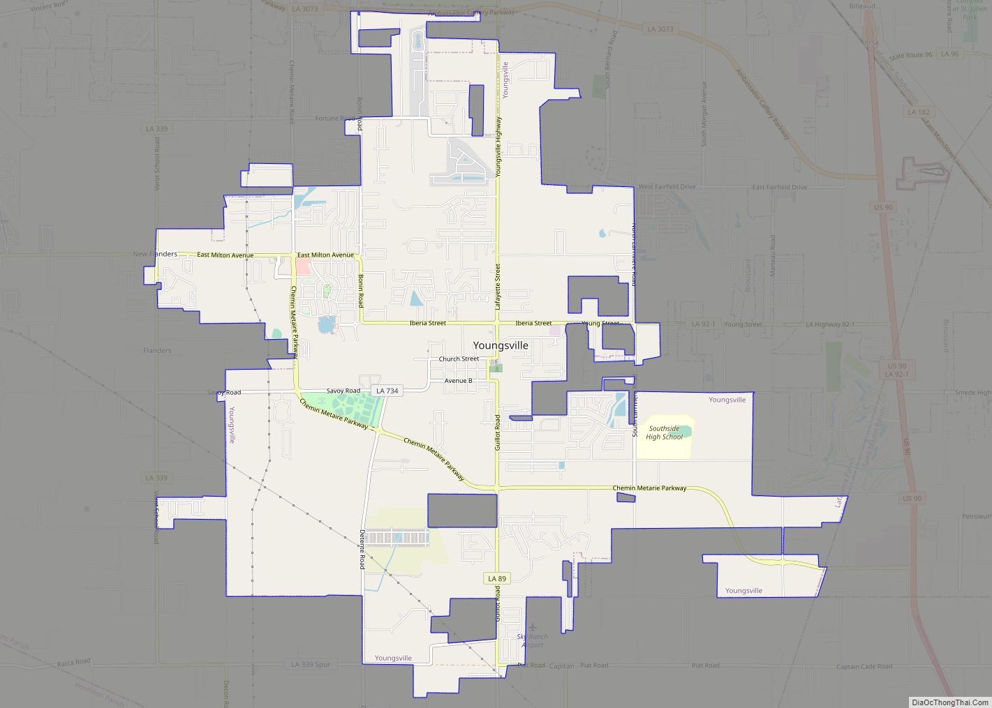
Online Interactive Map
Click on ![]() to view map in "full screen" mode.
to view map in "full screen" mode.
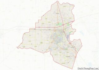
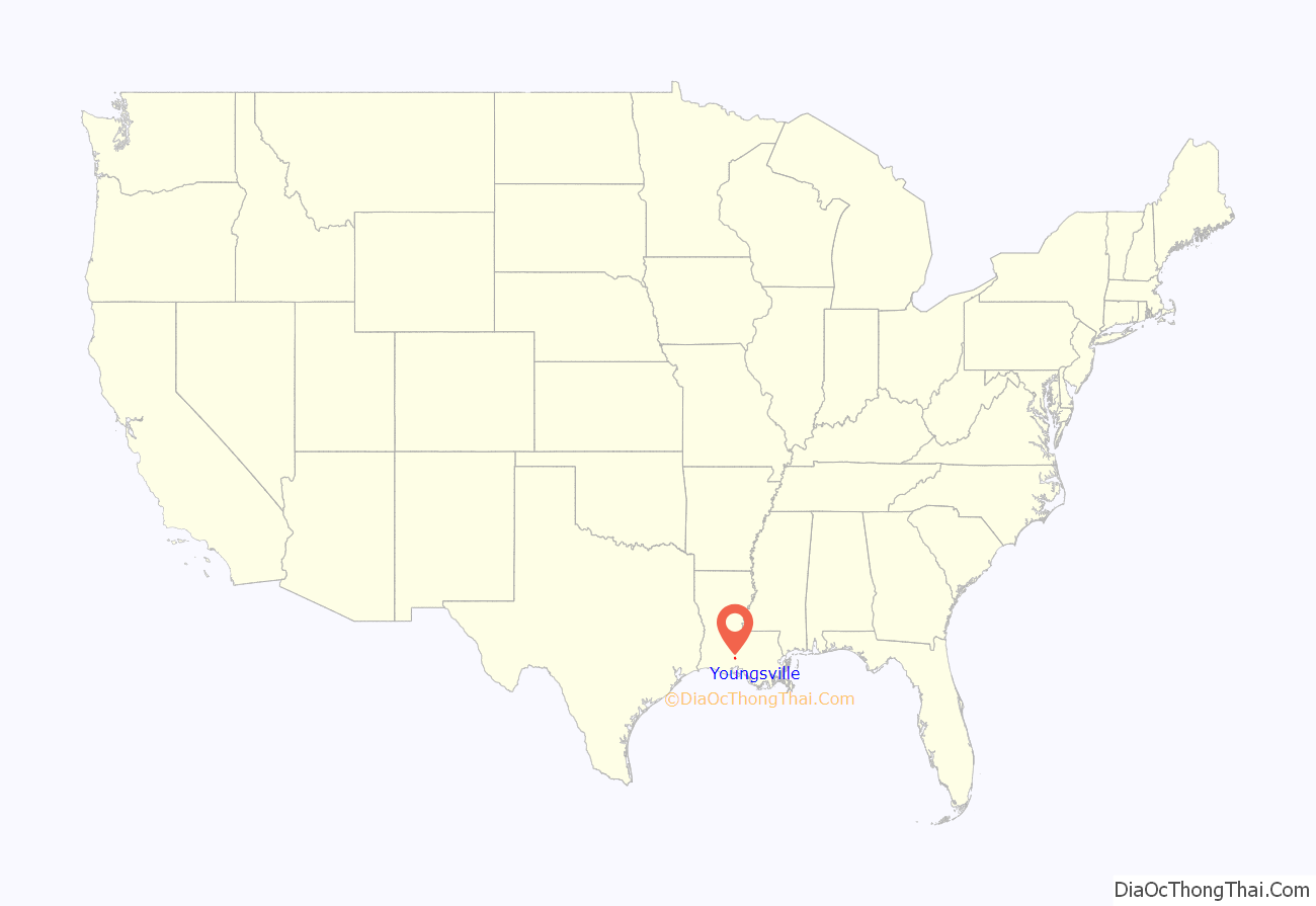
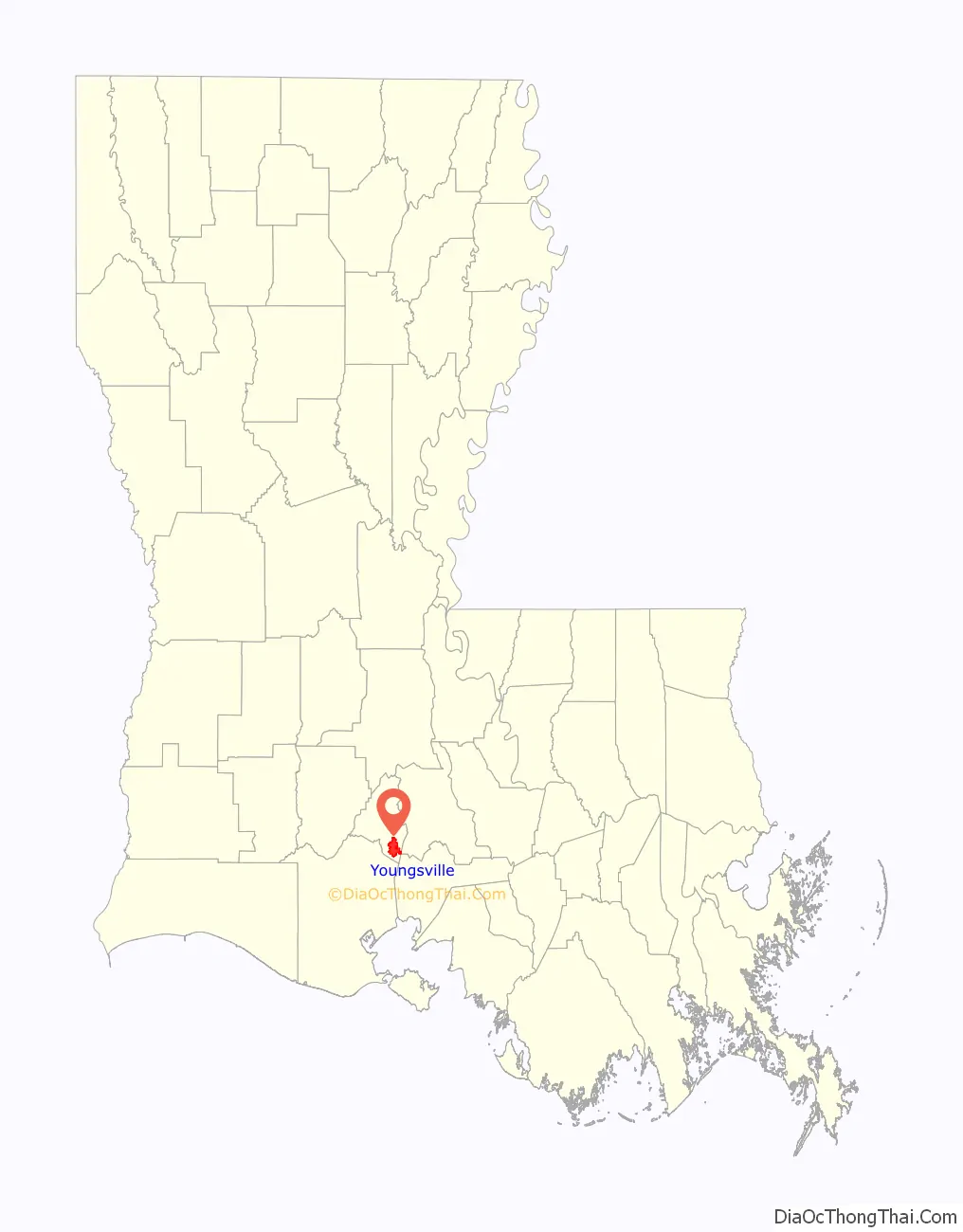
Youngsville location map. Where is Youngsville city?
History
Youngsville was settled in the early 19th century by French Acadian farmers. Prior to 1839, George Roy and his son, Desire, laid out the area and named the community “Royville”. The settlement had grown large enough by 1859 to establish one of the oldest Catholic churches in Lafayette Parish: St. Anne Church, on the community’s oldest street, Church Street. In 1908, the U.S. Postal Service asked village leaders to change the name because the town was being confused with the north Louisiana town of Rayville. So in 1908, the village of Youngsville was incorporated, with the name meaning “young village”. It chose a government of a mayor and three aldermen.
On January 20, 1983, Louisiana Governor David C. Treen declared Youngsville a town. The town increased its governing body to a mayor and five aldermen to accommodate its population.
Youngsville was the fastest growing town in Louisiana from 1990 to 2005. Its population has increased by over 300 percent. According to the 2010 U.S. census, Youngsville grew at a rate of 103% between year 2000 and 2010. Youngsville was declared a city by Governor Kathleen Blanco in 2006. In 2007, Mayor Wilson Viator and the Youngsville City Council named Joey Langlinais as the Chairman of the Centennial Committee.
Although the city has extended its boundaries and expanded its services, Youngsville has remained a rural city surrounded by sugarcane farms.
On the morning of August 12, 2016, rain began to fall over Youngsville, as well as much of the south central part of the state, in what is now being considered to be the state’s worst flood disaster by rainfall on record, in some areas.
The Louisiana flood of 2016 was triggered by a complicated, slow-moving low-pressure weather system that dumped as much as two feet of rain on several parishes in 48 hours. The record two-day rainfall in some areas had a 0.1 percent chance of occurring in any year, the equivalent of a “1,000-year rain”, according to the Lower Mississippi River Forecast Center, based at the Slidell office of the National Weather Service.
In the two-day period ending Saturday at 8 p.m., several areas also saw rainfall amounts equaling a 1 percent chance of occurring in any year, a so-called 100-year event. The Red Cross called this “the worst natural disaster since Hurricane Sandy”.
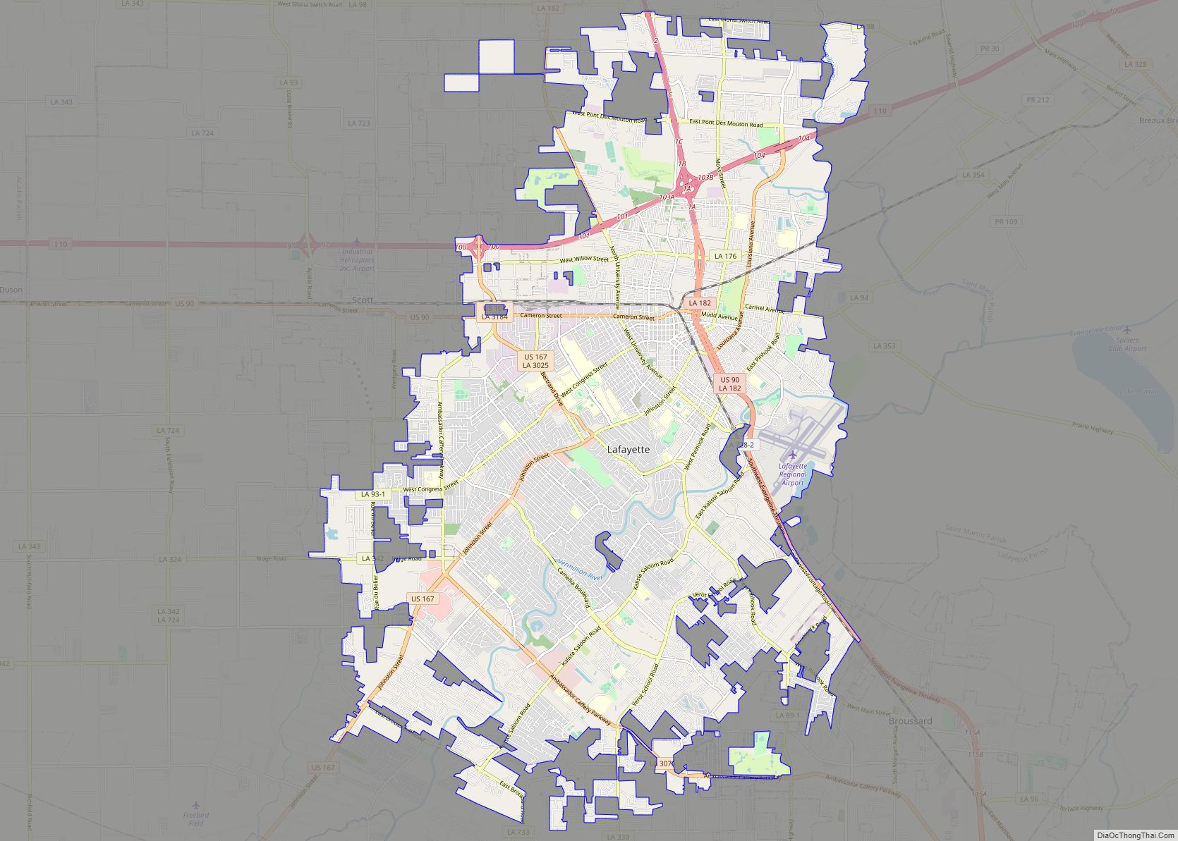
Youngsville Road Map
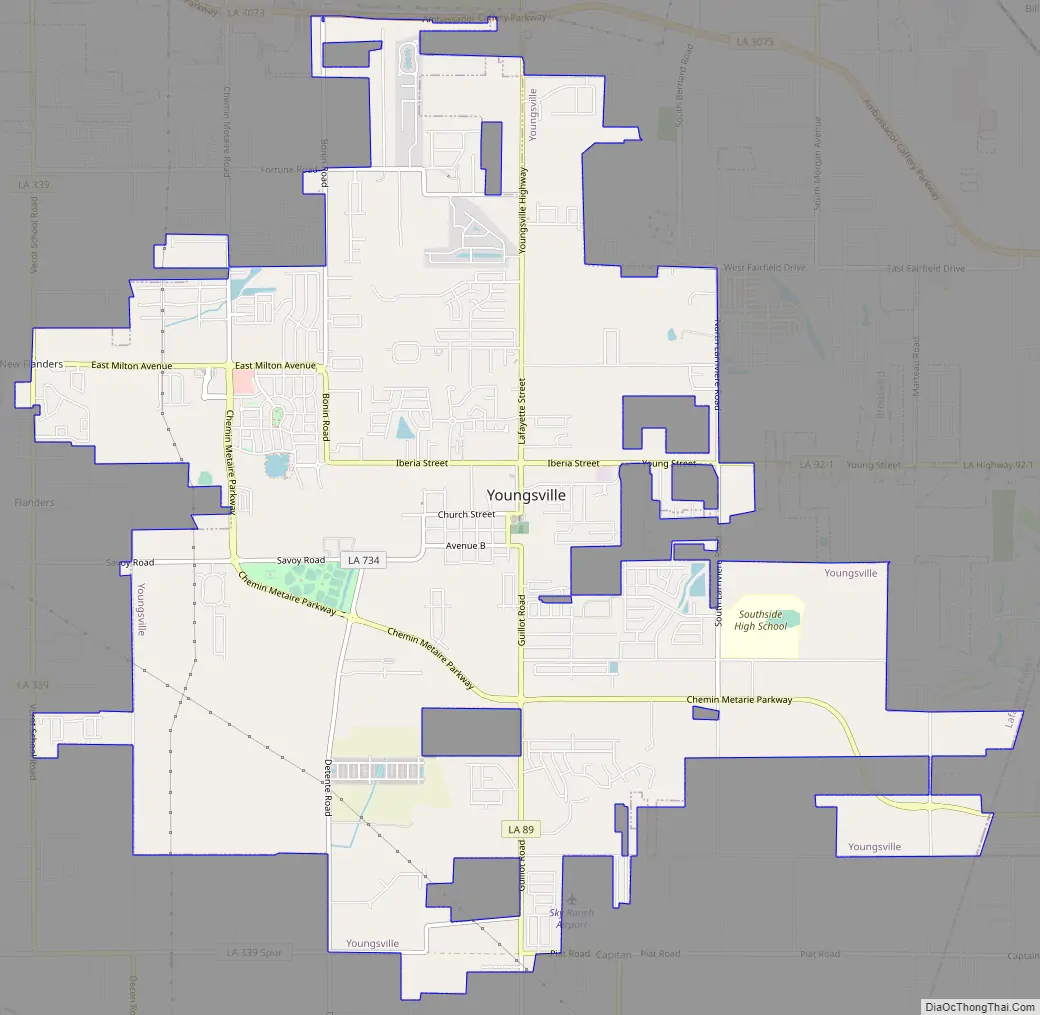
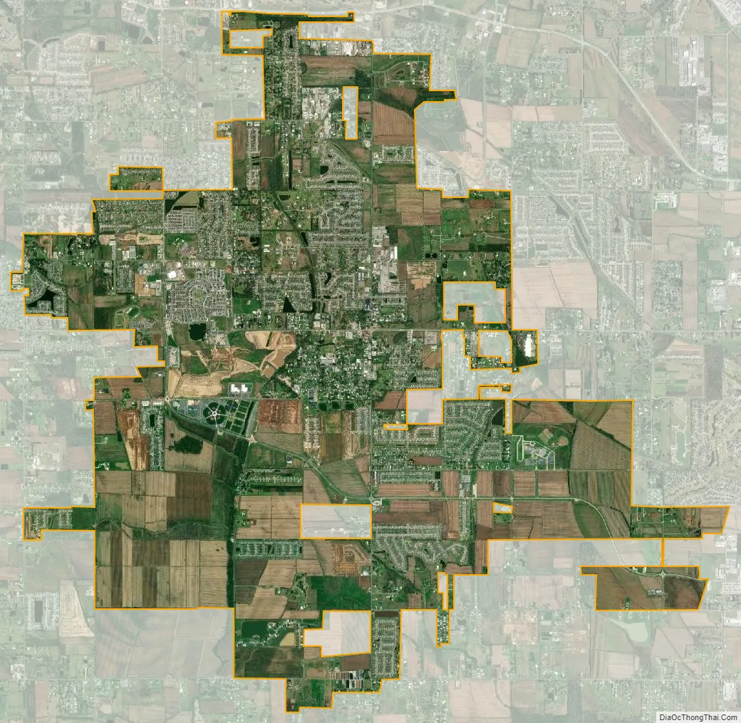
Youngsville city Satellite Map
Geography
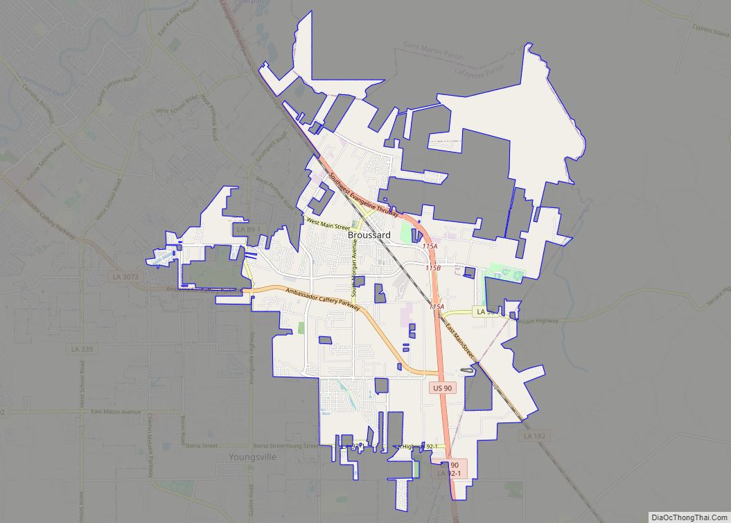
Youngsville is located in southeastern Lafayette Parish at 30°6′2″N 91°59′27″W / 30.10056°N 91.99083°W / 30.10056; -91.99083 (30.100595, -91.990707). It is bordered to the north by Lafayette, the parish seat, and to the east by the city of Broussard.
The center of Lafayette is 10 miles (16 km) to the north, Abbeville is 16 miles (26 km) to the southwest, and New Iberia is 16 miles to the southeast. According to the United States Census Bureau, Youngsville has a total land area of 12.07 square miles (31.26 km), all of it recorded as land.
See also
Map of Louisiana State and its subdivision:- Acadia
- Allen
- Ascension
- Assumption
- Avoyelles
- Beauregard
- Bienville
- Bossier
- Caddo
- Calcasieu
- Caldwell
- Cameron
- Catahoula
- Claiborne
- Concordia
- De Soto
- East Baton Rouge
- East Carroll
- East Feliciana
- Evangeline
- Franklin
- Grant
- Iberia
- Iberville
- Jackson
- Jefferson
- Jefferson Davis
- La Salle
- Lafayette
- Lafourche
- Lincoln
- Livingston
- Madison
- Morehouse
- Natchitoches
- Orleans
- Ouachita
- Plaquemines
- Pointe Coupee
- Rapides
- Red River
- Richland
- Sabine
- Saint Bernard
- Saint Charles
- Saint Helena
- Saint James
- Saint John the Baptist
- Saint Landry
- Saint Martin
- Saint Mary
- Saint Tammany
- Tangipahoa
- Tensas
- Terrebonne
- Union
- Vermilion
- Vernon
- Washington
- Webster
- West Baton Rouge
- West Carroll
- West Feliciana
- Winn
- Alabama
- Alaska
- Arizona
- Arkansas
- California
- Colorado
- Connecticut
- Delaware
- District of Columbia
- Florida
- Georgia
- Hawaii
- Idaho
- Illinois
- Indiana
- Iowa
- Kansas
- Kentucky
- Louisiana
- Maine
- Maryland
- Massachusetts
- Michigan
- Minnesota
- Mississippi
- Missouri
- Montana
- Nebraska
- Nevada
- New Hampshire
- New Jersey
- New Mexico
- New York
- North Carolina
- North Dakota
- Ohio
- Oklahoma
- Oregon
- Pennsylvania
- Rhode Island
- South Carolina
- South Dakota
- Tennessee
- Texas
- Utah
- Vermont
- Virginia
- Washington
- West Virginia
- Wisconsin
- Wyoming