Map of East Douglas CDP
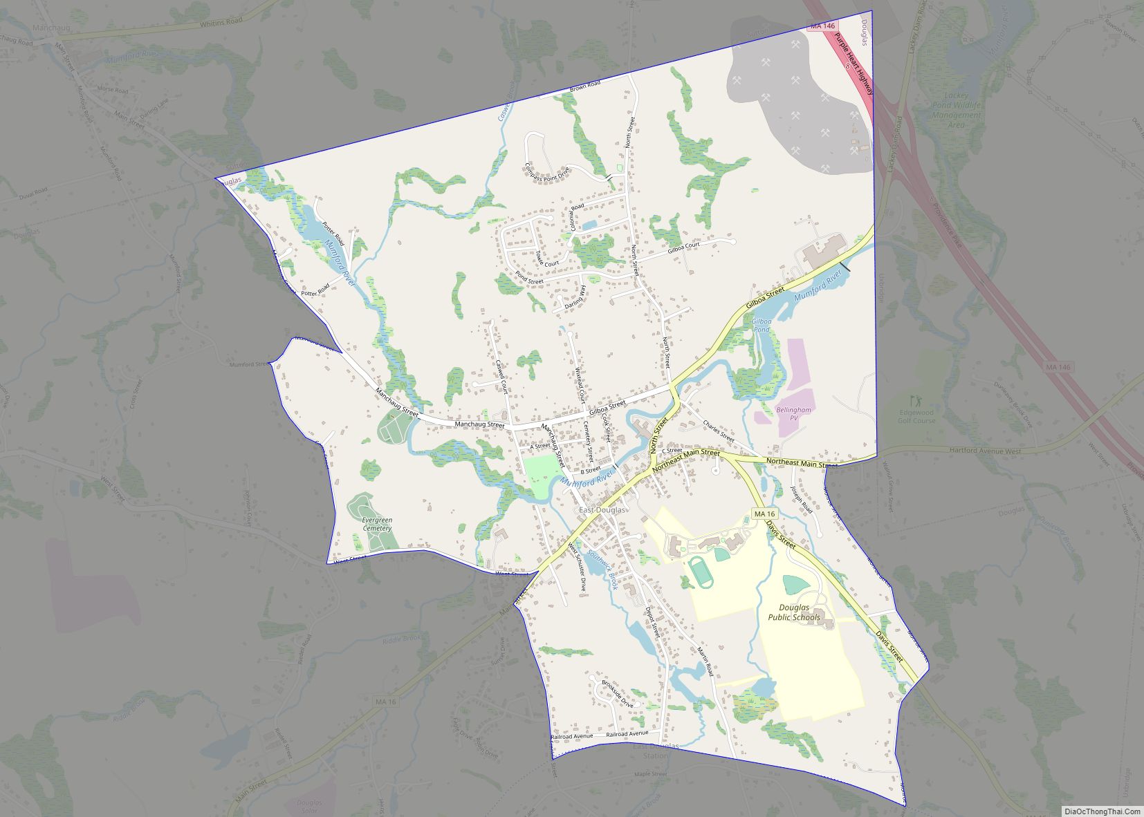
East Douglas is a census-designated place (CDP) in the town of Douglas in Worcester County, Massachusetts, United States. The population was 2,557 at the 2010 census. East Douglas CDP overview: Name: East Douglas CDP LSAD Code: 57 LSAD Description: CDP (suffix) State: Massachusetts County: Worcester County Elevation: 407 ft (124 m) Total Area: 3.53 sq mi (9.14 km²) Land Area: ... Read more
Map of East Douglas CDP
Map of Easthampton Town city
Easthampton Town city overview: Name: Easthampton Town city LSAD Code: 25 LSAD Description: city (suffix) State: Massachusetts County: Hampshire County FIPS code: 2519370 Online Interactive Map Easthampton Town online map. Source: Basemap layers from Google Map, Open Street Map (OSM), Arcgisonline, Wmflabs. Boundary Data from Database of Global Administrative Areas. Easthampton Town location map. Where ... Read more
Map of Easthampton Town city
Map of East Sandwich CDP
East Sandwich is a village and census-designated place (CDP) within the town of Sandwich in Barnstable County, Massachusetts, United States. The population was 3,940 at the 2010 census. East Sandwich CDP overview: Name: East Sandwich CDP LSAD Code: 57 LSAD Description: CDP (suffix) State: Massachusetts County: Barnstable County Elevation: 30 ft (9 m) Total Area: 7.64 sq mi (19.80 km²) ... Read more
Map of East Sandwich CDP
Map of East Pepperell CDP
East Pepperell is a census-designated place (CDP) in the town of Pepperell in Middlesex County, Massachusetts, United States. The population was 2,059 at the 2010 census. East Pepperell CDP overview: Name: East Pepperell CDP LSAD Code: 57 LSAD Description: CDP (suffix) State: Massachusetts County: Middlesex County Elevation: 226 ft (69 m) Total Area: 1.45 sq mi (3.76 km²) Land Area: ... Read more
Map of East Pepperell CDP
Map of Everett city, Massachusetts
Everett is a city in Middlesex County, Massachusetts, United States, directly north of Boston, bordering the neighborhood of Charlestown. The population was 49,075 at the time of the 2020 United States Census. Everett was the last city in the United States to have a bicameral legislature, which was composed of a seven-member Board of Aldermen ... Read more
Map of Everett city, Massachusetts
Map of Essex CDP, Massachusetts
Essex CDP is a census-designated place (CDP) in the town of Essex in Essex County, Massachusetts, United States. The population was 1,471 at the 2010 census. Essex CDP overview: Name: Essex CDP LSAD Code: 57 LSAD Description: CDP (suffix) State: Massachusetts County: Essex County Elevation: 23 ft (7 m) Total Area: 2.24 sq mi (5.79 km²) Land Area: 2.06 sq mi (5.33 km²) ... Read more
Map of Essex CDP, Massachusetts
Map of Edgartown CDP
Edgartown is a census-designated place (CDP) comprising the primary settlement in the town of Edgartown, Dukes County, Massachusetts, United States, on the island of Martha’s Vineyard. The CDP also includes the neighborhood of Clevelandtown. Edgartown was first listed as a CDP after the 2010 census with a population of 1,107 Edgartown CDP overview: Name: Edgartown ... Read more
Map of Edgartown CDP
Map of Fiskdale CDP
Fiskdale (or Fiskedale) is a census-designated place (CDP) in the town of Sturbridge in Worcester County, Massachusetts, United States. The population was 2,583 at the 2010 census. Fiskdale CDP overview: Name: Fiskdale CDP LSAD Code: 57 LSAD Description: CDP (suffix) State: Massachusetts County: Worcester County Elevation: 627 ft (191 m) Total Area: 3.31 sq mi (8.58 km²) Land Area: 3.17 sq mi ... Read more
Map of Fiskdale CDP
Map of Falmouth CDP, Massachusetts
Falmouth is a census-designated place (CDP) consisting of the primary settlement in the town of Falmouth in Barnstable County, Massachusetts, United States. The population of the CDP was 3,799 at the 2010 census, out of 31,532 in the town as a whole. It was named after Falmouth, Cornwall, England. Falmouth CDP overview: Name: Falmouth CDP ... Read more
Map of Falmouth CDP, Massachusetts
Map of Fall River city, Massachusetts
Fall River city overview: Name: Fall River city LSAD Code: 25 LSAD Description: city (suffix) State: Massachusetts County: Bristol County Elevation: 72 ft (37 m) Total Area: 40.24 sq mi (104.22 km²) Land Area: 33.12 sq mi (85.79 km²) Water Area: 7.12 sq mi (18.43 km²) Total Population: 94,000 Population Density: 2,837.91/sq mi (1,095.73/km²) Area code: 508/774 FIPS code: 2523000 GNISfeature ID: 0612595 Website: www.fallriverma.org Online Interactive ... Read more
Map of Fall River city, Massachusetts
Map of Foxborough CDP
Foxborough is a town in Norfolk County, Massachusetts, United States, about 22 miles (35 km) southwest of Boston, 18 miles (29 km) northeast of Providence, Rhode Island and about 40 miles (64 km) northwest of Cape Cod. The population was 18,618 at the 2020 census. “Foxborough” is the official spelling of the town name per local government, but ... Read more
Map of Foxborough CDP
Map of Forestdale CDP, Massachusetts
Forestdale is a village and census-designated place (CDP) within the town of Sandwich in Barnstable County, Massachusetts, United States. The population of Forestdale was 4,099 at the 2010 census. It is the most populous of the three CDPs in Sandwich. The ZIP code of Forestdale is 02644. Forestdale CDP overview: Name: Forestdale CDP LSAD Code: ... Read more
Map of Forestdale CDP, Massachusetts