East Pepperell is a census-designated place (CDP) in the town of Pepperell in Middlesex County, Massachusetts, United States. The population was 2,059 at the 2010 census.
| Name: | East Pepperell CDP |
|---|---|
| LSAD Code: | 57 |
| LSAD Description: | CDP (suffix) |
| State: | Massachusetts |
| County: | Middlesex County |
| Elevation: | 226 ft (69 m) |
| Total Area: | 1.45 sq mi (3.76 km²) |
| Land Area: | 1.42 sq mi (3.67 km²) |
| Water Area: | 0.04 sq mi (0.10 km²) |
| Total Population: | 2,120 |
| Population Density: | 1,497.18/sq mi (578.09/km²) |
| ZIP code: | 01463 |
| Area code: | 978 |
| FIPS code: | 2520310 |
| GNISfeature ID: | 0611110 |
Online Interactive Map
Click on ![]() to view map in "full screen" mode.
to view map in "full screen" mode.
East Pepperell location map. Where is East Pepperell CDP?


History
Like the town of Pepperell, East Pepperell is named for Sir William Pepperrell, a Massachusetts colonial soldier who led the Siege of Louisbourg during King George’s War.
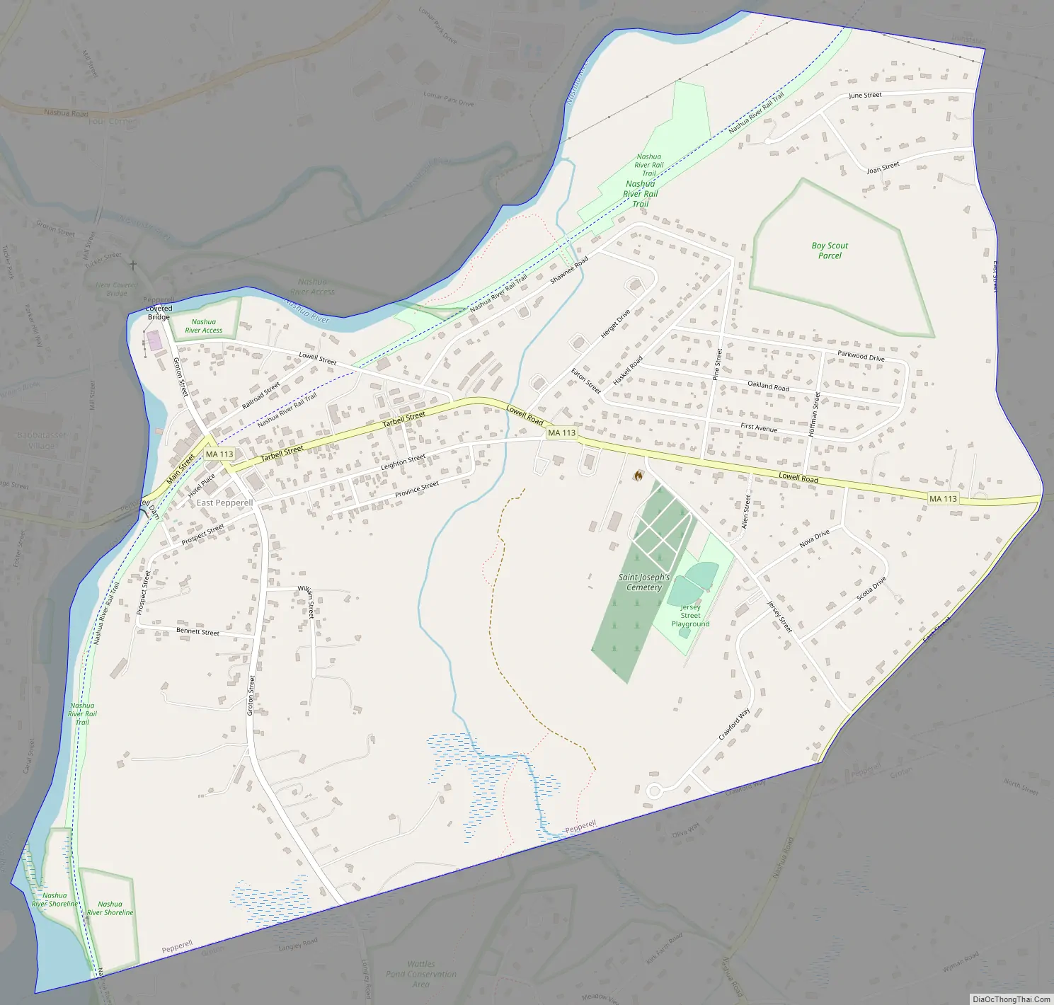
East Pepperell Road Map
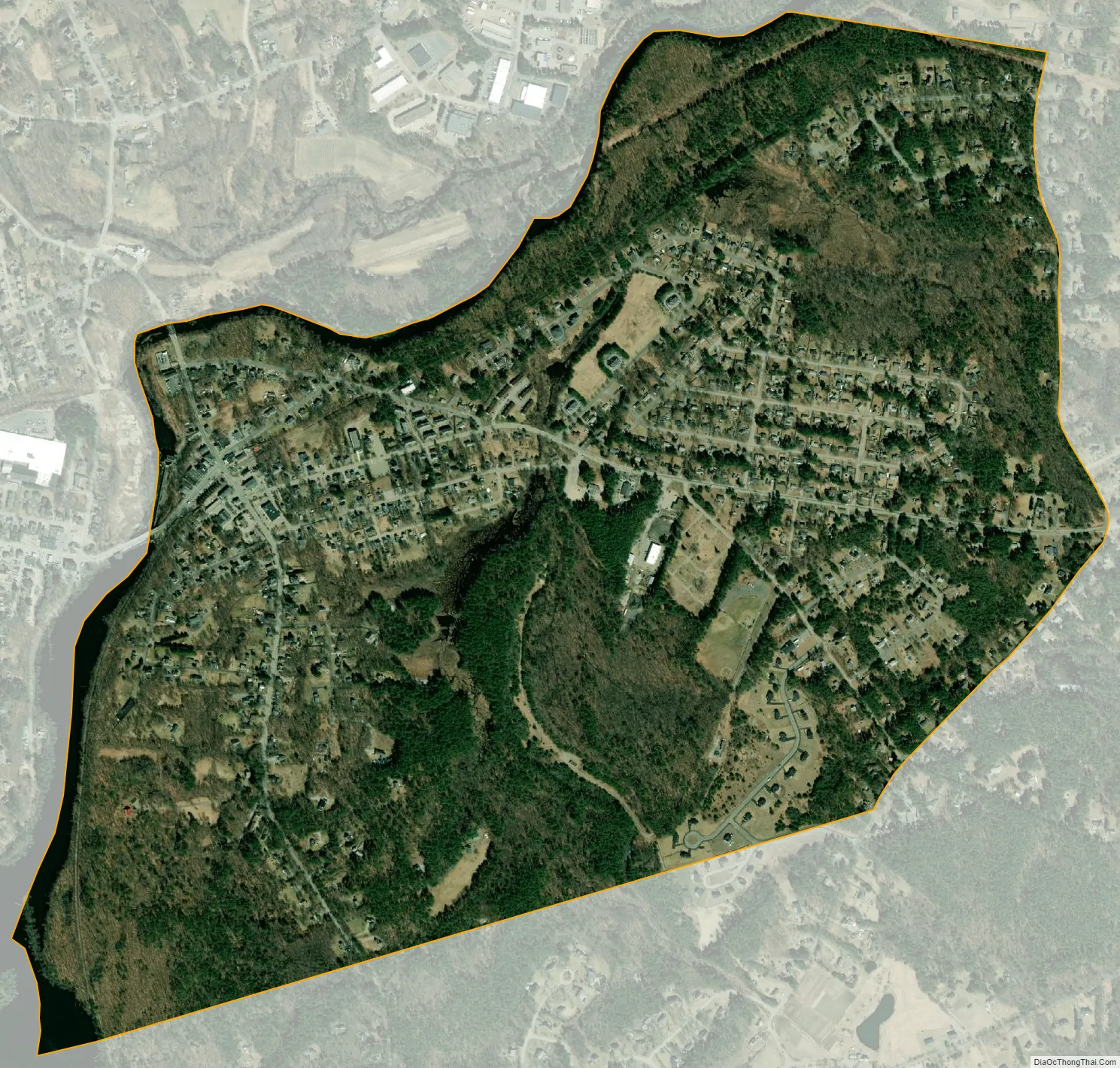
East Pepperell city Satellite Map
Geography
East Pepperell is located at 42°40′1″N 71°33′51″W / 42.66694°N 71.56417°W / 42.66694; -71.56417 (42.666956, -71.564063).
According to the United States Census Bureau, the CDP has a total area of 3.8 km (1.5 mi). 3.7 km (1.4 mi) of it is land and 0.1 km (0.04 mi) of it (2.76%) is water.
See also
Map of Massachusetts State and its subdivision: Map of other states:- Alabama
- Alaska
- Arizona
- Arkansas
- California
- Colorado
- Connecticut
- Delaware
- District of Columbia
- Florida
- Georgia
- Hawaii
- Idaho
- Illinois
- Indiana
- Iowa
- Kansas
- Kentucky
- Louisiana
- Maine
- Maryland
- Massachusetts
- Michigan
- Minnesota
- Mississippi
- Missouri
- Montana
- Nebraska
- Nevada
- New Hampshire
- New Jersey
- New Mexico
- New York
- North Carolina
- North Dakota
- Ohio
- Oklahoma
- Oregon
- Pennsylvania
- Rhode Island
- South Carolina
- South Dakota
- Tennessee
- Texas
- Utah
- Vermont
- Virginia
- Washington
- West Virginia
- Wisconsin
- Wyoming


