Quincy (/ˈkwɪnzi/ KWIN-zee) is a coastal U.S. city in Norfolk County, Massachusetts, United States. It is the largest city in the county and a part of Metropolitan Boston as one of Boston‘s immediate southern suburbs. Its population in 2020 was 101,636, making it the seventh-largest city in the state. Known as the “City of Presidents”, Quincy is the birthplace of two U.S. presidents—John Adams and his son John Quincy Adams—as well as John Hancock, the first signer of the Declaration of Independence and the first and third governor of Massachusetts.
First settled in 1625, Quincy was briefly part of Dorchester before becoming the north precinct of Braintree in 1640. In 1792, Quincy was split off from Braintree; the new town was named after Colonel John Quincy, maternal grandfather of Abigail Adams and after whom John Quincy Adams was also named. Quincy became a city in 1888.
For more than a century, Quincy was home to a thriving granite industry; the city was also the site of the Granite Railway, the United States’ first commercial railroad. Shipbuilding at the Fore River Shipyard was another key part of the city’s economy. In the 20th century, both Howard Johnson’s and Dunkin’ Donuts were founded in the city.
| Name: | Quincy city |
|---|---|
| LSAD Code: | 25 |
| LSAD Description: | city (suffix) |
| State: | Massachusetts |
| County: | Norfolk County |
| Elevation: | 30 ft (9 m) |
| Total Area: | 26.91 sq mi (69.69 km²) |
| Land Area: | 16.57 sq mi (42.92 km²) |
| Water Area: | 10.33 sq mi (26.77 km²) |
| Total Population: | 101,636 |
| Population Density: | 6,132.63/sq mi (2,367.87/km²) |
| ZIP code: | 02169, 02170, 02171 |
| FIPS code: | 2555745 |
| GNISfeature ID: | 0617701 |
| Website: | www.quincyma.gov |
Online Interactive Map
Click on ![]() to view map in "full screen" mode.
to view map in "full screen" mode.
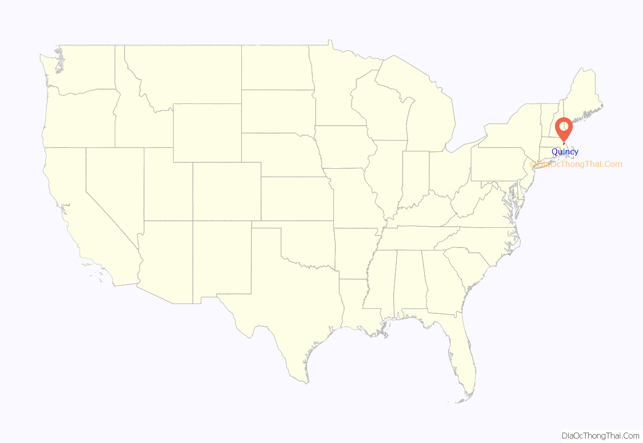
Quincy location map. Where is Quincy city?
History
Pre-Colonial Period to the Revolution
The road that eventually became the Old Coast Road from Boston to Plymouth, going through Quincy and Braintree, started out as a native american trail.
Massachusett sachem Chickatawbut had his seat on a hill called Moswetuset Hummock prior to the settlement of the area by English colonists, situated east of the mouth of the Neponset River near what is now called Squantum. It was visited in 1621 by Plymouth Colony commander Myles Standish and Squanto, a native guide.
Four years later, a party led by Captain Richard Wollaston established a post on a low hill near the south shore of Quincy Bay east of present-day Black’s Creek. The settlers found the area suitable for farming, as Chickatawbut and his group had cleared much of the land of trees. (The Indians used the name Passonagessit (“Little Neck of Land”) for the area.) This settlement was named Mount Wollaston in honor of the leader, who left the area soon after 1625, bound for Virginia.
The Wollaston neighborhood in Quincy still retains Captain Wollaston’s name. Upon the departure of Wollaston, Thomas Morton took over leadership of the post. Morton’s history of conflict with the Plymouth settlement and his free-thinking ideals antagonized the Plymouth settlement, who maligned the colony and accused it of debauchery with Indian women and drunkenness. Morton renamed the settlement Ma-re-Mount (“Hill by the Sea”) and later wrote that the conservative separatists of Plymouth Colony to the south were “threatening to make it a woefull mount and not a merry mount”, in reference to the fact that they disapproved of his libertine practices. In 1627, Morton was arrested by Standish for violating the code of conduct in a way harmful to the colony. He was sent back to England, only to return and be arrested by Puritans the next year. The area of Quincy now called Merrymount is located on the site of the original English settlement of 1625 and takes its name from the punning name given by Morton.
The area was first incorporated as part of Dorchester in 1630 and was briefly annexed by Boston in 1634. The area became Braintree in 1640, bordered along the coast of Massachusetts Bay by Dorchester to the north and Weymouth to the east. Beginning in 1708, the modern border of Quincy first took shape as the North Precinct of Braintree.
Post-Revolution
Following the American Revolution, Quincy was officially incorporated as a separate town named for Col. John Quincy in 1792, the grandfather of Abigail Adams and was made a city in 1888. Quincy, Massachusetts, is the only one of 17 cities named Quincy in the United States whose residents pronounce the name as (/ˈkwɪnzi/ KWIN-zee) rather than “QUINCE-ee.” In 1845 the Old Colony Railroad opened; the Massachusetts Historical Commission stated that the railroad was “the beginning of a trend toward suburbanization”. Quincy became as accessible to Boston as was Charlestown. The first suburban land company, Bellevue Land Co., had been organized in northern Quincy in 1870. Quincy’s population grew by over 50 percent during the 1920s.
Among the city’s several firsts was the Granite Railway, the first commercial railroad in the United States. It was constructed in 1826 to carry granite from a Quincy quarry to the Neponset River in Milton so that the stone could then be taken by boat to erect the Bunker Hill Monument in Charlestown. Quincy granite became famous throughout the nation, and stonecutting became the city’s principal economic activity. Quincy was also home to the first iron furnace in the United States, the John Winthrop Jr. Iron Furnace Site (also known as Braintree Furnace), from 1644 to 1653.
In the 1870s, the city gave its name to the Quincy Method, an influential approach to education developed by Francis W. Parker while he served as Quincy’s superintendent of schools. Parker, an early proponent of progressive education, put his ideas into practice in the city’s underperforming schools; four years later, a state survey found that Quincy’s students were excelling. Many of Quincy’s teachers were recruited by districts in other states, spreading the Quincy method beyond Massachusetts to New Jersey, New York, Connecticut, Vermont, Florida, Minnesota, and other places.
Quincy was additionally important as a shipbuilding center. Sailing ships were built in Quincy for many years, including the only seven-masted schooner ever built, Thomas W. Lawson. The Fore River area became a shipbuilding center in the 1880s; founded by Thomas A. Watson, who became wealthy as assistant to Alexander Graham Bell in developing the telephone, many famous warships were built at the Fore River Shipyard. Amongst these were the aircraft carrier USS Lexington (CV-2); the battleships USS Massachusetts (BB-59), now preserved as a museum ship at Battleship Cove in Massachusetts, and USS Nevada (BB-36); and USS Salem (CA-139), the world’s last all-gun heavy warship, which is still preserved at Fore River as the main exhibit of the United States Naval Shipbuilding Museum. John J. Kilroy, reputed originator of the famous Kilroy was here graffiti, was a rivet inspector at Fore River.
Quincy was also an aviation pioneer thanks to Dennison Field. Located in the Squantum section of town it was one of the world’s first airports and was partially developed by Amelia Earhart. In 1910, it was the site of the Harvard Aero Meet, the second air show in America. It was later leased to the Navy for an airfield, and served as a reserve Squantum Naval Air Station into the 1950s. The Army has also long maintained a presence in the city, with the Massachusetts Army National Guard occupying the Kelley Armory in Wollaston, from 1971 to 1976 it served as headquarters for the 187th Infantry Brigade.
The Howard Johnson’s and Dunkin’ Donuts restaurant chains were both founded in Quincy. Celtic punk band Dropkick Murphys got its start in the city’s Wollaston neighborhood in 1996. Quincy is also home to the United States’ longest-running Flag Day parade, a tradition that began in 1952 under Richard Koch, a former director of Parks and Recreation, who started the “Koch Club” sports organization for kids and had an annual parade with flags.
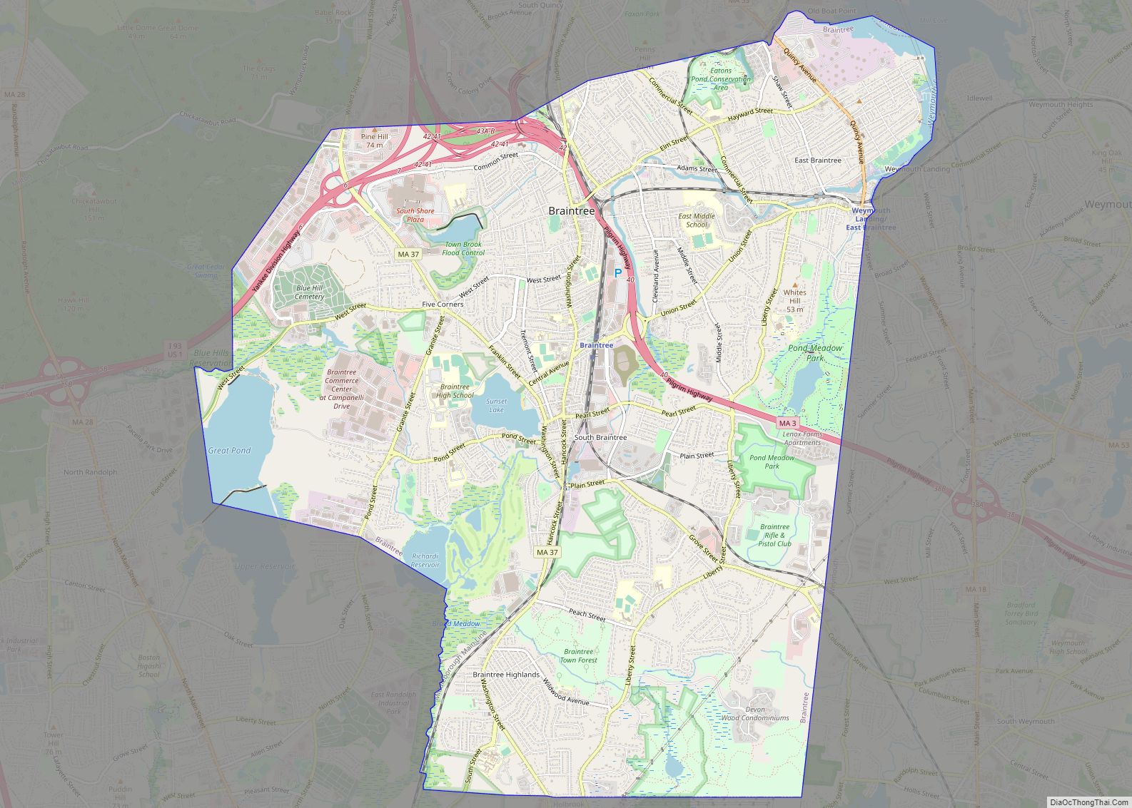
Quincy Road Map
Quincy city Satellite Map
Geography
Quincy shares borders with Boston to the north (separated by the Neponset River), Milton to the west, Randolph and Braintree to the south, and Weymouth (separated by the Fore River) and Hull (maritime border between Quincy Bay and Hingham Bay) to the east. Historically, before incorporation when it was called “Mount Wollaston” and later as the “North Precinct” of Braintree, Quincy roughly began at the Neponset River in the north and ended at the Fore River in the south.
Quincy Bay, within city limits to the northeast, is part of Boston Harbor and Massachusetts Bay. There are several beaches in Quincy, including Wollaston Beach along Quincy Shore Drive. Located on the western shore of Quincy Bay, Wollaston Beach is the largest Boston Harbor beach. Quincy’s territory includes Hangman Island, Moon Island (restricted access, and all land is owned by the City of Boston), Nut Island (now a peninsula), and Raccoon Island in the Boston Harbor Islands National Recreation Area.
According to the United States Census Bureau, the city has a total area of 26.9 square miles (70 km), of which 16.8 square miles (44 km) is land and 10.1 square miles (26 km) is water. The total area is 37.60% water.
Although Quincy is primarily urban, 2,485 acres (3.9 sq mi; 10.1 km) or fully 23 percent of its land area lies within the uninhabited Blue Hills Reservation, a state park managed by the Massachusetts Department of Conservation and Recreation. This undeveloped natural area encompasses the southwestern portion of Quincy and includes the city’s highest point, 517-foot (158 m) Chickatawbut Hill. Other hills within Quincy include Forbes Hill in Wollaston, Presidents Hill in Quincy Center and Penns Hill in South Quincy.
See also
Map of Massachusetts State and its subdivision: Map of other states:- Alabama
- Alaska
- Arizona
- Arkansas
- California
- Colorado
- Connecticut
- Delaware
- District of Columbia
- Florida
- Georgia
- Hawaii
- Idaho
- Illinois
- Indiana
- Iowa
- Kansas
- Kentucky
- Louisiana
- Maine
- Maryland
- Massachusetts
- Michigan
- Minnesota
- Mississippi
- Missouri
- Montana
- Nebraska
- Nevada
- New Hampshire
- New Jersey
- New Mexico
- New York
- North Carolina
- North Dakota
- Ohio
- Oklahoma
- Oregon
- Pennsylvania
- Rhode Island
- South Carolina
- South Dakota
- Tennessee
- Texas
- Utah
- Vermont
- Virginia
- Washington
- West Virginia
- Wisconsin
- Wyoming
