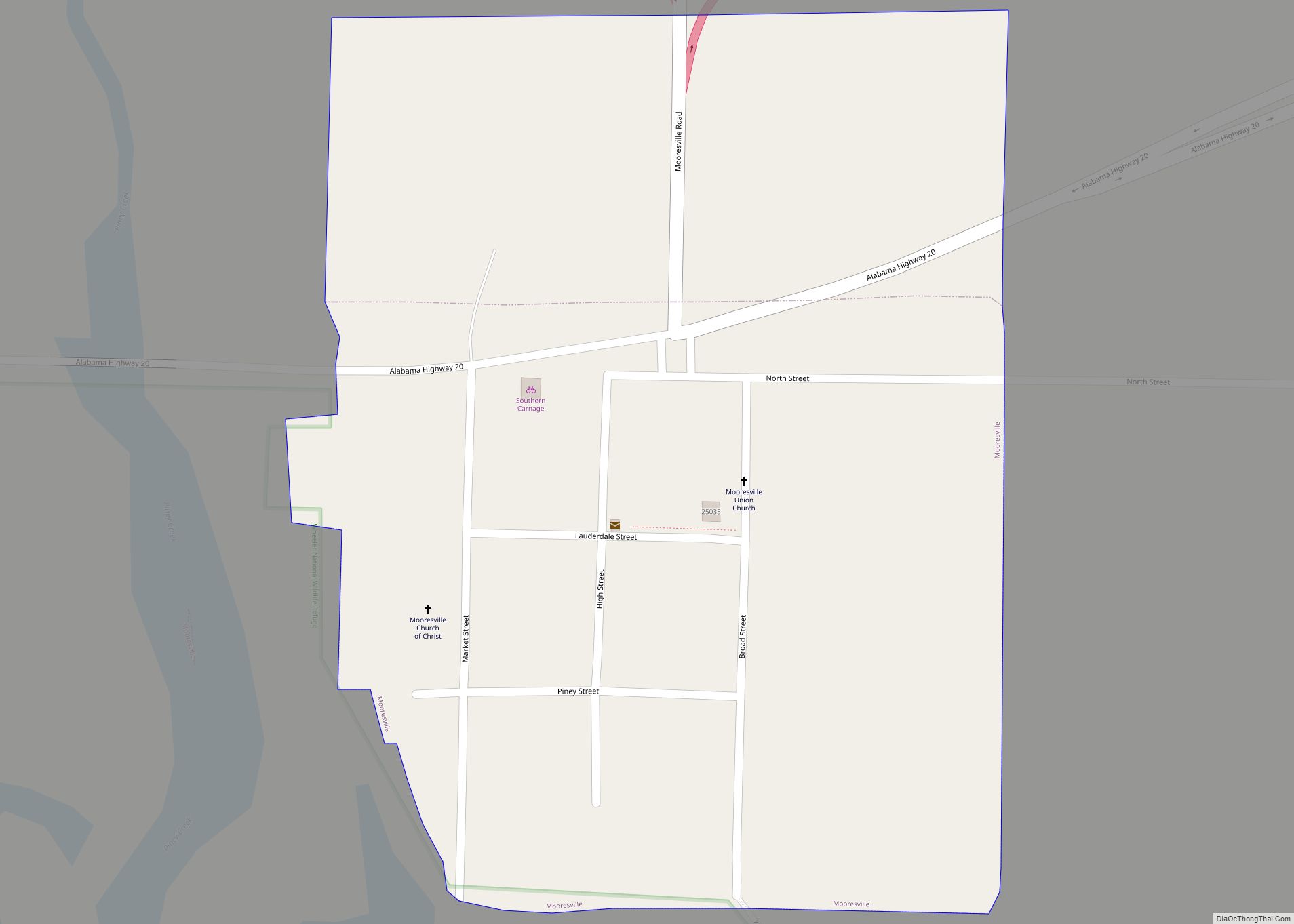
Map of Moores Mill CDP
Moores Mill is an unincorporated community and census-designated place (CDP) in Madison County, Alabama, United States, and is included in the Huntsville-Decatur Combined Statistical Area. The population was 6,729 at the 2020 census, up from 5,682 at the 2010 census. Moores Mill CDP overview: Name: Moores Mill CDP LSAD Code: 57 LSAD Description: CDP (suffix) ... Read more
Map of Moores Mill CDP
Map of Moody city, Alabama
Moody is a city located in St. Clair County, Alabama. The city was founded in 1907, and it was named after a local businessman named Epps Moody. It is located about 22 miles east of Birmingham and has a population of approximately 12,000 people. The city covers an area of 24.5 square miles, with a ... Read more
Map of Moody city, Alabama
Map of Mosses town
Mosses is a town in Lowndes County, Alabama, United States. At the 2010 census the population was 1,029, down from 1,101 in 2000. It is part of the Montgomery Metropolitan Statistical Area. It incorporated in 1979. Mosses town overview: Name: Mosses town LSAD Code: 43 LSAD Description: town (suffix) State: Alabama County: Lowndes County Elevation: ... Read more
Map of Mosses town
Map of Morrison Crossroads CDP
Morrison Crossroads (also known as Morrison Crossroad) is a census-designated place and unincorporated community in Randolph County, Alabama, United States. Its population was 219 as of the 2010 census. Morrison Crossroads CDP overview: Name: Morrison Crossroads CDP LSAD Code: 57 LSAD Description: CDP (suffix) State: Alabama County: Randolph County Elevation: 1,112 ft (339 m) Total Area: 5.26 sq mi ... Read more
Map of Morrison Crossroads CDP
Map of Morris town, Alabama
Morris is a town in Jefferson County, Alabama, United States. It is north of the Birmingham suburb of Gardendale. It initially incorporated on September 19, 1885. At some point after 1910, its incorporation lapsed and it failed to appear on the census rolls beginning in 1920 through to 1950. It reincorporated on July 11, 1950. ... Read more
Map of Morris town, Alabama
Map of Moulton city, Alabama
Moulton is a city in Lawrence County, Alabama, and is included in the Decatur Metropolitan Area, as well as the Huntsville-Decatur Combined Statistical Area. Although it incorporated in 1819, along with its rival of Courtland, to compete for the honor of county seat, it did not first appear on the U.S. Census rolls until 1900. ... Read more
Map of Moulton city, Alabama
Map of Mount Olive CDP, Alabama
Mount Olive, also spelled Mt. Olive is an unincorporated community and a census-designated place (CDP) in Jefferson County, Alabama. Its location is in the suburbs of Birmingham. As of the 2010 census, the population of the community is 4,079. Mount Olive is bordered on the south and the east by the town of Gardendale, and ... Read more
Map of Mount Olive CDP, Alabama
Map of Moundville town, Alabama
Moundville is a town in Hale and Tuscaloosa counties in the U.S. state of Alabama. It was incorporated on December 22, 1908. From its incorporation until the 1970 census, it was wholly within Hale County. At the 2010 census the population was 2,427, up from 1,809 at the 2000 census. It is part of the ... Read more
Map of Moundville town, Alabama
Map of Movico CDP
Movico is a census-designated place and unincorporated community in Mobile County, Alabama, United States. Its population was 291 as of the 2020 census. The town was heavily damaged by an EF2 tornado on January 12, 2023. Movico CDP overview: Name: Movico CDP LSAD Code: 57 LSAD Description: CDP (suffix) State: Alabama County: Mobile County Elevation: ... Read more
Map of Movico CDP
Map of Mountain Brook city
Mountain Brook is a city in southeastern Jefferson County, Alabama, United States, and a suburb of Birmingham. Its population at the 2020 census was 22,461. Mountain Brook city overview: Name: Mountain Brook city LSAD Code: 25 LSAD Description: city (suffix) State: Alabama County: Jefferson County Incorporated: March 24, 1942 Elevation: 955 ft (291 m) Total Area: 12.84 sq mi ... Read more
Map of Mountain Brook city
Map of Mount Vernon town, Alabama
Mount Vernon is a town in Mobile County, Alabama, United States. It is part of the Mobile metropolitan area. It incorporated in 1959. At the 2020 census the population was 1,354. Mount Vernon town overview: Name: Mount Vernon town LSAD Code: 43 LSAD Description: town (suffix) State: Alabama County: Mobile County Elevation: 30 ft (9 m) Total ... Read more
Map of Mount Vernon town, Alabama
Map of Muscle Shoals city
Muscle Shoals is the largest city in Colbert County, Alabama. It is located on the left bank of the Tennessee River in the northern part of the state and, as of the 2010 census, its population was 13,146. The estimated population in 2019 was 14,575. Both the city and the Florence-Muscle Shoals Metropolitan Area (including ... Read more
Map of Muscle Shoals city