Moundville is a town in Hale and Tuscaloosa counties in the U.S. state of Alabama. It was incorporated on December 22, 1908. From its incorporation until the 1970 census, it was wholly within Hale County. At the 2010 census the population was 2,427, up from 1,809 at the 2000 census. It is part of the Tuscaloosa Metropolitan Statistical Area. Within the town is Moundville Archaeological Site, the location of a prehistoric Mississippian culture political and ceremonial center.
| Name: | Moundville town |
|---|---|
| LSAD Code: | 43 |
| LSAD Description: | town (suffix) |
| State: | Alabama |
| County: | Hale County, Tuscaloosa County |
| Elevation: | 161 ft (49 m) |
| Total Area: | 4.67 sq mi (12.08 km²) |
| Land Area: | 4.61 sq mi (11.94 km²) |
| Water Area: | 0.06 sq mi (0.14 km²) |
| Total Population: | 3,024 |
| Population Density: | 655.82/sq mi (253.24/km²) |
| ZIP code: | 35474 |
| Area code: | 205, 659 |
| FIPS code: | 0151648 |
| GNISfeature ID: | 0160145 |
| Website: | www.moundvillealabama.com |
Online Interactive Map
Click on ![]() to view map in "full screen" mode.
to view map in "full screen" mode.
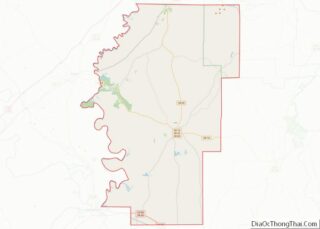
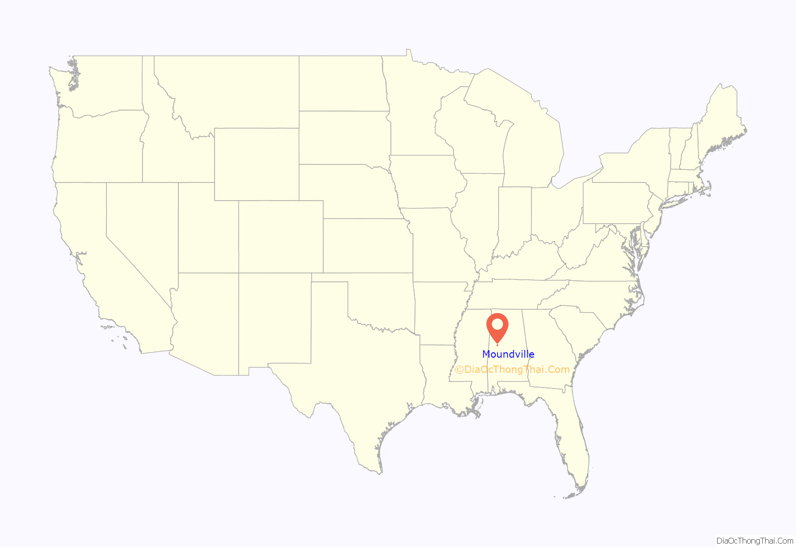
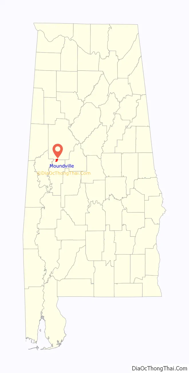
Moundville location map. Where is Moundville town?
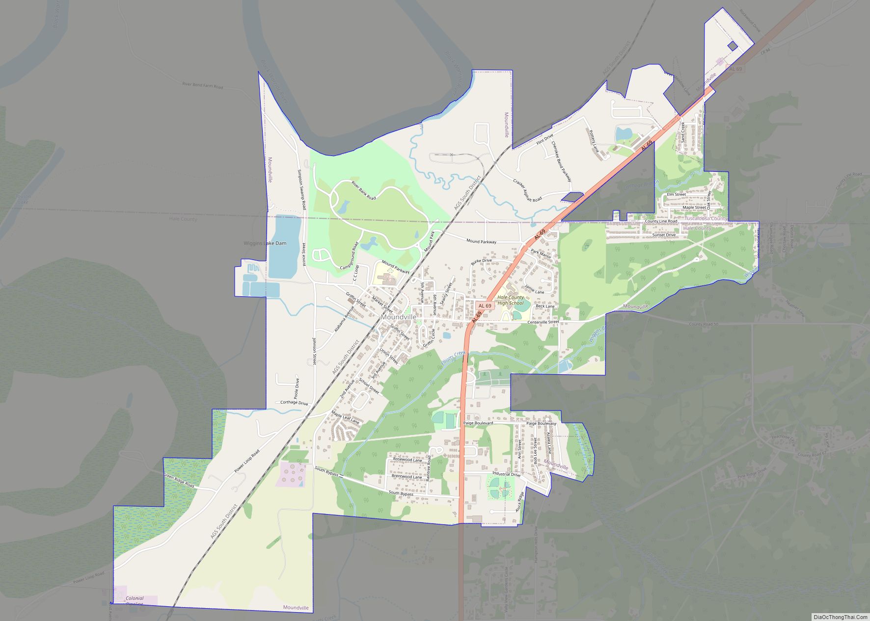
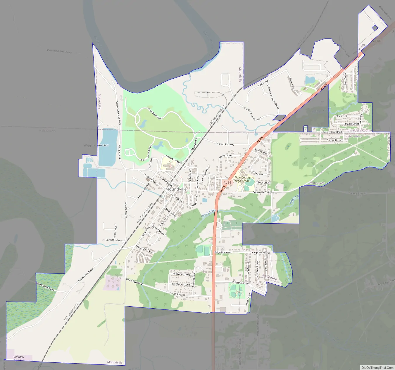
Moundville Road Map
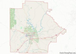
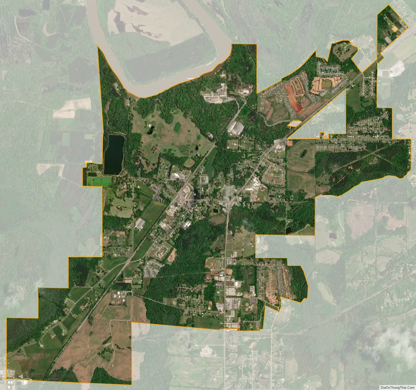
Moundville city Satellite Map
Geography
Moundville is located in northern Hale County at 32°59′55″N 87°37′34″W / 32.99861°N 87.62611°W / 32.99861; -87.62611 (32.998521, -87.626006), on the south side of the Black Warrior River. The town limits extend north into Tuscaloosa County. Alabama State Route 69 passes through the east side of the town, leading north 16 miles (26 km) to Tuscaloosa and south 22 miles (35 km) to Greensboro, the Hale County seat.
According to the U.S. Census Bureau, Moundville has a total area of 4.6 square miles (12.0 km), of which 0.06 square miles (0.15 km), or 1.26%, are water.
Climate
According to the Köppen climate classification, Moundville has a humid subtropical climate (abbreviated Cfa).
See also
Map of Alabama State and its subdivision:- Autauga
- Baldwin
- Barbour
- Bibb
- Blount
- Bullock
- Butler
- Calhoun
- Chambers
- Cherokee
- Chilton
- Choctaw
- Clarke
- Clay
- Cleburne
- Coffee
- Colbert
- Conecuh
- Coosa
- Covington
- Crenshaw
- Cullman
- Dale
- Dallas
- De Kalb
- Elmore
- Escambia
- Etowah
- Fayette
- Franklin
- Geneva
- Greene
- Hale
- Henry
- Houston
- Jackson
- Jefferson
- Lamar
- Lauderdale
- Lawrence
- Lee
- Limestone
- Lowndes
- Macon
- Madison
- Marengo
- Marion
- Marshall
- Mobile
- Monroe
- Montgomery
- Morgan
- Perry
- Pickens
- Pike
- Randolph
- Russell
- Saint Clair
- Shelby
- Sumter
- Talladega
- Tallapoosa
- Tuscaloosa
- Walker
- Washington
- Wilcox
- Winston
- Alabama
- Alaska
- Arizona
- Arkansas
- California
- Colorado
- Connecticut
- Delaware
- District of Columbia
- Florida
- Georgia
- Hawaii
- Idaho
- Illinois
- Indiana
- Iowa
- Kansas
- Kentucky
- Louisiana
- Maine
- Maryland
- Massachusetts
- Michigan
- Minnesota
- Mississippi
- Missouri
- Montana
- Nebraska
- Nevada
- New Hampshire
- New Jersey
- New Mexico
- New York
- North Carolina
- North Dakota
- Ohio
- Oklahoma
- Oregon
- Pennsylvania
- Rhode Island
- South Carolina
- South Dakota
- Tennessee
- Texas
- Utah
- Vermont
- Virginia
- Washington
- West Virginia
- Wisconsin
- Wyoming