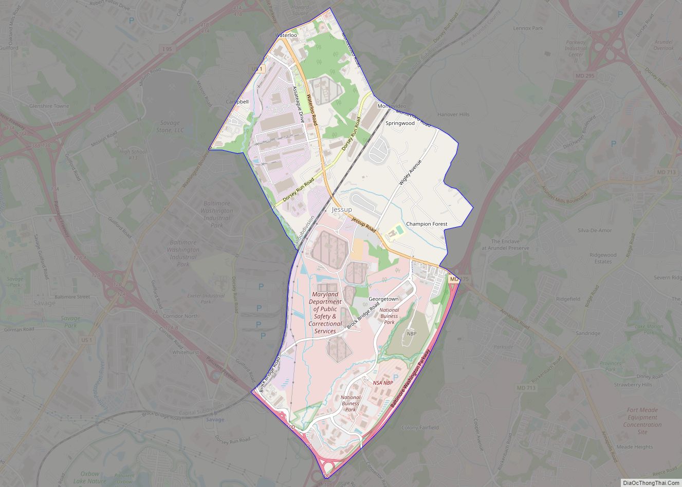
Jessup (/ˈdʒɛsəp/ JESS-əp) is an unincorporated community and census-designated place in Howard and Anne Arundel counties, about 15 miles (24 km) southwest of Baltimore, Maryland, United States. Per the 2020 census, the population was 10,535. Jessup CDP overview: Name: Jessup CDP LSAD Code: 57 LSAD Description: CDP (suffix) State: Maryland County: Anne Arundel County, Howard County ... Read more
Map of US Cities and Places
Kemp Mill is a census-designated place and an unincorporated census area in Montgomery County, Maryland, United States. The population was 13,378 at the 2020 census. Kemp Mill census area consists of the separate communities of Kemp Mill Estates and Kemp Mill Farms. Kemp Mill CDP overview: Name: Kemp Mill CDP LSAD Code: 57 LSAD Description: ... Read more
Keedysville is a town in Washington County, Maryland, United States. The population was 1,152 at the 2010 census. Keedysville town overview: Name: Keedysville town LSAD Code: 43 LSAD Description: town (suffix) State: Maryland County: Washington County Incorporated: 1872 Elevation: 394 ft (120 m) Total Area: 0.91 sq mi (2.35 km²) Land Area: 0.91 sq mi (2.35 km²) Water Area: 0.00 sq mi (0.00 km²) Total Population: ... Read more
Jugtown is an unincorporated community and census-designated place in Washington County, Maryland, United States. Its population was 204 as of the 2010 census. Jugtown CDP overview: Name: Jugtown CDP LSAD Code: 57 LSAD Description: CDP (suffix) State: Maryland County: Washington County Elevation: 755 ft (230 m) Total Area: 0.33 sq mi (0.86 km²) Land Area: 0.33 sq mi (0.86 km²) Water Area: 0.00 sq mi ... Read more
Kensington is a town in Montgomery County, Maryland, United States. The population was 2,213 at the 2010 United States Census. Greater Kensington encompasses the entire 20895 ZIP code, with a population of 19,054. Kensington town overview: Name: Kensington town LSAD Code: 43 LSAD Description: town (suffix) State: Maryland County: Montgomery County Incorporated: 1894 Elevation: 285 ft ... Read more
Kennedyville is an unincorporated community and census-designated place in Kent County, Maryland, United States. As of the 2010 census it had a population of 199. Knocks Folly, Shrewsbury Church, and Woodland Hall are listed on the National Register of Historic Places. Kennedyville CDP overview: Name: Kennedyville CDP LSAD Code: 57 LSAD Description: CDP (suffix) State: ... Read more
Kemps Mill is an unincorporated community and census-designated place in Washington County, Maryland, United States. Its population was 126 as of the 2010 census. It is named after a 1739 built mill structure which still stands in 2020 and has operated under a variety of names through almost three centuries. The mill dam creates a ... Read more
Kingstown is a census-designated place (CDP) in Queen Anne’s County, Maryland, United States. The population was 1,644 at the 2000 census. Kingstown CDP overview: Name: Kingstown CDP LSAD Code: 57 LSAD Description: CDP (suffix) State: Maryland County: Queen Anne’s County Elevation: 16 ft (5 m) Total Area: 2.58 sq mi (6.68 km²) Land Area: 2.27 sq mi (5.87 km²) Water Area: 0.31 sq mi (0.81 km²) ... Read more
Kettering is an unincorporated area and census-designated place in Prince George’s County, Maryland, United States. At the 2020 United States Census, the population was 14,424,. Kettering is adjacent to Prince George’s Community College, the upscale gated community of Woodmore, Six Flags America, Evangel Temple megachurch, and the community of Largo at the end of the ... Read more
Kent Narrows is a census-designated place and town in Queen Anne’s County, Maryland, United States. As of the 2000 census, the town had a population of 567. Kent Narrows CDP overview: Name: Kent Narrows CDP LSAD Code: 57 LSAD Description: CDP (suffix) State: Maryland County: Queen Anne’s County Elevation: 7 ft (2 m) Total Area: 3.22 sq mi (8.33 km²) ... Read more
Klondike is an unincorporated community and census-designated place (CDP) in Allegany County, Maryland, United States. As of the 2010 census it had a population of 118. It is located in western Allegany County, 5 miles (8 km) southwest of Frostburg, at the foot of Big Savage Mountain.It is built at the site of the Klondike Mine, ... Read more
Kitzmiller is a town in Garrett County, Maryland, United States. The population was 321 at the 2010 census. Kitzmiller town overview: Name: Kitzmiller town LSAD Code: 43 LSAD Description: town (suffix) State: Maryland County: Garrett County Elevation: 1,604 ft (489 m) Total Area: 0.25 sq mi (0.65 km²) Land Area: 0.22 sq mi (0.58 km²) Water Area: 0.03 sq mi (0.07 km²) Total Population: 300 Population ... Read more